Sight in Agulhas National Park
Cape Agulhas
The Map of Africa monument at the southern tip of the continent, a walk-on concrete relief map of Africa unveiled at Cape Agulhas in 2019.

The Map of Africa monument marks the southernmost point of the continent at Cape Agulhas, in Agulhas National Park. Unveiled in March 2019, it replaced a rather modest arrival experience with a piece of land art you can walk across. It is a short stroll along the boardwalk from the Cape Agulhas lighthouse and is the obvious photo stop for anyone who has driven out to the tip.
What to expect
The centrepiece is a relief map of Africa in concrete, laid flat in the ground. Its surface rises and dips to show features such as the Atlas Mountains, Kilimanjaro and the Drakensberg, and you are free to walk over it. Stone benches set in a compass pattern frame the map. After rain, water collects in the low parts, so the continent briefly turns into a wetland. Look closely and you will find fingerprints and a heart pressed into the concrete by the makers. Strijdom van der Merwe was among the land artists and architects behind the design.
Practical details
- Reach it on foot along the wooden boardwalk from the lighthouse.
- Parking is available nearby, and entry to the monument area was free when it opened.
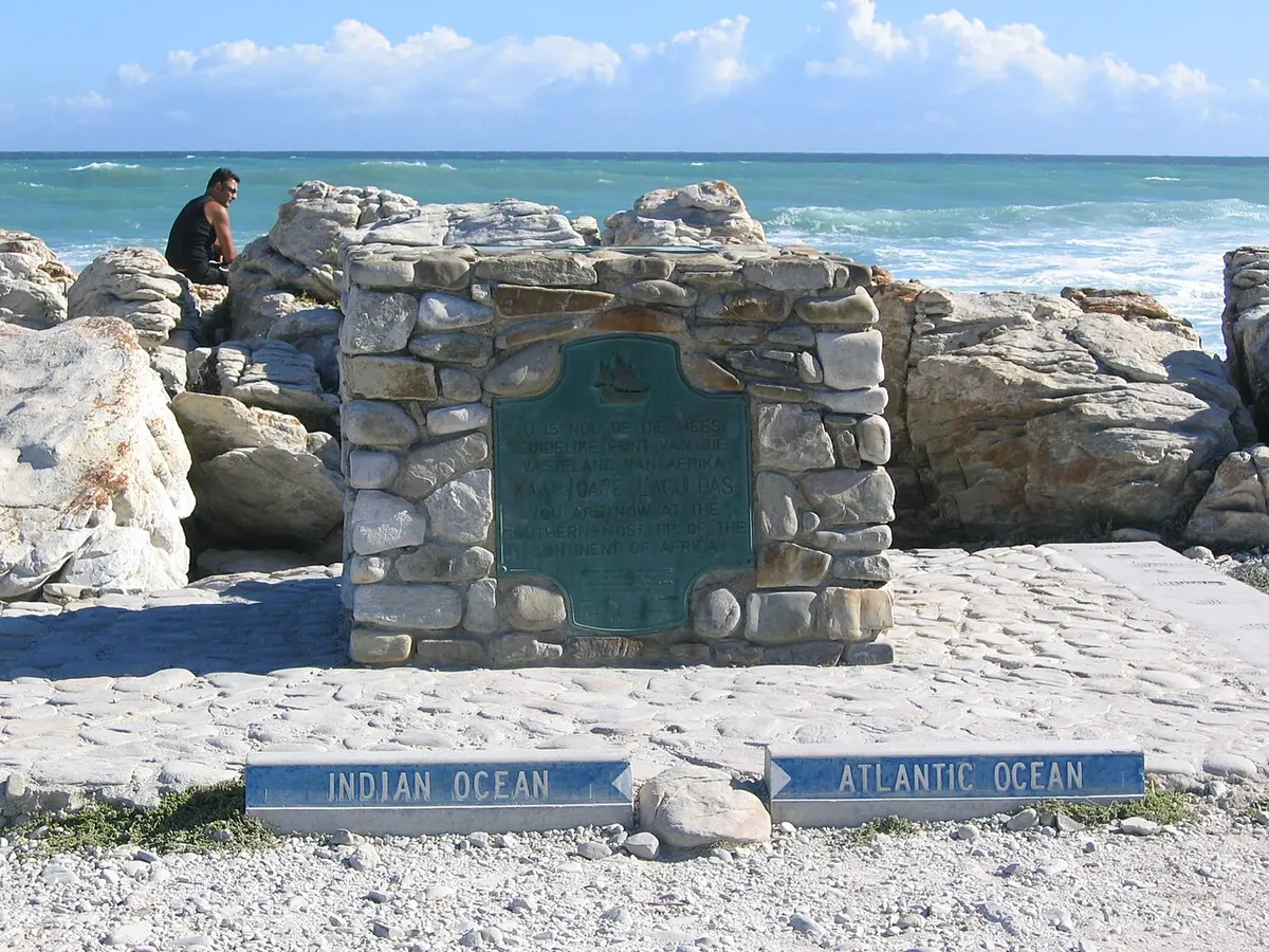
- The older stone cairn that marked the tip for decades still stands alongside, and the new monument points towards it.
Good to know
Combine it with the lighthouse, built in 1848, which has a museum inside and a lamp room you can climb to. SANParks bought the 4 ha around the tip in 1998, which is what made the new monument possible.
Park fees
Cape Agulhas is inside Agulhas National Park. See all Agulhas National Park fees
Nearby in Agulhas National Park
 Cape Agulhas17 MAttraction
- 927 M
- Two Oceans Hiking Trail - Yellow route4.8 KMHiking trail · 10.5 km
- Two Oceans Hiking Trail - Red route5.6 KMHiking trail · 4.8 km
- Two Oceans Hiking Trail - Blue route5.7 KMHiking trail · 3.1 km