Clarens
Sandstone village at 1,874 m in the eastern Free State, 17 km from Golden Gate Highlands National Park. Art galleries, a brewery, river rafting and snow on the Malutis in winter.

See every place on this map as a list
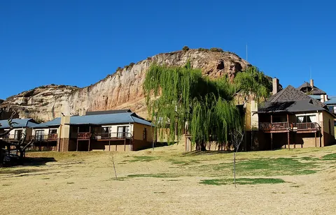
Clarens is a village of sandstone cottages around a square, set under the Rooiberge cliffs with the Maluti Mountains of Lesotho behind. It was laid out in 1912 and named after the Swiss town where Paul Kruger died in exile. Artists settled here and the galleries, coffee shops and breweries followed. At 1,874 m the air is clear and cold, and the village is the base for Golden Gate Highlands National Park, 17 km down the road.
Getting there
Clarens is 336 km from Johannesburg, 284 km from Bloemfontein and 389 km from Durban, all on tarred roads, with Bethlehem the last sizeable town on the way in from Johannesburg. There is no public transport, so drive. Golden Gate’s rest camps are 17 km east. The village itself is small and walkable.
When to go
Clarens has a temperate highland climate with 750 to 850 mm of rain, nearly all of it in summer thunderstorms between October and April. Winters, June to August, are dry and sunny by day and well below freezing at night, with frost and real snowfalls on the high ground around Golden Gate. Autumn, once the storms have stopped and before the hard frosts, is the local favourite. Long weekends and school holidays fill the village with Gauteng traffic; book ahead for those.
What to do
Golden Gate Highlands National Park covers 340 km² of eroded sandstone that turns gold and orange at sunset, from 1,800 m to the 2,829 m summit of Ribbokkop. There are San rock paintings in the shelters, eland and zebra on the slopes, and more than 210 bird species including bearded and Cape vultures and the bald ibis. The Brandwag Buttress walk is the short one; the Rhebok Trail is two days with a night out. The Basotho Cultural Village inside the park shows traditional homesteads.
The Ash River, 12 km from town, has grade 3 and 4 white water. Rafting companies run a full-day 18 km trip and a half-day 9 km one; from May to August they call it the Polar Bear Challenge and hand out wetsuits. Around the village there is horse riding, abseiling, fly fishing for trout and golf. The Titanic, a rock outcrop shaped like a ship’s bow, is the landmark everyone photographs. Fossil hunters should know this is Massospondylus country: 190-million-year-old dinosaur eggs have been found nearby.
Good to know
Nights are cold for much of the year, so check that your accommodation has heating or a fireplace. Snow on the high ground can make the mountain roads tricky in winter. The village is safe to walk around. Fuel up in town before heading into the park or on towards the Drakensberg; it is a long way between towns out here. Most galleries and restaurants are on or near the square, and weekends are when the place is liveliest.
In and around Clarens
80 PLACESPlaces to stay 49
- 28.51°S 28.43°E
- 28.52°S 28.42°E
- 28.52°S 28.42°E
- 28.52°S 28.41°E
- 28.52°S 28.42°E
- 28.52°S 28.42°E
- 28.52°S 28.42°E
- 28.56°S 28.48°E
Sights 7
- Art & Wine GalleryGallery
- Lesotho Highlands Water ProjectAttraction
- Robert Badenhorst Art GalleryGallery
- TBM Cross SectionAttraction
- Bushman PaintingsAttraction
- Maluti MountainsViewpoint
- Surrender HillMemorial
Restaurants and cafes 23
- Courtyard CafeCafe
- GostoRestaurant · portuguese
- Vito’s restaurantRestaurant · international, italian
- Clarens Roadside CafeCafe
- ClementinesRestaurant
- Highland CoffeeCafe
- Mosaic PizzeriaRestaurant · greek, italian
- Roter HahnRestaurant · german
- Di Vino - Restaurant & Wine loungeRestaurant
- Firkin Pub & GrillRestaurant
Bars and pubs 1
- Clarens BreweryBar