Park · Oshana, Namibia
Etosha National Park
Namibia's best-known park, a ring of waterholes around a huge white salt pan where elephant, lion and black rhino come to drink in the dry season. Self-drive on good gravel roads.
Short answer
At Etosha National Park, international visitors pay N$280 (about US$17, €15 or £12.50) per adult and N$180 per child per day. The rates apply from 1 April 2026 to 31 March 2027.
- Daily fee, international adult
- US$17 €15 · N$280
- Malaria
- The CDC recommends antimalarial tablets for the northern regions Etosha lies in and borders (Kunene, Oshana, Oshikoto and Otjozondjupa).
- Places to stay
- 8
- Where
- Oshana, Namibia18.99°S 15.75°E
Etosha National Park fees 2026/27
Checked Ministry of Environment, Forestry and Tourism tariffValid 1 April 2026 to 31 March 2027, per person per day, in Namibian dollars.
| Who | Adult | Child |
|---|---|---|
| International visitorsUS, Europe and everyone else | US$17 €15 · N$280 | US$11 €10 · N$180 |
| SADC nationals | N$180 | N$100 |
| Namibian citizens | N$60 | Free |
- Children aged 8 and under enter free. The child rate is for ages 9 to 15; Namibian children in that age group pay nothing. From 16 the adult rate applies.
- Vehicle fee per day, on top of the per person fee: N$60 for 10 seats or less, N$150 for 11 to 25 seats, N$600 for 26 to 50 seats and N$1,000 for 51 seats or more.
- The Namibian rate is for Namibian citizens. The gazette sets fees by nationality, so a foreigner living in Namibia pays the rate for their nationality.
- Each fee is half park entrance fee and half conservation fee; the figures shown are the two added together.
- These fees were gazetted with effect from 1 April 2026 and have no end date. I show them as valid to 31 March 2027, the end of Namibia’s financial year, and will re-check then.
- Fees are set by Ministry of Environment, Forestry and Tourism. Official tariff · Seen a new rate? Tell us
US$1 = N$16.64 · €1 = N$18.60 · £1 = N$22.31 (ECB rate, 3 Nov 2026, N$1 = R1). Converted amounts are approximate; you pay in Namibian dollars.
How we got these figures
- SafariFind gives the same adult figures but lower child rates (N$140 foreign, N$90 SADC) than the gazette; I used the gazette child rates.
- Government Gazette No. 8877 of 1 April 2026, Government Notice No. 115 (MEFT fee schedule), copy hosted by the Legal Assistance Centre · official · checked 7 Oct 2026
- Tourism Update (27 January 2026) · one source · checked 7 Oct 2026
- Namibian.org (19 January 2026) · one source · checked 7 Oct 2026
- Africa Beat (6 February 2026) · one source · checked 7 Oct 2026
- TravelComments.com (29 January 2026) · one source · checked 7 Oct 2026
- EtoshaNationalPark.com.na (independent park guide) · one source · checked 7 Oct 2026
- SafariFind · one source · checked 7 Oct 2026
Two ways to do Etosha
A couple, five nights camping at Okaukuejo, six days of park fees, a seven-day Hilux hire with camping kit and diesel: about US$1,816.
Plan it yourselfLodges just outside the park, from Onguma Bush Camp (dinner, bed and breakfast, game drives extra) to Onguma Camp Kala (all inclusive), plus a N$350 levy.
Get lodge prices for your datesFigures from our safari cost guide, updated 14 October 2026, in US dollars at the ECB rate of 13 October 2026.
Etosha is Namibia’s top tourist draw. It covers just under 23,000 square kilometres of the north, and a little over a fifth of that is the Etosha Pan, a flat bed of salt and clay about 130 km long, dry and white most of the year. The name is usually explained as Oshindonga for a great white place, though MEFT translates the older form, Etotha, as the place where no plants grow. Animals gather at the springs and waterholes along its edge, and you watch them from your car.
Getting there
The southern entrance is Andersson Gate, on the C38 from Outjo. Okaukuejo camp is 17 km inside, and Namibia Wildlife Resorts (NWR) puts it at 432 km by road from Windhoek. Von Lindequist Gate in the east is off the B1 from Tsumeb, with Namutoni camp 110 km from Tsumeb. King Nehale Gate on the northern side is about 106 km from Ondangwa. Galton Gate in the south-west is remote: Olifantsrus is 70 km in and Okaukuejo a further 130 km. Most park roads are graded gravel, fine in a normal car. Driving the length of the park, east to west, uses up most of a day.
When to go
May to October is the dry season and the time for game. With the bush dry, animals have to come to the waterholes to drink. Nights from June to August can drop close to freezing. The rains run roughly November to April, with days often above 35°C. Game spreads out then, but in a good year water on the pan and at Fischer’s Pan near Namutoni draws flamingos and pelicans.
What to do
Drive slowly between waterholes and wait. The three main camps (Okaukuejo, Halali and Namutoni) each have a floodlit waterhole just outside the fence, so the viewing carries on after dark. Okaukuejo’s is the famous one, and NWR says lion, elephant and black rhino are all common there. Halali sits under a dolomite hill in thicker mopane, which NWR says suits leopard. Namutoni is built into an old German fort. The quieter west, around Olifantsrus and Dolomite, is the only part with mountain zebra. NWR runs guided morning, afternoon and night drives from the camps. Don’t expect buffalo: there are none.
Good to know
You must stay in your car except inside the fenced camps and at marked picnic stops, and be in a camp or out of the park by sunset. Most guides give the speed limit as 60 km/h, but plan on about 25 km an hour once you stop for animals. Okaukuejo, Halali and Namutoni have filling stations; fill up at each. Etosha lies in the regions where the CDC recommends malaria tablets, and the UK advice puts the higher risk from December to April, so see a travel clinic first. The main road east of Okaukuejo is being rebuilt as a tarred road, so ask at reception about detours. A wildfire in September 2025 burned about a third of the park. Fees are in the table on this page.
Wildlife you might see
15- very likelyElephantAt the waterholes, where large herds can take over in the dry season; Okaukuejo's floodlit waterhole is a regular spot. Most of all in the dry season, May to Octobersource
- very likelySpringbokAlong the roads and around waterholes, often in large herds. All yearsource
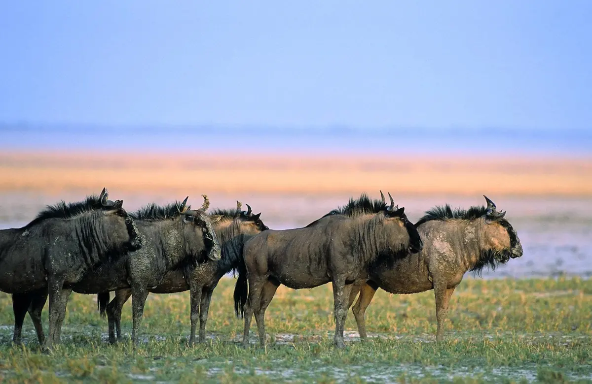
- very likelyPlains zebra and blue wildebeestAlong the roads and around waterholes. All yearsource
- very likelyGiraffeThroughout the park, often at waterholes. All yearsource
- likelyGemsbok (oryx)All yearsource
- likelyBlack-faced impalaOften along the roads and at waterholes. All yearsource
- likelyLionAround waterholes; NWR calls lion a very common sighting at the Okaukuejo floodlit waterhole, day and night. All yearsource
- likelyBlack rhinoThe floodlit Okaukuejo waterhole after dark. All year, mostly at nightsource
- possibleSpotted hyenaAround waterholes, most often at night. All yearsource
- possibleCheetahAll year; takes patience and searchingsource
- possibleMountain zebraOnly in the dolomite hills of western Etosha. All yearsource
- possibleDamara dik-dikAll yearsource
- possibleFlamingoOn the pan and at Fischer's Pan near Namutoni when they hold water. Rainy season (November to April) in good rain years onlysource
- possibleKori bustardAll yearsource
- rareLeopardThe thicker mopane around Halali. All yearsource
Likelihood is for a normal visit of two or three days, from the sources linked. Nothing is guaranteed in the wild.
Hikes and walks
1- Nature walk inside Halali camp
MEFT and the Namibia Tourism Board both list nature walks within the fenced Halali camp.
Permit: No separate permit; the walks are inside the camp
Ministry of Environment, Forestry and Tourism (MEFT), Etosha National Park
Staying safe in Etosha National Park
- Malaria
- The CDC recommends antimalarial tablets for the northern regions Etosha lies in and borders (Kunene, Oshana, Oshikoto and Otjozondjupa). See a travel clinic before you go and use repellent at dusk. source
- Malaria season
- The UK's NaTHNaC puts these regions at high risk from December to April, when it advises tablets, and at low risk from May to November, when it advises bite avoidance. CDC advice does not split the year, so ask your clinic which applies to your dates. source
- Stay in your vehicle
- Get out only inside the fenced camps and at the fenced picnic sites. If you break down or get a puncture, stay in the car until help reaches you, so keep a charged phone with you. Keep to the road network; driving off the roads is not allowed. source
- Gravel roads
- The main roads in from the gates are tarred, but most park roads are gravel, from smooth to badly potholed. Take it easy if you have not driven on gravel before, and keep to the speed limit, given as 60 km/h. source
- Heat and water
- From November to April days often go above 35°C, and camps and shops are far apart. Carry plenty of drinking water on every drive, and never drink from waterholes. source
- In camp at night
- Jackals come into the campsites after dark and some carry rabies, so keep your distance and never feed them. Sleep inside your tent or room, not in the open, and least of all on the benches by the waterholes: the fence there is low and would not stop a lion. source
Tips from travellers
- Fill up whenever you pass a pump. Okaukuejo, Halali and Namutoni all have filling stations, and there is little else on the long drives between them. several sources
- Plan on about 25 km an hour once you count stops for animals, and leave time to reach your camp before sunset. one source
- Spend an evening at the Okaukuejo waterhole. It is floodlit, and black rhino often come down after dark, even in the rainy season. several sources
- Keep the entry paperwork you are given. You fill it in at the gate, pay at the office in the camp, and show it again each time you go in or out. In busy months this can take up to an hour. one source
- The main road from Okaukuejo towards Halali is being rebuilt as a tarred road, with detours that have moved more than once and that bypass some waterholes east of Okaukuejo. Ask at reception for the current route before setting off. one source
- NWR's terms make it an offence to bring a plastic bag into a game park or nature reserve, so pack food and rubbish in other bags. official
Checked 7 October 2026. Conditions change, so confirm with the park or venue before you go.
Purple feet, a cursed tree and the lions of Okondeka
Charles John Andersson walked out onto the Etosha Pan at the end of May 1851 and, he wrote, within ten minutes his legs and the legs of his oxen had turned purple. The clay was soft, greenish-yellow and strewn with purple stone. Francis Galton, travelling with him, was more struck by the mirage. He could not guess the pan’s length through it, and thought it “must form a rather pretty lake” after rain. A day or so earlier the two had camped at a reed-choked spring that the Ovambo used as a cattle post, where Andersson woke in a cutting wind to find his quilt smouldering from a spark. That spring is Namutoni.
Seven men, 1,500 rounds and two memorials
The fort at Namutoni today is the second one. The first was a small block of unburnt brick and galvanised iron at a post left over from the 1897 rinderpest cordon and kept on to watch for guns and liquor going north. On 28 January 1904 it held seven Germans. About 500 Ondonga fighters of Nehale lya Mpingana attacked and kept at it most of the day. By late afternoon the seven were down to 150 rounds from 1,500, so they slipped away after dark. The fort was taken empty the next morning and wrecked. How many attackers died depends on who you read: 70 or 80, or about 200.
The Germans built the four-towered fort afterwards. The army left in 1910, the police in 1912, and it stood rotting until it was restored and opened to tourists in 1957. A plaque to the seven went into the wall. The park’s northern gate is named for Nehale. One battle, a memorial for each side.
Who was living at the waterholes
When Governor von Lindequist proclaimed Game Reserve No. 2 on 22 March 1907 it ran to the Skeleton Coast, roughly 80,000 square km by the later reckoning, about four times the park of today. The Hai||om had settlements at the springs south of the pan, and for decades officials did not mind. In 1936 the commissioner in charge, Major Hahn, reported that they were “part and parcel” of the reserve and were allowed to shoot certain game. In 1954 they were put out.
Ute Dieckmann spent years driving the park with Hai||om men born at those springs. The waterhole at Halali, opened in 1967, is not a natural spring. The old well, Tsînaib, is close by and off the map. About 17 km from Okaukuejo, near the main road, stood a lone buffalo thorn whose Hai||om nickname contains a swear word, because on that flat ground a tired walker could head for its shade for hours and never seem to get closer. At Homob, before the eviction, people waited under a tree near the waterhole in tourist season to be photographed, and were often paid in sweets and oranges.
Kadisen ||Khumub remembered the fence going up after the eviction and people arriving at the new gate to be told that whoever was outside stayed outside. One man, Axarob ||Oreseb, refused both the rest camps and the farms. He went on living in the bush with his dogs into the early 1970s, by which time his hunting counted as poaching.
Lions fed on Saturday evenings
The lowest lion estimate on record for Etosha is 150, in 1952. The highest is 500, in 1980, and the cause was a disaster. Fencing began in 1963 and closed the park completely in 1973. The northern fence cut wildebeest and zebra off from their old routes, and the herds left inside bunched around new boreholes. Gravel pits dug for the roads held water, the ground was grazed bare, and anthrax, always present, broke out badly. Wildebeest fell from more than 25,000 to under 5,000 within ten years. Lions, which shrug off anthrax, ate the carcasses and multiplied. When drought hit the springbok in the early 1980s the lions followed them down, to 200 by 1986. The 2018 estimate was 335.
Two lion places near Okaukuejo come with stories. At Leeubron, a borehole since closed, the warden of the early 1950s, P. Schoeman, shot zebra for a starving lioness and her five cubs. It turned into a feeding show that visitors could attend on Wednesday and Saturday evenings, until the park decided the visitors were the part it could not control. Okondeka, the spring on the pan’s western edge, is still among the places most often named for lion. One explanation of its name is an Oshindonga word for ambush, tied to 1950, when lions there killed three of four men who had stopped for water on foot. The fourth sat in a tree for three days until a policeman on patrol found him. Both stories come from a list of place names that park staff compiled in 1994. I have found no second record of either.
What people see, and what they don’t
Expert Africa asks its returning travellers what they saw. For Etosha, 73% saw lion, 65% black rhino, 22% cheetah and 16% leopard. So leopard is a long shot, and Halali is where to take it. The camp sits in thicker mopane, and the photographers behind Kruger-2-Kalahari say a resident leopard drinks at its waterhole most nights. Cheetah turn up on the open ground near Sueda and Salvadora. The Okaukuejo floodlights are the rhino spot everyone knows, but after a few months of good rain much of the game moves off to fresh grass elsewhere, as Expert Africa’s own staff have found on some visits. Namutoni’s camp waterhole is the weak one of the three. The same photographers took their lion pictures on that side of the park at Chudop.
Elephant is close to a sure thing: 87% in the same survey. Watch for a herd that suddenly freezes, all facing one way, while one animal lifts a foot. Caitlin O’Connell-Rodwell noticed that in Namibia in the 1990s, and her experiments in Etosha in 2002 and 2004, with equipment buried in the ground, showed elephants reacting to alarm calls that reached them through the soil alone.
People who write up a stay keep saying the same two things: the floodlit waterhole was the best part, and service at the state-run camps is hit and miss. Expert Africa’s staff found Okaukuejo’s seldom well stocked, and one South African family, there in a crowded August, wrote that the shops carried little beyond drinks and that friends who lost a tyre near Halali had a long wait for one from Tsumeb.
In and around Etosha National Park
66 places listedWhere to stay in Etosha National Park 8
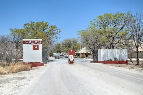 CampsiteCampsite Halali CampPrivate bag 13378, Windhoek+264 67 229 400nwr.com.na
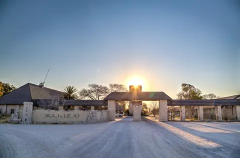 CampsiteCampsite Okaukuejo CampPrivate bag 13378, Windhoek+264 67 229 800nwr.com.na
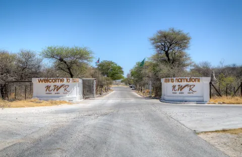 CampsiteCampsite Namutoni+264 67 229 300nwr.com.na
- HotelHalali Camp+264 67 229 400nwr.com.na
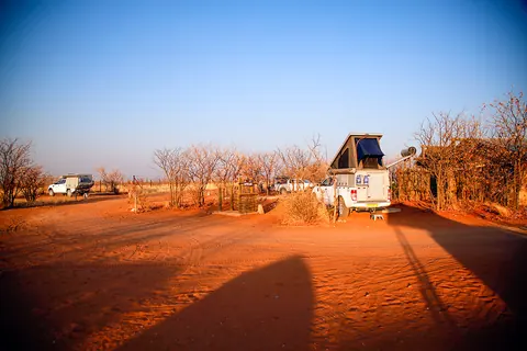 CampsiteOlifantsrus camping site+264 81 950 1162nwr.com.na
 HotelNamutoni Camp+264 67 229 300nwr.com.na
- 19.01°S 14.47°EHotelDolomite Camp+264 65 685 118nwr.com.na
- 18.66°S 16.72°EHotelOnkoshi Camp+264 81 950 1163nwr.com.na
Sights 55
- Olifantsrus site museumMuseum
- AdamaxViewpoint
- AndoniViewpoint
- Arendsnes (man-made water point)Viewpoint
- Aroe (man-made water point)Viewpoint
- Batia (natural waterhole)Viewpoint
- Bitterwater (man-made water point)Viewpoint
- Chudob (natural waterhole)Viewpoint
- Dolimietpuunt WaterholeViewpoint
- DorslandtrekkersMemorial
- DuikerdrinkViewpoint
- Duineveld (man-made water point)Viewpoint
Show all 55 sights
- Duiwelsvuur (man-made water point) · Viewpoint
- Etosha Lookout · Viewpoint
- Fort Namutoni · Castle
- Ghost Tree Forest · Viewpoint
- Groot Okevi (natural waterhole) · Viewpoint
- Groß Namutoni · Attraction
- Grünewald · Viewpoint
- Jakkalswater Waterhole · Viewpoint
- Kalkheuwel (man-made water point) · Viewpoint
- Klein Namutoni · Viewpoint
- Klein Okevi (natural waterhole) · Viewpoint
- Klippan (man-made water point) · Viewpoint
- Koinachas · Viewpoint
- Leeubron · Attraction
- Luiperdskop (man-made water point) · Viewpoint
- Luiperdskop Seasonal Waterhole · Viewpoint
- Miernes (man made waterhole) · Viewpoint
- Natco Waterhole · Viewpoint
- Ngobib (natural waterhole) · Viewpoint
- Nomab (man-made water point) · Viewpoint
- Noniams (natural waterhole) · Viewpoint
- Okaukuejo Waterhole · Attraction
- Okavao Waterhole · Viewpoint
- Okerfontein (natural waterhole) · Viewpoint
- Okondeka (natural waterhole) · Attraction
- Old Farm Buildings · Ruins
- Olifantsrus · Viewpoint
- Ombika Waterhole · Attraction
- Onautinda · Viewpoint
- Ozonjuitji m'Bari · Viewpoint
- Pan's Edge · Viewpoint
- Pionierdam · Viewpoint
- Rateldraf (man-made water point) · Viewpoint
- Renosterflei (man-made water point) · Viewpoint
- Rietfontein · Attraction
- Sonderkop · Viewpoint
- Springbokfontein · Viewpoint
- Stinkwater · Viewpoint
- Teespoet waterhole · Viewpoint
- Tobieroen (man-made water point) · Viewpoint
- Tsumcor · Viewpoint
- Twee Palms · Viewpoint
- Wolfsnes (natural waterhole) · Attraction
Restaurants and cafes 2
 Namutoni RestaurantRestaurant · german
- Okaukuejo RestaurantRestaurant
Bars and pubs 1
- Lion's BarBar
Quick answers
How much is the entry fee for Etosha National Park?
International visitors pay N$280 (about US$17, €15 or £12.50) per adult and N$180 per child per day. These rates apply from 1 April 2026 to 31 March 2027 and are set by Ministry of Environment, Forestry and Tourism (MEFT).
Do Namibians and SADC citizens pay less at Etosha National Park?
Namibian citizens pay N$60 per adult and SADC nationals pay N$180 per adult per day. You need ID or a passport to get the lower rate.
When were these Etosha National Park fees last checked?
We last checked them on 7 October 2026 against 7 published sources. We re-check every two weeks, but always confirm with Ministry of Environment, Forestry and Tourism (MEFT) before you travel.
What animals can you see in Etosha National Park?
Most visitors see elephant, springbok, plains zebra, blue wildebeest and giraffe. You have a good chance of seeing gemsbok (oryx), black-faced impala, lion and black rhino. Leopard is there but rarely seen.
Etosha and the parks nearest it
| Park | International adult | Distance | Where |
|---|---|---|---|
| Etosha National Park | US$17 €15 · N$280 | · | Oshana |
| Waterberg Plateau Park | US$17 €15 · N$280 | 226 km | Otjozondjupa |
| Okonjima Nature Reserve | US$15 €13 · N$250 | 228 km | Otjozondjupa |
| Palmwag Tourism Concession | US$6 €5 · N$100 | 241 km | Kunene |
Guides for Etosha National Park
- First Safari: South Africa, Namibia or Botswana?
- Malaria on Safari: Kruger, Etosha, Okavango, Malaria-Free Parks
- US Dollars, Cards and Cash in South Africa, Namibia, Botswana
- Plugs, SIM Cards and eSIMs: South Africa, Namibia, Botswana
- How Much Does a Safari Cost? South Africa, Namibia, Botswana
- How Much Does a Safari Cost from the UK? Prices in Pounds
- Safari in the UK School Holidays: Which Break, Which Park
- Safari Tipping in South Africa, Botswana and Namibia
- Best Time to Visit Etosha: Month by Month
- Etosha Gate Times by Month, Gates and Camps
- Self-Drive Namibia: Gravel Roads, Fuel and Borders
- Namibia Travel Essentials for First Visitors
Where the Etosha fees come from
- Government Gazette No. 8877 of 1 April 2026, Government Notice No. 115 (MEFT fee schedule), copy hosted by the Legal Assistance Centre
- Tourism Update (27 January 2026)
- Namibian.org (19 January 2026)
- Africa Beat (6 February 2026)
- TravelComments.com (29 January 2026)
- EtoshaNationalPark.com.na (independent park guide)
- SafariFind
Open data: all park fees (CSV) · JSON (CC BY 4.0)
Cite as: Travel Africa Guide, "Etosha National Park fees 2026/27", checked 7 October 2026, https://travelafrica.guide/namibia/etosha-national-park/
Map of Etosha National Park
See every place on this map as a list