Town · Kunene, Namibia
Outjo
The last town on the tar before Etosha's Andersson Gate, founded as a German military post in 1897, with a stone windmill tower, the Naulila Monument, a well-stocked Spar and a bakery travellers rate.
Short answer
Outjo is in Kunene, Namibia. This page lists 18 places to stay, 3 places to eat and drink and 3 sights. The nearest park with an entry fee on this site is Okonjima Nature Reserve, about 98 km away, where international adults pay from N$250.
- Malaria
- Outjo is in Kunene, one of the regions where the CDC says malaria is transmitted and recommends preventive tablets.
- Places to stay
- 18
- Eat and drink
- 3
- Sights
- 3
In and around Outjo
24 places listedWhere to stay in Outjo 18
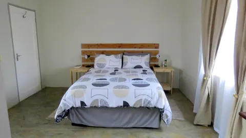 HotelFaith City GuesthousePresident Avenue, Outjo+264 85 124 0825faithcityguesthouse.wheretostay.na
- 20.10°S 16.15°EGuest houseKai-Oms BackpackersMeester St+264 81 346 3644facebook.com
- 20.11°S 16.15°EGuest houseFARMhouse B&BKronkel Street, Outjo+264 81 326 3739farmhouse-outjo.com
- 20.10°S 16.14°ECampsiteHai-//om San Camp SiteHage Geingob Avenue, Outjo+264 85 334 7064visitnamibia.com.na
- 20.12°S 16.06°ECampsiteCamping Sophienhof Lodge
- 20.10°S 16.14°EHotelEtotongwe Lodge & Camping
- 20.11°S 16.15°EGuest houseEyambeko GuesthouseNangolo Mbumba St (Long St)
- 20.12°S 16.16°ECampsiteOmbinda Country LodgeOutjo
- 20.12°S 16.06°EHotelSophienhof Lodge+264 67 312 999
Show all 18 places to stay
- Aloe Guesthouse & Conference Centre · Guest house
- Ansta Farmhouse Camping · Campsite
- Base Camp (was Oppiklippe) · Campsite
- Buschveld Park Resort · Guest house
- Dan-Marie Chalets · Guest house
- Mamselle Nature Camp · Campsite
- Matunda · Guest house
- Namatubis Guestfarm · Hotel
- Sasa Safafari Camp · Hotel
Sights 3
- Franke-Haus-MuseumMuseum
- Naulila MemorialMemorial
- Stone TowerRuins
Restaurants and cafes 3
- FARMhouse RestaurantRestaurant · pizza, coffee shop, burger, italian, chinese, sandwich, regional, kebab, sushi, greek, seafood, french, german, polish, international, pasta, dessert, cake, pancake · Kronkel Street, Outjo+264 67 313 444farmhouse-outjo.com
- Route 38Restaurant · african, chicken, coffee shop · Kronkel Street, Outjo
- Outjo BakeryCafe
Outjo is the last proper town on the tar before Etosha. It sits at about 1,216 m on the C38, roughly 90 km from Andersson Gate, and most visitors use it to fill the tank, buy food and draw cash before the park. That undersells it a little. It began as a German military station in 1897, keeps two national monuments, a memorial and a stone windmill tower, and it is growing quickly: the 2023 census counted 15,063 people, up from 8,445 in 2011.
Getting there
The C38 is tarred from Otjiwarongo through Outjo to Okaukuejo, the Etosha camp 17 km inside Andersson Gate, so an ordinary hire car is fine for the usual Windhoek to Etosha run. Outjo is also the junction for the north-west. The C39 runs west to Khorixas and the C40 to Kamanjab, both tarred. Beyond them most of Kunene is gravel, often badly corrugated, and some D roads need a 4x4. The branch railway from Otjiwarongo ended here, but no trains run any more. There is a small airstrip about 10 km out of town.
When to go
Your dates depend on Etosha more than on the town. Weather records kept at Etosha Safari Lodge from 2010 to 2017 show almost no rain from May to October and most of it from December to March, with January the wettest month. The dry months are the classic time for game at the waterholes, but by October the average high is above 37°C. In June and July nights drop to around 10°C, so bring something warm for early starts.
What to do
The Naulila Monument, unveiled in 1933 and a national monument since 1971, remembers German soldiers killed in 1914 at and around a Portuguese fort in southern Angola, after Outjo’s district officer and two officers with him were killed there. The 9.4 m stone tower near the riverbed was put up by German troops in 1900 to carry a wooden windmill that pumped water to their fort. The Franke House Museum is in a stone house from 1899, but it was reported closed for months in 2019, so ask in town whether it is open. Namibia (SWA) Gemstones on Hage Geingob Avenue also works as an information point and sells maps. For a drive out, Vingerklip, a 35 m finger of rock, stands about 80 km south-west of town above the Ugab valley.
Good to know
Outjo has banks, a hospital, supermarkets and filling stations, and self-drivers keep recommending its well-stocked Spar and its German-style bakery. Fill up here too. Inside Etosha the filling stations are at the three main camps, Okaukuejo, Halali and Namutoni. Plastic bags are banned in Namibia’s parks, so repack your shopping before the gate. Kunene is one of the regions where the CDC recommends malaria tablets, and Namibia’s health ministry counts it among the ten regions that still have malaria, so see a travel clinic before you fly. Don’t drive after dark, when animals are on the roads, and remember Etosha’s gates close at sunset.
History and culture
Outjo grew from a German military station set up in 1897 to control the country between the Ugab and Kunene rivers, at a small settlement of mainly Herero people with Damara, Nama and Aawambo neighbours. Its stone windmill tower and museum house date from German rule, and today it is a town of about 15,000 on the main road to Etosha, in a constituency where half of homes speak Khoekhoegowab.
- 1880
The trader Tom Lambert settled at Outjo and bought land from the Herero chief. The place was then a small settlement of mainly Herero people, with Swartbooi and Topnaar Nama, Damara and some Aawambo living nearby. source
- 1897
The colonial government made Outjo the seat of a new district reaching from the Ugab River to the Kunene, with Ludwig von Estorff as first magistrate. In December, Topnaar and Swartbooi Nama, with some Herero under Chief Kambata, rose against German rule in the Fransfontein, Otjitambi, Kamanjab and Grootberg areas. source
- 1898
The Swartbooi were defeated at Grootberg on 17 March and surrendered, and David Swartbooi and some of his followers were imprisoned in Windhoek and Outjo. A post office opened at Outjo in February and the first plots were surveyed in May. source
- 1904 to 1908
After the Herero and then the Nama rose against German rule, German forces waged a war of extermination against them. Between 40,000 and 80,000 Herero and about 10,000 Nama died, many in concentration camps. Germany acknowledged it as genocide in 2015. source
- 1914
Early in the First World War, Outjo's district officer Hans Schultze-Jena and German soldiers with him were killed at the Portuguese fort of Naulila in southern Angola, in circumstances never fully cleared up. German raids on Portuguese forts followed, and on 18 December a force under Victor Franke destroyed Naulila. The German soldiers killed on the expedition were buried in Outjo. source
- 1915
During the First World War South Africa invaded and occupied German South West Africa, and afterwards governed it under a League of Nations mandate. White minority rule, with apartheid, lasted until independence. source
- 1954
The Khoisan-speaking Haiǁom, who had lived around the Etosha pan north of Outjo, were forcibly removed from the park and lost their hunter-gatherer way of life, most becoming landless farm workers. Since 2007 the government has bought six farms next to the park to resettle Haiǁom families. source
- 1966 to 1990
SWAPO's armed wing, the People's Liberation Army of Namibia, began its guerrilla war against South African forces in 1966. Namibia became independent on 21 March 1990. source
- Languages
- In Outjo constituency, which includes the town, the 2023 census found Khoekhoegowab, the Damara and Nama language, to be the main home language in 2,507 of 4,994 households, about half. Otjiherero and Oshikwanyama follow with about 12% each, then Afrikaans (6%), Oshindonga (4%) and English (2%). Only five households named German. source
- Local politics
- Outjo is run by a seven-seat municipal council. From independence it was the only small town in Kunene controlled by SWAPO. SWAPO won the most votes again in 2020 but lost its majority, taking three seats, with one each going to the LPM, UDF, PDM and MAG. source
- Food
- German and Swiss cooking is easy to find. The FARMhouse on the main road serves German and Swiss dishes alongside traditional food, home-baked cakes and coffee. source
For German visitors: Namibian carnival started in Outjo. Fritz Kaufmann and Finko Finkeldey, emigrants who brought the traditions of the 1st Friedberger Karnevals-Gesellschaft 1904 with them, held the first one at the Zentralhotel in 1952, then moved to Windhoek in 1953 and took carnival to the SK Windhoek sports club. source
For German visitors: Victor Franke ran the Outjo district from 1899 and later commanded all German forces in the colony, surrendering to South African troops at Khorab on 9 July 1915. He died in Hamburg in 1936 and is buried at Ohlsdorf cemetery. His diaries are in the Bundesarchiv in Koblenz and were the main source for Gerhard Seyfried's 2003 novel Herero. source
For American visitors: Jakob (Japie) van Zyl, born in Outjo in 1957, took his doctorate at Caltech and worked at NASA's Jet Propulsion Laboratory from 1986 to 2019, building radar systems and later heading its solar system exploration directorate. NASA gave him its Outstanding Public Service Medal in 2019 for the InSight Mars mission, and since 2018 a street in Outjo carries his name. source
Main sights in Outjo
5- Naulila Monument
Commissioned by the Deutscher Verein and unveiled on 12 June 1933, it remembers the Germans killed at Fort Naulila in Angola in October 1914 and in the attack that followed, in which 31 Germans and about 150 on the Portuguese side were killed or wounded. Angolan losses were never recorded. A national monument since 1971.
National Heritage Council of Namibia: Heritage Places - Stone Tower
A 9.4 m tower of natural stone and clay built by German troops in 1900 over a stone well, working from March 1901 and a national monument since 1957. It stands by a riverbed near the Etosha Garden Hotel. The site of the old military station is now Outjo's business district.
Wikipedia (German): Wasserturm Outjo - Franke House Museum (Outjo Museum)
The town museum is in one of Outjo's oldest buildings, a stone house built in 1899 for the local administrator and named after Victor Franke. It shows gemstones, horns and skins, old furniture and tools. In 2019 the Museums Association of Namibia found the building in poor shape and the museum closed for months, so check before you go.
Wikipedia (German): Franke-Haus-Museum, citing the Museums Association of Namibia - German war cemetery
The German war cemetery in Outjo also remembers the 1897 and 1898 rising of the Topnaar and Swartbooi against German colonial rule.
Klaus Dierks, Chronology of Namibian History (1897) - Vingerklip
A 35 m pillar of sandstone and conglomerate about 80 km south-west of Outjo, left standing by erosion above the Ugab valley. Since Mukurob in the south collapsed it has been Namibia's best-known rock.
Wikipedia: Vingerklip
Did you know?
- Outjo is Otjiherero for small hills. The older Khoekhoegowab name, Tsuub, is said to mean bad place. source
- Outjo's stone tower is not a water tower in the usual sense, as it never held a tank. It carried a wooden windmill that pumped groundwater into a concrete basin, from where a 620 m pipe fed the barracks, kitchen, stables and sick bay of the German station. Some locals call it the powder tower, from a story that the troops kept gunpowder there. source
- Outjo was the most populous of Kunene's four urban places at both recent censuses, growing 78.4% from 8,445 people in 2011 to 15,063 in 2023. source
- In 1928 about 2,000 Dorslandtrekkers (Thirstland trekkers), Afrikaners whose families had left South Africa for Angola in the late 1800s, came back across the Kunene at Swartbooisdrift and were taken inland to Outjo. source
- From 1921 Outjo was the end of a 69 km branch line from Otjiwarongo, the shortest railway in the country and the only section ever built of a planned line to Ovamboland. In later years TransNamib ran only occasional freight trains on it, and none run today. source
- Okaukuejo, Etosha's main camp, lies in Oshana and Oshikoto regions, but its only road link runs south through Outjo, so its football club plays in Kunene's regional league. source
Checked 7 October 2026.
Wildlife you might see
5- possibleGreater kuduOff the main highways, even outside the parks. For the big game, Etosha is about 90 km up the C38. All yearsource
- possibleGiraffeOff the main highways, even outside the parks. For the big game, Etosha is about 90 km up the C38. All yearsource
- possibleOryx (gemsbok)Off the main highways, even outside the parks. For the big game, Etosha is about 90 km up the C38. All yearsource
- possibleSpringbokOff the main highways, even outside the parks. For the big game, Etosha is about 90 km up the C38. All yearsource
- possibleChacma baboonOff the main highways, even outside the parks. For the big game, Etosha is about 90 km up the C38. All yearsource
Likelihood is for a normal visit of two or three days, from the sources linked. Nothing is guaranteed in the wild.
Staying safe in Outjo
- Malaria
- Outjo is in Kunene, one of the regions where the CDC says malaria is transmitted and recommends preventive tablets. Namibia's Ministry of Health and Social Services also lists Kunene among the ten regions that still have malaria, and 2026 has been a bad year nationally. See a travel clinic before you go, and cover up and use repellent from dusk. source
- Heat
- Summers are hot. In weather records from Etosha Safari Lodge (2010 to 2017), the average high reaches 37.2°C in October and records pass 40°C in every month from October to February. Carry plenty of water in the car, and plan walks and stops for the early morning. source
- Driving at night and on gravel
- Try to be off the road by dusk, as wild animals are often on the roads at night. Stones thrown up on gravel crack windscreens and cut tyres, so look over the tyres and the spare every day or two. When a car comes past you on gravel, ease off and pull over to the left until its stones and dust have gone. source
- Etosha gate times
- Etosha's gates open at sunrise and close at sunset. If you are driving up from Outjo late in the day, leave enough time to reach Okaukuejo, 17 km beyond Andersson Gate, before the gates shut. source
Tips from travellers
- Stock up in Outjo. Self-drivers on Namibia forums point to its well-stocked Spar as the place to buy food before entering Etosha through Andersson Gate, or after leaving it. several sources
- The town bakery is a regular stop for coffee and cake. Travel guides, a forum list of the best shops on a Namibia route and the municipality itself all single it out. several sources
- Fill the tank in Outjo. Inside Etosha the filling stations are at the three main camps, Okaukuejo, Halali and Namutoni, so top up whenever you pass one. one source
- Plastic bags are not allowed into Namibia's parks, and NWR's terms make it an offence. Repack the shopping from town into boxes or cloth bags before you reach the gate. official
- Namibia (SWA) Gemstones on Hage Geingob Avenue doubles as a local information office, with maps and Etosha books for sale, and the owners speak English, German and Afrikaans. one source
- Gamkarab Cave near Outjo, known for its stalactites and the stone pietersite, is on private land and not open to the public, so don't go looking for it. one source
Checked 7 October 2026. Conditions change, so confirm with the park or venue before you go.
Sun-mirror telegrams, borrowed rails and a stone found in 1962
On 1 August 1902 a message could leave Windhoek and reach Outjo with no wire in between. It travelled by heliograph: a mirror on a hilltop flashing Morse in sunlight to the next hilltop. The chain ran up through Karibib and Omaruru, then Okowakuatjiwi (the place now called Kalkfeld) and Etaneno. In 1906 it was pushed north to Okaukuejo, inside what is now Etosha. The army’s heliographs in this colony could reach more than 70 km in one hop.
A cattle plague put the soldiers here
Outjo’s garrison dates from the rinderpest scare. The disease was south of the Zambezi early in 1896, and in August that year German and British officials met at Vryburg and agreed to shut their borders to animals. Fencing a whole colony was beyond the Germans, so from November the deputy governor, Friedrich von Lindequist, strung 16 military outposts across the north instead. Klaus Dierks’s chronology of Namibian history lists a military station put up at Outjo that same year, and the place became the base for everything between the Ugab and the Kunene. The cordon failed. Rinderpest reached Windhoek in April 1897 and went on to kill about half the Herero cattle. The line outlived the plague. A decree of 1907 used it as the northern limit of police protection, and in 1916 settlers drew a red line on a map along that same border to keep northern cattle out. South Africa adopted it, and that is the veterinary Red Line which still divides Namibia.
Manni Goldbeck, writing about the stone tower in The Namibian in 2024, adds that the post was also there to stop ammunition smuggling and free-for-all hunting, and that the riverbed then had strong springs, reed beds big enough to lose a lion in, and plenty of mosquitoes. One of the soldiers posted here was Emil Eisinger from Baden. The National Archives record has him landing at Swakopmund in June 1896, stationed at Outjo, fighting the Swartbooi in 1897 and 1898, then breaking down and being sent home and discharged. In 1913 he published Im Damaraland und Kaokofeld, the book to find if you read German and want that war from the inside.
Borrowed rails, and a trek that ended here
The railway to Outjo was started on 18 September 1914 with the First World War already in its second month. The plan was 265 km of narrow-gauge track from Otjiwarongo through Outjo and Okaukuejo to a waterhole called Okahakana, where the footpaths from the Ovambo kingdoms met, so that contract workers could be carried south. A month later the first 32 km of the Otavi line out of Swakopmund were lifted and the material brought inland for it. Hans Drinkuth surveyed the route. By February 1915 there were 46 km of embankment and 26 km of working track, and then the war stopped it. South Africa picked the job up in February 1921 and the Administrator, Gysbert Hofmeyr, opened the line on 20 December that year. It stayed narrow gauge until 1960.
Seven years after the opening, on 3 March 1929, Outjo was where the “Angola trek” finished. Between August 1928 and February 1929 South Africa brought 1,922 Afrikaners out of Angola, 373 families of them. They waited in a camp called Chimhaka by the Kunene before being moved inland. The first child of the trek born on this side of the river was Dirk Hendrik Ackerman, on 11 December 1928.
The Schultze-Jenas
The district officer whose death at Naulila set off the fighting remembered on the monument in town came from an unlikely family for a frontier post. Hans Schultze-Jena, born on 12 December 1874, was a lawyer and had run Outjo since 1911. His father was Bernhard Sigmund Schultze, a gynaecologist so well regarded in Jena that in 1912 the Grand Duke let the family add the city to its surname. His elder brother Leonhard was a zoologist who spent 1903 to 1905 in this same colony, wrote Aus Namaland und Kalahari about it, and late in life translated the Maya Popol Vuh. Hans had gone into Angola partly to find food supplies that had gone missing there. The two lieutenants who died with him on 19 October 1914 were A. Loesch and K. Roeder.
A stone with Sid Pieters’s name on it
Pietersite is known from two places on earth. One is Henan in China. The other is the farmland around Outjo, where Sidney “Sid” Pieters found it in 1962. The spot usually given is the farm Hopewell, about 40 km north-east of town. It is a blue-grey to brown-yellow stone with a silky shimmer that swirls in every direction at once, and it is often sold as broken-up tiger’s eye. A 2010 study in Gems & Gemology is cited for the opposite view: the two only share the crocidolite fibres that make them shimmer.
What walks the farms west of town
The game nearest to town is on the farms around it, and the fullest public record is the list kept by Sophienhof, a 9,000 ha farm in mopane country about 10 km out on the C39 towards Khorixas. The lodge says every animal on it was photographed there between 2009 and 2012. Kudu, giraffe, oryx and warthog are there, as you would expect. The surprises are the animals of the night: pangolin, aardvark, porcupine, genet, leopard. Don’t expect those on a two-hour afternoon drive. Damara dik-dik and klipspringer are on the list, and so is Hartmann’s mountain zebra. So are blesbok and black wildebeest, which belong on the South African highveld, and black-faced impala, whose home range is Kaokoland, so part of what you see has been brought in. The farm also offers a separate rhino drive, on which it says the guide keeps looking until the guests have seen one, and a sunset drive to the Ugab Terraces. It is one lodge’s own list, so read it as what lives in this bush, not a promise.
Guides for Outjo
Map of Outjo
See every place on this map as a list