Region · Namibia
Kunene
Namibia's remote north-west: Damaraland's rock engravings and desert elephants in the south, Himba country and the Kunene River in the north, the Skeleton Coast to the west.
Short answer
This page covers 2 parks and reserves and 8 towns and cities in Kunene. 2 of the parks have checked entry fees: international adults pay from N$100 at Palmwag Tourism Concession to N$280 at Skeleton Coast Park.
- Parks and reserves
- 2
- Towns and cities
- 8
- Places to stay
- 107
- Where
- Namibia19.08°S 13.46°E
Parks and reserves in Kunene
2Towns and cities in Kunene
8Written up in smaller places around Kunene
1
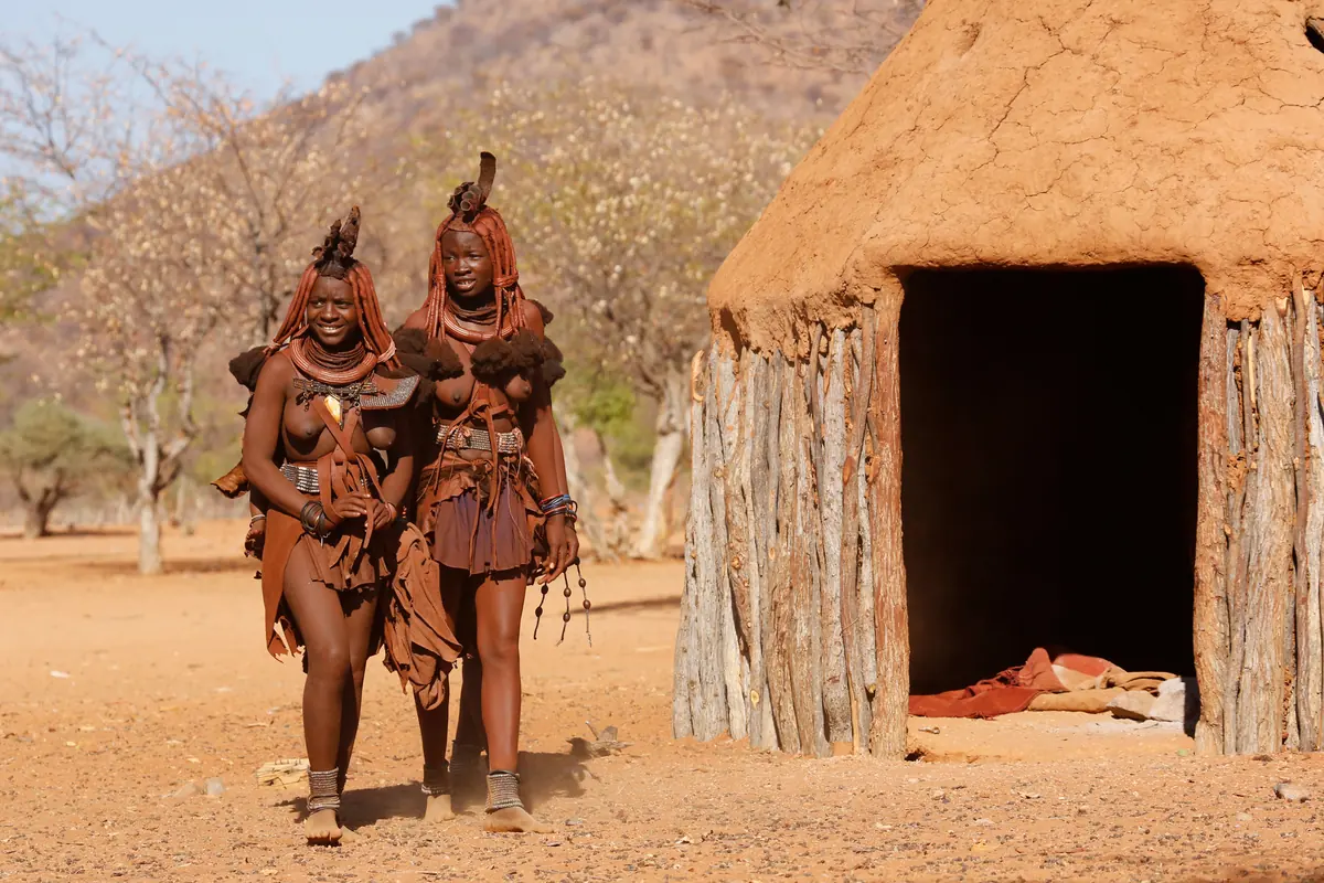
Kunene is Namibia’s north-west corner, about 115,000 km² of mountains, gravel plains and dry riverbeds running inland from the Atlantic, with the Kunene River as its border with Angola. The 2023 census counted 120,762 people, about one per km². The south is still widely called Damaraland and the north Kaokoland. People come for desert elephants and black rhino, the engravings at Twyfelfontein (ǀUi-ǁAis) and the Ovahimba of the north. I think it is the best self-drive country in Namibia, if you plan your fuel.
Getting there
Outjo, about 90 km south-west of Etosha’s Andersson Gate, is the gateway. From there the C39 runs to Khorixas and the C40 to Kamanjab, and further north the C35 and C41 are tarred to Ruacana and Opuwo, which is about 720 km from Windhoek. Kaokoland’s other C roads are rough gravel, only just passable in an ordinary car. Most D roads need a 4x4, and Van Zyl’s Pass needs one with low range and good clearance. Few hire companies allow the remote Kaokoland routes, so check your contract. There is no public transport, only small airstrips for light aircraft.
When to go
Kunene is dry (Khorixas averages about 220 mm of rain a year), but when rain comes it floods riverbeds and turns tracks to mud. If a river is running, wait, as the level can drop within hours. At Twyfelfontein July runs from about 10 to 28 °C and November from 21 to 35 °C, so see the engravings early or late in the day.
What to do
Twyfelfontein has at least 2,500 engravings, most of them made over the last 6,000 years. In 2007 it became Namibia’s first World Heritage Site. The tourism board says some of its four routes can be walked on your own, but other reports say every visit now goes with a local guide, so plan on one. West of Khorixas, just off the C39, the Petrified Forest has dozens of fossil trunks lying in the open, and you may only enter with a guide. Vingerklip, a 35 m finger of rock, stands about 80 km south-west of Outjo.
Desert elephants follow the dry Huab, Hoanib and Hoarusib rivers, and Palmwag has Africa’s largest population of south-western black rhino. The Skeleton Coast Park runs along the shore from the Ugab to the Kunene. Anglers use Terrace Bay, Torra Bay opens in December and January, and the northern section is fly-in only. Opuwo is the base for Himba visits with a local guide.
Good to know
- The CDC recommends malaria tablets for Kunene.
- Fuel: Opuwo has the last pump to the north and west, and Khorixas has fuel and an ATM. For the Hartmann Valley via Purros the last pump is at Sesfontein, and deep sand can double consumption.
- Carry water, food and a tow rope, and in Kaokoland a satellite phone.
- Expect a vehicle check at the Red Line veterinary fence north of Palmwag.
- Ask before photographing anyone, and never photograph people in front of their huts.
- The Kunene River has crocodiles and hippos, so do not swim.
History and culture
Kunene is Namibia's thinly peopled north-west, made up of old Kaokoland in the north and the western part of old Damaraland in the south, with the Skeleton Coast along its Atlantic side. Its rock engravings go back thousands of years. German rule here meant a few forts and a land company that never managed to make the area pay, and the Red Line fence the Germans first drew still divides communal land in the north from commercial farms further south.
- About 6,000 years ago
Stone Age hunter-gatherers settled the valley at Twyfelfontein and made most of its engravings. Khoekhoe herders arrived 2,000 to 2,500 years ago, called the spring ǀUi-ǁAis (jumping waterhole) and added rock art of their own. source
- 1860s
Swartbooi and Topnaar Nama groups raided Kaokoland for cattle, first from Fransfontein and later from Sesfontein, and many Ovahimba and Ovatjimba fled across the Kunene into Angola. The river crossing they used has been called Swartbooisdrift ever since. source
- 1896 to 1907
To stop a rinderpest (cattle plague) epidemic, the German colony drew a veterinary line across the north in 1896. In 1907, following a 1905 Reichstag resolution passed during the Herero war, it became a political border, and the northern areas beyond it were left to indirect rule through traditional leaders. The line survives as the Red Line veterinary fence, which today runs north of Palmwag. source
- 1904 to 1908
German forces carried out the genocide of the Herero and Nama. Between 40,000 and 80,000 Herero, about 80 percent of them, and some 10,000 Nama died. Around 1,000 Herero escaped north to the Ovambo kingdoms, and survivors were made to work on German farms. source
- 1925 to 1939
Under South African rule the first government office for Kaokoland was at Swartbooisdrift on the Kunene, from 1925 to 1939. After that the administration moved to Ohopoho, which became Opuwo, now the regional capital. source
- 1970s to 1989
Apartheid planners made Damaraland a Bantustan, an ethnic homeland meant to govern itself, for the Damara people, on the western edge of the area called Damaraland in the 1800s. From 1980 a Representative Authority for the Damara, organised by ethnicity rather than territory, took over its functions, and like the other homelands it was abolished in May 1989 as Namibia moved to independence. source
- 1980s
Drought killed about 90 percent of Himba livestock. Many Himba became refugees in Opuwo or joined Koevoet paramilitary units, and during the Border War Himba on the Angolan side were sometimes kidnapped, as hostages or as recruits for the Angolan branch of PLAN, SWAPO's army. source
- 1915 to 1990
German rule ended with defeat by South African forces in 1915, and apartheid was later applied to the territory. SWAPO (the South West Africa People's Organisation) began its armed struggle in 1966, which became part of the wider South African Border War, and Namibia became independent on 21 March 1990. source
- Language
- In the 2023 census Otjiherero was the main home language in 37.7% of households and Khoekhoegowab, the Damara and Nama language, in 27.3%. Next came Otjihimba (8.1%), Oshikwanyama (5.3%), Oludhimba (4.8%) and Afrikaans (2.9%). English, the official language, was spoken at home in 1.7%. source
- People
- Herero and Himba people in Kaokoland both speak Otjiherero. Younger Herero often speak English and Afrikaans as well, but few traditional Himba do, so a local guide makes a real conversation possible. source
- Damara heritage
- The Damara are, with the San, among the oldest peoples of Namibia, and their old way of life mixed hunting and gathering with herding cattle, goats and sheep. Much of it was lost under colonial rule, and the Living Museum of the Damara near Twyfelfontein was built by the community to bring it back. source
- Himba myrrh
- Namibian myrrh (Commiphora wildii) grows in the Kaokoveld and oozes a scented resin without being cut. Himba women collect it and use it for incense and cosmetics. source
- Opuwo Trade Fair
- The Opuwo Town Council started the Opuwo Trade Fair in 2012. It is held in May and mixes a business show with cultural performances and live entertainment. source
For German visitors: The Bremen merchant Adolf Lüderitz bought the Kaokoveld from local leaders before the German colony existed. The firm L. Hirsch & Co. took it over in 1893 and in 1895 set up the Kaoko-Land- und Minen-Gesellschaft in Berlin. Its backers paid for expeditions in 1894, 1895, 1897, 1906 and 1910, found two iron ore deposits that could not be mined for lack of transport, and the company was expropriated by South Africa after the First World War. source
For German visitors: Outjo began in 1897 as a small German military post, set up under Theodor Leutwein as a base for exploring the north of German South West Africa. source
For German visitors: Georg Hartmann, a geographer from Dresden, travelled into the northern Kaokoveld in 1900 and published his account in 1903. Hartmann's mountain zebra and the Hartmann Valley are named after him. source
For German visitors: Governor Friedrich von Lindequist proclaimed the game reserve that became Etosha National Park in March 1907, by Ordinance 88 of German South West Africa. source
For German visitors: The Living Culture Foundation Namibia, which works with the Living Museum of the Damara near Twyfelfontein, was founded in Tangermünde in Germany. source
For American visitors: Margaret Jacobsohn and Garth Owen-Smith of Namibia won the 1993 Goldman Environmental Prize. The prize is given by the Goldman Environmental Foundation of San Francisco, and winners are honoured at ceremonies in San Francisco and Washington, D.C. source
Main sights in Kunene
8- Twyfelfontein (ǀUi-ǁAis)
The largest open-air gallery of rock engravings in Namibia, and in 2007 the country's first UNESCO World Heritage Site. Go early in the morning or late in the afternoon, when it is cooler, and the morning shadows make the engravings easier to photograph.
Namibia Tourism Board: North-western region - Petrified Forest
West of Khorixas, just off the C39, with 50 to 60 large fossil trunks and welwitschia plants growing between them. It was declared a national monument on 1 March 1950, and you may only walk it with a guide.
Wikipedia (German): Versteinerter Wald (Namibia) - Fort Sesfontein
Built by German Schutztruppe soldiers (the colonial army) in 1896 as a police post to control cattle movements after rinderpest, and abandoned in 1914. The officers planted its palm trees. It was rebuilt in the 1990s as accommodation for tourists, and three graves remain, two of soldiers and one of a trader.
Wikipedia: Sesfontein - Naulila Monument, Outjo
Remembers three Germans killed at the Portuguese fort of Naulila in Angola on 19 October 1914 and the German attack that followed, which killed or wounded 150 on the Portuguese side (Angolan losses were not recorded). It was unveiled in 1933 and declared a national monument in 1971.
National Heritage Council of Namibia: Heritage Places - Franke House Museum, Outjo
Outjo's local history museum, which covers Major Viktor Franke's campaign in Ovamboland. The town also keeps an early German water tower, once fitted with a wooden wind turbine to pump water.
Wikipedia: Outjo - Rock engravings at Kamanjab
Engravings on a farm once owned by Peet Alberts, one of the Dorsland trekkers. They were proclaimed a protected relic in 1967.
National Heritage Council of Namibia: Heritage Places - Living Museum of the Damara
Close to Twyfelfontein, the first traditional Damara project of its kind in Namibia. The community that built it shows visitors the old Damara way of life and earns a regular income from it.
Living Culture Foundation Namibia: Living Museum of the Damara - Rusplaas (Otjitundua) and Kaoko Otavi
The Dorsland (thirstland) trekkers, Afrikaans-speaking Boer families from the Transvaal on their way to Angola, stayed at Rusplaas, Kaoko Otavi and other springs from May 1879 to October 1880, and deaths from fever went on. Ruins of their camps survive, including a church near Kaoko Otavi.
Wikipedia: Dorsland Trek
Did you know?
- Twyfelfontein means uncertain spring in Afrikaans. David Levin, who registered the farm in 1948, struggled to get enough water out of it, and a friend nicknamed him David Twyfelfontein. source
- The trunks in the Petrified Forest west of Khorixas are 240 to 300 million years old and have no roots. Scientists think they were driftwood, probably washed down from Angola in a great flood. source
- Kunene's desert elephants drink only every three or four days and can travel up to 200 km looking for water. In drought they dig holes in dry riverbeds, and other animals drink from them too. source
- When Etosha was proclaimed a game reserve in 1907, it reached all the way west to the mouths of the Kunene and Hoarusib rivers on the Skeleton Coast and covered about 80,000 km², nearly four times today's park. source
- Opuwo's name comes from Ohopoho, meaning it is enough. In the 1920s a colonial commissioner looking for land for an office was offered more by the local headman and said he had enough. The spelling changed to Opuwo in 1974. source
- Garth Owen-Smith and Margaret Jacobsohn worked with community leaders in the 1980s to stop the poaching that was wrecking north-western Namibia's wildlife, and together they set up IRDNC (Integrated Rural Development and Nature Conservation). Owen-Smith's view was that the people living with the wildlife had to be part of protecting it, and that shift underlies Namibia's community-run conservation. source
Checked 7 October 2026.
In and around Kunene
147 places listedWhere to stay in Kunene 107
 HotelTaleni Etosha Village+264 67 333 413etosha-village.com
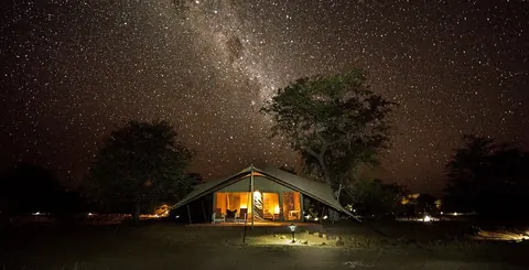 HotelMalansrus Tented Camp+264 64 416 824namibia-tracks-and-trails.com
 CampsiteEtosha Trading Postetosha-tradingpost.com
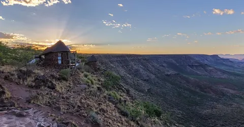 CampsiteHoada Campsite+264 61 228 104hoadacampsite.com
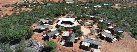 HotelOkutala Etosha Lodge+264 81 126 4324okutala.com
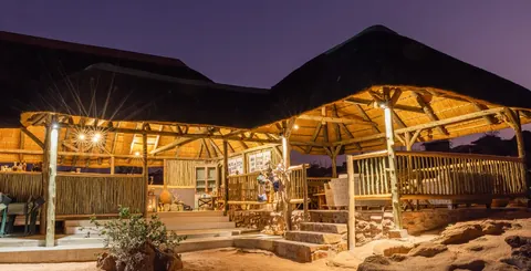 CampsiteOzondjou Trails Camp+264 81 269 7271namibia-tracks-and-trails.com
Show all 107 places to stay
- Ugab Terrace Lodge Campground · Campsite+264 81 149 1433ugabterracelodge.com
- Damaraland Camp · Hotelwildernessdestinations.com
- Etosha Safari Camp · Hotel+264 61 427 200gondwana-collection.com
- twyfelfontein tented camp & campsite · Campsite · D2612+264 67 687 802twyfelfonteintentedcamp.com
- Vreugde Guest Farm · Hotel+264 81 418 4865vreugdeguestfarm.com
- Bambatsi Guestfarm Campsite · Campsite+264 81 245 8803bambatsi.com
- Camp Syncro · Campsite+264 85 700 7540campsyncroweb.wixsite.com
- Etambura Camp · Guest houseinfo-namibia.com
- Etendeka Mountain Camp · Campsite+264 61 239 199etendeka-namibia.com
- Grootberg Lodge · Hotel+264 61 228 104grootberg.com
- Hobatere Lodge · Hotel+264 81 124 9772hobatere-lodge.com
- Little Ongava Lodge · Hotelongava.com
- Mowani Mountain Camp · Hotelmowani.com
- Ombundja Game Ranch · Hotel+264 81 601 7991ombundja.com
- Ongava Lodge · Hotelongava.com
- Otjitotongwe Cheetah Park · Guest housecheetahparknamibia.com
- Ugab Terrace Lodge · Hotel+264 81 149 1433ugabterracelodge.com
- Van Zyl's Pass Campsite · Campsiteconservationtourism.com.na
- Vingerklip Lodge · Hotelvingerklip.com.na
- Otjitambi Guest Farm · Hotel · P.O. Box 580, Outjootjitambi.info
- Puros Community Campsite · Campsitepuros.wild-exp.com
- Buruxa Camp · Hotel+264 81 698 2908planetofhotels.com
- Campsite Mowani Mountain Camp · Campsite+264 61 232 009africanreservations.com
- Ekoto Camp (Forgotten Valley) · Chalet+ 264 (0)81 745 7221forgotten-valley.com
- Huab Lodge · Hotel+264 67 312 070huab.com
- Khowarib Community Rest Camp · Campsiteconservationtourism.com.na
- Okarohombo Community Campsite · Campsiteconservationtourism.com.na
- Onjowewe Camp Site · Campsite+264 81 424 1114namibiajjtours.com
- Porcupine Camp · Campsite+264 67 330 274porcupine-camp.com
- Puros Bush Lodge · Chalet+264 61 251 661puros.wild-exp.com
- Aabadi Mountain Camp · Campsite+264 81 762 9804
- Camp Cornie · Campsite+264 83 700 0204
- Camp Xaragu · Campsitexaragu-damaraland.com
- Khowarib Lodge · Hotel · PO Box 1648, Swakopmund+264 81 219 3291
- Marble Community Campsite · Campsiteopenafrica.org
- Munsterland Guest Farm and Camping · Campsite · C39, Outjo
- Onjowewe House in the Rocks · Hotelnamibiajjtours.com
- Campsite Hoarusib · Campsite
- Eagle Tented Lodge & Spa · Hotel+27877409292
- Hunting & Guest Farm Katemba · Hotel · Farm Franken, Kamanjab
- Otjisakumuka Lodge Camp · Campsite+264 81 037 9950
- Roadside Camp · Campsite+264 81 652 5252
- Tsubes Camp · Campsite+264 81 127 9829
- Alpec Bush Camp · Hotel
- Anderson's Camp · Hotel
- Bambatsi Camp Biro · Campsite
- Camp Aussicht · Campsite
- Camp Kipwe · Motel
- Camp Living Museum Ovahimba · Campsite
- Camp X Ugab · Campsite
- Camping Rustig Toko Lodge · Campsite
- Campsite Alpec Bush Camp · Campsite
- Damari Camping · Campsite
- Desert Elephant Camping · Campsite
- Doro Nawas · Hotel
- Eldorado farm campsite · Campsite
- Eldorado lodge · Hotel
- Enyandi Campsite · Campsite
- Epacha Game Lodge & Spa · Hotel
- Etosha Heights · Hotel
- Etosha Mountain Lodge · Hotel
- Etosha Oberland Lodge · Hotel
- Etosha Omusati Lodge · Hotel
- Etosha Safari Lodge · Hotel
- Fonteine Camp Site Navrae J.M. Rhyn · Campsite
- Gelbingen Safaris Kamanjab · Campsite
- Gelukspoort Gästefarm · Guest house
- Granietkop Campsite · Campsite
- Heavens Gate · Hotel
- Hoarusib Camp Site · Campsite
- House on the Hill · Guest house
- Libertas · Campsite
- Mavinga Campsite · Campsite
- Mbakodja River Campsite · Campsite
- Mondjila · Campsite
- Mopane Village Lodge · Hotel
- Oganga · Campsite
- Ohorongo Safaris Tented Camp · Hotel
- Okahirongo River Camp · Hotel
- Okapuka Camp · Campsite
- Omburo-Ost · Guest house
- Omeva Omuri Community Camp · Campsite
- Omungunda Camping Site · Campsite
- Onduzo Camp · Campsite
- Ongava Tented Camp · Campsite
- Otjitotongwe Camping · Campsite
- Otjiwewa Community Camp · Campsite
- Ovivero Dam Campsite · Campsite
- Palm Community Camp · Campsite
- Serra Cafema Camp · Campsite
- Siyabonga Campsite · Campsite
- Sorris Sorris Lodge · Hotel
- Toko Lodge · Hotel
- Toshari Lodge · Hotel
- Tualuka Safari Lodge · Hotel
- Twyfelfontein Adventure Camp · Hotel
- Ugab Game Farm and Lodge · Hotel
- wildes Camp · Campsite
Sights 36
 Burnt MountainAttraction
 Petrified ForestAttractionnamibian.org
 Organ PipesAttraction
 VingerklipAttraction
- Ovahimba Living MuseumMuseum · Omungunda+264 81 838 2556lcfn.info
- Omapaha Himba VillageMuseum+264 61 237 294omapaha.com
- Twyfelfontein Elephant DriveAttraction
- Ancient Damari MuseumMuseum
- BaobabViewpoint
- BaobabsAttraction
- Brandberg LabirynthAttraction
- Damara Culture MuseumMuseum
Show all 36 sights
- De Riet · Attraction
- doro nawas water pump · Attraction
- Doros Crater · Attraction
- Grizzly bear rock formation · Attraction
- Grootberg viewpoint · Viewpoint
- Hartmann valley · Viewpoint
- Huab · Viewpoint
- Juriesdraai 709 · Ruins
- Kunene Rapids · Viewpoint
- Little Van Zyl‘s Pass · Attraction
- Ondorusu Waterfall · Viewpoint
- Onduli Ridge Airstrip and parking · Viewpoint
- Oryx Valley · Attraction
- Oryx Valley Junction · Attraction
- Rock paintings · Attraction
- Rusplaas Dorslandtrekkers memorial · Memorial
- Sundowner Spot · Attraction
- Sunset Viewpoint · Viewpoint
- Ugab-Valley · Attraction
- Van Zyls Pass · Viewpoint
- Viewpoint over Hoarusib · Viewpoint
- Viewpoint over Skeleton Coast Park · Viewpoint
- Welwitschia mirabilis · Attraction
- Wondergat · Attraction
Hiking trails 2
 Vingerklip walkHiking trail · 4.1 kmnamibweb.com
- South Terrace hikeHiking trail · 4.9 kmnamibweb.com
Bars and pubs 2
- Hoada Sunset barBar
- Red BarBar
Guides for Kunene
Map of Kunene
See every place on this map as a list