Village · Kunene, Namibia
Epupa
A small Himba settlement at the end of the C43, where the Kunene River breaks into palm-lined channels and drops into a gorge on the Angolan border, about 180 km north of Opuwo.
Short answer
Epupa is in Kunene, Namibia. This page lists 8 places to stay and 1 sight.
- Malaria
- The CDC lists Kunene as a malaria region and recommends preventive tablets for travellers going there.
- Places to stay
- 8
- Sights
- 1
- Where
- Kunene, Namibia17.00°S 13.25°E
In and around Epupa
9 places listedWhere to stay in Epupa 8
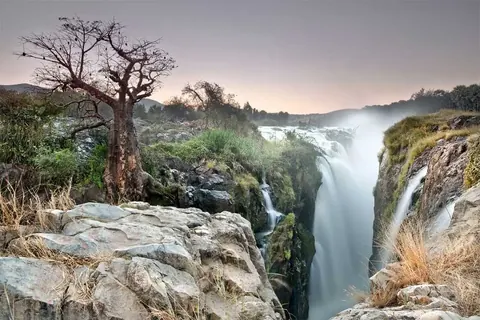 CampsiteEpupa Camp+264 81 127 4584epupa.com.na
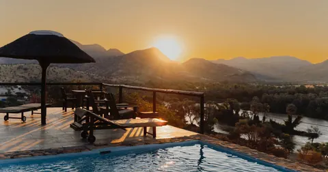 HotelKapika Waterfall Lodge+264 61 234 342epupalodge.com
- 17.00°S 13.25°ECampsiteMotjikutu Camp+264 81 337 7521motjikutu.com
- 17.00°S 13.24°ECampsiteEpupa Community Camp
- 17.00°S 13.24°EHostelEpupa Falls Lodge & Campsite
- 17.00°S 13.24°ECampsiteEpupa falls Viewpoint campsite
- 17.00°S 13.25°ECampsiteKing Fisher Camp
- 17.00°S 13.25°ECampsiteOmarunga Epupa-Falls Campgondwana-collection.com
Sights 1
 Epupa FallsAttraction
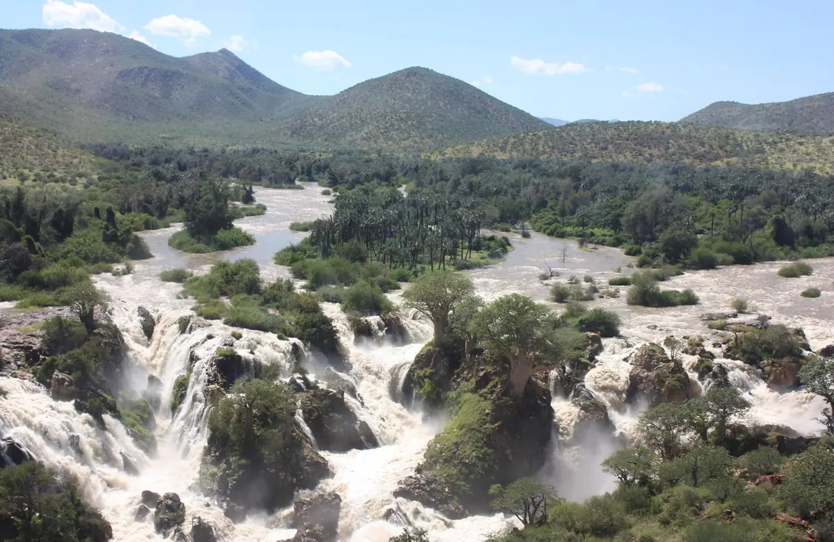
Epupa is where the C43 ends, on the bank of the Kunene, the river that is the border with Angola. Above the falls the river spreads into streams between islands thick with makalani palms, then breaks into a long run of cascades over a rock ledge, the main drop put at 36 to 40 metres. The name is Otjiherero, translated as foam or as falling water. The settlement is small and most people around it are Ovahimba.
Getting there
The only real way in is the C43 from Opuwo, about 180 km to the south. Opuwo is roughly 720 km from Windhoek and the road is tarred that far. North of Opuwo it is gravel all the way, through Okangwati, and the corrugations are bad for long stretches unless a grader has been through recently. Allow four to five hours. Take a 4x4, especially after rain, because the C43 deteriorates every rainy season. Windhoek to Epupa in one day means a very early start; better to stop over on the way. Work to tar the road began in November 2025 with the first 75 km north of Opuwo, a 28 month contract, so expect roadworks. The other route is the D3700, a 4x4 track that follows the river east for 94 km to Swartbooisdrift and on towards Ruacana; it was upgraded in 2016 but can be cut when the river floods. There is an airstrip, used by fly-in safaris, but no scheduled flights.
When to go
The river is fullest after the summer rains, and April and May are named as the best months to see the falls. The same rains turn Kaokoland roads to mud and send rivers into flood. Epupa Camp’s rafting trips on the Kunene have run from May to November.
What to do
Walk along the river to the falls, and go up the hill above them for sunset; the camps run sundowner walks and drives. Guided walks upstream are good for birds. Epupa is one of the best places to look for the rufous-tailed palm thrush, and the lower Kunene is as far south as it goes. Several camps arrange visits to Himba homesteads with a local guide, and a small craft market sits next to the community campsite. Plan on at least two full days.
Good to know
Fill up with fuel, water and food in Opuwo. There is no filling station north or west of it, and the shop in Epupa only stocks basics. Draw cash there too, since Opuwo has the banks. Kunene is a malaria region according to both the CDC and Namibia’s Ministry of Health, and national case numbers rose sharply in 2026, so take advice on tablets and sleep under a net. The river has crocodiles and hippos. Do not swim in it, and do not wander along the bank away from the settlement. Phone signal is patchy and internet unreliable. Always ask before photographing people, and never take pictures in front of someone’s huts without permission.
History and culture
Epupa is a few camps, a shop and a scatter of Himba homesteads beside the falls on the Kunene, the river that is Namibia's border with Angola. Its past is the story of the Ovahimba: raided and pushed across the river and back, their land traded on paper between German companies, made into an apartheid homeland, and then, after independence, the people whose opposition helped keep a dam away from the falls.
- 1860s
Swartbooi and Topnaar Nama groups raided Kaokoland, first from Fransfontein and later from Sesfontein, and many Ovahimba and Ovatjimba fled across the Kunene into Angola. The Otjimuhaka crossing on the river east of Epupa has been called Swartbooisdrift ever since. source
- 1885 to 1895
The Bremen merchant Adolf Lüderitz had bought rights to the Kaokoveld from local leaders before Germany declared its colony. In 1885 they passed to the Deutscher Kolonialverein (German Colonial Union, later the German Colonial Society), then in 1893 to the firm L. Hirsch & Co., which set up the Kaoko Land- und Minengesellschaft in Berlin in 1895. The company paid for expeditions but never managed to develop the area. source
- 1917
The Kaokoland chief Vita Tom, known as Oorlog, came back from Angola for good after a short visit the year before, and settled at Otjiyandjasemo, south-west of Okangwati. Tension grew with the Ovahimba chief Muhona Katiti, and the South African police tried to mediate between the two. source
- 1964 to 1989
South Africa's Odendaal Plan, which divided South West Africa into ethnic homelands, set Kaokoland aside for the Himba, and it was formally set up in 1980. No government of its own was ever established, and it was abolished in May 1989 as Namibia moved to independence. source
- 1980s
A severe drought killed about 90% of Himba livestock while the border war went on around them. Many Himba became refugees in Opuwo, some joined Koevoet paramilitary units, and Himba on the Angolan side were sometimes kidnapped, either as hostages or to be made to join PLAN, SWAPO's army. source
- 1992 to 1998
After independence the area became part of a new Ruacana Constituency in 1992. In 1998 its eastern part, Ruacana included, moved to Omusati Region and the rest was renamed Epupa Constituency after the falls. source
- Late 1990s
The government favoured the falls as the site for a new hydroelectric dam. Of 32 Himba chiefs, 26 signed a joint statement against it, and Chief Kapika told planners plainly that the people did not want it. source
- 2012 to 2013
With a new dam site now planned downstream at Orokawe in the Baynes Mountains, Himba chiefs sent protest declarations to the UN and the African Union in February 2012, and over a thousand Himba marched in Opuwo in March 2013. source
- 2026
No dam has been built. In September 2026 Namibian media reported that construction of the joint Angola and Namibia Baynes power station had been pushed back to 2028. source
- People
- Most people around Epupa are Ovahimba (one person is an OmuHimba), semi-nomadic cattle herders related to the Herero. The 2023 census counted 35,221 Himba in Namibia. source
- Language
- Himba and Herero people here both speak Otjiherero. Younger Herero people often speak English and Afrikaans, but few traditional Himba speak anything else, so a local guide is the way to have a real conversation. source
- Otjize and dress
- Himba people, women above all, cover skin and hair in otjize, a paste of butterfat and ochre, often scented with resin. Hair shows age and status: women married about a year or with a child wear a sheepskin headpiece called the erembe, and unmarried young men a single plait. source
- Homestead and sacred fire
- A Himba homestead, the onganda, is a ring of huts round the okuruwo, the sacred ancestral fire, and a kraal (cattle pen) for the sacred cattle. source
- Inheritance
- Every Himba belongs to two clans, the father's and the mother's. Cattle pass down the mother's line, so a son inherits from his maternal uncle rather than from his father. source
For German visitors: The whole Kaokoveld, Epupa included, was once a German company's land: the Kaoko Land- und Minengesellschaft, based in Berlin from 1895, until South Africa expropriated it after the First World War. The rights had first been bought by Adolf Lüderitz of Bremen. source
For German visitors: Georg Hartmann, a geographer from Dresden, led an expedition to the northern Kaokoveld in 1900 and wrote it up in 1903. Hartmann's mountain zebra is named after him. source
For German visitors: In 2013 Chief Kapika of Epupa publicly condemned the German RTL reality show Wild Girls, filmed with a Himba community here, and asked for broadcasts to stop because he said it mocked Himba culture. source
For American visitors: Epupa Falls appears in Samsara (2011), the non-narrative American documentary by Ron Fricke and Mark Magidson, shot in 70 mm in 25 countries. source
Main sights in Epupa
4- Epupa Falls
The Kunene drops in a chain of falls spread over about 1.5 km of river, with baobabs, figs and makalani palms growing among colourful rock walls. This is why everyone makes the long drive.
Wikipedia: Epupa Falls - Himba craft market
A small market beside the community campsite. It is one of the few places selling jewellery and goods Himba people actually wear and use.
Wikivoyage: Epupa Falls - Himba homestead visit
The camps and local guides arrange visits to nearby homesteads. Go with a guide who speaks Otjiherero, greet the head of the homestead first and ask before every photograph.
Wikivoyage: Kaokoland - Dorsland Trek memorial, Swartbooisdrift
At Swartbooisdrift, 94 km east along the river road (D3700). It marks the return in 1928 and 1929 of about 2,000 Dorsland (thirstland) trekkers from southern Angola to what was then South West Africa.
Travel News Namibia
Did you know?
- Epupa is an Otjiherero name that Wikipedia translates as foam, after the spray off the falls, though other sources give falling water. Wikipedia puts the biggest single drop at 37 metres. source
- The Himba use just four basic colour names, and one of them, zuzu, covers dark shades of blue, red, green and purple. Several researchers have studied how Himba people perceive colour. source
- The dam proposed at Epupa in the 1990s would have flooded Himba grazing land, and Cultural Survival reported that about 3,000 Himba would have had to move. source
- The lower Kunene is the southern limit of the rufous-tailed palm thrush, and the Zebra Mountains to the east are home to Namibia's rarest bird, the Angolan cave chat, which was only recorded in Namibia for the first time in May 2010. source
- The Epupa Falls lodge and campsite on the edge of the falls goes back to 1991, when Koos Verwey began building the first camp here. source
Checked 7 October 2026.
Wildlife you might see
7- possibleNile crocodileIn the Kunene. Omarunga runs guided walks to look for them. All yearsource
- possibleRufous-tailed palm thrushAlong the river at Epupa, one of the best places in Namibia to look for it. The lower Kunene is the southern edge of its range. All yearsource
- possibleHippopotamusIn the Kunene away from the settlement. All yearsource
- possibleVervet monkeyOn the guided walk upstream along the Kunenesource
- possibleKingfishersAlong the river; local writers say the area is rich in themsource
- possibleAfrican fish eagleOver the riversource
- rareCinderella waxbillAlong the Kunene. Birders looking for it often base themselves at Kunene River Lodge, east of Swartbooisdriftsource
Likelihood is for a normal visit of two or three days, from the sources linked. Nothing is guaranteed in the wild.
Hikes and walks
2- River walk from Epupa Camp to the falls
Epupa Camp sits about 800 m upstream of the falls and the walk follows the river. Stay on the path and well back from the water.
Permit: None
Epupa Camp - Sundowner hill above the falls
A hill overlooking the falls, reached on a guided sunset walk or drive. Omarunga's walk leaves at about 17:00.
Permit: Guided walk or drive booked at the camps
Gondwana Collection (Omarunga Epupa-Falls Camp)
Staying safe in Epupa
- Malaria
- The CDC lists Kunene as a malaria region and recommends preventive tablets for travellers going there. See a travel clinic before you go, sleep under a net and avoid mosquito bites, especially from dusk. source
- Crocodiles and hippos
- Do not swim in the Kunene. It has crocodiles and hippos, and away from the settlement it is not safe even to walk along the bank: hippos defend their patch and can outrun a person on land. You will see local people washing right at the falls; that is not a reason to join them. source
- Gravel roads
- The C-roads in Kaokoland, the C43 included, are gravel and badly corrugated, and in the rainy season there is deep mud and rivers come down in flood. If the water at the deepest point is above your knees, camp and wait for it to drop rather than drive in. Carry a tow rope, a shovel, extra water and food. source
- Remoteness
- Help is a long way off. Leave your route with someone, expect weak or no phone signal at Epupa, and consider a satellite phone if you are going further into Kaokoland. source
- Roadworks
- Work to tar the road north of Opuwo began in November 2025, starting with the first 75 km to Otjivize, with a 28 month construction period. Expect roadworks on that stretch. source
Tips from travellers
- Fill up in Opuwo. There is no fuel station north or west of it, and you should stock up on water and food there as well, because the shop at Epupa has basics only. several sources
- Give Epupa at least two nights. The drive in is long, and Epupa Camp recommends two nights, ideally three, to fit in the falls, a walk and a village visit. one source
- Visit Himba homesteads with a local guide, ask before every photograph, and expect to give something back. Food staples such as maize meal, sugar and cooking oil are often more welcome than money. several sources
- For Himba jewellery, the small market next to the community campsite is one of the few places that sells pieces people actually wear, not just items made for tourists. Fakes are hard to spot, so take a guide if you are buying something big. several sources
- If you want a meal at one of the lodges as a day visitor or a camper, book several hours ahead. several sources
- Do not hand out sweets or money to children who ask. Travellers in Kaokoland say it encourages begging; give something only when a child has actually helped you, for example by opening a gate. several sources
Checked 7 October 2026. Conditions change, so confirm with the park or venue before you go.
Quick answers
What are the best hikes in Epupa?
River walk from Epupa Camp to the falls (0.8 km) and Sundowner hill above the falls. See the hikes section for times, difficulty and permits.
Map of Epupa
See every place on this map as a list