Town · Kunene, Namibia
Khorixas
Small Damara town on the C39 in southern Kunene, once capital of the Damaraland homeland, and the place to fill up with fuel and draw cash on the way to the Petrified Forest and Twyfelfontein.
Short answer
Khorixas is in Kunene, Namibia. This page lists 5 places to stay and 2 places to eat and drink.
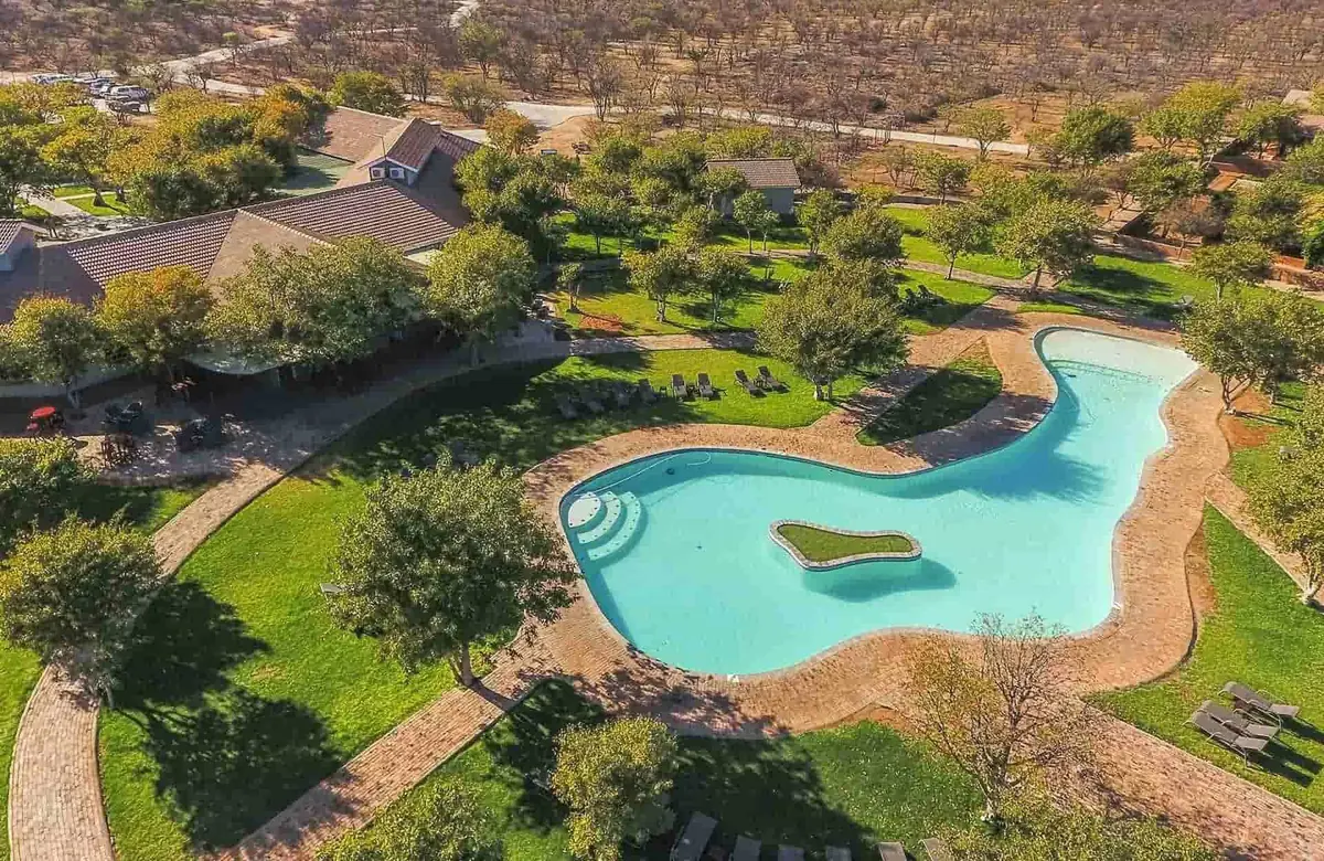
- Places to stay
- 5
- Eat and drink
- 2
- Where
- Kunene, Namibia20.37°S 14.96°E
In and around Khorixas
7 places listedWhere to stay in Khorixas 5
- 20.36°S 14.95°EResortLodge Damaraland+264 81 215 5351quiverandconamibia.com
- 20.37°S 14.97°EHoteliGowati Country Hotel and Lodge+264 67 331 592
- 20.37°S 14.97°ECampsiteiGowati Lodge Campsite
- 20.36°S 14.95°EResortKhorixas Restcamp+264 67 331 111nwr.com.na
Restaurants and cafes 2
- Petrified Coffee SjopRestaurant · C39+264 81 692 3018petrifiedforest.namne.ws
- iGowati RestaurantRestaurant · local
Khorixas is a small town in the south of the Kunene Region, and for most visitors it is where the tar ends on the C39 heading west into Damaraland. It was called Welwitschia until 1968 and was the capital of the Damaraland homeland under apartheid. Most people here are Damara, and the 2023 census counted 9,371 residents. There is little to see in town, but it has fuel, a bank, a supermarket and a hospital.
Getting there
Most self-drivers come in from the east on the C39, tarred all the way from Outjo. West of town it turns to gravel. Kunene’s gravel C roads are rough and badly corrugated and only just passable in an ordinary car, some D roads need a 4x4, and in the rainy season whole areas can be cut off.
For Twyfelfontein, follow the C39 west for about 72 km, turn left on to the D2612 for roughly 14 km, then right on to the D3254 and right again on to the D3214.
When to go
Khorixas gets only about 220 mm of rain a year, nearly all of it between December and April. January afternoons average around 29°C. July days reach about 22°C but nights drop to around 8°C, so campers should pack a warm layer. To my mind May to September is the best time for the rock art and fossil sites, which have little shade.
What to do
The Petrified Forest is the reason most people stop. A national monument since 1950, it is a spread of fossil tree trunks about 500 m north of the C39 west of town (sources put it anywhere from 30 to 50 km out). The trunks are 240 to 300 million years old and have no roots, so geologists think they arrived as driftwood in an ancient flood. The longest are said to measure 30 to 45 m, and welwitschia plants grow between them. You may only walk the site with a guide.
Nearer town on the C39 is the Petrified Living Museum, a private business listed by the tourism board. It is not the national monument, so don’t mix the two up.
Twyfelfontein, Namibia’s first UNESCO World Heritage Site (2007), has about 2,500 rock engravings, and you can only see them on a guided walk from the visitor centre (the guide is included in the entry fee). Burnt Mountain, a lava hill, and the columnar basalt of the Organ Pipes are on the D3254 about 10 km south east of it. East of Khorixas, roughly 50 km out, the Vingerklip is a 35 m pillar of sandstone and conglomerate above the Ugab valley.
Good to know
Fill up here. The main road has a fuel station, a bank with an ATM, an OK supermarket and craft stalls along the main road.
Kunene is a seasonal malaria region. TravelHealthPro rates the risk high from December to April, when tablets are advised, and low from May to November, when bite avoidance is enough. Ask your doctor.
Lodges and campsites across Damaraland are often booked out months ahead, so reserve before you leave home.
History and culture
Khorixas is a Damara town in southern Kunene that apartheid South Africa made the capital of its Damaraland homeland. Around it lie rock engravings thousands of years old, a Nama settlement with a German mission past, and the families sent here from South Africa in the 1970s, so the town tells a fair part of Namibia's twentieth century in one place.
- Thousands of years ago
Some 2,500 engravings were cut into the rocks at Twyfelfontein, west of today's town. The Namibia Tourism Board puts most of them at more than 6,000 years old and says they are believed to be the work of San people. source
- 1880 to 1891
People settled at the spring of Fransfontein, just north of Khorixas, in 1880. It is named after Frans Fredrick of the ǁKhauǀgoan (Swartbooi Nama), who found it while looking for land, and the German Rhenish Mission opened a station there in 1891. source
- 1904 to 1908
In German South West Africa the German Empire waged a war of extermination against the Herero (Ovaherero) and Nama. Between 40,000 and 80,000 Herero and about 10,000 Nama died, many in concentration camps. In 2015 Germany acknowledged that this was genocide. source
- 1915
German rule had begun in 1884. During the First World War South Africa invaded and occupied the German colony, and afterwards ran it as South West Africa under a League of Nations mandate. source
- 1970
Under the Odendaal Plan, South Africa's scheme to carve the territory into apartheid style ethnic homelands, Damaraland was set up as a homeland for the Damara, covering 47,990 square km. Its capital was Khorixas, which the plans still called Welwitschia. source
- Early 1970s
Apartheid South Africa cleared the community of Riemvasmaak near the Orange River in the Northern Cape to make way for a military range. Its Damara families were sent to Khorixas, where the Damara chief Justus ǁGaroëb gave them land. Some went back after land restitution in South Africa, while others stayed and set up their own traditional authority. source
- 1980 to 1989
From 1980 the homeland gave way to a Representative Authority of the Damaras, an ethnic tier of government with its own legislative assembly, whose executive was chaired by Justus ǁGaroëb. Like the other homelands it was abolished in May 1989 at the start of the move to independence. source
- 1990
Namibia became independent on 21 March 1990. The UN had ended South Africa's mandate in 1966, and that same year SWAPO's armed wing, the People's Liberation Army of Namibia, began its guerrilla war. source
- Language
- Khorixas constituency, which takes in the town and Fransfontein, is the most Khoekhoegowab speaking part of Kunene. In the 2023 census 71.7% of its 4,321 households spoke Khoekhoegowab (the Damara and Nama language, full of click sounds) at home, 10.6% Otjiherero and 5.5% Afrikaans. source
- The Damara
- The Damara call themselves ǂNūkhoen and make up 8.5% of Namibia's people. They speak Khoekhoegowab, the same language as the Nama, although genetic studies find them closely related to their Herero and Himba neighbours. source
- Clans of the area
- Several Damara clans are named after the land they lived on. The ǁHuruben of the Twyfelfontein area, between the Huab and Ugab rivers, are named for their dialect of Khoekhoegowab instead, which is said to sound like grumbling or mumbling. source
- Politics
- Khorixas has long been a stronghold of the Damara based United Democratic Front (UDF), and SWAPO first won here only in 2015. The UDF took the town council back in 2020, winning four of its seven seats. source
- Swartbooi Nama
- Fransfontein is still the main settlement of the Swartbooi Nama, and their Swartbooi Traditional Authority is based there. source
For German visitors: The Rhenish Missionary Society, one of the German mission societies of the colonial era, opened a station at Fransfontein, just north of Khorixas, in 1891. source
For German visitors: The surveyor Reinhard Maack, born in Herford in 1892, worked for the imperial land survey of German South West Africa from 1911 to 1914, and was the first to find the White Lady rock painting on the Brandberg. source
For German visitors: The name Damaraland was already in use in German colonial times, and it is still the everyday name for this part of the north west. source
Main sights in Khorixas
5- Petrified Forest
Some 50 to 60 large fossil trunks, 240 to 300 million years old, scattered over an area of about 300 by 800 m just north of the C39 west of town. It was declared a national monument on 1 March 1950 and you may only walk it with a guide.
Wikipedia (German): Versteinerter Wald (Namibia) - Twyfelfontein
Namibia's first UNESCO World Heritage Site (2007) and one of the largest groups of rock engravings in Africa. The topographer Reinhard Maack found them just before 1914, and a visitors' centre offers four routes, some guided only.
Namibia Tourism Board: Twyfelfontein Heritage Site - Burnt Mountain and the Organ Pipes
A hill of 80 million year old lava in shades of red, brown, purple and cream, rising about 200 m, a national monument since 15 September 1956. The Organ Pipes are close by on the D3254.
Wikipedia: Burnt Mountain (Namibia) - Vingerklip
A 35 m finger of sandstone and conglomerate about 50 km east of Khorixas, an erosion remnant of old deposits laid down by forerunners of the Ugab river. Since the Mukurob in the south collapsed it is the best known rock in Namibia.
Wikipedia: Vingerklip - Fransfontein
The Swartbooi Nama village about 12 km north of Khorixas, set in a gorge of the Fransfontein mountains and first mentioned in the 1870s. It is the hometown of Libertina Amathila, a former Deputy Prime Minister of Namibia.
Wikipedia (German): Fransfontein
Did you know?
- The name comes from khori, the Khoekhoegowab word for the mustard bush (Salvadora persica) that grows here. source
- Until 1968 the town was called Welwitschia, after the welwitschia, a desert plant found in parts of Namibia and southern Angola. source
- Justus ǁGaroëb, who became chairman of the Damara council in 1977, has been the Damara leader since 1982 and founded the UDF in 1989, lives in Khorixas. source
- Khorixas constituency covers 21,328 square km and reaches all the way to Torra Bay on the Atlantic coast, yet fewer than 16,000 people live in it. source
- The petrified trunks have no roots, which is why scientists think they were driftwood washed in by a great flood. They are made of jasper, not the opal or chalcedony of some other fossil wood, and their growth rings still show. source
- An average year brings about 220 mm of rain, but in the 2018 to 2019 drought only 106 mm fell. source
Checked 7 October 2026.
Map of Khorixas
See every place on this map as a list