District · Botswana
Kgatleng District
The Bakgatla's home district, just north-east of Gaborone. Mochudi and its hilltop museum, the Matsieng rock engravings and the Oodi weavers make an easy day out from the capital.
Short answer
This page covers 2 towns and cities in Kgatleng District.
- Towns and cities
- 2
- Where
- Botswana24.13°S 26.42°E
Towns and cities in Kgatleng District
2Written up in smaller places around Kgatleng District
1
Kgatleng is the small district on Gaborone’s north-eastern doorstep, and it is the home of one people, the Bakgatla. Mochudi is their capital. About 121,000 people live here (2022 census), with roughly 50,000 of them in Mochudi. There are no big parks. People come for a day out of the capital: a hilltop museum, old rock engravings and a weaving workshop. If you read the No. 1 Ladies’ Detective Agency books, this is where Mma Ramotswe was born.
Getting there
Take the A1 north from Gaborone, the main road to Francistown. Mochudi is about 37 km from the city and sits several kilometres off the highway. The turn is at Pilane, 10 km south-west of the village. Oodi is closer still, about 20 km north-east of Gaborone. Sir Seretse Khama International Airport is about 15 km north of the city centre, so you start on the right side of town.
From South Africa the Sikwane border post, opposite Derdepoort, opens from 06:00 to 19:00.
When to go
Any month works, since nothing here depends on game. The dry season runs from April to October. May to late August is winter, with sunny days and cold nights, and Gaborone’s lows drop to around 4 or 5 °C in June and July. Summer highs sit around 32 or 33 °C in January and February, and January is the wettest month. I would pick winter for walking around Mochudi.
What to do
The Phuthadikobo Museum is the reason to drive to Mochudi. It sits on top of Phuthadikobo Hill (the Bakgatla settled at its foot in 1871), in a school built between 1921 and 1923 under the regent Isang Pilane. The old classrooms hold displays on Bakgatla life, a craft shop and a silkscreen printing workshop, and the hill looks out over the village. Below it, Mochudi still has a traditional kgotla (the tribal meeting place) and some traditionally painted houses.
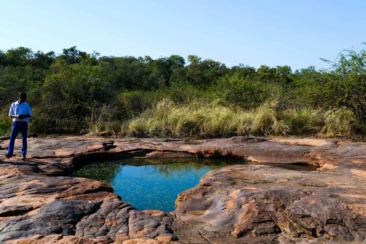
The Matsieng Footprints are engravings pecked into a flat sandstone outcrop: up to 117 of them, many shaped like human feet or big-cat paws, thought to be between 3,000 and 10,000 years old. Tswana tradition says the giant Matsieng climbed out of the waterhole here with his animals. People still hold rain ceremonies at the site, so treat it as a place of worship.
At Oodi a weaving workshop set up in 1972 makes woven wall hangings of village scenes, and visitors can watch the weavers at work. It is listed as open on weekdays only, so don’t plan it for a Saturday.
Bokaa Dam has a picnic spot on its southern shore and water birds when it is full. It dried up completely in 2012, so ask in Gaborone before you count on it.
Good to know
- Malaria is barely an issue. The CDC puts Kgatleng among the districts with rare cases only and advises avoiding bites, not tablets.
- The UK government warns about stray livestock and wildlife on roads outside the towns, most of all at night. Be back before dark.
- The Notwane River runs through Mochudi. It is dry through the dry season and can flash flood after rain.
In and around Kgatleng District
3 places listedSights 3
- Limpopo RapidsViewpoint
- Masama VillageAttraction
- TransformersAttraction
Map of Kgatleng District
See every place on this map as a list