Polokwane
Capital of Limpopo on the N1, the largest town north of Gauteng and a common overnight stop on the road to Zimbabwe, with one of the larger municipal game reserves in the country.

See every place on this map as a list
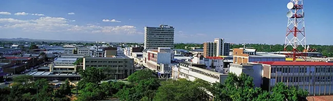
Polokwane, called Pietersburg until 2005, is the capital of Limpopo and the largest urban centre north of Gauteng. It sits on a high plateau at about 1,310 m, right on the N1 between Pretoria and the Zimbabwe border. Most travellers see it as a place to sleep, refuel and shop on the long drive north. That is fair, but if you have a spare morning, the city’s own game reserve is an easy first taste of the bush.
Getting there
By road it is about 275 km from Pretoria and 330 km from Johannesburg on the N1 toll highway, and around 200 km from the Zimbabwe border. Polokwane International Airport has several flights a day from Johannesburg, and you can pick up a hire car or a metered cab when you land. Intercity coaches, including City to City and Translux, run from Gauteng, and Shosholoza Meyl has run passenger trains from Johannesburg and Pretoria, though check the current timetable. The city is spread out and public transport is thin, so hire a car.
When to go
The climate is semi-arid. Average temperatures sit around 21 to 22°C in January and drop to about 11°C in July, and annual rainfall is under 500 mm. Malaria is a real risk in parts of Limpopo. Wits University’s guidance places it in the north-eastern parts of the province and the Lowveld around Kruger, and SA-Venues says antimalarials are recommended from October to May in the high-risk areas. If your route goes on towards Kruger or the far north-east, take medical advice before you travel.
What to do
Polokwane Game Reserve covers 3,200 hectares, one of the larger municipal reserves in the country. It protects a patch of Pietersburg Plateau false grassland, a vegetation type mostly lost to farming elsewhere, along with white rhino, sable, tsessebe, giraffe and zebra. You can drive yourself on its road network, take a short 5 km walk or tackle a 21 km hiking trail in one day or two. Birders come for species such as the short-clawed lark.
The Bakone Malapa Northern Sotho Open-Air Museum shows traditional village life. The Polokwane Art Museum and the Hugh Exton Photographic Museum, which holds around 23,000 glass negatives taken between 1892 and 1945, are the other cultural stops. Peter Mokaba Stadium was built for the 2010 World Cup.
Good to know
The town was founded by Voortrekkers in 1886 and named after Petrus Jacobus Joubert. The new name, adopted in February 2005, means sanctuary in Northern Sotho.
In and around Polokwane
47 PLACESPlaces to stay 18
- 23.94°S 29.42°E
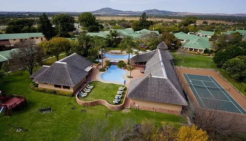
- 23.91°S 29.45°EHotelGarden Court PolokwaneCnr Thabo Mbeki & President Paul Kruger Street, Polokwane+27 15 291 2030Details
- 23.93°S 29.45°E
- 23.92°S 29.44°E
- 23.94°S 29.42°E
- 23.91°S 29.50°E
- 24.02°S 29.30°E
- 23.93°S 29.46°E
Sights 3
- ۲۲مارچViewpoint
Restaurants and cafes 24
 Vida e CaffèCafe
- Nando'sRestaurant · chicken, portuguese · Polokwane
- TorradorCafe
- DJ's RestaurantRestaurant · Polokwane
- Knit CaféCafe · coffee
Bars and pubs 1
- DJ's Pub & EntertainmentPub · Polokwane
Wineries, breweries and distilleries 1
- Polokwane BreweryBrewery · Veldspaat Street, Polokwane