Tzaneen
Subtropical farming town below the Wolkberg in Limpopo, a base for the Magoebaskloof forests, the Modjadji cycads and the Phalaborwa side of Kruger.

See every place on this map as a list
Tzaneen is a farming town in the Mopani district of Limpopo, below the Wolkberg range at the northern end of the Drakensberg. It is a working town rather than a resort, ringed by orchards and plantations of subtropical fruit, nuts and tea. People come because it is a green, comfortable base between the Magoebaskloof forests above and the hot bushveld and Kruger below.
Getting there
Tzaneen is roughly 420 km from Johannesburg. The classic way in is the R71 from Polokwane, which climbs through Haenertsburg and then drops down Magoebaskloof to the town. The same R71 carries on east to Phalaborwa, and Kruger’s Phalaborwa Gate is under 100 km away (listings vary between 84 and 95 km). You will want your own car; the sights are spread across the hills and the farm roads.
When to go
Summer runs roughly September to March, with average temperatures around 28°C and most of the year’s rain. The town gets about 800 mm a year, the mountains above it more than 1,500 mm, which is why the slopes are so thickly forested. Winters are mild, averaging around 15°C, and drier, which makes them the easier season for walking and driving the passes.
What to do
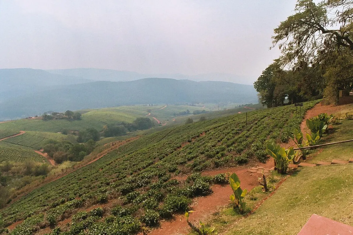
Drive up Magoebaskloof on the R71 towards Haenertsburg. The kloof is named after Chief Makgoba, whose small kingdom held this ground before the Boers took the Tzaneen area, and there is a museum to him along the route. Stop at Debengeni Falls and walk in the evergreen forest; there are several hiking trails in the area. The Sapekoe tea plantations are part of the same loop.
Modjadjiskloof (17 km away, formerly Duiwelskloof) is the home of the Rain Queen Modjadji of the Balobedu, whose title passes down the female line. The Modjadji cycad reserve there has walking routes. Between Modjadjiskloof and Ga-Kgapane, the big baobab at Sunland Nursery is counted among the largest in the world, and the provincial route guide also lists a baobab bar in Duiwelskloof itself.
In town, the small Tzaneen Museum is worth an hour for its Tsonga and North Sotho pottery, beadwork and weapons, and for its carved poles, a collection SA-Venues rates as the biggest in the country. Tzaneen Dam, the largest body of water in the area and a nature reserve, is good for waterbirds. Birders also drive up to the Agatha escarpment, where the Victorian garden at Kings Walden sits right on the edge of the drop. Purple-crested Turaco is on the list there, and Bat Hawks nest nearby.
Good to know
Tzaneen is the second-largest town in Limpopo after Polokwane, and several hundred thousand people live within 30 km of it, so it is a proper regional centre rather than a village. It works best as a night or two on a route that links Polokwane, Magoebaskloof and Phalaborwa, rather than a destination in its own right. Route guides call the wider area the Valley of the Olifants.
In and around Tzaneen
39 PLACESPlaces to stay 24
- 23.94°S 30.12°E
- 23.88°S 30.01°ECampsiteCoral Tree CampFranschhoek, Magoebaskloof
- 23.88°S 29.98°EGuest houseBramasole Guest House
- 23.83°S 30.22°E
- 23.82°S 30.16°EHotelHotel @ Tzaneen
- 23.92°S 30.15°EGuest houseKings Walden Garden Manor
- 23.84°S 30.15°EGuest houseTamboti Lodge
- 23.82°S 30.16°EHotelAvispark LodgeAqua Avenue
- 23.80°S 29.98°EMountain hutBroederstroom Hut
Sights 5
- Serala PeakViewpoint
- AJ O’Connor MonumentMonument
- Debegeni FallsViewpoint
- Magoebaskloof Lookout PointViewpoint
- Sapekoe Tea EstatesViewpoint
Hiking trails 4
- Magoebaskloof Hiking Trail Route 1Hiking trail · 7.1 km
- Magoebaskloof Hiking Trail Route 2Hiking trail · 11.1 km
- Magoebaskloof Hiking Trail Route 3Hiking trail · 12.2 km
- Magoebaskloof Hiking Trail route 4Hiking trail · 9.6 km
Restaurants and cafes 5
- Highgrove LodgeRestaurant
- Yum Yum RestaurantRestaurant
- Spur Steak RanchRestaurant · steak house
- WimpyRestaurant · burger, breakfast
- Wimpy Lifestyle (Tzaneen)Cafe