Region · Namibia
Oshikoto
The region between eastern Etosha and the Ovambo north, with the old German mining town of Tsumeb, two sinkhole lakes, caves and the Finnish mission at Olukonda.
Short answer
This page covers 2 towns and cities in Oshikoto.
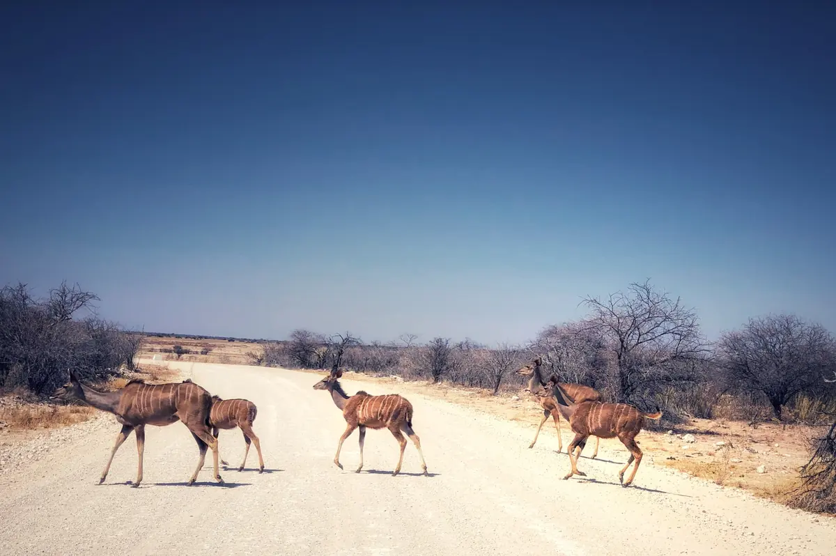
- Towns and cities
- 2
- Places to stay
- 5
- Where
- Namibia18.61°S 17.01°E
Towns and cities in Oshikoto
2Written up in smaller places around Oshikoto
1
Oshikoto is the region that wraps around the eastern end of Etosha, and it takes its name from Lake Otjikoto outside Tsumeb. It has two quite different halves. The south is cattle farms, dolomite hills and the copper town of Tsumeb, which grew up around a German-owned mine from 1905. The north is Ondonga country, with mahangu (pearl millet) fields and homesteads strung along the main road. The 2023 census counted 257,302 people, and fewer than one in five live in a town.
Getting there
The tarred B1 from Windhoek runs through Otavi to Tsumeb, then turns north past Oshivelo and Omuthiya, the regional capital, to Ondangwa. Lake Otjikoto is 20 km north-west of Tsumeb and only about 100 m off the B1. For Etosha, Namutoni camp sits about 10 km inside Von Lindequist Gate, and Namibia Wildlife Resorts puts it 110 km from Tsumeb and 486 km from Windhoek. North-east of Tsumeb a newer tarred road heads past Tsintsabis to the Katwitwi border with Angola. The Olukonda mission is about 20 km from Ondangwa, and you can reach it from Etosha through King Nehale Gate.
When to go
Tsumeb gets around 528 mm of rain a year, most of it from November to March, with January the wettest month. May to September is almost completely dry. July nights average about 5°C, so campers need warm bedding. October to December is the hot stretch, with afternoons around 33°C.
What to do
Tsumeb is worth a night rather than a fuel stop. The museum sits in the German private school of 1915 and shows field guns the Schutztruppe (the German colonial army) threw into Lake Otjikoto when they surrendered that year. The mine itself is on a world list of 100 geological heritage sites for its minerals. Lake Otjikoto is a sinkhole about 100 m across, right beside the main road. Lake Guinas, 38 km west of town, is the bigger of the two, but it is on private farmland and you need the owner’s permission. The Ghaub Caves, on the farm Ganachaams, have been a protected monument since 1967. Up north, the Nakambale Museum at Olukonda is the old house of the Finnish missionary Martti Rautanen, beside the oldest church building in northern Namibia and a full Ndonga homestead. Nearby Oniipa has a medical museum at Onandjokwe hospital.
Good to know
- This is a malaria area. The US CDC lists Oshikoto among the regions where it recommends prescription tablets, so see a travel doctor before you go.
- Tsumeb has ATMs, supermarkets and a pharmacy. Fill up there or at Namutoni, which has a filling station, before heading into the park.
- The Red Line, the veterinary fence that separates northern Namibia from the rest of the country, runs through Oshivelo on the way north.
- Dragon’s Breath Cave appears on our list because of its record underground lake, but it is on private land and closed to the public.
History and culture
Oshikoto joins two worlds. In the north is the Ondonga kingdom of the Ovambo, where Finnish missionaries arrived in 1870. In the south is Tsumeb, a copper town that grew around a German-owned mine from 1905, and the lake where German troops sank their guns in 1915. Between them lies eastern Etosha, where an Ondonga army overran the German fort at Namutoni in 1904.
- 1850s
Ovambo people lived north of the Etosha pan, Herero-speaking groups just beyond today's park boundary, and the Haiǁom, a San people, close to the pan itself. The Haiǁom recognised the authority of the Ondonga king. source
- 1870 to 1871
Finnish Lutheran missionaries, among them Martti Rautanen, began work in Ondonga in 1870 and founded the mission station at Olukonda in 1871. source
- 1885 to 1886
After a succession quarrel Nehale lyaMpingana broke away in 1885 and ruled eastern Ondonga from Onayena. In 1886 his men defeated the Boer settlers of the Dorsland Trek, who had acquired land between Otavi and Grootfontein and declared it the Republic of Upingtonia, and shot their leader William Worthington Jordan. The settlers scattered. source
- 1903 to 1906
The Otavi Mining and Railway Company (OMEG), founded in Berlin in 1900, built a 567 km narrow gauge railway from Swakopmund to its copper mine at Tsumeb, reaching it in 1906. The building years coincided with the genocide of the Herero and Nama, and labour shortages delayed the work. source
- 28 January 1904
Weeks after the Herero rose against German rule further south, about 500 Ondonga fighters under Nehale attacked the German fort at Namutoni. The seven defenders slipped away at night and the fort was destroyed. The Germans later rebuilt and enlarged it. source
- 1915
When South African troops conquered German South West Africa, the Schutztruppe (the German colonial army) threw their guns and ammunition into Lake Otjikoto as they surrendered. One account puts it at 30 cannons and 400 to 500 boxes of ammunition. source
- 1954
In 1954 the authorities forced the Haiǁom out of Etosha. They lost the land they had hunted and gathered on, and most ended up as farm labourers with no land of their own. Since 2007 the government has bought farms south of the park to resettle displaced families. source
- 1966 to 1990
The liberation war between PLAN, the armed wing of SWAPO, and the South African Defence Force began on 26 August 1966 and ended with Namibia's independence on 21 March 1990. source
- Language
- In the 2023 census Oshindonga was the main home language in 47.5 percent of households, Oshikwanyama in 34.8 percent and Khoekhoegowab in 5.2 percent. Afrikaans and English follow at about 2 percent each. source
- Peoples
- The Aandonga are the largest group at 46.3 percent, then the Aakwanyama at 32.6 percent. About 10,100 people identify as Damara and about 7,200 as Haiǁom San. source
- Ondonga kingship
- Ondonga still has its own king, the omukwaniilwa, who governs with a council of elders. Succession runs through the female line, first to the king's brother and then to a sister's son, and the royal residence is wherever the king chooses to live. Olukonda was once one of them. source
- Finnish influence
- The Finnish Missionary Society founded Oniipa in 1872, and the town still shows it: a teacher training school from 1913, the old church hospital at Onandjokwe, and what is said to be Namibia's only public sauna. source
- Farming and copper
- Ondonga people mined copper at Tsumeb for rings and tools long before colonial times. Today mahangu (pearl millet) is the main crop in the north, while the south runs cattle in the Mangetti and the Tsumeb district. source
For German visitors: Tsumeb's oldest buildings went up for the Otavi Minen- und Eisenbahn-Gesellschaft (OMEG): its mine office of 1907 and a director's house of 1912 still stand. The German school finished in 1915 taught 23 German children before it became a military hospital for the German forces. source
For German visitors: Etosha began as Game Reserve 2, proclaimed in March 1907 by Friedrich von Lindequist, governor of German South West Africa. Lieutenant Adolf Fischer of Fort Namutoni became its first game warden. source
For German visitors: Rautanen and the first Finnish missionaries worked at first with Carl Hugo Hahn of the German Rhenish Mission Society. In 1872 he married Frieda Kleinschmidt, daughter of the German missionary Franz Heinrich Kleinschmidt, and some of his plant collections went to museums in Germany. source
For German visitors: The Ombili Foundation near Tsumeb, set up in 1989 on a former farm to work with the San, is backed by a German association, the Freundeskreis Ombili Berlin-Brandenburg, which helps with its health, social and school work. source
For American visitors: For decades in the middle of the 20th century the American company Newmont held a controlling interest in the Tsumeb mine. Its Tsumeb and Kombat mines stopped work during the 1971 to 1972 contract workers' strike against the contract labour system and apartheid. source
For American visitors: In 1947 the old OMEG mine office in Tsumeb was sold by the Guardian of Alien Property to the American O'okiep Copper Company. source
Main sights in Oshikoto
8- Tsumeb Museum
A community museum opened in 1975 in the German private school, built in 1915 and briefly a military hospital. Among its exhibits are field guns recovered from Lake Otjikoto.
National Heritage Council of Namibia: Heritage places - Otjikoto Lake
A sinkhole lake about 100 m across, 20 km north-west of Tsumeb beside the B1, declared a national monument in 1972. The San called it Gaisis (ugly) and the Herero Otjikoto (deep hole), and Galton and Andersson came upon it in 1851. At least two cannons are still on the bottom.
Wikipedia: Otjikoto Lake - Nakambale House, Church and Cemetery, Olukonda
The church of 1889 is the oldest church building in northern Namibia, and services were held in it until 1970. The mission house of 1893 is now the Nakambale Museum, opened in 1995.
National Heritage Council of Namibia: Heritage places - OMEG Minenbüro, Tsumeb
Built in 1907, probably by Rudolf Mann, and thought to be the oldest building in Tsumeb. It served as the mine office until 1950 and later housed the Tsumeb Gymnasium.
National Heritage Council of Namibia: Heritage places - Roman Catholic church, Tsumeb
Built by Rudolf Mann in 1913 and inaugurated in 1914, now a national monument.
National Heritage Council of Namibia: Heritage places - Ghaub Caves
A cave system on the farm Ganachaams, first reported in a German colonial magazine in 1914 and protected as a historical monument since 1967.
National Heritage Council of Namibia: Heritage places - Fort Namutoni
The German fort of the 1890s at the eastern edge of Etosha, rebuilt after the 1904 battle, declared a national monument in 1947 and restored in 1957. The camp beside it overlooks the King Nehale waterhole.
Wikipedia: Namutoni - Onandjokwe medical museum, Oniipa
The old church hospital, now run by the government, houses Namibia's only medical museum. Its name comes from oondjohwi, black birds of a nearby valley.
Wikipedia: Oniipa
Did you know?
- Tsumeb's ore pipe is listed by the International Union of Geological Sciences as one of 100 geological heritage sites in the world. The mine is noted for 243 minerals, and 56 of them were first described from here. source
- Lake Guinas has its own fish, Tilapia guinasana, a critically endangered cichlid found naturally nowhere else. The lake is up to 133 m deep. source
- A legend says the Germans also sank a safe holding 6 million gold marks in Lake Otjikoto in 1915. Nobody has found it. source
- Dragon's Breath Cave holds the largest known underground lake on earth that is not under ice, almost 2 hectares of water about 60 m below the entrance. It is named for the mist that rises from it when air pressure drops. source
- People in Ovamboland called Martti Rautanen Nakambale, the one who wears the hat, after his skullcap. The mongongo nut tree, Ricinodendron rautanenii, is named after him. source
- Omuthiya, proclaimed a town in October 2007, has taken over from Tsumeb as the regional capital. Its full name is Omuthiyagwiipundi. source
Checked 7 October 2026.
In and around Oshikoto
8 places listedWhere to stay in Oshikoto 5
 HotelMokuti Etosha Lodge+264 67 229 084ol-leisure.com
- 18.98°S 17.85°EHotelLa Rochelle LodgeTsumeb+264 67 221 326larochellelodge.com
- 19.47°S 17.75°EHotelGhaub Lodgeghaub-namibia.com
- 18.84°S 18.15°ECampsiteBush camp Garooab Treesleepers
- 18.79°S 18.02°ECampsiteFarm Reinhardt Friederich
Sights 3
- Dragon's Breath CaveCave
- Ombili FoundationAttraction
- Ghaub CaveCave
Map of Oshikoto
See every place on this map as a list