Town · Matabeleland South, Zimbabwe
Beitbridge
The hot Limpopo border town where the road from Musina crosses into Zimbabwe. A place to clear the bridge, fill up and sleep, with Nottingham Estate and the Tuli bush out to the west.
Short answer
Beitbridge is in Matabeleland South, Zimbabwe. This page lists 8 places to stay and 1 places to eat and drink. The nearest park with an entry fee on this site is Tuli Safari Area, about 96 km away, where international adults pay from US$5.

- Places to stay
- 8
- Eat and drink
- 1
- Park fee nearby: Tuli Safari Area
- US$5 €4about 96 km away
- Where
- Matabeleland South, Zimbabwe22.20°S 29.99°E
In and around Beitbridge
9 places listedWhere to stay in Beitbridge 8
- 22.14°S 29.77°EWilderness hutKuduland Safari Lodge
- 22.19°S 29.99°ECampsiteArchie Beitbridge
- 22.20°S 29.99°EMotelBako Lodge
- 22.19°S 30.00°EMotelBeitbridge Express
- 22.20°S 29.99°EMotelBeitbridge Inn
- 22.21°S 29.99°EHotelBeitbridge Inn & Casino
- 22.22°S 29.99°EMotelPeters Motel & Conference Cneter
- 22.18°S 30.00°EMotelWhite Lodge
Restaurants and cafes 1
- ElandRestaurant
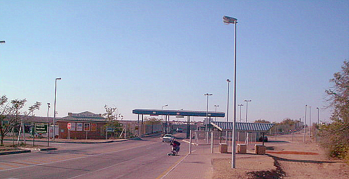
Beitbridge is where South Africa stops and Zimbabwe starts: a hot border town on the north bank of the Limpopo, a kilometre from the Alfred Beit road bridge across to Musina. Almost everyone is passing through. Give it a night if the crossing ate your afternoon, then head north or west into the Tuli bush.
Getting there
From Johannesburg it is a little over 500 km through Musina, which now has a bypass. The road bridge opened in November 1995 beside the 1929 original, now rail only. On the Zimbabwean side the A6 runs 321 km to Bulawayo and the A4 goes north through Masvingo to Harare. Roads and car paperwork are in the self-drive guide, visas in the entry requirements guide.
The post runs 24 hours. Since the Zimborders upgrade you work through the terminal building with a paid access coupon scanned at every stop: Zimborders, immigration, ZIMRA, ZINARA for the bridge, customs, police. Apply for the eTIP online first and keep every receipt. People who have done it say a quiet weekday morning takes 40 to 45 minutes a side. The festive season is another world: traffic roughly triples, and 618,562 people crossed in the 2025 to 2026 holidays.
When to go
Winter. The town sits at 457 m in the lowveld: January’s average daily maximum is 33.5 °C and The Herald puts summer highs in the district at about 42 °C. Rain is a thin 332 mm a year, nearly all between November and March. May to August is dry and bearable, July nights about 8 °C.
What to do
In town, not much: it is a trucking town of about 58,500 people (2022 census), with around 1,000 lorries a day through the border off peak. The reason to linger is west. A signposted turn 5 km from the A6/A4 junction leads to Nottingham Estate, a private citrus estate known for its fishing, elephant, hippo and birds (Kuduland Safari Lodge, which we list, shares the sign). The same route carries on about 150 km to the Tuli Safari Area: 416 km² of mopane scrub on the west bank of the Shashe, elephant, lion, wild dog and black rhino, Fort Tuli of 1890, and no hotels, only camping. The Shashe crossing is about 600 m of sand, so 4x4 or nothing.
Good to know
Cash is US dollars in small notes; rand and cards work at the border. Touts take your money and passport and disappear, says Zimborders itself; a forum regular says Zimbabwe Tourism staff with ID badges help for free, so pay nobody. Canada warns of robberies from vehicles around Beitbridge, the UK of vehicle robberies on the Masvingo road. Both say do not drive at night. The Tourism Authority rates Matabeleland South low for malaria, the CDC lists the whole country; in a river valley in the wet months I would take the tablets. Power cuts are frequent and fuel is sometimes unavailable, so fill up whenever you can.
History and culture
Beitbridge is the town most visitors see first and remember least: a hot, dusty border post on the Limpopo where the N1 from Johannesburg meets the A4 to Masvingo and Harare (Salisbury) and the A6 to Bulawayo. It exists because of a bridge, opened in 1929 and named after Alfred Beit, a Hamburg-born diamond financier, and it has been Zimbabwe's front door to South Africa ever since. The valley around it is older and stranger than the town: San paintings, a dinosaur in the sandstone and, across the water, the ruins of Mapungubwe.
- Before AD 900 to about 1200
San hunter-gatherers painted the sandstone ridges that run beside the Limpopo and Shashe, and at least 95 percent of the rock art recorded in the valley since 1992 is almost certainly theirs. Farming people arrived while the painters were still here: the Zhizo culture from about 900, then the K2 people from about 1000, both working the valley that later became Mapungubwe. source
- About 1220 to 1300
At the confluence of the Shashe and Limpopo a hilltop capital grew out of K2, one of the first class-based societies in southern Africa. The elite lived on Mapungubwe Hill and by 1250 about 5,000 people lived around it, sending gold and ivory to the coast through Sofala and taking glass beads from India and South-East Asia in return; the gold-foil rhinoceros from a grave near the palace, dug up in the 1930s, is the best known object from it. The hill was abandoned around 1300 and Great Zimbabwe, to the north, became its successor. source
- 1929
The first bridge over the Limpopo here was finished in 1929, paid for jointly by the Beit Railway Trust and the South African Railways at a cost put at $600,000, and named after Alfred Beit, Cecil Rhodes's business partner. The town and the district date from the same year and took the bridge's name. It carried road and rail; today it carries only trains. source
- 1965 to 1980
Rhodesia's white government declared independence from Britain on 11 November 1965 and sanctions followed. South Africa's air force gave training, aircraft and crews from 1966, and Mozambique, independent from 25 June 1975, soon closed its border. As the liberation war spread, civilian traffic had to travel in escorted convoys against ambush. Zimbabwe became independent on 18 April 1980. source
- 1983 to 1988
Gukurahundi was the Fifth Brigade's campaign in Matabeleland. Its first onslaught, in February 1983, fell mainly on Matabeleland North and reached only the northern edge of Matabeleland South. In February 1984 the brigade started months of mass beatings and detentions across the southern province, and after three straight years of drought the government stopped drought relief, closed stores and restricted food moving into the region, a hardship that fell on about 400,000 people. Mass abuses tailed off after May 1984, when the brigade was withdrawn for retraining, and reports of abuses went on until the 1988 amnesty. source
- 1995
A second road bridge went up beside the old one and was opened on 24 November 1995. It is a toll bridge. The old 1929 bridge was left to the railway. source
- 2008
The hyperinflation year ended in cholera. Health officials reported the first five cases in Beitbridge on 14 November 2008; two days later there were more than 500 and by the end of the week more than 1,500, with 54 dead in one week. The water pumps ran on power from a coal mine that had not been paid in over a year, open sewage ran through most streets and the hospital had no drip fluid, so patients were moved outside behind the buildings. Médecins Sans Frontières set up a 130-bed treatment centre in three days. source
- 2018
Beitbridge got town status in 2006. A notice in the Government Gazette made it a municipality from 9 March 2018, citing its growth since 2006, its busy port of entry and the roughly 13,000 people passing through each day; a US$40 million water treatment plant had been commissioned the year before. source
- Languages and people
- This is Venda country first, with Sotho, Shangani (Tshangana) and Vhalemba (Lemba) communities in the district. Chief Tshitaudze and Chief Matibe lead the main traditional communities, and the Masevhe family hope to set up a museum or heritage centre for the district's past, after archaeologists from Midlands State University worked at Sindavhanyai and Homba Hills. source
- The Venda across the river
- About 2.5 million Venda live mainly on either side of the South Africa and Zimbabwe border. Oral tradition names Shiriyadenga as the first king of Venda and Mapungubwe, and the legendary chief Thoho-ya-Ndou made the first Venda settlement in the Soutpansberg, where his capital D'zata is now a national monument. Musangwe, bare-knuckle fighting with no time limit, no kicking or biting and no betting, is still fought under the eye of village elders for a family's or village's honour. Cyril Ramaphosa in Pretoria and Kembo Mohadi in Harare are both Venda. source
- Choosing a chief
- A chief is the hereditary head of a traditional community. In the Matibe chieftaincy of Beitbridge East the choice follows Vapfumbi custom: a dead chief's body stays in his bedroom hut for a year, and when his children push at the door, whoever opens it is the heir. In May 2011 Eilsh Matibe, 43, opened it ahead of 16 rivals at Makothe village, about 80 km east of town, and his father Chichewo was buried between 4 and 6 in the morning at the family shrine in the Malungudzi mountains. source
- Tshitaudze Heritage Festival, September
- The first Tshitaudze Heritage Festival was set for 25 to 27 September 2026 at Mpande Culture Village in ward 12 of Gwanda-Tshitaudze constituency: three days of Tshivenda dance, poetry, storytelling, drama, a cook-out competition, traditional games and market stalls, with elders running counselling sessions for the young. Chief Tshitaudze calls it a creative-industry incubator as much as a celebration. source
- A town of women and travellers
- About 60 percent of the town's people are women, because so many men work in South Africa. The district counts around 2,570 houses in formal suburbs and 3,000 informal ones, and the informal homes were destroyed in 2005 during Operation Murambatsvina, the national slum clearance. Lutumba and Mazunga are the district's other settlements, and the Chikwarakwara and Shashi irrigation schemes are out in the dry country. source
For German visitors: The town is named after a man from Hamburg. Alfred Beit, born there in 1853 to a Jewish family, learnt diamonds at Jules Porgès in Amsterdam, was sent to Kimberley in 1875 and became Cecil Rhodes's partner, founding the British South Africa Company in 1888. He helped plan and pay for the Jameson Raid of 1895, was found guilty by a House of Commons inquiry and had to resign from the Company's board. When he died at Tewin Water on 16 July 1906 his will left £1,200,000 for infrastructure in the Rhodesias. source
For American visitors: Musina (Messina), the South African town just down the N1 from the crossing, was founded in March 1904 by J P Grenfell, who had come after copper south of the Limpopo, and his Messina (Transvaal) Development Company had Herbert Hoover, years before he became President of the United States, on its board from 1914 to 1916. source
Main sights in Beitbridge
8- The two Limpopo bridges
The 1929 steel bridge, now rail only, and the 1995 road bridge stand side by side over the Limpopo, and you will likely spend longer looking at them than you planned. In January 2013 the river flooded high enough to close the road bridge for about three hours from midnight; the old bridge stayed open to people on foot.
The Herald, Floods close Beitbridge Border Post (21 January 2013) - Giraffe petroglyph, Mtetengwe
A giraffe about 2.7 m long engraved into sandstone below the wall of Giraffe Dam in the Mtetengwe communal lands, about 30 km north-west of town: take the A6 north and turn left at the Tongwe High School sign. The outline is cut deep and the hide is a grid of crossing lines; it is the only naturalistic engraving of a whole animal known in Zimbabwe, almost certainly San work, walled off for protection in 1957. Two smaller, worn giraffes and a spoor engraving are nearby. The road can be sandy, so a 4x4 may be needed, and the local guide appreciates a small donation.
Zimbabwe Field Guide, Giraffe Petroglyph at Mtetengwe - Dinosaur fossils at Border Ridge, Sentinel Ranch
The most complete Massospondylus yet excavated, an Early Jurassic plant-eater 4 to 6 m long from a genus that lived 183 to 200 million years ago, lies on its back in the rock near the Border Ridge homestead, a property wrapped on three sides by Sentinel Ranch about 63 km by road from Beitbridge. Darlington Munyikwa of the National Museum of Natural History in Bulawayo described it in 1997, and the front half may still be in the rock. Visits are by appointment only, Monday to Saturday.
Zimbabwe Field Guide, Sentinel Ranch Dinosaur Fossils - Rock art of Nottingham Estate
The sandstone ridges around Nottingham Retreat and the Fly Camp, about 35 km from the Limpopo-Shashe confluence, are rock art country. The odd ones are the red Y-shapes found at more than 60 percent of the 85 recorded sites: Harald Pager read them as fish traps, but Geoffrey Blundell and Edward Eastwood argue they are probably San men's loincloths and the spread-eagled shapes beside them women's back aprons.
Zimbabwe Field Guide, the Y-shaped rock art motifs of Nottingham Estate, Limpopo-Shashi valley - Tuli Circle and Fort Tuli
Thuli Parks and Wildlife Land, 416 km² of Jurassic basalt hills on the Shashe, holds the site of an 1890 Pioneer Column fort, a supply base where oxen and horses rested before crossing the river; the fort was moved to Tuli village in the 1970s. The land was a controlled hunting area from 1958 and a safari area from 1975 and is still run through hunting concessions, with elephant, lion, wild dog and black rhino moving across into Botswana and South Africa. Camping only; the roads are poor and you need a 4x4 to cross the Shashe.
Wikipedia, Thuli Parks and Wildlife Land - Greater Mapungubwe Transfrontier Conservation Area
Three countries signed up on 22 June 2006 to join the land around the Shashe-Limpopo confluence into one 4,872 km² conservation area, renamed for Mapungubwe on 19 June 2009. Zimbabwe's share is 960 km²: Sentinel Ranch, Nottingham Estate and the Tuli Circle, with the Maramani, Machuchuta and Hwali community wildlife areas pencilled in for a second phase. South Africa brings Mapungubwe National Park, Botswana the Northern Tuli Game Reserve. It is still being built, so do not expect a gate and a map.
Wikipedia, Greater Mapungubwe Transfrontier Conservation Area - Mapungubwe, across the river
The hill capital itself is on the South African bank, inside Mapungubwe National Park, part of a World Heritage Site since 3 July 2003. It is the obvious stop on the way to or from Beitbridge if you have a day, with the confluence where Botswana, South Africa and Zimbabwe meet.
Wikipedia, Kingdom of Mapungubwe - Zhovhe Dam
The 133 million cubic metre dam on the Mzingwane, east of the Bulawayo road, is one of the ten biggest in the country and supplies Beitbridge's water and commercial irrigation in very dry country. It has a 30-room lodge that takes up to 100 people.
Wikipedia, Zhovhe Dam
Did you know?
- The 1929 bridge was built by the British steel firm Dorman Long and opened on 31 August 1929 by the Earl of Athlone, South Africa's Governor-General. The 1995 road bridge beside it was built by Murray & Roberts for New Limpopo Bridge Ltd, which still runs it. source
- Beitbridge sits at 457 m and its weather records say it all: 44.7 °C at the top, 332 mm of rain in an average year and nearly 2,960 hours of sunshine. Bear that in mind if you are sitting in a border queue in December. source
- Rudyard Kipling's 'great grey-green, greasy Limpopo River, all set about with fever-trees' is this river, and the crocodile that pulled the Elephant's Child's nose is not pure fiction: in 2013 about 15,000 Nile crocodiles got out of the nearby Rakwena crocodile farm when its flood gates were opened. source
- The Beitbridge Bulawayo Railway, opened on 15 July 1999, was built by Concor as a private build-operate-transfer deal: after 30 years the line goes to the National Railways of Zimbabwe for nothing. It puts Bulawayo 317 km from South Africa, about 200 km shorter than the old route through Botswana, and Botswana Railways' Zimbabwe freight reportedly fell from 90,000 tons to 10,000. source
- Kembo Mohadi, born in Beitbridge on 15 November 1949 and elected member of parliament for Beitbridge East in 2008, was sworn in as Second Vice-President on 28 December 2017. He resigned on 1 March 2021 over leaked recordings in which he reportedly asked women for sexual favours, which he called character assassination, and was back in the same office on 8 September 2023. source
- The town has more than doubled since 2002: 22,136 people at that census, 42,137 in 2012 and 58,574 on 20 April 2022, while the rural district around it went from 81,588 to 94,001 in the same twenty years. source
Checked 19 October 2026.
The other Beitbridge crossing: rafts, girders and crocodiles
At about seven one morning in May 2015 a female crocodile, roughly three metres long, came at a group of eighteen people and a fisherman at the spillway on the Limpopo, about 900 m downstream of the Alfred Beit Bridge. They got a fishing net over her head and beat her with stones until she stopped moving. A man from the local neighbourhood watch tried to stop them and they scattered; parks rangers came out at midday and shot what was left. The eighteen were described as suspected border jumpers. About two weeks earlier a hippo had killed two men crossing the same river, men who, the report said, made their living robbing people like them at the spillway and in the Dulibadzimu gorges.
That is the Beitbridge most visitors never see. You sit in the queue on the road bridge, and a few hundred metres either side of you there is a second border running on its own rules.
Under the old girders
Zimbabwe and South Africa share about 225 km of border and one official crossing. Everything else is the Limpopo, and the people who make money from it are called maguma guma. Al Jazeera described them in 2008 as hundreds of men who took people across on the underside of the disused railway bridge, cut holes in the three barbed wire fences on the far bank, kept in touch by mobile phone and waited in the bush for the army and police vans to pass before telling everyone to run. A South African soldier on that stretch said he saw 60 to 100 crossers a day and caught about ten. People who fell into the wrong hands were robbed and beaten. Women who ended up in Musina told the Mail & Guardian about robbers waiting in the trees by the fence, and one, stuck there without money or papers, said she did not want to cross the river again because the gangs would take her things.
The bridges themselves get used. In January 2017, with the river full after heavy rain and running fast, The Citizen reported people squeezing through damaged pillars and fencing onto the trusses of the road bridge, some 30 m above the water, and climbing down the bank into South Africa, some ducking behind the stalled traffic. A passerby counted more than forty getting through, children and infants among them, and afterwards police told people in the stuck vehicles to delete their photos or hand over their phones.
Fifteen bodies in a crocodile cave
The river is the cruel part. In April 2014 police from both countries pulled fifteen bodies out of a cave used by crocodiles about 3 km east of the old bridge, seventeen that week in all, and some were missing limbs. The report on the crocodile put the number of informal crossing points along the border at about 200. The other way is through the post itself with the omalayitsha, the minibus drivers with friends among the officials on both sides who get people through without papers. A regular crosser told FairPlanet in 2015 that paying them beat risking your life in the Limpopo.
A washing line of razor wire
When South Africa went into lockdown in late March 2020, its public works department ordered an emergency fence, 40 km of coiled razor wire along the river, up in three weeks. It came in at 1.8 m instead of the 2.2 m specified, with the coils stretched so far they sagged, and critics called it the washing line. The minister, Patricia de Lille, told MPs it was breached within about a day of going up. By February 2021 she had decided it was not fit for purpose and would not be repaired, and fourteen officials were in line for discipline.
The same year ended with a queue nobody there will forget. In December 2020 trucks backed up for kilometres on the South African approach while Covid screening crawled along and the usual festive season crowd of Zimbabweans went home. eNCA counted at least fifteen people dead in a few weeks, put down locally to exhaustion and illness after days of waiting with no facilities, a figure officials would not confirm to Reuters. In the end screening for outgoing traffic was dropped. If you ever find yourself grumbling in the queue on a busy Friday (the practical side is in our entry requirements guide), that is the yardstick.
Rafts one way, the bridge the other
Doctors Without Borders has worked at this border since 2000, and its 2019 survey of migrants in Beitbridge and Musina found that for most of them the town was not a destination at all, only a stop on the way south, and many had come from countries further north. French speakers from Burundi and the DRC said even getting treated was hard where the clinics work in English.
This year the bridge filled with people going home. After weeks of anti-immigrant protests and attacks in South Africa, AFP reported in July 2026 that more than 46,000 people had been repatriated or deported through Beitbridge since 7 June, most of them Malawians, then Zimbabweans. One young man carried a computer monitor, one of the few things he had saved from his home in Limpopo province. A Zimbabwean couple who had paid smugglers to take them over the river in 2024 were heading back with their one-year-old son. Meanwhile, a short way from the post, wooden rafts were still being pulled along a rope across the Limpopo into South Africa. The father put the river crossing simply: in winter there is not much water, so it is easy.
None of this touches a tourist with a passport and a booking in Bulawayo or Masvingo. But when the queue stalls on the bridge, look down at the river. Somebody is probably crossing it.
Guides for Beitbridge
Map of Beitbridge
See every place on this map as a list