District · Botswana
Kgalagadi District
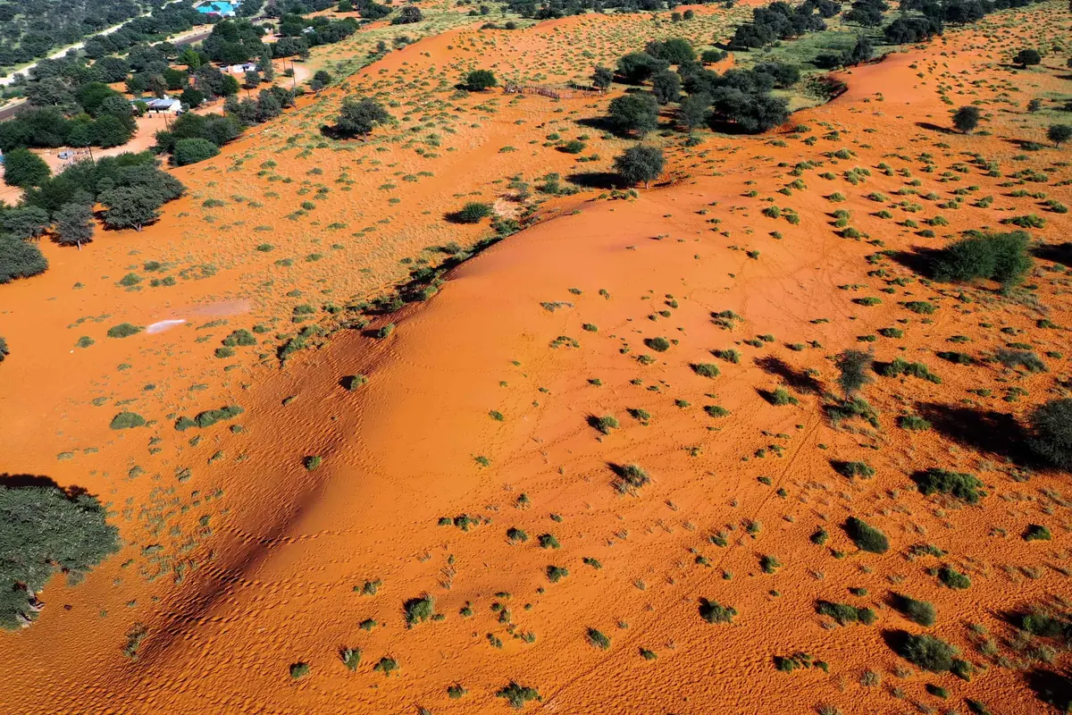
Botswana's south-west corner: 105,200 km² of Kalahari sand and fewer than 60,000 people. Tsabong is the capital, and the Kgalagadi Transfrontier Park covers more than a third of it.
Short answer
This page covers 1 parks and reserves and 2 towns and cities in Kgalagadi District.
- Parks and reserves
- 1
- Towns and cities
- 2
- Places to stay
- 51
- Where
- Botswana25.11°S 22.34°E
Parks and reserves in Kgalagadi District
1Towns and cities in Kgalagadi District
2Kgalagadi is the south-west corner of Botswana, 105,200 km² of Kalahari sand pressed against Namibia and South Africa. The name comes from a Tswana word for a waterless place, and fewer than 60,000 people live here. Kgalagadi North, the Hukuntsi and Kang end, has 0.3 people to the square kilometre. Tsabong is the capital. More than a third of the district is the Kgalagadi Transfrontier Park, and that is why most visitors come. The rest is scattered villages and very long roads.
Getting there
Two tar roads do the work. The A2, the Trans-Kalahari Highway between Lobatse and the Namibian border, runs through Kang in the north of the district. For the south you leave the A2 at Sekoma and turn down the A20. Buses leave Gaborone for Tsabong each morning and take six to seven hours. Hukuntsi is about 110 km of tar west of Kang.
From South Africa, McCarthy’s Rest is the post for Tsabong. Middlepits and Bokspits are village crossings further south-west. All three shut at 16:00 on the Botswana side.
When to go
May to September, when the heat is off. Winter nights freeze, and Tsabong holds Botswana’s record low of minus 15°C, so campers should pack for it. Summer is harsh. Tsabong’s record high is 42.6°C. What rain there is, around 250 mm a year, falls between November and May.
What to do
Mabuasehube, the eastern end of the transfrontier park, is the reason to be here. The park has its own page.
Outside the park, Tsabong has the camel park about 10 km from town. The herd began with 40 police camels handed over in 2003, a leftover of the days when the border police patrolled on them, and has grown to around 500. A trust for Tsabong, Maubelo and Maleshe runs it with the tourism board, with camel rides, quad bikes and chalets. It has had money and grazing troubles, so phone before you drive out.
Hukuntsi (the name means “many corners”) is mostly Bangologa, with Tshane, Lokgwabe and Lehututu close by. Tshane has a !Xóõ cultural centre. Khawa, west of Tsabong on dirt roads, hosts a desert challenge every year.
Kang is a stopover and nothing more, but a useful one, with fuel and a handful of places to stay.
Good to know
Plan around fuel. Tsabong, Kang, Hukuntsi and Sekoma have it and the park has none, so fill up at every one. Tsabong has a bank and a hospital. Travellers disagree about its shops (one calls the supermarket well stocked, another found very little), so buy food earlier.
For the sand tracks to the park you need a 4x4 with good clearance, tyres let down and all your own water. The UK government advises a convoy or a satellite phone for country this empty. Livestock and wildlife stray onto the tar, so don’t drive after dark.
Malaria is close to a non-issue. The CDC records only rare cases in Kgalagadi North, and UK advice for the southern half of Botswana is bite avoidance, no tablets.
In and around Kgalagadi District
56 places listedWhere to stay in Kgalagadi District 51
- 25.09°S 20.43°ECampsitePolentswa Camp Site (KTPOL01)+267 318 0774mewt.gov.bw
- 25.09°S 20.43°ECampsitePolentswa Camp Site (KTPOL02)+267 318 0774mewt.gov.bw
- 25.09°S 20.43°ECampsitePolentswa Camp Site (KTPOL03)+267 318 0774mewt.gov.bw
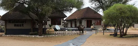
- 26.47°S 20.62°ECampsiteTwo Rivers Campsite (Botswana)+267 318 0774mewt.gov.bw
- 25.01°S 21.90°ECampsiteKhiding (KT-KHI-01)+267 318 0774mewt.gov.bw
- 24.94°S 22.05°ECampsiteLesholoago (KT-LES-01)+267 318 0774mewt.gov.bw
- 24.94°S 22.06°ECampsiteLesholoago (KT-LES-02)+267 318 0774mewt.gov.bw
Show all 51 places to stay
- Mabuasehube (KT-MAB-02) · Campsite+267 318 0774mewt.gov.bw
- Mabuasehube (KT-MAB-04) · Campsite+267 318 0774mewt.gov.bw
- Mabuasehube Entrance Gate (KT-ENG-02) · Campsite+267 318 0774mewt.gov.bw
- Matopi Camp Site (KTMOT1) · Campsite+267 318 0774mewt.gov.bw
- Matopi Camp Site (KTMOT2) · Campsite+267 318 0774mewt.gov.bw
- Monamodi (KT-MON-02) · Campsite+267 318 0774mewt.gov.bw
- Mosomane Campsite (KTMOS01) · Campsite+267 318 0774mewt.gov.bw
- Mpayathutlwa (KT-MPA-01) · Campsite+267 318 0774mewt.gov.bw
- Mpayathutlwa (KT-MPA-02) · Campsite+267 318 0774mewt.gov.bw
- Two Rivers Rest Camp (Botswana) · Chalet+267 318 0774mewt.gov.bw
- Spillover camp Polentswa · Campsite
- Rooiputs Campsite · Campsite
- Tashebube Polentsa Lodge · Hotel
- Bosobogolo (KT-BOS-01) · Campsite
- Bosobogolo Campsite · Campsite
- Khiding (KT-KHI-02) · Campsite
- Lefika · Campsite
- Mabuasehube (KT-MAB-01) · Campsite
- Mabuasehube (KT-MAB-03) · Campsite
- Mabuasehube Entrance Gate (KT-ENG-01) · Campsite
- Mabuasehube Entrance Gate (KT-ENG-03) · Campsite
- Monamodi (KT-MON-01) · Campsite
- Mpayathutlwa Reserve Campsite · Campsite
- Swartpan (KT-SWP-01) · Campsite
- Swartpan (KT-SWP-02) · Campsite
- (unofficial) Camping Opportunity · Campsite
- Campsite Kaa Pan · Campsite
- Campsite Kalahari Rest Camp · Campsite
- Gnus Gnus (KT-GNU-01) · Campsite
- Kaa Entrance Gate (KT-KAA-01) · Campsite
- Kaa Entrance Gate (KT-KAA-02) · Campsite
- Kgane Pan · Campsite
- Lang Rambuka · Campsite
- Masetlheng pan · Campsite
- Name Pan · Campsite
- Peach Pan · Campsite
- Sesatswe · Campsite
- Sizatswe (KT-SIZ-01) · Campsite
- Tashebube Rooiputs Lodge · Hotel
- Thupapedi (KT-TH-01) · Campsite
- Towe Pan · Campsite
- Zonye Pan · Campsite
Sights 5
- Cheleka WaterholeAttraction
- Kameelsleep WaterholeAttraction
- Mabuasehube PanViewpoint
- Malatso WaterholeViewpoint
- Rooi Rambuka PanViewpoint
Map of Kgalagadi District
See every place on this map as a list