Town · Hardap, Namibia
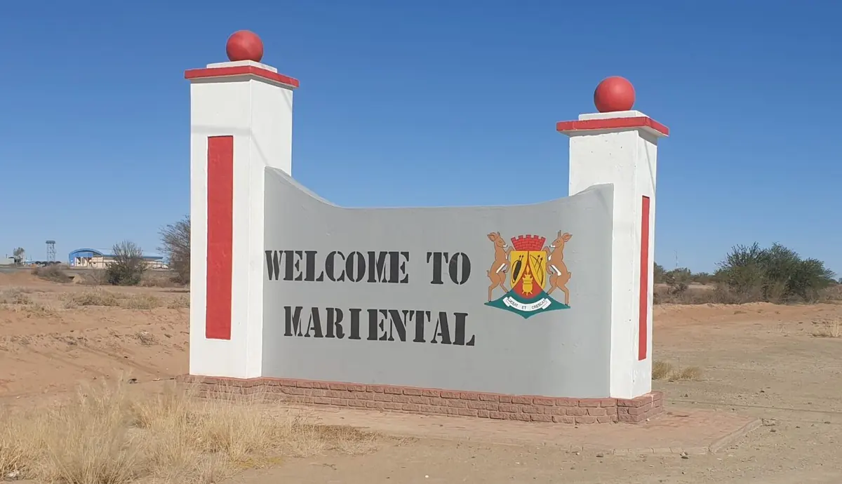
Mariental
The capital of the Hardap region, a farming and service town on the B1 and the Fish River where most people stop for fuel and food, with Hardap Dam just up the road.
Short answer
Mariental is in Hardap, Namibia. This page lists 14 places to stay and 10 places to eat and drink. The nearest park with an entry fee on this site is Hardap Game Park, about 26 km away, where international adults pay from N$200.
- Places to stay
- 14
- Eat and drink
- 10
- Park fee nearby: Hardap Game Park
- US$12 €11 · N$200about 26 km away
- Where
- Hardap, Namibia24.63°S 17.97°E
In and around Mariental
24 places listedWhere to stay in Mariental 14
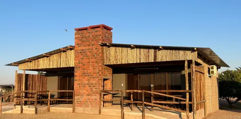
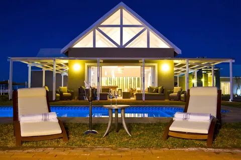
- 24.63°S 17.95°EChaletRiver Chalets+264 81 128 2601riverchalets.com
- 24.62°S 17.97°EHotelAub Guesthouse - MarientalAub Street, Mariental+264 81 808 8028
- 24.62°S 17.97°EHotelDulcis Guest HouseMariental+264 81 321 2329
- 24.43°S 18.10°ECampsiteAnib Lodge Basic Camp Site
- 24.51°S 17.93°EGuest houseBastion Farm
- 24.59°S 17.96°EHotelFlying Ostrich GuesthouseFarm Keikanachab Ost, Mariental
Show all 14 places to stay
- Anandi · Guest house
- Bastion Farmyard · Campsite
- Koha Guesthouse · Campsite
- La Vida Inn · Guest house
- Mariental Hotel · Hotel
Restaurants and cafes 4
- Die KooperasieRestaurant · regional · Park Road
- Hungry Lion MarientalRestaurant · Mariental+264 83 333 8107
- Tahiti Guesthouse and Restaurant MarientalRestaurant
- Desert Fox SpurRestaurant · steak house · Namibia+264 63 242 016spursteakranches.com
Bars and pubs 6
- Conna ShopBar · Mariental
- Parliament BarBar · Mariental
- ShoelessBar · Mariental
- Triple IIIBar · Mariental
- TSARASBar · Mariental
- U-TURNBar
Mariental is the capital of the Hardap region and the main town on the B1 between Windhoek and Keetmanshoop. It grew out of a German settler’s farm and a railway stop beside the Fish River, and it still lives off the farms around it, with lucerne, grapes and vegetables watered from Hardap Dam. The 2023 census counted 18,494 people. Most travellers stop to refuel and shop on the way to Sossusvlei or the Kalahari, and that is a fair use of it.
Getting there
The town is 274 km south-east of Windhoek on the tarred B1, about three hours of driving, and 232 km north of Keetmanshoop. The tarred C19 runs west to Maltahöhe; past there it is only partly tarred on the way to Sesriem and Solitaire. The tarred C20 heads north-east to Aranos. On good gravel 60 to 80 km/h is sensible, and the D roads are rarely graded. Coaches between Windhoek and South Africa pass through, and a slow freight train with a passenger coach calls a few times a week.
When to go
It is a hot desert town with about 194 mm of rain a year, most of it from January to March. Summer days are very hot: 44.0 °C was recorded on 11 November 2021. Winter days are warm, but July nights average around 3 °C, so pack a jersey. May to September is the easier time for driving and walking.
What to do
Hardap Dam lies just over 20 km north-west of town. It was finished in 1963 and has its own game park, with plains game, great white pelicans on the water and fishing (you need a permit). See our Hardap Game Park page for the details.
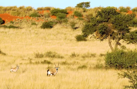
About 30 km north-east on the C20, Kalahari Anib Lodge sits in the private Gondwana Kalahari Park, with gemsbok, springbok and sociable weaver nests in the camelthorn trees. A sedan gets there fine. The lodge has self-guided walks of 6, 7.5 and 9.5 km and guided drives in the early morning and before sunset.
The town itself has little to see. River Chalets on the B1 has a restaurant, farm shop and a playground with tame animals, handy with children. For the Nama history of the area, Gibeon, the Witbooi home town, is further south.
Good to know
- Mariental has supermarkets, filling stations and tyre repair. It is the obvious place to fill up and buy water before you leave the B1 for the C19 or C20.
- If you are staying on a farm off a D road, phone ahead and ask if you need a 4x4.
- Malaria is rare here. The US CDC does not list Hardap as a transmission area and advises insect bite precautions only, with no tablets.
- The town floods when the Hardap sluices have to be opened fully in a big rain year. In February 2006, 122 houses and 80 businesses went under. Dykes up to three metres high now guard the eastern side, but in a very wet summer watch the local news.
History and culture
Mariental is the farming and government town of central southern Namibia, on the Fish River and the B1. It began as a farm a German settler bought from the Nama leader Hendrik Witbooi in the 1890s, in country that has long been Nama land, and grew up around the railway. Its past is short but it touches most of Namibia's story: German rule, the war of 1904 to 1908, South African rule and the big dam that both feeds the town and sometimes floods it.
- Before 1890s
The country around Mariental has long been a centre for the Nama people, and many of the town's people today are Nama speakers descended from the early Khoi (Khoekhoe) inhabitants of Namibia. source
- 1895
Hermann Brandt, a farmer and transport rider from Porta Westfalica in Germany, bought the farm Gui-ǀganabis from Hendrik Witbooi, Kaptein (chief) of the Witbooi Nama. He renamed it after his wife, Anna Maria, whom he had married in 1894, and the town grew from that farm. source
- 1898
A Dutch Reformed (NGK) congregation was founded here as the Gibeon congregation. It is the oldest NGK congregation in Namibia, and its first minister for some years served the whole of what was then South West Africa. source
- Late 1890s
The German colonial army stationed 15 soldiers on the farm Mariental, and a police station followed soon after. source
- 1904 to 1908
Hendrik Witbooi, who had fought beside the Germans against the Herero earlier in 1904, led the Nama into war against German rule later that year. Witbooi was killed on 29 October 1905, and the war ended in the genocide of the Herero and Nama, in which about 10,000 Nama were killed, around half their number. source
- 1911 to 1920
The railway between Windhoek and Keetmanshoop reached Mariental in 1911, a few kilometres west of the old farm, and shops and businesses followed. Residents asked to be made a village in 1912, but the First World War and South African rule from 1915 delayed it until 1920. Mariental became a municipality in 1946. source
- 1960 to 1963
Under South African rule the Hardap Dam was built upstream on the Fish River between 1960 and 1963, and it stayed the country's largest dam until 2018. source
- 2006
After days of heavy rain the Hardap Dam filled, and on 25 February 2006 water through the flood gates swept into Mariental. 122 houses and 80 businesses were under water and two people drowned. source
- Language
- In the 2023 census the Nama and Damara language, Khoekhoegowab, was the main home language in 39.5% of households in Mariental Urban constituency. Afrikaans came second at 30.8% and the Oshiwambo languages third at 18.6%. English was the home language of only 3.8%. source
- A growing town
- Mariental had 12,478 people in 2011 and 18,494 in 2023, growth of 48.2% in twelve years. It is the second biggest town in the region, after Rehoboth. source
- Farming
- The town lives off the farms around it. Water from Hardap Dam irrigates lucerne, maize, fruit, vegetables and export grapes, while the dry farms further out keep sheep, cattle and game. What is left of the karakul sheep trade in the south is centred here. source
For German visitors: Mariental is named after the wife of a Westphalian. Hermann Brandt, from Porta Westfalica, married Anna Maria Mähler in 1894, emigrated the same year and named his farm after her. He died in Lüderitz in 1925. source
For German visitors: In the official gazette of German South West Africa in 1910 the town is spelled the German way, Marienthal. source
For German visitors: The German association Fahrräder für Afrika e.V. (Bicycles for Africa) set up a Bicycle Empowerment Centre in Mariental with Catholic Aids Action and BEN Namibia, training people living with HIV to repair second-hand bicycles, which are then sold cheaply in the region. source
Main sights in Mariental
4- Hardap Dam and Game Park
About 22 km north-west of town, the dam supplies Mariental's water, feeds the irrigated farms and controls the Fish River, which is why the town still floods when the sluices are opened fully. Our Hardap Game Park page covers the park around it.
Wikipedia: Mariental, Namibia - Witbooi sites, Gibeon
Gibeon, south of Mariental, was named by Kido Witbooi, first Kaptein of the ǀKhowesin, and has been the Witbooi home town ever since. It is where to go for the Nama side of the region's history.
Wikipedia: Gibeon, Namibia - Monument at Kub
A monument in the Hardap region to a fight between the Nama and German troops on 22 November 1904, in which seven German soldiers were killed. It was proclaimed a historical monument in 1968.
National Heritage Council of Namibia: Heritage Places - Gondwana Kalahari Park
Not a historical site but the easiest taste of the Kalahari from town: a private reserve about 30 km north-east on the C20, with gemsbok, springbok and sociable weaver nests in the camelthorn trees.
Gondwana Collection: Kalahari Anib Lodge
Did you know?
- Mariental flooded in 1923 and 1934, before the dam was built, and again in 1972, 1974, 1976, 2000 and 2006 after it. Since 2006 the dam is kept no more than 70% full, so that the sluices never have to be thrown fully open. source
- The town's Nama name is Tsaraxeibes, and its nickname is Stofbakkies. source
- Hardap, the name of the dam and the region, comes from a Nama word for nipple or wart, after the small cone-shaped hills around the dam. source
- Hermann Brandt's farm was called Gui-ǀganabis, which Dierks also gives as Enkelkameelboom (Afrikaans for a single camelthorn tree). source
Checked 7 October 2026.
The friend of Witbooi who rode to Mariental alone
On 3 October 1904 Hendrik Witbooi ended ten years of peace with the Germans. The next morning the district chief at Gibeon, Henning von Burgsdorff, got on his horse and rode north to Marienthal, Hermann Brandt’s farm, to find him. He went alone. The two men had fought each other in 1894 and then become friends, close enough that people in the colony remarked on it, and Burgsdorff seems to have believed he could talk the old Kaptein round.
He was shot as he reached the Witbooi camp. The man usually named as the killer is Salomon Sahl, one of Witbooi’s soldiers. What exactly happened was never settled, even with witnesses. The German side decided Witbooi had lured him in. Nothing found since supports that, and the killing probably went against what Witbooi wanted. His body was found a year later, dried out in a cleft in the rocks, and taken home to the family estate near Frankfurt an der Oder, where it was buried in June 1906.
Sahl did not outlive him by long. The story, which the historian Klaus Dierks takes from a 1991 book by Zondagh (Connie Zondagh, one of Stampriet’s oldest residents, has published several local histories), is that lightning struck and crippled him and that he died of thirst in the Kalahari the following April. Treat that as legend. The names are real enough though: a farm near Mariental still carries Burgsdorff’s, and Maltahöhe, which he founded in 1899, is called after his wife Malta. Two towns about 110 km apart, both named for a German’s wife.
A post office that kept closing
Brandt had not bought the farm alone. Klaus Dierks’s biographical register has his brother-in-law Oskar as partner in the deal with Witbooi, and puts the Brandts’ wedding at Taung, in what is now South Africa’s North West province, on Christmas Eve 1894.
Marienthal got a post office on 1 February 1900, listed under its Nama name as well. Witbooi’s men wrecked it in the first days of the war, along with the one at Gochas. The railway from the south reached the place in December 1911, and less than four years later the post office shut again. That was 27 April 1915, the day the Germans beaten at Gibeon came through in retreat from the South Africans.
Nine years after that, on 26 July 1924, an Afrikaner named F.J. Jooste founded the National Party of South West Africa here. It wanted the territory absorbed into South Africa, and Dierks marks it as the first time white voters in the country divided along party lines. Its first branches were all in the farming south and east, in places like Gibeon, Kub and Gochas.
The camp west of town
The hardest part of Mariental’s record is recent. On 4 May 1978 South African forces raided SWAPO camps in southern Angola. The people they brought back, 36 women and 96 men by The Namibian’s count, were put in a detention camp at Kaiganachab, west of the town (the paper spells it Keikanachab), and held there for six years without trial. Dierks notes that there were children among the captives. In 2012 some of the former detainees were still waiting to be recognised as war veterans.
I have found nothing that directs a visitor to the site.
Milk, lucerne and the ostriches that left
The green fields below Hardap Dam are largely lucerne. It is the main crop on the government’s Hardap green scheme, where it is cut about every 45 days. Next door is milk. The !Aimab Superfarm had 1,400 cows in milk and was producing more than 30,000 litres a day when President Pohamba opened it in August 2009, in a cow house built to an Israeli design.
Ostriches went the other way. In 2004 Agribank put up a loan facility for 49 up-and-coming farmers and a Mariental producer. More than four birds in ten died, and by the end of 2005 the bank had decided the business would never pay and pulled out. The farms that once lined the road north of town were gone by 2016, though one was still there to be flooded on 2 April 2020, when 100 mm fell on the eastern side in two hours. That flood had nothing to do with Hardap Dam. It was the Aub River, and it went straight through the sand banks built to hold it. (The dam’s own long quarrel with the town is on our Hardap Game Park page.)
Red dunes up the C20
There is no wildlife to speak of in town. The animals are on the private Kalahari reserves off the C20 to the north-east, starting about 30 km out, where the long red dunes run in parallel lines with flat grassy valleys between them known as streets.
Oryx (gemsbok) and springbok are the two animals every account of a drive here mentions, from a magazine writer in 2004 to the lodges today. Eland, wildebeest and ostrich are on the reserves too. One family who stayed at Bagatelle in October 2024 wrote of oryx grazing beside their rooms near the pool, and now and then a white rhino.
Be clear about the cheetahs. Bagatelle’s are orphans and other animals that cannot go back to the wild, placed there with the Cheetah Conservation Fund and kept in an enclosure. Guests watch them fed at sundowner time. It is a good look at a cheetah and not a wild sighting, and writers have described the same arrangement since 2004.
What I would look for hardest is smaller: sociable weaver nests, the haystacks wedged into the camelthorn trees. One nest can hold more than a hundred pairs. Researchers who put thermometers inside found the chambers shifting by only 7 or 8 degrees while the air outside swung from 16 to more than 33. Cape cobras and boomslangs raid them, so look up before you stand underneath.
Map of Mariental
See every place on this map as a list