Town · Karas, Namibia
Keetmanshoop
Capital of the ǁKaras Region where the B1 meets the B4, the fuel and supply town of the south, with an 1895 mission church in the centre and the Quiver Tree Forest just outside.
Short answer
Keetmanshoop is in Karas, Namibia. This page lists 14 places to stay, 7 places to eat and drink and 8 sights. The nearest park with an entry fee on this site is Fish River Canyon (ǀAi-ǀAis), about 124 km away, where international adults pay from N$280.

- Malaria
- The CDC lists malaria regions only in the north and north-east of Namibia (Kavango East and West, Kunene, Ohangwena, Omaheke, Omusati, Oshana, Oshikoto, Otjozondjupa and Zambezi), and says it is rare elsewhere.
- Places to stay
- 14
- Eat and drink
- 7
- Sights
- 8
In and around Keetmanshoop
29 places listedWhere to stay in Keetmanshoop 14
- 26.58°S 18.13°EHotelCentral Lodge5th Avenue, Keetmanshoop+28663225850central-lodge.com
- 26.58°S 18.12°EGuest houseGesserts Guesthouse+264 63 223 892natron.net
- 26.58°S 18.14°EGuest houseBird's Nest Guest HousePastorie Street, Keetmanshoop+264 63 222 906birds-accommodation.com
- 26.58°S 18.14°EGuest houseAt HomeSam Nujoma Drive, Keetmanshoop
- 26.58°S 18.14°EHotelCanyon HotelSwakara Avenue, Keetmanshoop
- 26.61°S 18.17°EHotelMaritz Country Lodge+264 63 224 316maritzcountrylodge.com.na
- 26.57°S 18.14°EGuest houseThe Golden Rule
Show all 14 places to stay
- Burgersternum Backpacker · Guest house · 3rd Avenue, Keetmanshoop
- Keetmanshoop Municipal Rest Camp · Caravan park · Keetmanshoop
- Maritz Campsite · Campsite
- Garas Rest Camp · Campsite
- Schützenhaus Guest House · Guest house
Sights 8
 Eagle MonumentMonument
 Quiver Tree ForestAttraction
 Giants PlaygroundAttraction
 Steam locomotiveAttraction · Keetmanshoop
- Karakul MonumentMonument · 5th Avenue
- Hendrik TseibMemorial
- Kokerboom WoudAttraction
Restaurants and cafes 4
- Sushi BarRestaurant · sushi · 5th Avenue
- ily Coffee ShopCafe · 5th Avenue, Keetmanshoop
- SchützenhausRestaurant
- SteersRestaurant · Keetmanshoop
Bars and pubs 3
- Karas Take AwayBar · Swakara Avenue, Keetmanshoop+264 63 225 252
- Bullring PubBar · Keetmanshoop
- make a turnBar
Keetmanshoop is the capital of the ǁKaras Region and the main town of Namibia’s south, with 27,862 people at the 2023 census. Namibians mostly just say Keetmans. It sits where the B1 from South Africa meets the B4 to the coast, so nearly every self-drive trip through the south comes through here. Most people refuel and drive on. Stay a night instead, for the old mission church and the Quiver Tree Forest.
Getting there
You will almost certainly drive. Keetmanshoop is about 500 km south of Windhoek on the tarred B1, which carries on south through Grünau to the Orange River. On the southern edge of town a traffic circle sends the B4 west for 334 km to Lüderitz (ǃNamiǂNûs). Without a car, take one of the coaches between Windhoek and South Africa or a shared minibus taxi (combi). The overnight train from Windhoek has seats only and takes about ten hours.
When to go
Expect sun, with more than 3,870 hours of it a year. Afternoons average about 35°C in December and January, and July nights drop to around 6°C. The little rain there is (roughly 159 mm a year) falls mostly from January to April. May to September is the comfortable time for walking about, and the quiver trees flower yellow in winter, roughly May to July.
What to do
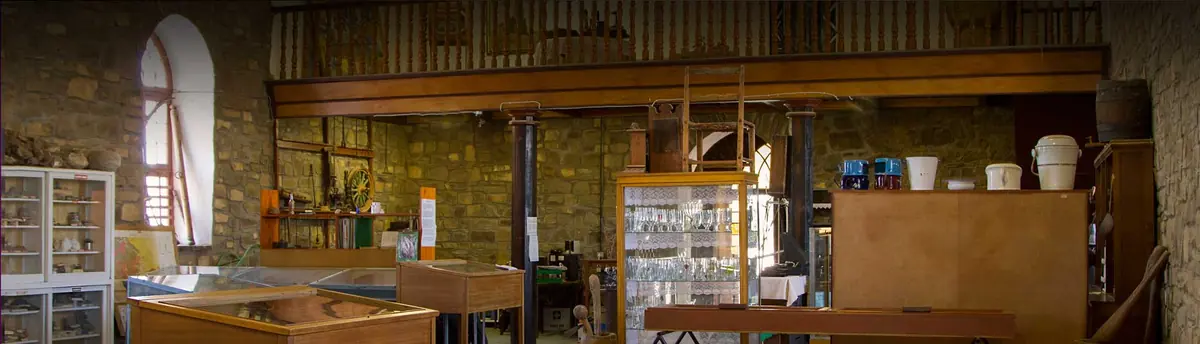
Start at the Rhenish Mission Church. The first church, paid for by Johann Keetman of the Rhenish Missionary Society in Germany, was washed away by the Aub River in 1890. The Nama congregation built the stone one that replaced it, consecrated in 1895, and it now holds the town museum. The Imperial Post Office of 1910 houses the tourist information office, and the Schützenhaus (1905 to 1907) and the 1908 railway station are still standing.
The Quiver Tree Forest is about 14 km north-east on the farm Gariganus: some 250 quiver trees (kokerboom in Afrikaans), declared a national monument in 1955. The name comes from the San, who hollowed out the branches to make quivers. A few kilometres further along the same road, the Giant’s Playground is a maze of dolerite boulders piled into stacks that look deliberately built. Day visits to both run from sunrise to sunset, and the farm can arrange night photography if you ask beforehand.
Good to know
- Fuel up and check your tyres here. The hot tar of the B1 is hard on them.
- The CDC does not list ǁKaras among the regions where it advises malaria tablets, and the Namibia Tourism Board calls the south almost risk free. Repellent is enough.
- Many gravel roads break up in the January to April rains. The UK government advises carrying two spare tyres, checking road conditions before you set off and not driving outside towns after dark, when wildlife and livestock are on the road.
- Theft from cars at filling stations is common in Namibia. Don’t leave yours unattended.
- The boulders at the Giant’s Playground form a proper maze and people do get turned around in it, so keep to the marked route.
History and culture
Keetmanshoop began as ǂNūǂgoaes, a Nama settlement at an iron-rich spring, and became a German mission station in 1866, named after a banker in Elberfeld who never saw it. Soldiers, a fort and two railways followed, then South African rule, which split the town into separate quarters by race. The stone church the Nama built in 1895 still stands in the centre and holds the town's story.
- 1808 to 1850
Kaptein (chief) Hendrik Tseib of the Kharoǃoan, one of the Nama clans, found the spring in 1808 while out hunting and named the place ǂNūǂgoaes, place of black mud, after its iron-rich water. The Afrikaans name Swartmodder means the same. In February 1850 the clan split from the Red Nation, the senior Nama group, and settled here for good. source
- 1866
The Rhenish Missionary Society, a German Protestant mission, sent Johann Georg Schröder, who arrived on 14 April 1866. The town counts that day as its founding and is named after the society's benefactor Johann Keetman. source
- 1890 to 1895
The Aub River washed away the first church in 1890. Kaptein Tseib gave land for a new one, and the community built it in stone under the missionary Tobias Fenchel. It was consecrated in 1895. source
- 1894 to 1898
The German colonial government posted soldiers here in 1894 under a Lieutenant Bethe, and a fort for its colonial troops (the Schutztruppe) was finished in 1898. The fort later made way for the police station. source
- 1904 to 1908
In 1904 most Nama clans rose against German rule, months after the Herero. German forces answered with a war of extermination now recognised as genocide: about 10,000 Nama, half their number, and most of the Herero died, many of them in concentration camps. source
- 1908
The railway from the port of Lüderitz reached Keetmanshoop in 1908, giving the town its link to the Atlantic. The station building from that year still stands. source
- 20 May 1915
In the First World War South African troops under Jan Smuts advanced inland from Lüderitz and took Keetmanshoop, where they met two columns that had crossed the border from South Africa. source
- 1960s
Under apartheid the town was divided into strictly separate residential areas for each population group, a pattern still partly visible today. Tseiblaagte, named after Kaptein Tseib and now called Hendrik Tseib, dates from this time. source
- 1968 to 1990
The United Nations renamed the territory Namibia in 1968 and recognised SWAPO (the South West Africa People's Organisation) as the representative of its people. After a long struggle against South African rule the country became independent as Namibia on 21 March 1990. source
- Languages
- Across the ǁKaras Region, the 2023 census found Afrikaans the main home language in 31.8% of households, followed by Khoekhoegowab (the Nama and Damara language, 17.8%) and Oshikwanyama (14.2%). Keetmanshoop itself grew from 19,447 people in 2011 to 27,862 in 2023. source
- Nama heritage
- Hendrik Tseib's name lives on in the suburb once called Tseiblaagte, now Hendrik Tseib, while Krönlein is named after an early German missionary who worked in the area. source
- Karakul farming
- Tourism and the breeding of karakul sheep are the town's main businesses. The climate is too dry for much other farming, and some years bring no rain at all. source
- Music
- The singer Jackson Kaujeua, a voice of the liberation struggle, was born at ǃHuns near Keetmanshoop in 1953. Expelled from South Africa for anti-apartheid activism, he went into exile with SWAPO's help and came home before independence in 1990. source
For German visitors: Johann Keetman (1793 to 1865) was born in Hamburg and became a banker and town councillor in Elberfeld, now part of Wuppertal. He was a director of the Wuppertal-based Rhenish Missionary Society from 1828 and its chairman from 1843, gave the money for the mission and died before it was named after him. source
For German visitors: The missionary Tobias Fenchel modelled the 1895 church on his home church in Gambach, with the same square tower about 30 m tall. source
For German visitors: In 2015 the German government acknowledged that the killing of the Herero and Nama was genocide, and in 2021 it agreed to pay 1.1 billion euros in development aid. Most Herero and Nama organisations rejected the deal because they were not part of the negotiations. source
For German visitors: The soldier Hellmut von Leipzig (1921 to 2016) was born in Keetmanshoop, as were the actress Ingeborg Körner (born 1929) and the SPD politician Hans-Günther Toetemeyer (1930 to 2017). source
Main sights in Keetmanshoop
6- Rhenish Mission Church and Keetmanshoop Museum
The stone church the Nama community built in 1895, a national monument since 1978. Its Black congregation used it until 1961, when they were expelled from the town's white quarter, and it has served as the town museum since 1978.
National Heritage Council of Namibia: heritage places - Imperial Post Office
The German colonial post office of 1910, now the town's tourist information office.
Wikipedia: Keetmanshoop - Schützenhaus and railway station
The German marksmen's club house, built from 1905 to 1907, and the 1908 station building of the railway that tied the town to Lüderitz. Both are still standing in town.
Wikipedia: Keetmanshoop - Quiver Tree Forest
Some 250 to 300 large quiver trees spread over the farm Gariganus north-east of town, with an information board and a bronze plaque. The forest was declared a national monument in 1955.
National Heritage Council of Namibia: Quiver Tree Forest site record 021/1955 (archived copy) - Giant's Playground
Dolerite boulders of volcanic origin, about 170 million years old, weathered into stacks that look built by giants. A marked loop of about 45 minutes runs through it, on the same farm as the Quiver Tree Forest.
Wikipedia (German): Spielplatz der Riesen - Naute Dam
Built from 1970 to 1972 on the Löwen River about 42 km south-west of town, it supplies Keetmanshoop with water. Below the wall, irrigation started in 1991 grows dates and grapes.
Namibia Tourism Board: Naute Recreation Resort
Did you know?
- Keetmanshoop is one of the sunniest places on earth, with more than 3,870 hours of sunshine a year, about 10.7 hours a day. source
- The hoop in Keetmanshoop is Afrikaans for hope: Johann Keetman hoped the mission would bring peace between the feuding clans of Namaland. source
- The white streaks running down the boulders at the Giant's Playground are the urine of the rock hyraxes that live there. source
- The Neckartal Dam on the Fish River, about 40 km north-west of town, has been Namibia's largest dam since 2018, but the irrigation scheme it was built for has not been started. source
- Keetmanshoop has been twinned with Upington, across the border in South Africa, since September 2018. source
Checked 7 October 2026.
Wildlife you might see
10- likelyRock hyrax (dassie)Among the rocks of the Quiver Tree Forest and the Giant's Playground. All yearsource
- likelySociable weaverBig communal nests in some of the quiver trees at the Quiver Tree Forest. All yearsource
- possibleGround squirrelFarm Gariganus, around the Quiver Tree Forestsource
- possibleMeerkat (suricate)Farm Gariganus, around the Quiver Tree Forestsource
- possibleOryx (gemsbok)Naute Recreation Resort, about 42 km south-west of town; only a small area on the southern bank of the dam is open to the publicsource
- possibleSpringbokNaute Recreation Resortsource
- possibleAfrican fish eagleNaute Dam, one of 164 bird species recorded theresource
- possibleGreat white pelicanNaute Damsource
- possibleSouth African shelduckNaute Damsource
- rareKlipspringerNaute Recreation Resortsource
Likelihood is for a normal visit of two or three days, from the sources linked. Nothing is guaranteed in the wild.
Hikes and walks
2- Quiver Tree Forest walk
The walk starts from a parking area beyond the campsite and goes uphill over loose rock among some 200 quiver trees. Closed shoes help, and take water.
Permit: Entry ticket from the Quivertree Forest Rest Camp reception, which also covers the Giant's Playground
Roxanne Reid: Quivertree Forest and Giant's Playground - Giant's Playground circuit
A marked loop of about 45 minutes through some 5 square km of stacked dolerite boulders on the same farm as the Quiver Tree Forest. The boulders form a maze, so keep to the markers.
Permit: Same entry ticket as the Quiver Tree Forest, sold at the rest camp reception
Wikipedia (German): Spielplatz der Riesen
Staying safe in Keetmanshoop
- Malaria
- The CDC lists malaria regions only in the north and north-east of Namibia (Kavango East and West, Kunene, Ohangwena, Omaheke, Omusati, Oshana, Oshikoto, Otjozondjupa and Zambezi), and says it is rare elsewhere. Keetmanshoop and ǁKaras are outside those regions, so no tablets are advised. Use repellent anyway if you head north later. source
- Heat and sun
- Average afternoon highs are around 34 to 35°C from December to February, and there is little shade among the rocks. Walk early or late, wear a hat and sunscreen and carry water. source
- Gravel roads and night driving
- Many gravel roads break up in the January to April rains. The UK government advises carrying two spare tyres, checking road conditions before setting off and not driving outside towns at night, when wildlife and livestock are serious hazards. It also notes that accidents on gravel roads are common. source
- Theft at filling stations
- Theft from vehicles at service stations is common in Namibia. Don't leave the car unattended while you refuel and keep valuables out of sight. source
- Rocky ground and getting lost
- The paths at the Quiver Tree Forest and the Giant's Playground are rocky, and the boulders at the Giant's Playground form a maze in which it is easy to get disoriented. Wear closed shoes and follow the marked route. source
Tips from travellers
- One ticket covers both the Quiver Tree Forest and the Giant's Playground. Buy it at the Quivertree Forest Rest Camp reception before you drive on to the boulders. one source
- Day visits run from sunrise to sunset, and the first and last hours give the best light for photos. Night photography and star trails can be arranged with the farm beforehand. official
- Come in winter if you can. The quiver trees flower bright yellow around June and July, and the nectar brings in birds and insects. several sources
- Quiver trees grow all over this area. Campers at Mesosaurus Fossil Camp, 24 km further along the C17 to Koës, see as many around their sites as at the paid forest. one source
- Fill up and check your tyres in Keetmanshoop. It is the main stop on the B1 between Windhoek and South Africa, and the hot tar is hard on tyres. one source
- Without a car, the coach between Windhoek and South Africa beats the overnight train, which has seats only and takes about ten hours. Northbound coaches from South Africa arrive in the small hours. one source
Checked 7 October 2026. Conditions change, so confirm with the park or venue before you go.
The outlaw who farmed Keetmanshoop before the mission
The spring at Keetmanshoop had a white farmer on it eighty years before it had a missionary, and he was on the run. Guilliam Visagie farmed near the Olifants River in the Cape until 1780, when he was found guilty of killing a Nama man and wounding two others. To get out of reach of the Dutch East India Company he crossed the Orange River with his wife Elsabe, and by about 1785 they had settled at the mud spring the Nama called ǂNūǂgoaes. He translated the name as Modderfontein, farmed, and swapped guns for cattle.
He was not hard to find. In 1791 or 1792 the Cape explorers Willem van Reenen and Pieter Brand came up from the Orange between the Little and Great Karas mountains, reached the spring and went on north to the country around Rehoboth and the Auas Mountains, just south of where Windhoek now stands. In 1793 Klaas Afrikaner’s Oorlam commando arrived. Klaus Dierks, whose online chronology of Namibian history is the best free reference there is, records that Visagie beat them off. He gave up the farm that year anyway, and nobody wrote down what became of him. He is usually counted as the first European to live permanently in Namibia.
Twelve sheep off a freighter
On 24 September 1907 a freighter put two rams and ten ewes ashore at Swakopmund. They were karakul, fat-tailed sheep from Central Asia, and the Leipzig fur house Thorer had talked the colonial government into trying them on the grounds that Namibia’s dry country was much like the steppe they came from. Farmers sold 91,000 pelts in 1930, more than 2.6 million in 1950 and 3,428,683 in 1971. People called the sheep black diamonds, and the trade name Swakara (South West Africa karakul) dates from the 1960s.
Then Europe and North America turned against fur in the 1980s, and by 1997 the whole country sold 56,667 pelts. Keetmanshoop still hosted the industry’s centenary festival in September 2007, the government’s karakul research farm, Gellap-Ost, is just outside town, and the elite ram auction was being held here in the 2000s. Brenda Bravenboer’s history, Karakul: Gift from the Arid Land, was launched at that festival and is the book to find if the subject grabs you.
The rock a ten-year-old picked up
The first Mesosaurus known to science was a slab being used as a pot lid in a Griqua hut in about 1830. The Frenchman Paul Gervais named it in 1865. It later became one of the best arguments for continental drift, because the same small water reptile turns up in southern Africa, Brazil and Uruguay, and it could not have swum an ocean.
Something similar happened about 40 km north-east of Keetmanshoop on the farm Spitzkop. Around 1990 Giel Steenkamp was rebuilding his farm road when his son Hendrik, who was ten, showed him a rock the work had turned up. Steenkamp hit it along the crack and it opened on part of a fossil. He took it for a salamander. It was Dr Oelofsen, who had written his Stellenbosch doctorate on the animal, who told him what he had: a reptile about 270 million years old.
Visitors who have written up the tour mention a brown streak in the shale that is fossil dung, and one of them an animal with a broken toe. Several also describe Steenkamp finishing the walk by playing tunes on the dolerite boulders with a stone. One blogger recognised Nkosi Sikelel’ iAfrika.
Near the fossil beds is a headstone for Unteroffizier J. Splittgerber, born 2 November 1877, who died here on 13 November 1904 in the fighting with the Nama. One account mentions two soldiers’ graves, the others one.
A forest that is not a forest
A Travel News Namibia writer once got her family up at five to photograph sunrise at the Quiver Tree Forest, with a German exchange student in tow. The student watched her shoot the scattered trees and asked where the forest was. Fair question. Counts for the national monument run from about 200 to 300 trees. Steenkamp says he has more than 5,000 on his farm up the road.
The trees are also a warning. Between 2001 and 2003 the South African researcher Wendy Foden surveyed quiver trees across Namibia and the dry west of South Africa. Her 2007 paper found more dead trees the further north and the lower down she went, and no matching spread at the cooler southern edge. It was among the first studies to record a changing climate harming plants in Africa, and the species is now on the IUCN Red List as Vulnerable. Coenie Nolte, who has had the rest camp at the forest since the 1990s, told The Namibian in 2015 that the first rains used to come at the end of October and now arrive in April. A quiver tree does not flower until it is 20 or 30 years old, so it is slow to replace its losses.
Americans measuring the sun
All that clear sky drew scientists once. From 1926 to 1931 the National Geographic Society and the Smithsonian Institution kept a station on Brukkaros, the 1,590 m crater mountain about 100 km to the north-north-west, to measure the sun’s radiation and see whether its changes could be tied to the weather. They picked it for the clearness of the air. The South African astronomer Arthur Bleksley joined the station in 1930.
Back in town, the mission church has its own small footnote. In 1930 the white congregation broke away and built a separate church. When the municipality restored the old one in 1985 it did so as a tenant, renting the building from the Rhenish Mission Society.
Quick answers
What animals can you see in Keetmanshoop?
You have a good chance of seeing rock hyrax (dassie) and sociable weaver. Klipspringer is there but rarely seen.
What are the best hikes in Keetmanshoop?
Quiver Tree Forest walk and Giant's Playground circuit. See the hikes section for times, difficulty and permits.
Map of Keetmanshoop
See every place on this map as a list