Region · Namibia
Karas
Namibia's far south, from Keetmanshoop and the Fish River Canyon to the diamond coast at Lüderitz and the Orange River. The biggest region in the country and the emptiest.
Short answer
This page covers 3 parks and reserves and 9 towns and cities in Karas. 2 of the parks have checked entry fees: international adults pay from N$280 at Fish River Canyon (ǀAi-ǀAis) to N$280 at Tsau ǁKhaeb (Sperrgebiet) National Park.

- Parks and reserves
- 3
- Towns and cities
- 9
- Places to stay
- 58
- Where
- Namibia26.99°S 17.62°E
Parks and reserves in Karas
3Towns and cities in Karas
9Written up in smaller places around Karas
2


ǁKaras is the bottom of Namibia, the region between Hardap and the Orange River. It is the biggest of the fourteen regions at about 161,500 km², yet only around 110,000 people live here (2023 census), 0.7 to the square kilometre. Don’t just drive through. The Fish River Canyon, the diamond ghost town of Kolmanskop near Lüderitz (ǃNamiǂNûs) and the quiver trees of Keetmanshoop are all here.
Getting there
You drive. The B1 crosses from South Africa at Noordoewer and runs north through Grünau to Keetmanshoop, the regional capital, about 500 km south of Windhoek. The B3 comes in from South Africa at Ariamsvlei, and both of those border posts are open 24 hours. The B4 runs 334 km west from Keetmanshoop to Lüderitz. B roads are tar and most C roads are decent gravel, but D roads and farm tracks can be rough, so ask your host whether you need a 4x4. A slow freight train with a passenger coach runs from Windhoek to Keetmanshoop a few times a week.
When to go
Inland it is hot desert. Keetmanshoop averages about 35°C on January afternoons and around 6°C on July nights, and Karasburg drops below freezing in winter. The little rain falls mostly from January to early April. Lüderitz, on the cold Atlantic, is cool, windy and often grey all year. May to September suits most people, and the Fish River Canyon hiking trail only opens from 1 May to 15 September. After winter rain, the plains around Aus can flower for a few weeks in August.
What to do
Start with the Fish River Canyon. NWR puts it at about 160 km long and 550 m deep in places. The viewpoints are near Hobas and the ǀAi-ǀAis hot springs sit at the southern end.
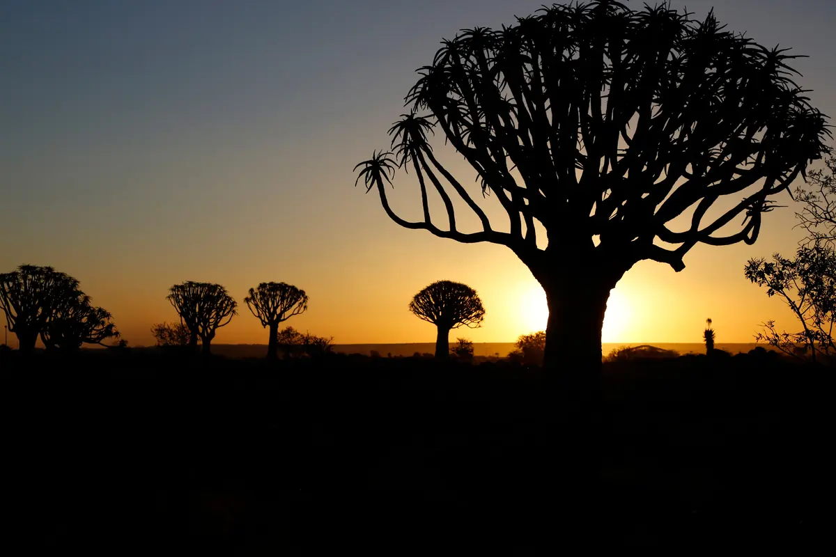
The Quiver Tree Forest, 14 km north-east of Keetmanshoop, has about 250 quiver trees and is a national monument. The stacked dolerite boulders of the Giant’s Playground are close by. Brukkaros, a collapsed crater rising over 650 m above the plain near Berseba, is only for the self-sufficient: no water, no phone signal.
Out west the B4 crosses the Sperrgebiet, the diamond area Germany closed off after diamonds were found in 1908. Kolmanskop, abandoned in 1956 and slowly filling with sand, needs a permit; Pomona and Elisabeth Bay can only be seen on a booked tour. The Orange River flows all year and has no crocodiles or hippos. Lodges near Noordoewer hire out canoes.
Good to know
- The CDC does not list ǁKaras among the regions where it advises malaria tablets, only care to avoid mosquito bites.
- Every town has a filling station, but the gaps between them are long.
- The UK government warns that gravel roads break up in the January to April rains. Carry two spare tyres and don’t drive outside towns after dark, when livestock and wild animals are on the road.
- Between Aus and Lüderitz, leave the B4 only at marked places.
- Farm roads are private. Close any gate you open.
History and culture
ǁKaras is Nama country, the far south of Namibia between the Kalahari, the Orange River and the Atlantic. The German colony began on its coast in 1884, Nama fighters, the Bondelswarts among them, fought German troops across it from 1903, and the Shark Island camp at Lüderitz (ǃNamiǂNûs) was one of the worst places of the genocide. Diamonds found in 1908 still shape the coast, much of which is still restricted ground.
- About 30,000 years ago
People sheltering under a rock overhang in what is now the ǀAi-ǀAis/Richtersveld Transfrontier Park painted animals on stone slabs. Carbon dated to about 30,000 years ago, these Apollo 11 Stones are the oldest figurative art found in Africa, and they are kept at the National Museum of Namibia in Windhoek. source
- 1796 to 1820s
Klaas Afrikaner and his sons Jager and Titus, leaders of an Oorlam clan (people of Khoekhoe descent who had moved north out of the Cape Colony), built the stone fort of ǁKhauxaǃnas as a hideout from the Cape authorities. It is the oldest systematically planned structure known in Namibia, older than any European building. source
- 1805 to 1834
Abraham and Christian Albrecht of the London Missionary Society began the first mission station in the territory at Warmbad in 1805. Jager Afrikaner's Oorlam destroyed it in 1811, and in 1834 the Wesleyan missionary Edward Cook put up a new mission building on the old foundations. source
- 1904 to 1908
The Herero rose against German rule in January 1904, and Nama groups fought a guerrilla war against the Germans across the south. During the genocide that followed, the Germans held Herero and Nama prisoners on Shark Island at Lüderitz from March 1905 until the camp closed in April 1907. Estimates of how many men, women and children died there run from 1,032 to 3,000. Prisoners were worked on the harbour and on the railway inland to Aus. source
- 1908
Zacharias Lewala, a railway worker, picked up a diamond near Lüderitz and showed it to his supervisor August Stauch. Germany then closed a huge strip of the coast as the Sperrgebiet (forbidden area), and the mining town of Kolmanskop grew up in the dunes. source
- 1922
South Africa, then ruling the territory under a League of Nations mandate, sent 400 armed men and aircraft to bomb the Bondelswarts, a Nama clan of the far south, after they refused a dog tax and protected five wanted men. About 100 Bondelswarts were killed, among them some women and children. source
- 1960s to 1989
Under the apartheid Odendaal Plan, South Africa set aside a Nama homeland, Namaland, made up of the reserves at Berseba, Tses and near Bethanie and Gibeon. The Bondels people of Warmbad were expected to move there. In 1980 it was replaced by a Representative Authority of the Namas, based on ethnicity rather than on fixed borders. source
- 1966 to 1990
SWAPO (the South West Africa People's Organisation) began its armed struggle against South African rule in 1966, and in 1973 the United Nations recognised it as the representative of the Namibian people. Namibia became independent on 21 March 1990. source
- Languages
- In the 2023 census Afrikaans was the main home language in 31.8% of households, followed by Khoekhoegowab (the Nama and Damara language, 17.8%), Oshikwanyama (14.2%), Oshindonga (7.4%), Rukwangali (5.1%) and English (3.9%). source
- Nama place names
- Keetmanshoop's older Nama name is ǂNūǂgoaes, given by Kaptein Hendrik Tseib of the Kharoǃoan. It means place of black mud, after an iron-rich spring, and the Afrikaans name Swartmodder means the same. source
- Grapes on the Orange River
- At Aussenkehr, downstream of Noordoewer, the Orange River is used to irrigate vineyards in a valley where almost no rain falls. The heat means the table grapes can be picked three to five weeks earlier than elsewhere. source
- Colonial Lüderitz
- Lüderitz still has a cluster of German colonial buildings from the 1900s, several of them national monuments. The Deutsche Bank building of 1907 was the town's first bank, and diamond workers collected their pay through a sliding window. The Krabbenhöft & Lampe building went up in 1909 as a shop with a home attached, with bricks shipped in from Cape Town and the roof tiles and rafters from Germany. source
For German visitors: Keetmanshoop is named after Johann Keetman, a German trader and director of the Rhenish Missionary Society, who paid for the mission but never visited it. Its first missionary, Johann Georg Schröder, arrived on 14 April 1866, the date the town counts as its founding. source
For German visitors: Morenga's fighters inflicted heavy enough German losses to force a special election to the Reichstag, and Paul von Lettow-Vorbeck lost the sight of his left eye in a fight with them in 1906. Uwe Timm's German novel Morenga tells the story of the uprising. source
For German visitors: The German archaeologist Wolfgang Erich Wendt (1934 to 2015) named the Apollo 11 Cave after the American moon mission, which had just returned to Earth. source
For German visitors: Lüderitz is twinned with its namesake Lüderitz in Germany, which has been part of the town of Tangerhütte since 2010. source
For German visitors: Between 2004 and 2006 the Namibian and German governments supported a project to restore the public bath at Warmbad's hot spring and rebuild some of its historic buildings. source
For American visitors: From 1926 to 1931 the National Geographic Society and the Smithsonian Institution ran a solar observatory on Brukkaros to measure the sun's radiation every day. source
Main sights in Karas
7- Rhenish Mission Church, Keetmanshoop
The second mission church, consecrated in 1895 after the Aub River washed the first one away in 1890. Its Black congregation worshipped here until 1961, when they were expelled from the part of town kept for whites. The building has been a museum since 1978.
National Heritage Council of Namibia: Heritage Places - Quiver Tree Forest
About 250 quiver trees 14 km north-east of Keetmanshoop, and a national monument. The tree takes its name from the San use of its branches to make quivers.
Wikipedia: Quiver Tree Forest - ǁKhauxaǃnas
The ruined stone fort above the Bak River, east of the Great Karas Mountains, built by the Afrikaner clan and later used by Morenga against the Germans. It long appeared on maps as an old German fort. Only a 4x4 gets you close, and the last kilometre is on foot.
Wikipedia: ǁKhauxaǃnas - Warmbad
The site of the territory's first mission station, now a small settlement with a hot spring, a museum in the old police station and a statue of Jacob Morenga in the cemetery.
Wikipedia: Warmbad, Namibia - Shark Island, Lüderitz
The site of the concentration camp where Cornelius Fredericks, captain of the ǃAman (the Bethanie Oorlam), died on 16 February 1907. He was one of a group of 1,795 Nama sent there in September 1906. A memorial to him stands on the island.
Wikipedia: Cornelius Fredericks - Kolmanskop
The diamond town abandoned in 1956, where sand now drifts through the empty houses. It is run by Namdeb and sits inside the restricted area, so you need a permit.
Wikipedia: Kolmanskop - Site of the original Dias Cross
Bartolomeu Dias raised a stone padrão (cross) at Lüderitz on 25 July 1488. Fragments of the original went to the South African Museum in Cape Town in 1855, and the site is a national monument.
National Heritage Council of Namibia: Heritage Places
Did you know?
- ǁKaras is the least densely populated of Namibia's 14 regions. The 2023 census counted 109,893 people, fewer than one for every square kilometre. source
- Brukkaros gets its name from the long loincloth worn by Khoekhoe women, called broek-en-karos (trousers and kaross) in Afrikaans. The Nama name for the mountain, Geitsi Gubib, refers to the same garment. source
- Keetmanshoop is one of the sunniest places on earth, with more than 3,870 hours of sunshine a year. source
- Oranjemund, at the mouth of the Orange River, was a closed company town run by the diamond miners and was only opened to the public in 2017. source
- Since its completion in 2018, the Neckartal Dam on the Fish River near Berseba has been the largest dam in Namibia, but the irrigation scheme it was built for has not yet been started. source
- On 26 September 1914, early in the First World War, German troops surrounded and beat a South African force at Sandfontein near the border. Its wells were the only good water within 75 km, which made it worth fighting over. source
Checked 7 October 2026.
In and around Karas
86 places listedWhere to stay in Karas 58
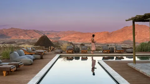 HotelSandfontein Lodge & Nature ReserveD208, Karas+264 63 683 160sandfontein.com
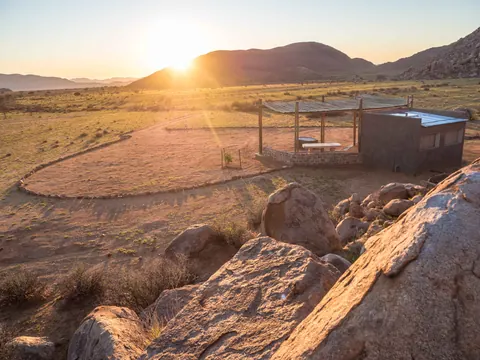
- 26.24°S 18.82°EChaletBranddam self-cateringF549+27 82 388 4286branddamcottage.com
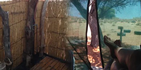

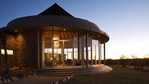
 HotelMesosaurus Fossil Trail Camp+264 63 222 990mesosaurus.com
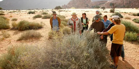 HotelNamib Desert Lodge (Namtib)+264 63 683 055namtib.net
Show all 58 places to stay
- Namtib Camp Site · Campsite+264 63 683 055namtib.net
- Helmeringhausen Hotel · Campsite+264 81 637 9521helmeringhausennamibia.com
- Kalahari Farmstall · Hotel+264 81 235 1859kalaharifarmstall.com
- Kalahari Game Lodge · Hotel+264 63 252 052kalaharigamelodge.com
- Mount D'Urban Campsite · Campsite+264 81 547 3532mountdurban.com.na
- Torgos Safari Lodge · Hoteltorgoslodgenam.com
- White House Guest Farm · Hotelwithuis.iway.na
- Bemen Guest house · Guest house · D298+264 81 127 3952bremen4.na.com
- Mesosaurus Fossil Site · Campsitemesosaurus.com
- Oana Base Camp · Campsiteoananamibia.org
- Tirool · Campsite+264(0)812176932tirool.com
- Camping Lovedale Farm Holidays · Campsitelovedale-namibia.com
- Vogelstrausskluft Campground · Campsitevogelstrausskluft.com
- Vogelstrausskluft Lodge · Hotelvogelstrausskluft.com
- Aubures Camping · Campsite
- Mountain Rustic Chat Campsite · Campsite
- Namuskluft Camping · Campsite
- OraBo River Village · Campsite · D292, Karas
- Wildheim campsite · Campsite
- Wildheim Wes Kalahari Lodge · Wilderness hut · C11
- Aar Farm · Guest house
- Barby Guest Farm Camping · Campsite
- Bo Plaats Rest Camp · Campsite
- BRENMEN TRANQUILLITY WINDOW TO THE CANYON · Mountain hut
- Bushcamp Sterreprag · Campsite
- Camp Edge · Chalet
- Camp Eternity · Chalet
- Camp Spot · Campsite
- Camping Oas Holiday Farm · Campsite
- Canyon Farm Yard · Guest house
- Farm Tiras · Guest house
- Farm Tiras Camping · Campsite
- Goais Camp · Campsite
- Goibib Mountain Lodge · Campsite
- Kanaan Rest Camp · Campsite
- Kleinbegin Game Lodge · Campsite
- Koiimasis Lodge · Hotel
- Konkiep Lapa Rest Camp · Campsite
- Little Hunter’s Rest · Campsite
- Naute Dam Rest Camp · Campsite
- Nice place near the river · Campsite
- Sandmund Rest Camp · Campsite
- Savanna Campsite · Campsite
- Seeheim Hotel · Hotel
- Seeheim Hotel Campsite · Campsite
- Sitsas Campsite · Campsite
- Sjambok River Camp · Campsite
- White House Campsite · Campsite
- WHITE HOUSE FARM GUEST HOUSE B&B · Mountain hut
Sights 21
 ǁKhauxaǃnasCastle
- Tiras Exhibition + InformationMuseum · Gundsbewys
- SopieshoogteAttraction
- C10 AI-AISViewpoint
- dune viewpointViewpoint
- Fish River Viewpoint & Sunset SpotViewpoint
- Fish-Orange ConfluenceAttraction
- Helmeringhausen Farming MuseumMuseum
- Historic CemeteryMemorial
- Kyk In Die PotViewpoint
- Lieutenant Thilo von Trotha's graveAttraction
- Nice ViewpointViewpoint
Show all 21 sights
- Old german heliograph station · Ruins
- Old Train · Attraction
- Quivertree Forest · Viewpoint
- South Viewpoint · Viewpoint
- Stromatolithes · Memorial
- sun downer · Viewpoint
- Sunset Viewpoint · Viewpoint
- Valley overview · Viewpoint
- Window of Hope · Viewpoint
Hiking trails 2
- Felsental TrailHiking trail · 4.7 km · Hard
- Namib View HikeHiking trail · 2.2 km · Moderate
Restaurants and cafes 4
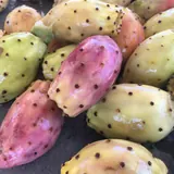 Naute KristallCafe · bistro+264 81 284 5107nautekristall.com
- Dry beefCafe
- Kitchen 51Restaurant
- Quiver Taste RestaurantRestaurant
Wineries, breweries and distilleries 1
- Naute Kristall DistilleryDistillery+264 81 284 5107nautekristall.com
Map of Karas
See every place on this map as a list