Town · Otjozondjupa, Namibia
Okahandja
Fast growing junction town 70 km north of Windhoek where the B1 and B2 split, known for its woodcarvers' market and as the burial place of Herero leaders.
Short answer
Okahandja is in Otjozondjupa, Namibia. This page lists 19 places to stay, 5 places to eat and drink and 7 sights. The nearest park with an entry fee on this site is Von Bach Game Park, about 7 km away, where international adults pay from N$200.
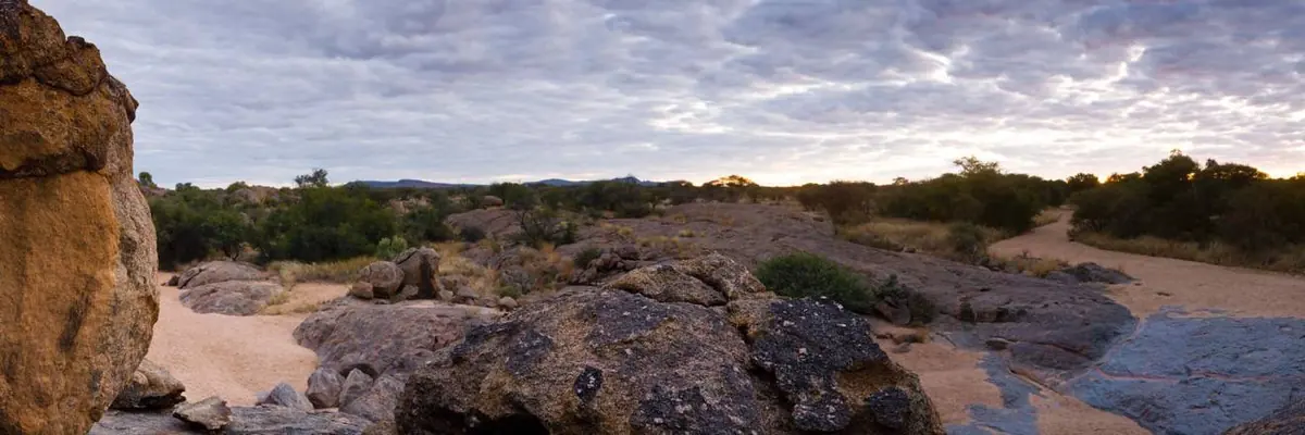
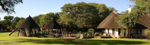
- Places to stay
- 19
- Eat and drink
- 5
- Sights
- 7
- Park fee nearby: Von Bach Game Park
- US$12 €11 · N$200about 7 km away
In and around Okahandja
32 places listedWhere to stay in Okahandja 19
- 22.11°S 16.75°EHotelGross Barmen Resort+264 62 501 091nwr.com.na
 HotelOtjisazu Guest Farmotjisazu.com
- 22.04°S 16.92°ECampsiteHodygos Training Centre (Youth for Christ)+264 62 503 748yfcnamibia.org
- 22.00°S 16.92°ECampsiteKings Highway Campsitekingshighway.co.za
- 22.00°S 16.92°EGuest houseKings Highway Restcampkingshighway.co.za
- 21.98°S 16.91°EGuest houseTown View Guest HouseVoortrekker Street, Okahandja+264 81 293 0605
- 21.76°S 16.85°EGuest houseOmatozu Safaris
- 21.96°S 16.90°ECampsiteCamping Okahandja Country Hotel
Show all 19 places to stay
- Elizabeth Hill Scout Camp · Campsite
- Farm Waldau · Guest house
- Gross Barmen Camp · Campsite
- Khaya Guesthouse · Guest house
- MTB Base Camp · Campsite
- Ombo Rest Camp · Motel
- Ombo Rest Camp · Campsite
- Teufelsbach River Camp · Campsite
- The Rock Lodge · Hotel
- Vyf Rand Guesthouse · Guest house
Sights 7
- MoordkoppieBattlefield
- Grave of Hosea KutakoMemorial
- Grave of Kahimemua NguvauvaMemorial
- Grave of Samuel MahareroMemorial
- Gross Barmen Hot SpringHot spring
- Okahandja viewViewpoint
- WegekreuzMonument
Restaurants and cafes 4
- kapana spotRestaurant · regional, burger · Ignas moleleking, Okahandja
- Kom eet met onsRestaurant · regional
- Brew Coffee ShopCafe
- Rhino'sRestaurant
Bars and pubs 1
- Next Level BarBar
Wineries, breweries and distilleries 1
- AB InBevBrewery · Industrie North Street, Okahandja
Okahandja sits where the main road north from Windhoek splits, the B1 carrying on towards Otjiwarongo and the far north and the B2 heading west for the coast. Most people stop for fuel and carvings and drive on, but this is the traditional centre of the Herero and their great chiefs are buried here. It is also growing fast: the census counted 22,639 people in 2011 and 45,182 in 2023.
Getting there
The town is about 70 km north of Windhoek. Most of that stretch is now the A1 freeway (older maps call it the B1). The B1 proper starts again here and runs about 175 km north to Otjiwarongo, and the B2 turns west for Swakopmund and Walvis Bay. There is a station (1902) on the old Windhoek to Swakopmund line, but the Bradt guide called the trains very slow and most overseas visitors drive.
When to go
Windhoek’s weather record is the best guide. Most of the rain falls from December to March, February wettest, and May to September is close to dry. July nights in Windhoek average about 6°C and have dropped below freezing, so pack a warm layer if you camp.
Late August is when Herero Day (Red Flag Day) is held here, on the weekend closest to 23 August. The heart of it is a procession to the chiefs’ graves and a church service, men in military style uniforms, women in the long Herero dress and horned headdress. It is a memorial, not a show.
What to do
The Mbangura woodcarvers’ market by the railway line on Voortrekker Road is the best known stop, with everything from bowls to thin wooden giraffes two metres tall.
For history, the Rhenish mission church, begun in 1871 and consecrated in 1876, is the oldest building in town. Nearby are the Herero graves, a national monument since 1990, and the grave of the Mbanderu chief Kahimemua Nguvauva, shot by the Germans beside the Okahandja river in 1896. Moordkoppie, where about 700 Herero were killed in 1850, is a small hill with little to see. The Bradt guide says casual visitors can’t get to the graves of the chiefs, so expect to look from outside.
Gross Barmen, an NWR resort on a Swakop tributary 25 to 28 km west of town (sources differ), has a hot spring that comes out at 65°C and is cooled for its thermal pool. Day visitors are let in. The Von Bach dam just outside Okahandja supplies most of Windhoek’s water (it has its own page with fees).
Good to know
Banks, supermarkets and several fuel stations line the main roads, so fill up here before the long stretches north or west. The military museum built in 2004 was still closed at the last report I can find (2022), so don’t plan around it. TravelHealthPro rates Otjozondjupa, Okahandja’s region, high risk for malaria from December to April and low risk from May to November, so see a travel clinic before a summer trip.
History and culture
Okahandja is the town the Herero (Ovaherero), the cattle herding people of central Namibia, still treat as their traditional centre. Their great chiefs lie buried here, the 1904 uprising against German rule began here, and every August the Herero gather here for Herero Day. Knowing that history turns a fuel stop on the B1 into one of the more meaningful places on a Namibian road trip.
- Late 1700s
Herero groups moving in from what is now Botswana, under their chief Mutjise, made the meeting of two rivers their favoured settlement. The town's name means the place where two rivers flow into one in Otjiherero, the Herero language; the rivers are the Okakango and the Okamita. source
- 1850
On 23 August 1850 the Nama under Jonker Afrikaner fell on the Herero of Chief Kahitjene here. About 700 of Kahitjene's followers were killed at the small hill now called Moordkoppie (Afrikaans for murder hill). source
- 1894
Under German colonial rule a military post was set up here at the initiative of Theodor Leutwein. Okahandja officially dates its founding from 1894, even though Herero and Nama groups had settled the place around 1800 and missionaries had lived here from 1844. source
- 1904 to 1908
The Herero uprising of January 1904 started around Okahandja, where Samuel Maharero had his headquarters; the historian Jan-Bart Gewald argues it was provoked by a German officer stationed here, Ralph Zürn. In the genocide of 1904 to 1908 about 80 percent of the Herero died. Okahandja held one of the five main concentration camps, where three quarters of the prisoners were women and children and hunger and disease killed many. source
- 1923
Samuel Maharero died in exile on 14 March 1923. The South African administration gave permission for his body to be brought home, and he was reburied here on 26 August 1923 before about 3,000 Herero. The anniversary became Herero Day, a yearly act of remembrance and defiance of colonial rule. source
- 1970 to 1978
Under apartheid South Africa set up ethnic homelands, among them Hereroland. Clemens Kapuuo, born on a farm near Okahandja, became Herero paramount chief in 1970 after his uncle Hosea Kutako and was a leading opponent of apartheid rule. He was shot dead in Katutura, Windhoek, in 1978 and buried here beside Kutako; more than 10,000 people came despite fears that the cemetery was mined. source
- 1990
South Africa occupied German South West Africa in 1915 and ruled it until Namibia became independent on 21 March 1990. SWAPO's armed wing, the People's Liberation Army of Namibia, began its guerrilla war on 26 August 1966 with the battle at Omugulugwombashe. source
- 2015 to 2021
Germany acknowledged in 2015 that a genocide had been committed. In 2021 the two governments reached a controversial deal under which Germany would pay 1.1 billion euros as development aid, while rejecting any legal responsibility. source
- Language
- In the 2023 census the most common home languages in Okahandja constituency households were Afrikaans (20.2%), Oshikwanyama (16.4%), Khoekhoegowab, the Damara and Nama language (16.0%), Otjiherero (13.6%), English (7.3%) and Oshindonga (6.4%). Counted together, the Oshiwambo languages of the north make up about a third, so the Herero capital is now a very mixed town. source
- A growing town
- Okahandja doubled in twelve years, from 22,639 people in 2011 to 45,182 in 2023, an average growth of 5.8% a year. source
- Herero dress
- Married and older Herero women wear the long dress, the ohorokova, as everyday clothing; younger women keep it mostly for special occasions. The style was taken from the floor length gowns of the German missions in the late 1800s, and one dress can use up to ten metres of cloth over several petticoats. The headdress, the otjikaiva, sticks out sideways like a pair of horns, a mark of respect for the cattle Herero life has long depended on. source
- Flag days
- Okahandja hosts two of the three Herero commemorations. The Red Flag of the Maharero royal house meets on the weekend closest to 23 August, and the Green Flag of the Ovambanderu (Mbanderu) on the weekend closest to 11 June, marking the reburial of Hiatuvao Nguvauva, brought home from Botswana. A third, the White Flag, meets in Omaruru in October. source
- Woodcarvers
- The open air craft market by the railway line on Voortrekker Road was described in the Bradt guide as run by the Namibian Carvers Association, based in Rundu far to the north east. Its carvers are known for large wooden pieces, giraffes of two metres or more among them, and the guide noted it opens on Sundays. source
For German visitors: Gross Barmen was named in 1844 after Barmen, now part of Wuppertal, where the Rhenish Missionary Society had its headquarters. source
For German visitors: Heinrich Vedder, the Rhenish missionary from Westphalia who wrote a well known history of early South West Africa, taught at the Augustineum here for decades and died in Okahandja in 1972. source
For German visitors: The Herero organised Samuel Maharero's 1923 funeral on the pattern of German state funerals for senior colonial officials, with an honour guard led by his sons and Hosea Kutako. The church service was taken by the German missionary Heinrich Vedder. source
For German visitors: In August 2004, for the 100th anniversary of the battle of Waterberg, German development minister Heidemarie Wieczorek-Zeul asked the Herero for forgiveness at Okakarara, about 200 km from Okahandja, the first time a German minister accepted moral and political guilt for the colonial crimes. source
For German visitors: Okahandja has had a climate partnership with Schwäbisch Hall in Baden-Württemberg since 2017, under a German federal development ministry programme. source
For American visitors: Before the German and Namibian governments negotiated, Herero and Nama groups took their reparations claim to court in the United States under the Alien Tort Act. The case failed. source
Main sights in Okahandja
7- Herero Grave Complex
The graves of Tjamuaha, Maharero and Samuel Maharero, on what was Tjamuaha's cattle kraal, with a memorial stone put up in 1924. Later chiefs lie here too. A national monument since 1990.
National Heritage Council of Namibia: heritage places register - Rhenish Mission Church and cemetery
Consecrated in 1876, the oldest building in Okahandja, and often used as a refuge. Until the German Lutheran congregation built its own church opposite in 1952 it was a meeting place for Germans and local people. Apartheid policy then pushed the Lutheran church to build in the black part of town in the late 1960s, and this one stood abandoned for more than 20 years before it was restored. A national monument since 1972.
National Heritage Council of Namibia: heritage places register - Grave of Kahimemua Nguvauva
The Mbanderu chief was shot by the German Schutztruppe (colonial army) on the bank of the Okahandja river in 1896 after a dispute over land near Gobabis. His grave has been a national monument since 1979.
National Heritage Council of Namibia: heritage places register - Moordkoppie
The small hill where about 700 followers of the Herero chief Kahitjene were killed by Jonker Afrikaner's Nama on 23 August 1850. It has been a national monument since 1972.
National Heritage Council of Namibia: heritage places register - Friedenskirche (Church of Peace)
The church of the German speaking Lutheran congregation, consecrated in 1952. Several important graves, Hosea Kutako's among them, are close by.
Wikipedia (German): Friedenskirche (Okahandja) - Gross Barmen
Founded in 1844 as the first Rhenish mission to the Herero, at the spring the Herero called Otjikango. The ruins of the mission house can still be seen near the hot spring resort run by Namibia Wildlife Resorts (NWR).
Wikipedia: Gross Barmen - Okahandja Military Museum
Built in 2004 by Mansudae Overseas Projects, the firm that also built Heroes' Acre and the State House, on the site of the former German police station it pulled down. It was still closed to the public in 2022.
Wikipedia: Okahandja Military Museum
Did you know?
- Only traditional leaders may be buried in the Herero cemetery. Yet Jonker Afrikaner, the Nama leader whose men massacred Herero here in 1850, lies there too among the Herero chiefs. He and Chief Tjamuaha both died in 1861. source
- The Herero holy fire (okuruuo) of the Tjamuaha line is kept at Okahandja. On Herero Day 2011 a group around Paramount Chief Kuaima Riruako moved it to an undisclosed place, saying it had faced east for 88 years when it should face the sunset. The move caused a row among the Herero. source
- Herero Day is usually not held on 26 August itself, because that is also Heroes' Day, the national holiday for the start of the liberation war in 1966, and senior officials of Herero descent want to attend both. source
- The Herero graves were once Chief Tjamuaha's cattle kraal, an enclosure for livestock. Tjamuaha was buried there in 1861, his son Maharero beside him in 1890, and Samuel Maharero in 1923. source
- The Augustineum, one of Namibia's oldest schools, was founded at Otjimbingwe in 1866, moved to Okahandja in 1890 and stayed until it went to Windhoek in 1968. Its former pupils include Samuel Maharero, President Hage Geingob and Prime Minister Theo-Ben Gurirab. source
- Since August 2016 the town has drawn its daytime electricity from the InnoSun solar power plant. source
Checked 7 October 2026.
A hyena by moonlight and the treaty Göring's father signed
One night early in 1851 a young Englishman called Francis Galton floundered across the bed of the Swakop River here wearing his shoes and nothing else. His dogs had cornered one of the hyenas that kept walking through his camp. The riverbed was about 300 yards of loose sand, and he shot the animal from four or five feet away once the dogs had it ringed in a patch of moonlight.
Galton did not call the place Okahandja. On his map it is Schmelen’s Hope, after the missionary Heinrich Schmelen, who came through in 1827 and was probably the first European to see it. He fixed its position at 22°0’ south, 16°56’ east, about three kilometres from the middle of the modern town. His Narrative of an Explorer in Tropical South Africa (1853) is the liveliest account of this spot before there was a town on it.
The spring nobody mentioned
Hugo Hahn and Franz Kleinschmidt tried to start a mission here in 1844 and gave up for want of water. They moved west to Otjikango, the hot spring now called Gross Barmen. Galton thought they had swapped the better site for the worse one: Okahandja had grass, trees and garden ground but only rain pools and wells. Then, on his first day’s travel north, he slept beside a spring in the riverbed five miles away. The missionaries had been asking about water for years and nobody had told them it was there.
Friedrich Kolbe tried again on 22 March 1850. Five months later Jonker Afrikaner’s horsemen rode in at night, the raid remembered at Moordkoppie. Galton reached Barmen later that year and found Kolbe and his young wife there with almost nothing left. He was told Jonker had turned up at the mission house the next morning drunk and asked for breakfast. He also met two women who had crawled the twenty or so miles to Barmen after the raiders cut through their ankles, both on one woman and one on the other, to get at their iron anklets.
Counting the dead after a raid like this was close to impossible, he says, because the survivors scattered and the hyenas got to the bodies first. About 700 is the figure on the monument register and in most histories. Galton, who was there within months, offers no number at all.
Then he packed a red hunting coat and jackboots, rode an ox for three days and more to Jonker’s village (today’s Windhoek), lectured him through interpreters and made him write Kolbe an apology. Kolbe never came back to Okahandja.
The raider’s grave came first
Jonker moved to Okahandja himself in 1854, onto the ground where the mission church was later built, and died here on 18 August 1861. In April 1949 the South West Africa Monuments Council named four national monuments in one go: Fort Namutoni, the Hoba meteorite, the Petrified Forest and Jonker Afrikaner’s grave. The Herero chiefs’ graves waited until 14 March 1990, a week before independence.
Klaus Dierks, in his chronology of Namibian history, gives a reason for where the later leaders lie. When Frederick Maharero died in 1952, let home from exile only shortly before, the municipality made Hosea Kutako sign an undertaking that no more of Maharero’s descendants would go into the old plot. That, he says, is why Kutako and Clemens Kapuuo lie beside Jonker and not beside the Mahareros.
Göring’s father comes for a signature
On 17 October 1885 Hendrik Witbooi fought Maharero at Osona, on the Windhoek side of town, and lost. Two of his sons, Jeremia and Salomo, were killed. Four days later Maharero agreed a protection treaty with the German commissioner, Heinrich Göring. Yes, that Göring: his son Hermann was born eight years later. No land changed hands.
On 30 October 1888 Maharero cancelled the treaty to Göring’s face, with an English trader named Robert Lewis standing by as his new agent, and Göring withdrew to British Walvis Bay.
The Germans were back by 1890 and the shopkeepers followed. Wecke & Voigts opened in Okahandja on 3 September 1892, and the firm is still in the Voigts family five generations on, running Spar supermarkets from Windhoek. Dierks lists two of its founders among the traders being paid for Herero debts in land by 1899, which goes some way to explaining what came next.
Two trains in January 1904
The railway from Swakopmund reached Okahandja on 7 December 1901. Late on 10 January 1904 a trader arrived saying 300 armed Herero were on their way, and the settlers panicked. The district chief, Lieutenant Zürn, put the garrison on alert the next day. Shooting began on the 12th, with most of the settlers inside the fort. The resident missionary, Diehl, reported that the only fire his house took came from the German side.
A relief party sent up the line from Windhoek under Lieutenants Boysen and Voigts was beaten back, and Boysen and six of his men died. An armoured train from the coast under Lieutenant von Zülow got to Waldau on the 13th, mended the torn-up track ahead of itself and steamed in on the 15th. When von Zülow tried to push on to Windhoek on the 19th he was stopped at Osona, where Witbooi had been stopped eighteen years earlier. Captain Franke’s column, up from the south, relieved the town on 27 January.
What Galton shot for the pot
Galton came back from Jonker’s on 8 February 1851 and stayed three weeks. His party shot at geese and ducks, and his companion Charles Andersson brought down a bustard for the cook. Caterpillars covered the ground, then locusts came, then a flock of migrating storks arrived and went to war on the locusts. Galton does not name the species. Abdim’s stork, which breeds north of the equator and spends the rest of the year in eastern and southern Africa eating mostly those two things, fits the description, but he gives too little to be sure.
The Swakop he crossed that night has been dammed since 1970 at Von Bach, just outside town.
Map of Okahandja
See every place on this map as a list