City · Erongo, Namibia
Walvis Bay
Namibia's main port, on the only natural deep-water harbour of its coast, with a Ramsar lagoon full of flamingos, boat trips out to the seals of Pelican Point and big dunes at the edge of town.
Short answer
Walvis Bay is in Erongo, Namibia. This page lists 32 places to stay, 36 places to eat and drink and 7 sights. The nearest park with an entry fee on this site is Dorob National Park, about 126 km away, where international adults pay from N$280.
- Malaria
- Erongo is not among the regions where the CDC recommends malaria tablets; it says malaria is rare outside the listed northern and eastern regions, so insect bite precautions are enough here.
- Places to stay
- 32
- Eat and drink
- 36
- Sights
- 7
In and around Walvis Bay
76 places listedWhere to stay in Walvis Bay 32

- 22.97°S 14.49°EGuest houseLagoon LogeKovambo Nujoma Drive, Walvis Baylagoonloge.com.na
- 22.96°S 14.49°EHotelOyster Box GuesthouseThe Esplanade, Walvis Bayoysterboxguesthouse.com
- 22.95°S 14.51°EHostelNamibia Skipper ServicesMoses Garoeb Street, Walvis Bay+264 81 808 3197nssbackpackers.com
- 22.98°S 14.48°EGuest houseBella Luna Bed and BreakfastHesko Street, Walvis Bay+264 81 143 2451
- 22.98°S 14.48°EHotelIRIS Boutique Hotel & RestaurantKovambo Nujoma Drive Meersigsites.google.com
- 22.82°S 14.54°EHotelSandpiper DunesLangstrand, Walvis Baytheholidayclub.co.za
- 22.85°S 14.54°EGuest houseSummer Place GuesthouseOystercatcher Street, Dolphin Beach, Walvis Bay
Show all 32 places to stay
- Guesthouse The Rez · Guest house
- Langholm · Hotel
- Mizpah Guesthouse · Hostel · Namib Street, Walvis Bay+264 81 775 6416
- Lagoon View Self Catering · Chalet · The Esplanade, Walvis Bay
- Ngandu at Sea · Guest house · Erskine Street, Walvis Bay
- Niche Guesthouse · Guest house · The Esplanade, Walvis Bay
- Aha! Cheers Guest House · Guest house
- Ana's Inn · Hotel
- Atlantic · Hotel
- Casa Mia · Hotel
- City Centre hotel and restaurant · Hotel
- Courtyard Pension · Hotel
- Dolphin B&B · Guest house
- Dolphin Park Resort · Chalet
- Esplanade Park · Chalet
- Kleines Nest B&B · Hotel
- Lagoon Chalets & Camping · Resort
- Menuchah · Hotel
- Shifting Whispering Sands · Guest house
- Tasha Guesthouse · Guest house
- Wind Beggars · Hotel
- Protea Hotel Pelican Bay · Hotel · The Esplanade, Walvis Baymarriott.com
- Protea Hotel Walvis Bay · Hotel
Sights 7

- Dolphin BeachTheme park
- Hope LocomotiveAttraction
- Independence BeachBeach
- Lovers HillViewpoint
- Moth CenterMuseum
- Nathaniel Maxuilili MonumentMonument
Restaurants and cafes 28
- Rojo Seaside Pub & RestaurantRestaurant · 4 star · Atlantic Street, Walvis Bay+264 64 221 739rojobistro.com
- GodenfangRestaurant · pizza, cake, fish, grill · Atlantic Street+264 81 719 8981m.facebook.com
- Anchors @ The JettyRestaurant · Atlantic Street, Walvis Bayanchors-the-jetty-restaurant.business.site
- Dock SideRestaurant · seafood, grill · Atlantic Street, Walvis Bay
- Dolphins Coffee ShopCafe · breakfast, cake, coffee shop, fish, fish and chips, sandwich · Atlantic Street, Walvis Bay
- Chez CuiRestaurant · chinese
- Crazy MamasRestaurant+264 64 207 364
- Ocean FoodsRestaurant · 2nd St North, Walvis Bay+264 81 262 4747
- Probst WilliRestaurant+264202744
- Aladdin's Mediterran RestaurantRestaurant+264 81 212 2711
- Bruegel's PizzeriaRestaurant · italian
- Desert Rose Take AwayRestaurant · Langer Heinrich Crescent, Walvis Bay
Show all 28 restaurants and cafes
- Fortune Foods · Restaurant
- Harbor Cafe · Cafe · Walvis Bay
- La Bella Vita · Restaurant · Atlantic Street, Walvis Bay
- Quinton's Restaurant · Restaurant+264 81 449 3547
- Seafood Restaurant & Take-Away · Restaurant · chinese
- Steve's Take Away · Restaurant
- abantu · Restaurant
- Heineken Steak House · Restaurant
- Hungry Lion · Restaurant
- O'Heilie's Steakhouse · Restaurant
- Pizza DEN · Restaurant
- Slowtown · Cafe
- Tumaini · Restaurant
- Spur · Restaurant · steak house
- Debonairs Pizza · Restaurant
- Mugg & Bean · Restaurant
Bars and pubs 8
- Champs' PubPub
- Fisherman Bar n°1Bar
- Nautilus Sports BarBar
- Nice BarBar
- Pink SpotBar
- Sahra'sPub
- Skeletons Sport BarBar
- Walvis Bay Angling ClubBar
Wineries, breweries and distilleries 1
- Copper & Coal Distillery CompanyDistillery · Trekkopje Street, Walvis Bay+264 81 148 3021distillerynamibia.com
Walvis Bay is Namibia’s working port, a town of 102,704 people at the 2023 census, built round the only natural deep-water harbour on the coast. It was British and then South African territory until 1994, and it still feels more practical than pretty. People come for what surrounds it: a lagoon that holds tens of thousands of flamingos and waders, seals and dolphins in the bay, and the dunes that start a few kilometres out of town.
Getting there
Most people drive the tarred B2 from Windhoek, about five hours through Swakopmund, which is roughly 35 km north. The airport sits 15 km east of town, with flights from Cape Town and Johannesburg and car hire at the terminal. Intercape coaches run from Windhoek via Swakopmund, and TransNamib has had an overnight train, though I would check it is running before you plan round it.
Heading south to Sossusvlei, the C14 is gravel and often rough, and there are no plans to tar it. Fill up in town. Solitaire, further down the C14, has a petrol station and a shop.
When to go
The weather hardly changes. Out at Pelican Point the average daily high runs from about 16°C in September to 20°C in February, and the yearly rain comes to about 13 mm. Inland at the airport it is noticeably warmer. Summer is best for birds, with over 100,000 on the lagoon, while most of southern Africa’s flamingos spend the winter here or at Sandwich Harbour. Whales are seen most often from July to November. December brings the Namibian holiday crowds.
What to do
Walk the promenade along the lagoon, about 3 km, for flamingos and pelicans, then carry on south to the red and blue evaporation pans of the salt works. A morning catamaran trip out to Pelican Point and its lighthouse passes a seal colony of tens of thousands, and Heaviside’s and bottlenose dolphins are common. Kayak trips paddle among the seals.
On the road to Swakopmund you pass Bird Island, a wooden guano platform on stilts, and the dune belt. Dune 7, about 6 km out of town, is the big one people climb or slide down on a board. Sandwich Harbour, where the dunes drop into a lagoon, lies inside Namib-Naukluft National Park, so you need a permit and a 4x4, and a guided tour is the easier way to do it. In town, the Rhenish Mission Church of 1880 and the museum in the civic centre are worth an hour.
Good to know
Erongo is not one of the regions where the CDC recommends malaria tablets, so bite precautions are enough. The beach track to Sandwich Harbour narrows where the dunes meet the sea and is impassable at high tide, so check tide times both ways. Under the 2011 park rules, driving or riding a quad in the dune belt is only allowed in the marked off-road area between Langstrand and Walvis Bay, with a free permit from the environment ministry office in town. Accidents on gravel roads are common, and the UK advice is not to drive outside towns at night.
History and culture
Walvis Bay has the only natural deep-water harbour on Namibia's coast, and that one fact shaped its whole history. Britain took it in 1878 to keep it from Germany, it was run as part of the Cape and then South Africa, and South Africa held on to it for four years after Namibia became independent. It was finally handed over in 1994, and the Topnaar people still live beside it on the Kuiseb River.
- Thousands of years ago
Archaeological finds show that small groups of Khoekhoe people, the Topnaar among them, lived along this coast for thousands of years before any European ship arrived. source
- 1487
Bartolomeu Dias anchored his flagship São Cristóvão in the bay on 8 December 1487 on his way to find the sea route round the Cape, and named it the Gulf of Santa Maria da Conceição. Portugal never claimed it. source
- 1820s
The Topnaar (ǂAonin), a clan of the Nama, first lived at the Swakop mouth and moved south past Walvis Bay to the Kuiseb mouth between 1820 and 1830. Their settlements are still all on the Kuiseb River. source
- 1878 to 1884
Worried by German interest in the coast, Britain annexed the harbour and the land round it on 12 March 1878, and six years later handed it to the Cape Colony. Germany meanwhile claimed the country all around as German South West Africa, so the best harbour stayed in British hands. source
- 1910 to 1922
Walvis Bay became part of the Union of South Africa in 1910, and a border dispute with Germany was settled in 1911, fixing the enclave at 1,124 km². German troops occupied it early in the First World War until South African forces drove them out in 1915, and from 1922 it was run as if it were part of South West Africa. source
- 1971
The general strike against the contract labour system, which also opposed apartheid and called for independence, began in Windhoek on 13 December 1971 and in Walvis Bay the next day. source
- 1977
On 31 August 1977 South Africa moved Walvis Bay back under the Cape Province, apparently so as not to lose it to a SWAPO-led government (SWAPO, the South West Africa People's Organisation, led the fight for independence). The United Nations condemned the move and called for the town to be returned to Namibia. source
- 1990 to 1994
Namibia became independent on 21 March 1990, but South Africa kept Walvis Bay and even sent in more troops. In 1992 the two countries agreed to run it through a joint authority, and South Africa handed it and the offshore Penguin Islands to Namibia on 1 March 1994. source
- Language
- In the 2023 census, just over half the people in Walvis Bay's two constituencies lived in homes where one of the Oshiwambo languages was the main language, mostly Oshikwanyama and Oshindonga. Afrikaans was the home language for about 23%, Khoekhoegowab (the Nama and Damara language) for 8%, English for 7% and Otjiherero for 5%. Only 142 people lived in homes where German was the main language. source
- Townships
- Under South African rule the town was laid out on apartheid lines: Kuisebmond, about 3 km northeast of the centre, for Black residents, Narraville for people classed as coloured, and the centre for whites. Since independence the town has grown fast, mostly with people moving down from the north for work in the port and the fishing industry. source
- The Topnaar and the ǃnara melon
- Topnaar families still keep sheep and goats in the Kuiseb delta south of town and harvest the seeds of the ǃnara, a melon that grows only in this desert, to sell. Ruins of older Khoekhoe homes can still be found across the delta. source
- Fishing town
- Fishing is the backbone of the town: the boats bring in hake, horse mackerel, snoek, kingklip and sardines, among others, and oysters are farmed in the bay for export. source
- Football
- Kuisebmond Stadium is home to Eleven Arrows and Blue Waters, two clubs in the Namibia Premier Football League. source
For German visitors: In 1889 soldiers of the German colonial force (the Schutztruppe) under Captain Curt von François landed at British-held Walvis Bay, because Sandwich Harbour was not available to them. source
For German visitors: The Rhenish Mission Church was built almost entirely from materials brought from abroad, mainly from Hamburg, and was at the time the only building in the country made wholly of imported timber. source
For German visitors: Two brothers from Niederfischbach in the Siegerland, Father Julius and Brother Antonius Morgenschweis, came out as missionaries in 1925 and 1927. Julius led the Catholic mission in Walvis Bay and built the Stella Maris church, consecrated in 1960. Antonius, who worked in Swakopmund and Windhoek, kept his brother's mission going with a distillery whose brandy he called 'Der Katholische'. source
For German visitors: Bird Island was the idea of Adolf Winter, a German who emigrated to South West Africa in 1912 and noticed from the train how the sea washed the guano off a rock in the bay. source
For German visitors: The German geologists Henno Martin and Hermann Korn landed at Walvis Bay in 1935. When war came in 1939 they feared internment as enemy aliens, and in 1940 fled into the desert round the Kuiseb Canyon, where they lived as hunters for two and a half years. Martin's book about it is called Wenn es Krieg gibt, gehen wir in die Wüste. source
For American visitors: From the 1780s North American and European whalers used the bay as a hunting ground, drawn by the whales that came for the plankton of the cold Benguela Current. Whaling here carried on into the early 1900s. source
Main sights in Walvis Bay
6- Rhenish Mission Church
Made of timber shipped out from Germany and put up in 1880. It served as a mission church until the start of the 1960s, when the congregation moved to a new building in Kuisebmond, and the Lions Club saved it from demolition. It has been a national monument since 1972.
Wikipedia (German): Rheinische Missionskirche (Walvis Bay) - Hope Locomotive
A national monument. The engine was landed in the harbour in 1899 and worked there before failed attempts to run it on the narrow-gauge line to Plum.
Municipality of Walvis Bay: tourism activities - Walvis Bay Museum
The municipal museum in the civic centre covers the town's history, Namib archaeology, maritime history and the natural history of the coast, from gemstones to marine fossils.
Museums Association of Namibia: Walvis Bay Museum - Pelican Point Lighthouse
A 34 m cast-iron tower painted in black and white bands, opened by the South African government in 1932 on the Pelican Point sand spit that shelters the harbour. Boat trips pass it on the way to the seals.
Wikipedia: Pelican Point Lighthouse - Nathaniel Maxuilili Monument
It honours Nathaniel Maxuilili (1927 to 1999), a SWAPO veteran of the independence struggle who later served as a deputy minister. He was killed in Walvis Bay in June 1999 when the ambulance taking him to hospital was hit head-on by another vehicle.
Wikipedia: Nathaniel Maxuilili - Kuiseb delta
South of town, wind uncovers traces of the past in the silt: 18th century elephant tracks and the ox-wagon ruts of the Bay road of 1844, the trade route between Walvis Bay and Windhoek.
Municipality of Walvis Bay: tourism activities
Did you know?
- Bird Island, the wooden platform off the road to Swakopmund, was put up by Adolf Winter to catch the guano of the coast's seabirds. The first platform, finished in 1930, was four metres square; it now covers 17,000 m², and its guano is still collected and sold as fertiliser. source
- The salt works south of town make about a million tonnes of salt a year, simply by letting the sun evaporate sea water. source
- The wetland holds about 60% of the world's chestnut-banded plovers, and 80 to 90% of southern Africa's flamingos winter here or at Sandwich Harbour. source
- The Kuiseb River no longer reaches its own delta, because it was dammed off in 1962 to stop it flooding the town. source
- Walvis Bay's hottest days are not in summer. The record highs come in autumn, winter and spring, when hot winds blow down off the inland plateau, and the airport, just inland, once recorded 42.8°C on 15 April 2016. source
- Walvis Bay airport began as AFB Rooikop, a South African Air Force base, which closed in 1994, the year the town became Namibian. source
Checked 7 October 2026.
Wildlife you might see
13- very likelyGreater and lesser flamingosThe lagoon and the evaporation ponds of the salt works south of town, close to public areas. All year, in largest numbers in winter, when 80 to 90% of southern Africa's flamingos winter here or at Sandwich Harboursource
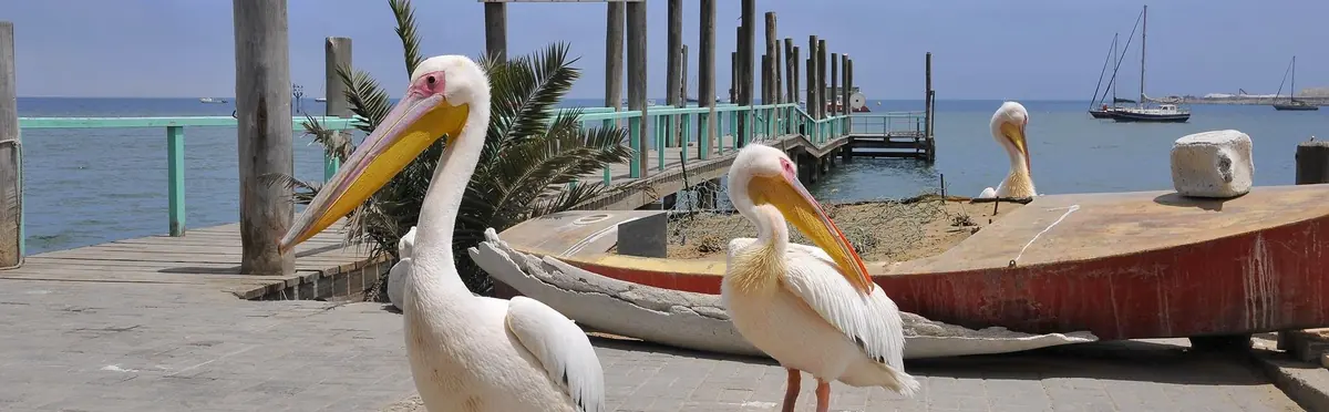
- very likelyGreat white pelicanAround the lagoon and the waterfront, and hungry pelicans often fly in to the cruise boatssource
- very likelyCape fur sealThe colony at Pelican Point, seen on boat and kayak trips; curious seals often come right up to the boatssource
- likelyHeaviside's dolphin (Benguela dolphin)In the bay on morning boat tripssource
- likelyBottlenose dolphinIn the bay on morning boat tripssource
- likelyChestnut-banded ploverMudflats of the lagoon and the salt pans; this wetland holds about 60% of the world populationsource
- likelyPalearctic waders (curlew sandpiper, little stint, bar-tailed godwit and others)Lagoon mudflats at low tide. Southern summer, when over 100,000 birds use the wetland, most of them migrantssource
- likelyCape cormorantBird Island, the guano platform off the road to Swakopmund, which is mainly their breeding groundsource
- possibleDamara ternAround the lagoon; it breeds in the areasource
- possibleOcean sunfish (mola mola)In the bay on boat tripssource
- possibleHumpback whaleIn and off the bay on boat trips. July to Novembersource
- possibleSouthern right whaleIn and off the bay on boat trips. July to Novembersource
- rareLeatherback turtleOccasionally seen from kayaks and boats in the baysource
Likelihood is for a normal visit of two or three days, from the sources linked. Nothing is guaranteed in the wild.
Hikes and walks
1- Lagoon promenade
An easy walk along the edge of the lagoon, the simplest way to see the flamingos and waders.
Permit: None
Municipality of Walvis Bay (tourism activities)
Staying safe in Walvis Bay
- Malaria
- Erongo is not among the regions where the CDC recommends malaria tablets; it says malaria is rare outside the listed northern and eastern regions, so insect bite precautions are enough here. Take advice if you go on to Kunene or the far north. source
- Tides at Sandwich Harbour
- The beach route to Sandwich Harbour narrows for a few kilometres where the dunes reach the sea and is impassable at high tide or in rough seas. An ordinary 4x4 is too heavy to cross the dunes beside it, so check tide times for the return too, or go with a guided tour. source
- Driving in the dunes
- Vehicles and quads may only go off road in the marked off-road area of the dune belt between Langstrand and Walvis Bay, with a free permit from the environment ministry office in Walvis Bay or Swakopmund. Quads are banned on the beaches between Walvis Bay and Swakopmund. These rules date from 2011, so check with the ministry office. source
- Gravel roads
- Accidents are common on gravel roads. Drive slowly, carry two spare tyres and plenty of water, and avoid driving outside towns at night, when wildlife and livestock are on the road. Check what your hire car insurance covers, as most policies exclude accidents that involve no other vehicle or animal. source
- Sun in the fog
- Sunburn is a real risk on cool, foggy days on this coast, when you do not feel the sun. Wear sunscreen and a hat on the water and in the dunes. source
Tips from travellers
- The catamaran cruises leave the Walvis Bay waterfront at 09:00 and are back around 12:30. Oysters and sparkling wine are served on the way back. several sources
- Book a seal kayak trip if you want to be on the water at eye level with the seals; the trips paddle in the sheltered water of the bay while the seals swim round the kayaks. several sources
- Sandwich Harbour is inside Namib-Naukluft National Park, so you need a park permit, issued by the environment ministry office in Swakopmund. If you go on a tour, ask whether the operator includes it. several sources
- Fill up and stock up in Walvis Bay before heading south on the C14. Solitaire, at the C19 turn-off, has a petrol station and a general dealer. several sources
- Dune 7, in Dorob National Park, is run for the environment ministry by a private concessionaire, Sandwich Dune Tours and Safari. When it won the bid, the ministry said the company would charge for the activities there, though not for entry to its restaurant. one source
- Anglers need a fishing permit from the Ministry of Fisheries and Marine Resources office in town before casting a line. several sources
Checked 7 October 2026. Conditions change, so confirm with the park or venue before you go.
A mud island, seventy-odd dolphins and a 65-knot boat
On 1 June 1900 the daughter of the resident magistrate was looking across the bay through field glasses when she saw what she took for the hull of a ship lying just inside Pelican Point, about 10 km from the settlement. Her father, J. J. Cleverley, took the steam launch out to look. It was not a ship. An island of mud had come up about a hundred yards off the inner shore of the point, in water 13 to 15 metres deep. It was roughly 46 metres long, 9 wide and 4.5 high, and lumps of it were already dropping off.
Frank Waldron, a Cape Town public works engineer who went out with the magistrate’s party, wrote it up for the South African Philosophical Society that August. The place stank of hydrogen sulphide, and he was told afterwards that the smell had been noticed at Swakopmund. Next day a Lieutenant Gutsche of the Cape Garrison Artillery swam over from a boat to fetch a sample and said he felt no heat in the mud and that the water was very cold. By 4 June the island stood at about half its height. On 7 June it was gone, and the soundings were back to what they had been.
What the bay is sitting on
Waldron could only guess at a cause. He blamed rotting animal matter in the still water of the bay, and he listed his clues. There were “sulphur holes” on the peninsula. Gas came up often in the winter months, the water turned dirty and bubbled, and fish suffocated and floated. He also quoted the officers of HMS Leven, who surveyed the bay in 1825 and found that the bottom mud turned their sounding leads and anchor chains black.
He was close. The culprit is the mud, though what rots in it is mostly plankton. The sea off this coast grows so much of it, and the bottom water holds so little oxygen, that the sediment fills with hydrogen sulphide. Now and then the gas breaks out. Satellites catch it: a NASA image from 17 June 2010 shows slivers of green water close inshore along this coast, the colour coming from fine sulphur that forms when the gas meets oxygen near the surface. In 1997 the German microbiologist Heide Schulz, working from a Russian research ship, found a bacterium in the seabed mud off Walvis Bay that lives on the sulphide. Its cells reach three quarters of a millimetre across, big enough to see without a microscope, and it was named Thiomargarita namibiensis, the sulphur pearl of Namibia.
So if the town smells of bad eggs one morning, that is the seabed.
Seventy-odd dolphins, each one known
The bottlenose dolphins you may meet on a boat trip are not passing through. They are a small, cut-off resident group, and since 2008 the Namibian Dolphin Project has been photographing them and telling them apart by their marks and scars. Simon Elwen, Ruth Leeney and Tess Gridley put numbers on it after 238 survey trips: between 74 and 82 animals in 2008, and 76 or 77 in 2012. An unfinished study in the early 1990s had suggested 100 to 150. Groups ran from a single dolphin to 45, and were met more often in winter.
Heaviside’s dolphins are far more numerous, and the researchers found them gathering at the tip of the bay, off Pelican Point. There are thought to be about 500 around Walvis Bay. They are small, 1.7 metres at most, and they like a bow wave. The name is a mistake that stuck: a Captain Haviside of the East India Company brought the first specimen to England, and the zoologist John Edward Gray’s name for it ended up spelt like that of a surgeon called Heaviside.
For whales, the months to hope for are July to November. One hiker on an October 2017 cruise wrote of a pair of humpbacks and a sunfish on the same trip, and other travellers report a humpback in October 2020 and a whale close to the boat in August 2025. Both the hiker and the people who sell the trips warn that the coast is far colder than inland.
The spit that keeps growing, and the seals on it
Pelican Point is not a fixed thing. Measured from 1895 to 1980 the spit grew north by about 17 metres a year, and faster after that.
Published figures for the seal colony run from 30,000 to 50,000 animals. Pups come in November and December. Kayak trips drive 40 km round the lagoon to reach them and go early, before the swell builds. The outfit that sells them says it is the younger seals that come up to the kayaks, and one traveller in September 2025 noted several groups on the water at once.
Naude Dreyer began cutting entangled seals free out here in 2013. In 2020 he and Katja Dreyer turned that into Ocean Conservation Namibia, which says its team freed more than 5,000 seals between 2020 and 2025. A 2021 study of Namibian colonies found fishing line behind just over half the entanglements.
121 km/h on a strip of flat water
Paul Larsen brought his Sailrocket team to Walvis Bay for strong wind over flat water. Their first boat reached 52 knots in 2008 and then crashed. With Vestas Sailrocket 2 they averaged 65.45 knots over 500 metres on 24 November 2012, which is 121 km/h, with a peak of 68 in about 25 knots of wind. Until that month the record had belonged to a kitesurfer at Lüderitz, at 55.65. Larsen’s mark was still the outright record in October 2026, and a Swiss team, SP80, had named this same bay for its own attempt.
Why the first houses stood on poles
The first buildings here were put up on poles, and for good reason. When the Kuiseb came down in 1934 the whole town flooded and people rowed between the houses. Travel News Namibia puts the time residents spent out of their homes at seven months. The wall that now turns the river aside mostly holds, but by the same magazine’s account the river broke through in 2011 and reached the salt pans, taking the road with it.
Quick answers
What animals can you see in Walvis Bay?
Most visitors see greater, lesser flamingos, great white pelican and cape fur seal. You have a good chance of seeing heaviside's dolphin (benguela dolphin), bottlenose dolphin, chestnut-banded plover, palearctic waders (curlew sandpiper, little stint, bar-tailed godwit and others) and cape cormorant. Leatherback turtle is there but rarely seen.
Guides for Walvis Bay
Map of Walvis Bay
See every place on this map as a list