Region · Namibia
Erongo
Namibia's central coast and the desert behind it: Swakopmund and Walvis Bay on a foggy shore, with Spitzkoppe, the Erongo Mountains and the Brandberg inland.
Short answer
This page covers 4 parks and reserves and 8 towns and cities in Erongo. 2 of the parks have checked entry fees: international adults pay from N$280 at Cape Cross Seal Reserve to N$280 at Dorob National Park.
- Parks and reserves
- 4
- Towns and cities
- 8
- Places to stay
- 41
- Where
- Namibia22.15°S 15.35°E
Parks and reserves in Erongo
4Towns and cities in Erongo
8Erongo is the strip of central Namibia between the Ugab River in the north and the Kuiseb in the south, running from the Atlantic inland to the farmland around Omaruru. Most visitors come for Swakopmund and Walvis Bay, but to my mind the interior is the better reason to stay: Spitzkoppe, the Erongo Mountains and the Brandberg, Namibia’s highest mountain, with its San rock paintings. Nearly nine in ten of its 240,206 people (2023 census) live in towns.
Getting there
Most people drive from Windhoek on the B2, tarred through Karibib and Usakos to Swakopmund, about 360 km and four to five hours. Walvis Bay has the airport, with flights from Cape Town, Johannesburg and Windhoek and car hire at the terminal.
The towns are linked by tar. Off it, C roads are gravel but usually fine in an ordinary car, while D roads are rougher, sandy and corrugated, and worse after rain. The C34 up the coast from Swakopmund is a salt road, like tar when dry and like soap when wet. The C28 over the Bosua Pass is steep and rocky on the climb inland.
When to go
The coast is mild all year, with Swakopmund’s daytime highs around 18 to 23 °C and under 20 mm of rain a year. Fog off the cold Benguela Current covers it on many mornings and can push winter nights below 10 °C, so pack something warm. Inland is another story. Around the Brandberg summer days often pass 40 °C, so walk there in the cooler months and start early.
What to do
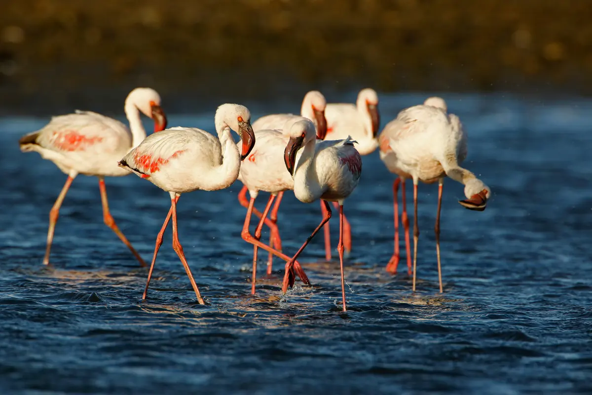
Swakopmund is the base for skydiving and for quad biking and sandboarding in the dune belt that runs south to Walvis Bay, and boats out of Walvis Bay look for dolphins, seals and pelicans. The Walvis Bay lagoon and Sandwich Harbour are both Ramsar wetlands, good for flamingos. Sandwich Harbour is inside the Namib-Naukluft Park, so you need a permit and a 4x4.
Inland, the main Spitzkoppe peak rises about 670 m off the plain. The ǂGaingu Conservancy runs the camp, and the San paintings in its rock shelters can only be seen with a local guide. At the Brandberg a guide is compulsory for the walk of about 45 minutes to the White Lady, a painting at least 2,000 years old, with Uis as the base.
Good to know
- Erongo has a very low malaria risk, and UK advice is bite avoidance rather than tablets. Kunene and Otjozondjupa next door are high risk from December to April.
- Fill up in the towns. Uis has fuel and a supermarket, but there is nothing else around the Brandberg, and Spitzkoppe has few facilities and no water at the campsites.
- Desert elephants use the Ugab riverbed, so keep your distance.
- Farm roads are private. Stay off them unless your stop is signposted, and close any gate you open.
- Semi-precious stones from roadside stalls need a permit to leave the country.
History and culture
Erongo is Namibia's central coast and the desert and mountains behind it, named after the Erongo Mountains west of Omaruru. The German colony built its own harbour here at Swakopmund in 1892, and thousands of Herero and Nama prisoners died in the town's camps between 1904 and 1908. Walvis Bay, the region's port, only became part of Namibia in 1994, four years after independence.
- Long before colonial rule
San hunter-gatherers painted the rock shelters of the Brandberg, a mountain of great spiritual importance to them. One ravine alone, the Tsisab, holds more than 1,000 shelters and over 45,000 paintings, the White Lady among them. source
- Before Herero and Nama settlement
Damara people lived around the Brandberg and the Erongo Mountains before Nama and Herero herders moved in looking for grazing, and Damara groups are still named after these places: the ǃOeǂgân of the Erongo Mountains and the Dâuredaman of the Brandberg (Dâureb in Khoekhoegowab). source
- 1849 to 1867
German missionaries of the Rhenish Mission Society settled at Otjimbingwe, on the old ox-wagon road from Windhoek to Walvis Bay, in 1849. In the 1860s Herero communities gathered there to face attacks from the Nama, chose Maharero as their military commander and in 1867 agreed to create the post of paramount chief, which still exists. source
- 1884
Britain let the Cape Colony complete its annexation of Walvis Bay and the Penguin Islands in 1884, after first steps in 1878. The German Empire annexed the land all around it as German South West Africa, leaving the only natural deep-water harbour on the coast in British hands. source
- 1892
Needing a harbour of its own, the German colony founded Swakopmund in August 1892, when a German navy crew put up a beacon at the mouth of the Swakop River. The site was picked for its fresh water and its route inland to Otjimbingwe and Windhoek. source
- 1904 to 1908
After the Herero rose against German rule in 1904, the German army carried out the genocide of the Herero and Nama. Prisoners, three quarters of them women and children, were held in concentration camps, Swakopmund and Karibib among the five main ones. Germany acknowledged the genocide in 2015, and a controversial 2021 deal offered 1.1 billion euros of development aid while rejecting any legal responsibility. source
- 1915
South African troops took German South West Africa early in the First World War. With Walvis Bay no longer foreign territory, all harbour work left Swakopmund, government offices closed and the town declined, until it was remade as a holiday resort for the territory's white population. source
- 1990 to 1994
Namibia became independent on 21 March 1990, after the South African Border War, the liberation war led by SWAPO (the South West Africa People's Organisation), and Sam Nujoma was sworn in as its first president. South Africa held on to Walvis Bay and the Penguin Islands until 1994, handing them over shortly before its own first democratic elections. source
- Language
- In the 2023 census the most common home languages were Oshiwambo (38.8% of households), Afrikaans (20.4%), Damara/Nama (18.8%), Otjiherero (9.6%) and English (5.3%). source
- Herero heritage
- In the 1800s Otjimbingwe was the seat of the Zeraua royal house, and the Ovaherero Traditional Authority still holds elections for the Herero paramount chief there. source
- The Topnaar of the Kuiseb
- The Topnaar (ǂAonin), a Nama clan, have lived on the Kuiseb River near Walvis Bay since the early 1800s. Their staple is the ǃnara melon that grows on the riverbanks, and they also sell ǃnara products to visitors. source
- German Swakopmund
- Swakopmund's colonial architects set out to make it look as much like a town in Germany as they could, and the old centre still does. A sizeable German community lives there today. source
- Herero as a written language
- Otjiherero became a written language in Omaruru. In 1874, in the Rhenish mission house, missionary Gottlieb Viehe translated the New Testament, the liturgical prayers and the catechism into it. source
For German visitors: The German Rhenish Mission Society made Otjimbingwe the centre of its Namibian work from 1849. Carl Hugo Hahn founded the Augustineum seminary there in 1866 and, in 1876, the first school in South West Africa. source
For German visitors: In October 2007 descendants of Lothar von Trotha came to Omaruru at the invitation of Herero royal chiefs and publicly apologised for his part in the genocide. source
For German visitors: The stone cross Diogo Cão set up at Cape Cross was removed by a German naval officer on 30 January 1893 and taken to Germany, where it ended up in the Deutsches Historisches Museum in Berlin. After a request from Namibia in 2017, the museum gave it back, and it has been in Namibia since August 2019. source
For German visitors: The Woermann line, which ran the shipping service from Germany, employed around 600 Kru boatmen from Liberia to land people and cargo through the surf at Swakopmund, where the first Schutztruppe soldiers (the colonial army) and settlers had to dig shelters in the sand in 1893. source
For American visitors: Angelina Jolie and Brad Pitt came to Namibia to escape the press for the birth of their daughter Shiloh, who was born in Swakopmund on 27 May 2006. They sold the first photographs and gave the money to UNICEF. source
Main sights in Erongo
8- Swakopmund Museum
For 125 years the town museum showed only the German colonial side of the story. In 2024 it opened its first exhibition on the 1904 to 1908 genocide of the Herero and Nama, based on research that found five camps in Swakopmund (four run by private firms for their workers, one by the military).
New Era: Swakopmund museum spotlights Nama, Ovaherero genocide (3 April 2024) - Ovaherero and Nama memorial, Swakopmund
The memorial in Memorial Park in Kramersdorf (once the African Cemetery) honours the thousands who died in the German camps. Behind its tombstones lie thousands of unmarked graves of genocide victims.
The Namibian: Genocide memories alive through silent desert (31 May 2026) - Woermannhaus, Swakopmund
You can spot it by its tower, the Damara tower, which once served as a lookout for ships coming in. It went up in 1894 for Adolph Woermann's trading company, with offices added in 1903 and 1904, and these days it houses a public library.
Wikipedia (German): Woermannhaus (Swakopmund) - Old railway station, Swakopmund
Built in 1901 for the new line to Windhoek, with the clock tower added by the builder who finished it. Trains used it until 1994, when it was turned into a hotel with a casino. It is a National Monument.
National Heritage Council of Namibia: Heritage Places - Rhenish Mission Church, Otjimbingwe
Opened on 1 December 1867 by Carl Hugo Hahn, with Chief Zeraua of the Herero giving 10,000 bricks for it. It served as a refuge during the wars and raids of the 1800s and is a National Monument.
National Heritage Council of Namibia: Heritage Places - Franke Tower and the mission house, Omaruru
The tower recalls 4 February 1904, when Captain Victor Franke's men broke a Herero siege of Omaruru in a battle that left about 100 Herero and 7 Germans dead. The battlefield around the tower is a National Monument, and so is the Rhenish mission house, the oldest building in town.
National Heritage Council of Namibia: Heritage Places - White Lady, Brandberg
The best known of the Brandberg's San paintings, at least 2,000 years old, and despite the name thought to show a male shaman. A guide is compulsory for the walk of about 45 minutes, and drinks stay behind because visitors once poured water on the painting for photographs.
Wikivoyage: Brandberg - Spitzkoppe rock art
The rock shelters at Spitzkoppe hold engravings and paintings from about 4400 BC to AD 100. Because of vandalism you can only see them on a guided tour.
Bradt Guides: Spitzkoppe (Marguerite Engelbrecht, 25 October 2019)
Did you know?
- The first European ship known to have anchored in Walvis Bay was Bartolomeu Dias's flagship, on 8 December 1487. He named it the Gulf of Santa Maria da Conceição. source
- Walvis Bay gets about 13 mm of rain a year, one of the lowest totals of any city on earth, yet its average humidity stays above 80% all year. source
- Namibia's great general strike against the contract labour system, a system many compared to slavery, started in Windhoek on 13 December 1971 and reached Walvis Bay a day later. Around 25,000 workers joined it, most of them men from Ovamboland in the north. source
- Photographs of Spitzkoppe were used as backgrounds for the Dawn of Man scenes in 2001: A Space Odyssey. source
- Just outside Swakopmund stands Martin Luther, a steam traction engine shipped from Hamburg in the 1890s to take over the haul inland from ox wagons. Early in 1897 it ground to a halt about 4 km from town and was left there. A local joke gave it its name: like Luther, it could say 'Here I stand, I can do no other'. source
- Rössing, near Arandis, has been mining uranium since 1976 and is the longest-running open pit uranium mine in the world. source
Checked 7 October 2026.
In and around Erongo
68 places listedWhere to stay in Erongo 41
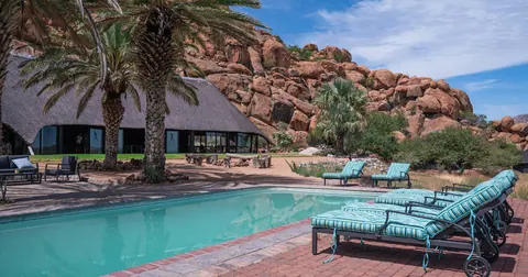 Guest houseAi-Aiba Lodge+264 61 257 175aiaiba-namibia.com
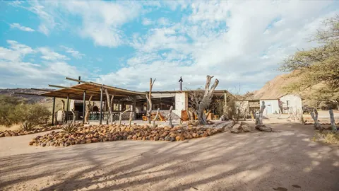 HotelOmandumba Bush Camp+264 64 571 086omandumba.de
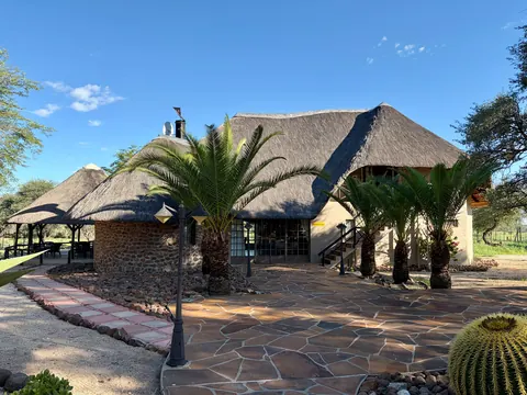 HotelRoidina Safari Lodge+264 64 571 188roidinanaturefarm.com
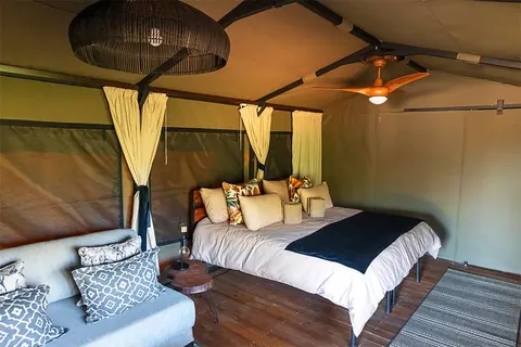 Guest houseTimBila - Camp Namibia+264 61 228 869timbila.com.na
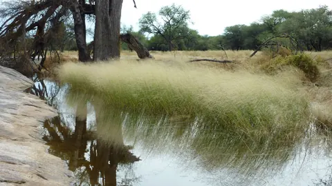 Guest houseGross Okandjougross-okandjou.de
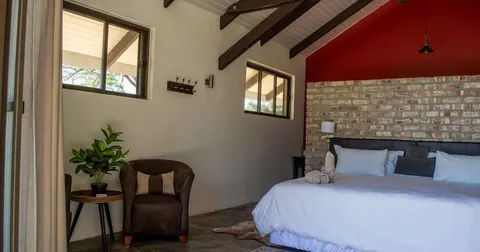 HotelKhan River Lodge+264 62 503 883khanriverlodge.com
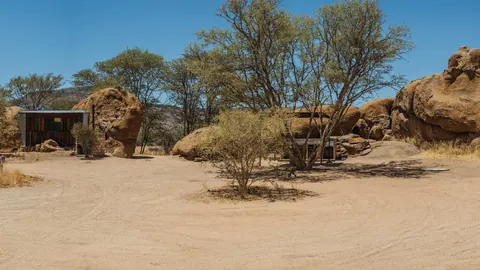 CampsiteOmandumba Campingomandumba.de
- CampsiteOmandumba Cave Campsiteomandumba.de
Show all 41 places to stay
- Omandumba Farm · Hostelomandumba.de
- Ozongwindi Lodge · Hotelozongwindi.com
- Tsaobis Nature Park Restcamp · Campsitetsaobisnaturepark.com
- Brandberg White Lady Lodge · Hotel+264 81 791 3117
- Brandberg White Lady Lodge Campground · Campsite
- 3 Elephant Campsite · Campsiteomandumba.de
- Omurenga Lodge · Resortomurenga.com
- Ondjamba Hills Camp · Hotel
- Split Apple · Campsiteomandumba.de
- Ugab Rhino Trust Conservation Camp · Campsite
- Camp 360 · Campsite
- Camp KykNet · Campsite
- Okarundu Camping Site · Campsite081 2100002, 081 8354981
- Omukutu · Campsite+264 81 128 3234
- Aabadi Bush Camp · Campsite
- Busch Hotel · Campsite
- Camp Dik-dik · Campsite
- Camp Granite · Campsite
- Camp Mountain View · Campsite
- Camp Petite · Campsite
- Camp X Ugab · Campsite
- Camping Kaliombo Safari Lodge · Campsite
- Community Camp · Campsite
- Elephant Rock Community Campsite · Campsite
- Erongo Lodge · Hotel
- Klein Eden Guest House · Hotel
- Ondombo B&B · Guest house
- Owl Campsite · Campsite
- Ozohere Campsite · Campsite
- Private Camping · Campsite
- San Campsite · Campsite
- Ukuib Guest Farm and Camping · Resort
Sights 19
- San Living MuseumMuseumomandumba.de
- Brandberg West MineAttraction
- Cave with San PaintingsAttraction
- Gaaseb GorgeAttraction
- GramadoelasViewpoint
- Herero Craft MarketAttraction
- Jakkalswater Railway StationRuins
- Linga LongaViewpoint
- Mason ShelterArchaeological site
- OkombaheViewpoint
- Old MineAttraction
- Pyropholite StockpileAttraction
Show all 19 sights
- Schöne Aussicht · Viewpoint
- Singing Rock · Attraction
- sun set viewpoint · Viewpoint
- Sundowner-Koppe · Viewpoint
- Swartklip · Viewpoint
- White Lady Rock Paintings · Attraction
- Yoga Rock · Viewpoint
Fishing spots 5
- Desalination Plant Fishing AreaFishing spot
- Die Drom Fishing AreaFishing spot
- Hobooms Gat Fishing AreaFishing spot
- Mile 17 Fishing AreaFishing spot
- U-Boat Rock Fishing AreaFishing spot
Restaurants and cafes 3
- KwetuCafe+264 81 242 5037
- SlowtownCafe · coffee shop
- ReceptionCafe
Map of Erongo
See every place on this map as a list