Village · Erongo, Namibia
Uis
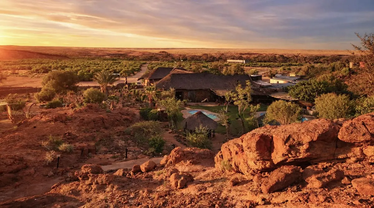
An old tin mining town in western Erongo, about 30 km from the Brandberg, with fuel, a supermarket and the guides who walk you to the White Lady rock painting.
Short answer
Uis is in Erongo, Namibia. This page lists 7 places to stay and 2 places to eat and drink. The nearest park with an entry fee on this site is Dorob National Park, about 94 km away, where international adults pay from N$280.
- Malaria
- Uis is in Erongo, which UK advice rates very low risk for malaria: bite avoidance and awareness, no tablets.
- Places to stay
- 7
- Eat and drink
- 2
- Park fee nearby: Dorob National Park
- US$17 €15 · N$280about 94 km away
In and around Uis
9 places listedWhere to stay in Uis 7
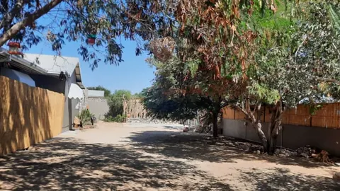 Guest houseThe Desert House2nd Avenue, Uis+264 81 803 7830deserthousenamibia.com
- 21.22°S 14.86°ECampsiteDaureb Isib CampsiteUisdaurebisib.com
- 21.22°S 14.87°ECaravan parkBrandberg Rest Camp
- 21.22°S 14.86°EGuest houseGreen Elephant Uis Self Catering Cottages
- 21.22°S 14.87°EGuest houseMontis-Usti Restaurant
- 21.22°S 14.87°EGuest houseThe White Lady B&B
- 21.22°S 14.87°EGuest houseUis Elephant Guesthouse
Restaurants and cafes 2
- Cactus & Coffee Tea GardenCafe · coffee shop, cake, tea+264 64 504 106daurebisib.com
- Vicky's Coffee ShopCafe
Uis is a small mining town on the gravel plains of western Erongo, about 30 km from the foot of the Brandberg (Dâureb), Namibia’s highest mountain. Most people come for the mountain and for the White Lady, the best known of its San rock paintings, and use Uis as the place to sleep, eat and fill up. The white dumps of the old tin mine show from far off. The name is Khoekhoegowab for a bitter spring.
Getting there
Uis sits where the C35 from Henties Bay meets the C36 from Omaruru. It is about 180 km from Swakopmund and 320 km from Windhoek. The C36 is gravel all the way from Omaruru except for the last 5 km into town. The C35 from Henties Bay is being tarred, but the work fell well behind schedule in 2025 for lack of money, so expect roadworks and stretches of gravel. For the White Lady, turn west onto the D2359.
When to go
It gets very hot here. Summer days around the Brandberg often pass 40 °C, and from December to February the average high is over 30 °C. The cooler months, roughly April to September, are the time to walk, and the climb to the Königstein is only done with a guide in those months. Start the White Lady walk early.
What to do
The White Lady is why most people stop. She is one figure on a rock panel about 5.5 m long under an overhang in the Tsisab gorge, painted at least 2,000 years ago, and despite the name the figure is now usually read as a shaman. A guide is compulsory. The Daureb Mountain Guides, young people from Uis, take you up the dry riverbed, a rough walk of 45 minutes to an hour each way. Longer hikes in the gorges and the climb to the 2,573 m summit need a permit from the National Heritage Council, which travellers say is also sold at the Brandberg Rest Camp in Uis.
With a 4x4 you can drive right round the mountain on a slow track of about 125 km, or take the D2342 out to the Messum Crater, the ring of an ancient volcano inside Dorob National Park.
Good to know
Fill up in Uis. It has a petrol station and a well-stocked supermarket, and around the Brandberg there is nothing else. Away from town there is no mobile signal, so on the back tracks carry a satellite phone and plenty of water. On the last stretch to the White Lady you leave bags and water bottles behind. Visitors used to splash water on the painting to make it show up in photographs, and it faded. Erongo has a very low malaria risk and UK advice is bite avoidance, but Kunene, across the Ugab, is high risk from December to April. Semi-precious stones from the roadside stalls need a permit to leave the country. Desert elephants use the Ugab riverbed to the north, and only about 20 are left there, so give them room.
History and culture
Uis was built for a tin mine and nearly died with it, but people have lived in the shadow of the Brandberg for thousands of years. San painters left tens of thousands of images in its gorges, a Damara group took its name from the mountain, and German and South African owners, and now Andrada Mining, have all dug the tin, tantalum and lithium of the plains around the town.
- At least 2,000 years ago
San hunter-gatherers (also called Bushmen) painted the rock shelters of the Brandberg, a mountain of great spiritual meaning to them. The Tsisab gorge alone has more than 1,000 shelters and over 45,000 paintings, the White Lady among them. source
- From about 1600
Damara people lived around the Dâureb (Brandberg) and other mountains of central Namibia until, by their own oral and written records, invaders scattered them around 1600. One of the groups that later split off moved to the Brandberg and became known as the Dâuredaman, the Damara of the Brandberg. source
- 1884 to 1908
Germany declared the territory a colony, German South West Africa, in 1884. Between 1904 and 1908 the German Empire carried out the genocide of the Herero and Nama after they rose against colonial rule. Germany acknowledged it as genocide in 2015. source
- 1911 to 1939
Dr Paul of the Deutsche Kolonialgesellschaft (German Colonial Company) found tin near Uis in 1911. August Stauch bought the deposits in 1923, no tin was mined in the Depression years of 1930 to 1933, and the German firm Krupp bought the mine in 1938, only for the Second World War to stop its plans. source
- 1915 to 1990
South Africa occupied the German colony in 1915, during the First World War, and went on to rule it under a League of Nations mandate. SWAPO (the South West Africa People's Organisation) began its armed struggle in 1966, and Namibia became independent on 21 March 1990. source
- 15 June 1951
The Brandberg area was declared a National Monument by the Historical Monuments Commission for South West Africa. source
- 1958 to 1991
In 1958 the South African company Iscor started mining here on a larger scale and built a settlement for its workers. In its day it was the largest open-cast tin mine in the world, though the ore was so poor that it only paid because sanctions kept South Africa from buying tin on the world market. When apartheid ended and sanctions were lifted the mine could no longer compete, and it closed in 1991 after tin prices fell. source
- 1996 to 2025
Uis was proclaimed a village in 1996, downgraded to a settlement in 2010 as the economy shrank, and declared a village again in July 2025, electing its own council that year. Mining restarted in 2019 under AfriTin, now Andrada Mining. source
- Languages
- In Dâures constituency, which takes in Uis and the farmland and villages around it, the 2023 census found Khoekhoegowab (the Damara and Nama language) to be the main home language in 39.9% of households and Otjiherero in 37.4%. Oshikwanyama (5.7%), Afrikaans (4.9%) and English (2.4%) follow a long way behind. source
- Names for the mountain
- Brandberg means burning mountain in German and Afrikaans, after the glow of the granite at sunset. The Damara name, Dâures (also written Dâureb, as in the Daureb Mountain Guides), means burning mountain too, while the Herero call it Omukuruvaro, mountain of the gods. source
- Reading the rock art
- The White Lady panel probably shows a ritual dance, and the main figure, with white legs and arms, holding a bow, is usually taken to be a shaman. The paint was likely made from ochre, charcoal, manganese and haematite, bound with blood serum, egg white and casein. source
- Small miners
- The area is known for semi-precious stones and crystals, which small local miners dig and sell directly to travellers. source
For German visitors: Reinhard Maack, a German surveyor, made the first ascent of the Königstein on 2 January 1918 with Ernst August Gries and Georg Schulze. On the way down, on 4 January, he came across the White Lady. source
For German visitors: The mining story of Uis began with Germans: tin was found here in 1911 by the Deutsche Kolonialgesellschaft, August Stauch, who had found the diamonds near Kolmanskop, bought it in 1923, and Krupp owned the mine from 1938. source
For German visitors: Harald Pager of the University of Cologne spent eight years until his death in 1985 recording about 43,000 paintings at 879 sites in the upper Brandberg, traced by hand onto 6 km of plastic sheeting. The Heinrich Barth Institute in Cologne published the work in a series of volumes. source
For German visitors: The University of Cologne's Africa Research Centre, with money from the Jutta Vogel Foundation, now trains women from the Daureb Mountain Guides of Uis to lead tours into the high Brandberg. source
Main sights in Uis
5- White Lady, Brandberg
The best known painting on the mountain, in Maack Shelter in the Tsisab gorge, on a panel about 5.5 m by 1.5 m with human figures and oryx. Visits are guided only, and the panel is now protected by two metal bars instead of the old wire netting.
Wikipedia: The White Lady (Namibia) - Brandberg National Monument
The granite massif, Namibia's highest at 2,573 m on the Königstein, has been a National Monument since 1951 and holds Namibia's four highest peaks. It is on Namibia's list of candidates for World Heritage status.
Wikipedia (German): Brandbergmassiv - Uis tin mine dumps
The white spoil heaps of the old open-cast mine are visible from far off and are the town's landmark. The mine is working again, so the site itself is private.
Wikipedia: Uis - Brandberg Rest Camp
Built as the Uis Tin Mine recreation club, it has taken in travellers since 2006 and still has its half Olympic size pool.
Brandberg Rest Camp - Messum Crater
The ring of hills, 18 to 23 km wide, is what remains of an enormous eruption about 132 million years ago, when Africa and South America were still joined. It lies inside Dorob National Park and is reached on the D2342 from Uis. It takes its name from the Messum River, named after the British captain William Messum, who came this way in 1850 on an expedition to the Brandberg.
Wikipedia: Messum Crater
Did you know?
- Uis is Khoekhoegowab for a bitter spring. source
- The Frenchman Henri Breuil gave the White Lady her name and argued she was painted by visitors from the Mediterranean. The idea suited the racist politics of South Africa at the time and was dropped in the later 1900s. The painting is now accepted as San work. source
- In 1914 two German survey soldiers climbed what they thought was the summit and cemented an iron rod on top. In 1955 the rod turned up on the Horn, at 2,519 m the second highest peak, so they had missed the Königstein. source
- A whole new group of insects, the Mantophasmatodea, was first found on the Brandberg in 2002. source
- No other part of Namibia is as rich in endemics as the Brandberg: eight plants found nowhere else, and 49 of the country's 59 near-endemic reptiles and 11 of its 14 near-endemic birds live on or around it. source
- The lithium, tin and tantalum resource in just two of the 180 pegmatites at Uis was put at 138 million tonnes in 2023, and petalite is the main lithium mineral. source
Checked 7 October 2026.
Wildlife you might see
13- likelyRock hyrax (dassie)Rocky shelters in the Brandberg gorges, where white streaks on the rock give their colonies away. All yearsource
- likelyPale chanting goshawkAbundant on the mountain, which has 18 raptor species. All yearsource
- possibleHartmann's mountain zebraFree-roaming herds in the Brandberg area. All yearsource
- possibleSpringbokRoaming free in the Brandberg area. All yearsource
- possibleGiraffeAlong the Ugab River, which also supports mountain zebra and desert elephant. All yearsource
- possibleHerero chatGorges and valleys around the mountain, one of the Namibian near-endemics found here. All yearsource
- possibleRockrunnerGorges and valleys around the mountain. All yearsource
- possibleRosy-faced lovebirdGorges and valleys around the mountain. All yearsource
- possibleLudwig's bustardThe flat gravel plains below the mountain, with Rüppell's korhaan and Gray's lark. All yearsource
- rareDesert elephantThe Ugab riverbed north of the Brandberg. EHRA counted only 20 in the Ugab group in 2024, down from 32 in 2016. All year, moving along the riversource
- rareBlack rhinoThe Brandberg area. Numbers are small and sightings are a matter of luck. All yearsource
- rareVerreaux's eagleAn uncommon breeding resident on the Brandberg. All yearsource
- rareLappet-faced vultureAn uncommon breeding resident on the Brandberg. All yearsource
Likelihood is for a normal visit of two or three days, from the sources linked. Nothing is guaranteed in the wild.
Hikes and walks
3- White Lady trail, Tsisab gorge
A walk over rough ground up the dry Tsisab riverbed to the overhang known as Maack Shelter, where the White Lady panel is. Bags and bottles stay behind at the far end of the path.
Permit: Guided only. Visits are allowed only with an official guide
Wikipedia: The White Lady (Namibia) - Brandberg gorge hikes
Hikes into the gorges of the massif. Guides carry a satellite phone for emergencies, and if you go without a guide you should carry your own.
Permit: Permit from the National Heritage Council in Windhoek, also sold at the Brandberg Rest Camp in Uis
Wikivoyage: Brandberg (covers Uis) - Königstein summit
The climb to Namibia's highest point at 2,573 m is a multi-day trip, only done with a guide in the cooler months from April to about September. The usual route starts on the south side.
Permit: Only with a guide
Wikipedia (German): Brandbergmassiv
Staying safe in Uis
- Malaria
- Uis is in Erongo, which UK advice rates very low risk for malaria: bite avoidance and awareness, no tablets. Kunene, just north across the Ugab, is high risk from December to April, when tablets are recommended, so check with a travel clinic if your route goes north. source
- Desert heat
- Summer days around the Brandberg often pass 40 °C and there is almost no water on the mountain. Walk early, carry far more water than you think you need, and keep long hikes for the cooler months. source
- Desert elephants
- Elephants use the Ugab riverbed. Do not drive closer than 10 to 15 m. If one shakes its head it is angry: stay in the car, switch off the engine, keep quiet and wait for it to move off. source
- Remote tracks
- There is no mobile signal outside Uis. A tourist couple once died of thirst near here after a breakdown, within 5 km of a farmhouse. On the 4x4 tracks take a good map and GPS, a satellite phone, ample food and water, ideally a second car, and leave word of your route. source
- Gravel roads
- The C36 from Omaruru is gravel apart from the last 5 km into Uis, and it crosses several riverbeds on the way. Take it at a steady, sensible speed. source
Tips from travellers
- Fill up and stock up in Uis. It has a petrol station and a surprisingly well-stocked supermarket, and there are no other shops around the Brandberg. several sources
- Leave drinks in the car for the White Lady walk. For years visitors poured water on the painting to make the colours show in photos, which faded it, so bags and bottles are not allowed at the panel. several sources
- Semi-precious stones from the roadside stalls need an export permit, and picking stones up yourself is illegal. several sources
- The guides at the White Lady are the Daureb Mountain Guides, young people from Uis, and several of them are qualified women guides. Booking a local guide keeps the money in town. official
- The C35 from Henties Bay is being tarred, but the contractor missed its targets in 2025 for lack of money and equipment. Expect roadworks and gravel sections, and ask locally how far the tar has got. one source
- You can drive right round the Brandberg on a 4x4 track of about 125 km. It is easy to follow at the foot of the massif but slow, at 10 to 15 km/h, so allow a long day. Free camping is allowed along the track but not in the gorges. several sources
Checked 7 October 2026. Conditions change, so confirm with the park or venue before you go.
Quick answers
What animals can you see in Uis?
You have a good chance of seeing rock hyrax (dassie) and pale chanting goshawk. Desert elephant, black rhino, verreaux's eagle and lappet-faced vulture are there but rarely seen.
What are the best hikes in Uis?
White Lady trail, Tsisab gorge, Brandberg gorge hikes and Königstein summit. See the hikes section for times, difficulty and permits.
Map of Uis
See every place on this map as a list