Park · Erongo, Namibia
Dorob National Park
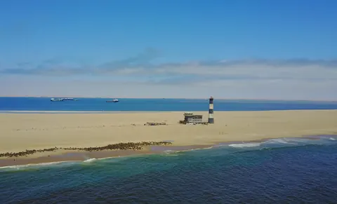
The central Namibian coast from the Kuiseb delta to the Ugab River: the dune belt between Walvis Bay and Swakopmund, the flamingo lagoon, lichen fields and the fishing coast.
Short answer
At Dorob National Park, international visitors pay N$280 (about US$17, €15 or £12.50) per adult and N$180 per child per day. The rates apply from 1 April 2026 to 31 March 2027.
- Daily fee, international adult
- US$17 €15 · N$280
- Malaria
- Erongo, the region this park lies in, is not on the CDC list of malaria areas where tablets are advised.
- Places to stay
- 14
- Park fee nearby: Cape Cross Seal Reserve
- US$17 €15 · N$280about 33 km away
Dorob National Park fees 2026/27
Checked Ministry of Environment, Forestry and Tourism tariffValid 1 April 2026 to 31 March 2027, per person per day, in Namibian dollars.
| Who | Adult | Child |
|---|---|---|
| International visitorsUS, Europe and everyone else | US$17 €15 · N$280 | US$11 €10 · N$180 |
| SADC nationals | N$180 | N$100 |
| Namibian citizens | N$60 | Free |
- Children aged 8 and under enter free. The child rate is for ages 9 to 15; Namibian children in that age group pay nothing. From 16 the adult rate applies.
- Vehicle fee per day, on top of the per person fee: N$60 for 10 seats or less, N$150 for 11 to 25 seats, N$600 for 26 to 50 seats and N$1,000 for 51 seats or more.
- The Namibian rate is for Namibian citizens. The gazette sets fees by nationality, so a foreigner living in Namibia pays the rate for their nationality.
- Each fee is half park entrance fee and half conservation fee; the figures shown are the two added together.
- These fees were gazetted with effect from 1 April 2026 and have no end date. I show them as valid to 31 March 2027, the end of Namibia’s financial year, and will re-check then.
- Fees are set by Ministry of Environment, Forestry and Tourism. Official tariff · Seen a new rate? Tell us
US$1 = N$16.64 · €1 = N$18.60 · £1 = N$22.31 (ECB rate, 3 Nov 2026, N$1 = R1). Converted amounts are approximate; you pay in Namibian dollars.
How we got these figures
- SafariFind gives the same adult figures but lower child rates (N$140 foreign, N$90 SADC) than the gazette; I used the gazette child rates.
- New Era reported in 2025 that the draft schedule kept this park free for Namibians. The gazetted schedule charges Namibian adults N$60, so the draft was changed.
- Government Gazette No. 8877 of 1 April 2026, Government Notice No. 115 (MEFT fee schedule), copy hosted by the Legal Assistance Centre · official · checked 7 Oct 2026
- Tourism Update (27 January 2026) · one source · checked 7 Oct 2026
- Namibian.org (19 January 2026) · one source · checked 7 Oct 2026
- Africa Beat (6 February 2026) · one source · checked 7 Oct 2026
- TravelComments.com (29 January 2026) · one source · checked 7 Oct 2026
- SafariFind · one source · checked 7 Oct 2026
- New Era (report on the 2025 draft fee schedule) · one source · checked 7 Oct 2026
Dorob National Park is the central stretch of the Namibian coast, from the Kuiseb delta south of Walvis Bay up to the Ugab River. It covers the dune belt, the Walvis Bay lagoon, gravel plains, lichen fields and the fishing shore north of Swakopmund. Proclaimed on 1 December 2010, it was zoned for recreation as well as protection. The towns sit inside it but are not part of it, so many visitors use the park without realising.
Getting there
Swakopmund is 362 km from Windhoek on the tarred B2, four to five hours’ drive, and Walvis Bay is 35 km further south, with flights from South Africa. The main public roads are cut out of the park, so you can drive them without a permit. The C34 has been tar from Swakopmund to Henties Bay since 2019. Beyond that it is a salt road to Ugab Gate, smooth when dry but slippery when wet. Henties Bay is the last town on that stretch, so fill up there.
When to go
The weather barely changes. Swakopmund averages 15 to 25°C with under 20 mm of rain a year, but the coast can get more than 180 days of thick fog. The Namibian summer holidays bring the big rush to the coast, and December and January are the only months NWR opens its Mile 72 and Jakkalsputz camps. When I checked in October 2026 NWR’s online booking system was down and it was asking for booking requests by email to reservations@nwr.com.na. Anglers rate November to March best. Walvis Bay holds over 100,000 birds in summer, and most of the region’s flamingos winter there.
What to do
The dune belt between Swakopmund and Walvis Bay is where operators run quad biking, sandboarding and guided morning tours that find the small desert animals, such as the shovel-snouted lizard and Peringuey’s adder. At Walvis Bay, drive round the lagoon (a Ramsar site) for flamingos, and out towards Pelican Point, a 10 km sand spit where kayak trips paddle among the seals.
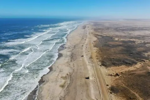
North of Swakopmund the fishing spots along the C34 are named after their distance in miles or a local story. The trawler Zeila broke loose from its tow in August 2008 and still sits in the shallows about 14 km south of Henties Bay, with cormorants on it. Past Wlotzkasbaken the lichen fields east of the road are fenced; look from the edge. The Cape Cross seal colony is a separate reserve with its own page.
Good to know
- Driving off marked tracks is banned, except in the off-road area of dunes between Langstrand and Walvis Bay, which needs a free MEFT permit from the Swakopmund or Walvis Bay office. The Damara tern breeding area, the Swakop River and the lichen fields are closed to vehicles, and quad bikes are banned north of the Omaruru River. The rules date from 2011, so check with MEFT.
- Tyre tracks on the gravel plains last for decades, and lichens that are driven over do not come back.
- Camping is only at designated sites, and anglers need a fishing permit. The daily park fee is in the table on this page.
- Erongo is not one of the regions where the CDC advises malaria tablets.
- The sea is icy with a strong current. In Swakopmund, swim where the breakwater shelters the beach.
Wildlife you might see
10- very likelyGreater and lesser flamingoWalvis Bay lagoon and the shallows by the salt works. All year; most of southern Africa's flamingos spend the winter heresource
- very likelyCape fur sealPelican Point at the tip of the Walvis Bay sand spit, best seen from a kayak or boat trip. All yearsource
- likelyCormorantsRoosting and nesting on the Zeila wreck south of Henties Baysource
- possibleChestnut-banded ploverWalvis Bay lagoon mudflats and salt pans, which hold a large share of the world populationsource
- possibleShovel-snouted lizardDune belt between Swakopmund and Walvis Bay, on a guided living desert toursource
- possiblePeringuey's adder (sidewinder)Buried in the sand of the dune belt; guides on desert tours look for itsource
- possibleNamaqua chameleonDune belt and its edges, on a guided desert toursource
- possibleWeb-footed Namib dune gecko (palmato gecko)Dune belt between Swakopmund and Walvis Bay, on a guided desert toursource
- possibleBottlenose dolphinAround the Walvis Bay waterfront and in the baysource
- rareDamara ternGravel plains among the dunes between Walvis Bay and Swakopmund; the breeding sites are fenced and closed to visitors. Breeds in the summer holiday months, then leaves for West Africasource
Likelihood is for a normal visit of two or three days, from the sources linked. Nothing is guaranteed in the wild.
Staying safe in Dorob National Park
- Malaria
- Erongo, the region this park lies in, is not on the CDC list of malaria areas where tablets are advised. The CDC rates transmission outside the listed regions as rare. Tablets are advised for listed regions in the north and east, such as Kunene, the Kavangos and Zambezi, so take advice if you carry on north into Kunene. source
- Sea
- Expect cold water at any time of year, heavy surf and a strong current setting north along the shore. Locals swim where the breakwater in Swakopmund shelters the beach, and that is the place to do it. source
- Salt and gravel roads
- North of Henties Bay the C34 is a salt road. It is smooth when dry but turns slippery when wet, so ease off in fog and drizzle. On gravel the limit is 80 km/h. Let some air out of the tyres, and make sure you have a spare and a jack that works before you leave. source
- Closed areas and night driving
- Vehicles must stay on proclaimed roads and marked MEFT tracks, except in the permitted off-road area of dunes between Langstrand and Walvis Bay. The Damara tern breeding area, the Swakop River and the lichen fields are closed, quad bikes are banned north of the Omaruru River, and away from the proclaimed roads no vehicle may be used between 21:00 and 05:00. These rules are from the 2011 park pamphlet; check for changes at the MEFT office. source
- Sun under fog
- Cool, foggy days hide how strong the sun is. People burn here without noticing, so use sunscreen and a hat even when it feels cold. source
Tips from travellers
- To drive or ride a quad in the dune belt between Langstrand and Walvis Bay you need a free permit from the MEFT office in Swakopmund or Walvis Bay. official
- Stay on existing tracks. Wheel marks on the gravel plains and lichen fields can last for decades, and lichens that are driven over do not recover. several sources
- For the lichen fields, go early while the fog is still in, or sprinkle a little water on them, to see them change colour. one source
- Wash the underside of your car after driving the salt road north of Henties Bay. one source
- NWR's Mile 72 and Jakkalsputz camps open only in December and January. At the Mile 72 and Mile 108 chalets you bring your own bedding, and NWR advises buying water to drink rather than using the chalet tap. official
- Anglers need a recreational fishing permit from the Ministry of Fisheries and Marine Resources. Regulars rate November to March as the best months. several sources
Checked 7 October 2026. Conditions change, so confirm with the park or venue before you go.
Tern eggs, horse skulls and the tracks Mad Max left
On 20 November 2003 a Damara tern was caught on its nest on the gravel just south of Swakopmund and given two yellow rings. In August 2008 the researcher Justine Braby found the same bird roosting on Lighthouse Beach at Tarkwa Bay, Lagos, about 4,000 km up the coast. It had been trapped back in Namibia on 11 November 2007 and was trapped again on 11 November 2008, both times within metres of the original scrape. A bird 23 cm long, flying to Nigeria and back to the same patch of gravel in the same weeks of November.
The barriers Rod and Sigi Braby put up
Almost every Damara tern in the world breeds in Namibia, and a coast survey in 1991 showed that the gravel flats among the dunes from Walvis Bay to Swakopmund are the most densely used breeding ground of all, with up to 200 nests in a season. The pair lays a single egg in a scrape on bare ground, and only about a third of chicks get as far as flying. Jackals, crows and kestrels take some. Quad bikes and bakkies crushed others.
Rod Braby, once a warden at Möwe Bay and later chief warden for Erongo, monitored two colonies here with his wife Sigi from 1995 to 2010. Cable barriers and signboards went up at the first of them in November 2000 and breeding success rose from a little over half to about 80 per cent. Their daughter Justine built the ringing records into a University of Cape Town PhD, which notes that drivers were still cutting the cables years on. One tern ringed as a chick in November 1993 was caught on a nest in 2004 and again in 2008, fifteen years old.
The colonies are closed, so do not go looking for nests. The first eggs are laid in early November, breeding runs to about February, and the birds have left by April. They fish close inshore, in and just behind the surf, dropping from a few metres up, so the place to look in summer is the water’s edge between the two towns, not the plains. Even there they are small, pale and easy to miss.
Why one colony is called Horses Graves
The Brabys’ two study colonies were Caution Reef, 8 km south of Swakopmund, where 120 pairs were counted in the 1994/95 season, and Horses Graves, 4 km south of town. The second name is no figure of speech. In October 1915, a few months after the German surrender, the Union Defence Force moved its horses and mules down to the coast because feed had run short inland. Glanders broke out. A Ministry of Defence telegram of 15 May 1916, found in the South African military archives, gives the count: 1,695 horses and 944 mules destroyed at Swakopmund in November and December 1915. The vet sent from Cape Town with mallein, the reagent used to test for the disease, arrived ten days late because his ship, the British Prince, was wrecked on the way.
The bones lie in the dune valleys 4 to 5 km south of the Swakop River, inside the area now cabled off for the terns. The few 4x4 drivers who came across them described long mounds of bleached skulls, most with a bullet hole in the forehead, and a more recent visitor found rusted horseshoes and scraps of halter among them. Dunes here move up to 2 m a year, so the bones vanish under sand and then surface again.
What a film crew can do in six months
Wheel marks on these plains outlast the people who made them. Dune guides still point out ox-wagon ruts left by the early German settlers, and the lichen researcher Jennifer Lalley worked out that a machine-cleared track through a lichen field needs several hundred years to heal. One of the big Teloschistes lichen fields starts 4 km north of Wlotzkasbaken.
So it mattered when Mad Max: Fury Road arrived in July 2012, a year and a half after the park was proclaimed. The shoot had been planned for Australia until heavy rain turned the desert there green. Filming ran to December, six months in all. Tommy Collard, who guides in the dune belt, said the crew cut tracks into untouched ground and then dragged nets over them to hide the marks, pulling plants out as they went. The coastal project NACOMA hired the ecologist Joh Henschel to look into it. He reported that some areas had been destroyed and that a ploughing device had been used in one place, and his report called the ministry’s permit too unspecific to manage the shoot by. The Namibia Film Commission answered with a full-page advert in the state newspaper New Era rejecting the allegations. The film won six Oscars.
Salt tables and Bennie’s red lorry
People who drive north from Swakopmund towards Henties Bay and the Skeleton Coast describe gravel, sea, and very little between. Anglers have named the fishing spots, and the names are the best reading on the map. Bennie se Rooi Lorrie is where a young man lost his favourite red truck. Sarah se Gat was one keen fisherwoman’s regular hole.
Wlotzkasbaken is about a hundred owner-built houses, each with its own water tank, no fences, plots marked with rocks. One traveller on the way to Cape Cross wrote of unmanned roadside tables selling salt crystals, with a slotted bottle for the money, and of nearly treading on a horned adder between the lichen fields.
As for big animals, the ministry lists springbok, oryx, zebra and brown hyaena for the park. Trip reports from the coast road mention seals and seabirds and nothing bigger, so do not plan around them. Far inland in the north of the park is the Messum Crater, a collapsed volcano some 20 km across and 132 million years old. It was first recognised for what it is in 1939 by Henno Martin, the geologist who a year later went to ground in the Namib for two and a half years and wrote The Sheltering Desert.
In and around Dorob National Park
89 places listedWhere to stay in Dorob National Park 14
- 22.69°S 14.89°EGuest housePalmenkop Campsite+264 81 149 7824palmenkopcampsite.com
- 21.38°S 13.77°EChaletSt Nowhere Spa & Campsite
- 21.38°S 13.77°ECampsiteSt. Nowhere Campsite
- 21.38°S 13.77°ECampsiteAtlantic Salt Rest Camp
- 22.69°S 14.88°ECampsiteFlinstone Caves
- 23.18°S 14.66°ECampsiteGroot Tinkas Campsite
Show all 14 places to stay
- Lauberville · Campsite
- Mile 108 Rest Camp · Campsite
- Mile 72 · Campsite
- Rooi tafel · Campsite
- Tented Camp · Campsite
Sights 50
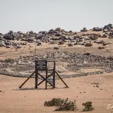
- Bakkrans Historical SiteAttraction
- Baklei GatViewpoint
- Black RockViewpoint
- BlareViewpoint
- CanopyViewpoint
- Cape CrossViewpoint
- Dare Devil AdventuresAttraction
- Die DraadViewpoint
- Die DraadViewpoint
- Die TolViewpoint
- Doep se GatViewpoint
Show all 50 sights
- Dollosse · Viewpoint
- Dunes · Attraction
- Grysduintjie · Viewpoint
- Horingbaai · Viewpoint
- Illegal Turn-Off · Viewpoint
- Lichen Field · Attraction
- Lighter · Viewpoint
- Maketo's Turn · Viewpoint
- Myl 72 Border (No Fishing) · Viewpoint
- Padkamp · Viewpoint
- Pelicans · Viewpoint
- Pink Lake · Attraction
- Popeye · Viewpoint
- Predikants Gat · Viewpoint
- Richtersveld · Viewpoint
- Richtersveld · Viewpoint
- Rondebos · Viewpoint
- Rondeklip · Viewpoint
- Rondeklip · Viewpoint
- Salt Pan · Attraction
- Saltpan · Viewpoint
- Sarah se Gat · Viewpoint
- Sicombe's Turn · Viewpoint
- Skerpioenbos · Viewpoint
- St. Nowhere · Viewpoint
- Sunset Viewpoint · Viewpoint
- Swartklip · Viewpoint
- Tolla se Gat · Viewpoint
- Trappies · Viewpoint
- Ugabmond Gate · Viewpoint
- Walvis Bay Salt Works · Attraction
- Welwitschia · Attraction
- Welwitschia · Attraction
- Welwitschia · Attraction
- Winston · Viewpoint
- Winston · Viewpoint
- Yster Gat · Viewpoint
- Zeila Wreck · Viewpoint
Fishing spots 24
- 1st PaalFishing spot
- 4de PaalFishing spot
- ArraratFishing spot
- Bennie se Rooi Lorrie Fishing AreaFishing spot
- Black Rock Fishing AreaFishing spot
- Die Walle Fishing AreaFishing spot
- Donkey BayFishing spot
- Fish Cleaning AreaFishing spot
- Galjoenfontein Fishing AreaFishing spot
- Grys Duintjie Fishing AreaFishing spot
- Mile 14 Fishing AreaFishing spot
- Mile 26 Fishing AreaFishing spot
Show all 24 fishing spots
- Mile 32 Fishing Area · Fishing spot
- Mile 8 Fishing Area · Fishing spot
- Mombakkies Fishing Area · Fishing spot
- Omarurumond Fishing Area · Fishing spot
- Ou Watertenk · Fishing spot
- Popeye Fishing Area · Fishing spot
- Skerpioenbos Fishing Area · Fishing spot
- Swartklip Fishing Area · Fishing spot
- Trappies Fishing Area · Fishing spot
- Watergat · Fishing spot
- Windston · Fishing spot
- Zeila Wreck Fishing Area · Fishing spot
Bars and pubs 1
- Desert PoolbarBar
Quick answers
How much is the entry fee for Dorob National Park?
International visitors pay N$280 (about US$17, €15 or £12.50) per adult and N$180 per child per day. These rates apply from 1 April 2026 to 31 March 2027 and are set by Ministry of Environment, Forestry and Tourism (MEFT).
Do Namibians and SADC citizens pay less at Dorob National Park?
Namibian citizens pay N$60 per adult and SADC nationals pay N$180 per adult per day. You need ID or a passport to get the lower rate.
When were these Dorob National Park fees last checked?
We last checked them on 7 October 2026 against 7 published sources. We re-check every two weeks, but always confirm with Ministry of Environment, Forestry and Tourism (MEFT) before you travel.
What animals can you see in Dorob National Park?
Most visitors see greater, lesser flamingo and cape fur seal. You have a good chance of seeing cormorants. Damara tern is there but rarely seen.
Dorob and the parks nearest it
| Park | International adult | Distance | Where |
|---|---|---|---|
| Dorob National Park | US$17 €15 · N$280 | · | Erongo |
| Cape Cross Seal Reserve | US$17 €15 · N$280 | 33 km | Erongo |
| Palmwag Tourism Concession | US$6 €5 · N$100 | 242 km | Kunene |
| Okonjima Nature Reserve | US$15 €13 · N$250 | 269 km | Otjozondjupa |
Where the Dorob fees come from
- Government Gazette No. 8877 of 1 April 2026, Government Notice No. 115 (MEFT fee schedule), copy hosted by the Legal Assistance Centre
- Tourism Update (27 January 2026)
- Namibian.org (19 January 2026)
- Africa Beat (6 February 2026)
- TravelComments.com (29 January 2026)
- SafariFind
- New Era (report on the 2025 draft fee schedule)
Open data: all park fees (CSV) · JSON (CC BY 4.0)
Cite as: Travel Africa Guide, "Dorob National Park fees 2026/27", checked 7 October 2026, https://travelafrica.guide/namibia/dorob-national-park/
Map of Dorob National Park
See every place on this map as a list