Region · Namibia
Otjozondjupa
Central and north-eastern Namibia from Okahandja up the B1 to Otjiwarongo and Grootfontein, with the Waterberg Plateau, cheetah country and the San lands around Tsumkwe.
Short answer
This page covers 3 parks and reserves and 5 towns and cities in Otjozondjupa. 3 of the parks have checked entry fees: international adults pay from N$200 at Von Bach Game Park to N$280 at Waterberg Plateau Park.
- Parks and reserves
- 3
- Towns and cities
- 5
- Places to stay
- 53
- Where
- Namibia20.56°S 17.18°E
Parks and reserves in Otjozondjupa
3Towns and cities in Otjozondjupa
5Otjozondjupa is the big middle slice of Namibia that most self-drivers cross on the way to Etosha. It runs from Okahandja up the B1 through Otjiwarongo, the regional capital, to Otavi and Grootfontein, then east across empty Kalahari bush to Tsumkwe and the Botswana border. The 2023 census counted 220,811 people on about 105,000 km². Come for the Waterberg Plateau, the cheetah projects around Otjiwarongo and the Juǀʼhoansi San villages in the far east.
Getting there
The tarred B1 carries most traffic, running up from Windhoek through Okahandja and Otjiwarongo to Otavi, where the B8 leaves for Grootfontein and Rundu. Most C roads are gravel and usually fine in an ordinary car. D roads, especially in the east, may need a 4x4, so ask your host first. The long distance coaches between Windhoek and Lusaka stop at Okahandja, Otjiwarongo, Otavi and Grootfontein. There are no scheduled flights.
When to go
At Otjiwarongo nearly all of the roughly 457 mm of yearly rain falls from November to April, with February the wettest month. June to September is close to dry. From October to January afternoons average 32°C to 34°C, and June and July nights drop to around 6°C. Around Tsumkwe, August to October is best for animals and January to April for birds.
What to do
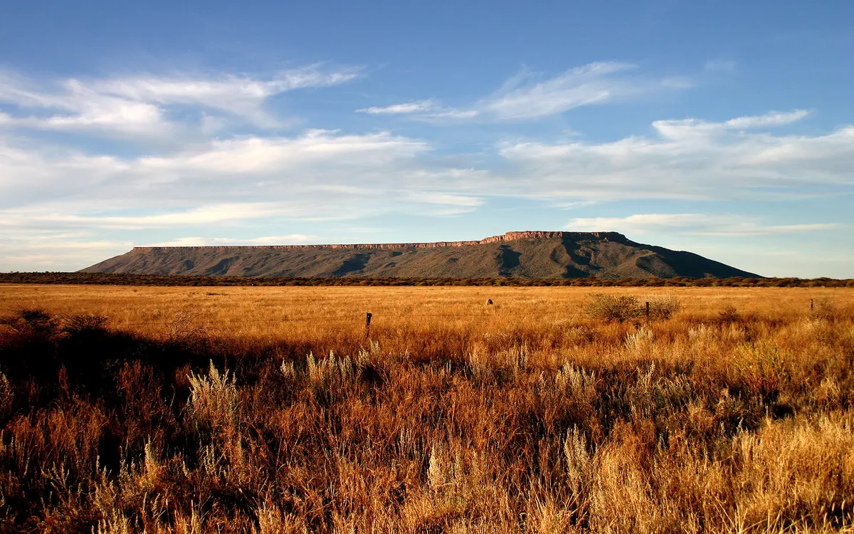
The Waterberg Plateau Park sits 68 km east of Otjiwarongo by road, a sandstone table mountain with more than 200 bird species and rare antelope on its lower slopes. Walking trails start from the rest camp, guided game drives leave in the morning and afternoon, and the German war graves from 1904 lie near the camp at the foot of the plateau.
The Cheetah Conservation Fund, 44 km east of Otjiwarongo, takes visitors 364 days a year for cheetah runs, feeding and its livestock guarding dogs. Okonjima has its own page. Fossil fans can see the Otjihaenamparero dinosaur tracks, a national monument since 1951, 23 km east of Kalkfeld.
The east is San country. The Nyae Nyae Conservancy around Tsumkwe (Tjumǃkui) covers about 9,000 km². It was gazetted in February 1998, and its members were the first in Namibia to earn from the communal conservancy programme. At Grashoek the Living Museum of the Ju/’Hoansi-San, Namibia’s first Living Museum, has been run by the Juǀʼhoansi themselves since 2004.
Good to know
The CDC recommends malaria tablets for Otjozondjupa. The UK’s NaTHNaC rates the region high risk from December to April and low risk from May to November, so ask a travel clinic about your dates. Tsumkwe has had a filling station since 2008, but bread, milk and eggs are rarely in stock, so shop in Grootfontein first. Coming from Gobabis, the 350 km of gravel to Tsumkwe passes no obvious fuel stop. Minor roads around Tsumkwe are deep sand and need a 4x4. Meat is confiscated at the Red Line veterinary fence heading south or east. Farms are private, so close any gate you open.
History and culture
Otjozondjupa is where the Herero war against German rule reached its turning point, at the Ohamakari waterhole below the Waterberg in August 1904, and where the genocide that followed began. Its far east is the home of the Juǀʼhoansi San, whom the American filmmaker John Marshall filmed from 1950. Knowing that past changes how the Waterberg, the war graves and the San villages read.
- Several thousand years ago
The San were the first people at the Waterberg and left rock engravings there that are believed to be several thousand years old. source
- 1896
Kahimemua Nguvauva, chief of the Mbanderu (a branch of the Herero), was sentenced to death after a quarrel with the Germans over a boundary in the Gobabis district, and was shot by the Schutztruppe, the German colonial army, on the bank of the Okahandja river. In the same year the Schutztruppe built the fort at Grootfontein. source
- 11 August 1904
In August 1904, months into the Herero war against German rule, more than 60,000 Herero and their herds had gathered at the Waterberg. Lothar von Trotha attacked on 11 August. The Herero call it the battle of Ohamakari, after the waterhole where the fighting centred, and most of them broke out to the south-east into the Omaheke sandveld. source
- 1904 to 1908
Von Trotha, acting on his own authority, issued an extermination order against the Herero, and most of those who had fled into the Omaheke died there of thirst, hunger or German killings. Between 40,000 and 80,000 Herero (about 80 percent of the people) and some 10,000 Nama died in the genocide, and about 1,000 Herero, Samuel Maharero among them, reached British Bechuanaland (now Botswana). source
- 9 July 1915
In the First World War the German forces in the territory surrendered unconditionally to General Louis Botha's South African troops at Khorab, just north of Otavi. The Treaty of Khorab ended German rule in what was then German South West Africa. source
- 1976 to 1989
In 1976 South Africa's apartheid government proclaimed Bushmanland, a homeland meant for the San. No San government was ever set up, only an advisory council in 1986. The homelands gave way in 1980 to ethnic administrations, which were abolished in May 1989 as the move to independence began. source
- 21 March 1990
The UN recognised SWAPO (the South West Africa People's Organisation) as the representative of the Namibian people in 1973, and on 21 March 1990 Namibia became independent from South Africa, with Sam Nujoma sworn in as its first president. source
- February 1998
The Nyae Nyae Conservancy around Tsumkwe, about 9,000 km² run by roughly 2,000 Juǀʼhoansi, was gazetted on 16 February 1998 and became the first in Namibia to earn from the communal conservancy programme, which lets rural communities manage and benefit from their wildlife. source
- Languages
- At the 2023 census Otjiherero was the main home language in 25.8 percent of households, followed by Khoekhoegowab (the Nama and Damara language) at 17.0 percent, Oshikwanyama at 14.2 percent, Afrikaans at 9.3 percent, Oshindonga at 5.3 percent and English at 5.1 percent. source
- Herero remembrance
- Herero descendants remember Ohamakari at Okakarara, about 110 km east of Otjiwarongo, near the graves of those who died. In May 2026 the governor's office organised the region's first Genocide Remembrance Day commemoration there, opening with a panel discussion, with horse riding and drills by Herero troops on the programme. source
- San culture
- At the Living Museum in Grashoek, Juǀʼhoansi San in traditional dress show the old hunter-gatherer way of life. Most of the programme is hands on (bow and arrow, a Juǀʼhoan skipping game, singing), and a guide puts it all into English. They call it ǀXao-o Juǀʼhoansi-Ga, the life of the Juǀʼhoansi. source
- German-speaking Namibians
- Otjiwarongo is one of the Namibian towns with a large German-speaking community, and German style buildings show it. Its Donatus School was once the Deutsche Schule Otjiwarongo. source
For German visitors: In August 2004, at the centenary commemoration in Okakarara, the German development minister Heidemarie Wieczorek-Zeul told a crowd of about 1,000 that Germans accepted their historic and moral responsibility and called the crushing of the Herero uprising genocide. Germany ruled out compensation at the time. source
For German visitors: German-speaking Namibians see the war graves at the Waterberg as part of their roots in the country. The Schutztruppe marked the battle's anniversary from 1905, and a yearly ceremony was held at the cemetery until 2003. source
For German visitors: The Living Culture Foundation Namibia, which helps communities set up Living Museums such as the one at Grashoek, is a German-Namibian organisation that was founded in Tangermünde in Germany. source
For American visitors: The Boston-born filmmaker John Marshall first met the Juǀʼhoansi of Nyae Nyae in 1950 on a family expedition and filmed them for 50 years, starting with The Hunters (1957). He later helped found what became the Nyae Nyae Development Foundation, and his footage at the Smithsonian was added to UNESCO's Memory of the World Register in 2009. source
For American visitors: The American zoologist Laurie Marker founded the Cheetah Conservation Fund in 1990 as a research outpost in a small farmhouse near Otjiwarongo, after learning that farmers were killing around 900 cheetahs a year. Its livestock guarding dog programme dates from 1994. source
For American visitors: In 2001 a group of Herero filed a case in the United States against the German government and two German companies, seeking compensation for the genocide. source
Main sights in Otjozondjupa
7- Waterberg Plateau Park
The battlefield of 1904 lies at the foot of the plateau, where there is a German soldiers' cemetery and a plaque for the fallen Herero put up in 1984. Some of the old fighting ground is on today's Hamakari guest farm, which also has German graves.
Wikipedia (German): Schlacht am Waterberg - Ohamakari graves and Okakarara Cultural Centre
The graves of Herero who died in the war lie near the cultural centre on the edge of Okakarara, which hosted the main events of the region's first Genocide Remembrance Day in May 2026.
The Namibian: Otjozondjupa to mark historic first Genocide Day commemoration at Ohamakari (27 May 2026) - Living Museum of the Ju/'Hoansi-San, Grashoek
Namibia's first Living Museum, started by the Namibian tour guide Werner Pfeifer and the Grashoek teacher Ghau N!aici, and run entirely by the Juǀʼhoansi themselves since July 2004.
Living Culture Foundation Namibia: Living Museum of the Ju/'Hoansi-San - Khorab Memorial
On a farm 2.6 km north of Otavi, it marks the Treaty of Khorab of 1915, under which about 4,000 German soldiers surrendered to Louis Botha's South African forces. It was dedicated in 1973.
Wikipedia: Khorab Memorial - Otjihaenamparero dinosaur tracks
More than 30 three-toed prints of bipedal dinosaurs in Etjo sandstone, 23 km east of Kalkfeld, declared a national monument in 1951.
Wikipedia: Otjihaenamparero dinosaur tracks - Herero graves and Rhenish mission church, Okahandja
The Herero chiefs Tjamuaha, Maharero and Samuel Maharero are buried on what was Tjamuaha's cattle kraal (livestock enclosure). The Rhenish mission church, consecrated in 1876, is the oldest building in Okahandja.
National Heritage Council of Namibia, heritage places register - Old Fort, Grootfontein
The fort the Schutztruppe built in 1896 was used by the South West Africa administration after 1915 as headquarters and barracks, later as a school and hostel, and opened as a museum in 1983.
National Heritage Council of Namibia, heritage places register
Did you know?
- Tsumkwe constituency in the east covers 28,491 km² but had only 15,357 people in 2023, about one person for every two square kilometres. source
- Nǃxau ǂToma, the San farmer who starred in The Gods Must Be Crazy (1980), was buried at Tsumkwe on 12 July 2003, next to the grave of his second wife. source
- The dinosaur tracks at Otjihaenamparero, east of Kalkfeld, were first reported as dinosaur prints by the palaeontologist Friedrich von Huene in 1925. The longest trackway in the sandstone runs about 32 m. source
- Waterberg means water mountain: the sandstone of the plateau soaks up rain and lets it out again as springs on the south-east side. source
Checked 7 October 2026.
In and around Otjozondjupa
68 places listedWhere to stay in Otjozondjupa 53

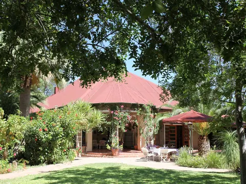
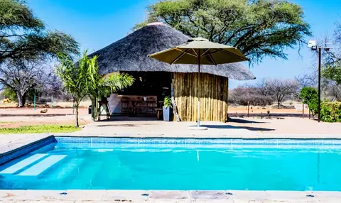
 HotelOhange Namibia Lodge+264 61 224 712ohange.com
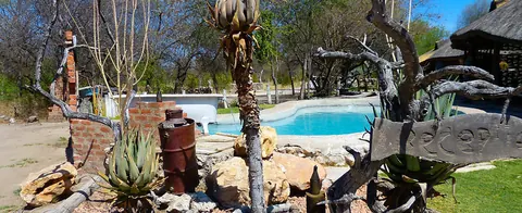 CampsiteRoys Rest Camp+264 67 240 302roys-rest-camp.com
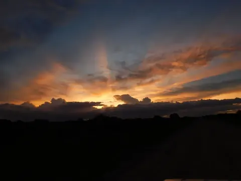
- 19.35°S 18.29°ECampsiteFiume Lodge & Camp+264 81 127 6706due-north.net
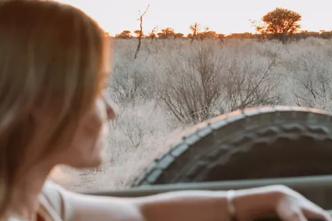
- 20.61°S 17.34°ECampsiteHamakari Camping+264 67 306 633hamakari.com
Show all 53 places to stay
- KlipKop Lodge & Farming · Guest house+264 81 214 3765klipkop.de
- Nhoma Safari Camp · Hotel+264 81 826 6677nhomasafaricamp.com
- Okawaka Jagtfarm · Hotelotjiruze.com
- Ombu Camping · Campsiteombu.co.na
- Opperman Safari House · Hotel+264 81 278 0283oppermansafarihouse.com
- Otjiwa Lodge · Hotelotjiwa.com.na
- Otjiwa Mountain Lodge · Hotelotjiwa.com.na
- Ouhave Country Home · Resortouhave.com
- Wildacker Guestfarm · Guest housewildacker-namibia.com
- Frans Indongo Lodge · Hotel+264 67 307 946indongolodge.com
- Guest Farm Dinosaur's Tracks Campsite · Campsite+264 81 462 2983dinosaurstracks.com
- Otjitoroa Guest & Gamefarm · Guest house+264 67 303 001namibia-live.com
- Otjiwa Lodge Campsite · Campsite+264 67 306 671otjiwa.com.na
- Midgard Otjihavera · Resort+264 62 503 888ol-leisure.com
- Waterberg Guest Farm · Hotelwaterbergnamibia.com
- Grashoek Living Village Campground · Campsite · Grashoek
- Haasenhof Guestfarm · Hotelhaasenhof.com
- Khoi-Khoi Guesthouse · Guest housekhoikhoiguesthouse.com
- Mount Etjo Safari Lodge · Hotel+264 67 290 173mount-etjo.com
- Ovita Wildlife (Lodge/Campsite) · Guest houseovitawildlife.com
- Weaver's Rock Guest Farm · Hotel
- Frans Indongo Campsite · Campsite
- Insele Lodge · Hotel
- Mount Etjo Camping Site · Campsite
- Ovisume Lodge · Resort
- Yakandonga Lodge · Hotel+264 81 287 6359
- Baobab Tree Camp · Campsite
- Cheetah View Lodge · Hotel
- Düsternbrook · Hotel
- Farm Dornhügel · Guest house
- Gerus Campsite · Campsite
- Heisers Olive Farm · Guest house
- Hochfeld Guesthouse · Guest house
- Kamrav Guestfarm · Guest house
- Namibia Dinosaur's Tracks Guest Farm · Guest house
- Okatjuru Game Farm · Guest house
- Omatako Valley Rest Camp · Campsite
- Omega Rest Camp · Campsite
- Oropoko Lodge · Hotel
- Paradise Rest Camp · Campsite
- TRAIN · Hostel
- Train Car · Chalet
- Wabi Game Lodge · Hotel
- Wewelsburg Camping · Campsite
Sights 10
- Living Museum of the Ju/'Hoansi-SanMuseum · Grashoek+264 81 610 0052lcfn.info
- Auto MuseumMuseum
- BaobabAttraction
- Dinosaur TracksAttraction
- Dinosaur Tracks Saurichnium DamarenseAttraction
- DorslandboomAttraction
- Here lies Carl ListMonument
- Small Dinosaur TracksAttraction
Restaurants and cafes 4
- Bali Boma & BBQRestaurant
- Carl’s Dining Room & TerraceRestaurant
- Cheetah CaféCafe
- Die SkuurRestaurant
Bars and pubs 1
- Carl's Bar & LoungeBar
Map of Otjozondjupa
See every place on this map as a list