Town · Otjozondjupa, Namibia
Grootfontein
Farming town in the Otavi Triangle on the B8, with the Hoba meteorite just outside town, a museum in an 1896 fort and the last proper shopping before Tsumkwe.
Short answer
Grootfontein is in Otjozondjupa, Namibia. This page lists 17 places to stay, 7 places to eat and drink and 2 sights. The nearest park with an entry fee on this site is Waterberg Plateau Park, about 128 km away, where international adults pay from N$280.
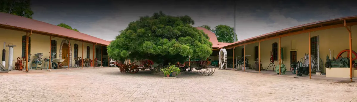
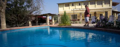
- Places to stay
- 17
- Eat and drink
- 7
- Sights
- 2
- Park fee nearby: Waterberg Plateau Park
- US$17 €15 · N$280about 128 km away
In and around Grootfontein
26 places listedWhere to stay in Grootfontein 17
- 19.53°S 18.11°EGuest houseMaori Rest CampGrootfontein+264 67 242 351sacampsites.co.za
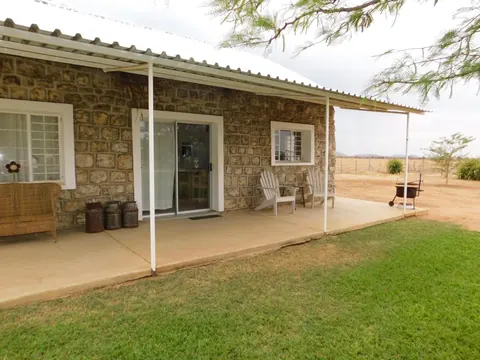 Guest houseMeteorite Rest Camp
- 19.56°S 18.10°EHotelStonehouse LodgeToenessen St, Grootfontein+264 81 289 9393stonehouse.iway.na
- 19.56°S 18.08°EHotelBambi LodgeTsumeb - Grootfontein Highwaybooking.com
- 19.56°S 18.10°EHostelBeyer Self-CateringCourtney-Clark Road, Grootfonteinbeyer-namibia.com
- 19.53°S 18.02°ECampsiteBush Baby Camp Site+264 67 243 391
- 19.57°S 18.10°EHotelMeteor Travel InnOkavango Road, Grootfontein
- 19.59°S 18.05°EHotelPeace Garden LodgeOtavi Main Road, Grootfontein
Show all 17 places to stay
- The Greenhill Chalets · Chalet · Galton St, Grootfontein
- Assers Bed & Breakfast · Guest house
- Bush Baby Lodge · Hotel
- Courtyard Guesthouse · Guest house
- Kalkfontein Guest Farm · Hotel
- Maori · Campsite
- Pondoki Guestcamp · Campsite
- Tigerquelle Guest Farm · Hotel
Sights 2

- Grootfontein MuseumMuseum · Dr. Nickey Iyambo St, Grootfontein+264 67 242 456grootfonteinmuseum.com
Restaurants and cafes 5
- Decent AfricaRestaurant · regional+264 81 388 6507
- Internet CafeCafe
- Kitchen caféCafe
- Pondoki ResctcampRestaurant
- Purple Fig BistroRestaurant
Bars and pubs 2
- KingsBar
- New Age BarBar
Grootfontein is a farming and trading town of about 27,000 people (2023 census) in the Otavi Triangle, the wetter corner of northern Namibia it shares with Otavi and Tsumeb. Most visitors come for the Hoba meteorite, the largest known on Earth, which still lies where it fell west of town. The museum in the old German fort is worth an hour, and this is where you stock up before the gravel road to Tsumkwe.
Getting there
Grootfontein is on the B8, a main trunk road that starts at Otavi and carries on to Rundu, roughly 250 km further north. The big coaches between Windhoek and Lusaka come through town. The airfield 4 km south of town is a Namibian Air Force base.
Coming from the north or east you cross the Red Line, the veterinary fence, and any meat you carry is confiscated at the checkpoint. Buy braai (barbecue) meat once you are through it.
When to go
Most of the rain falls from December to March, when the farmland turns properly green. June and July bring cold nights, with average lows near 7°C, and October is the hottest month. Spring is the pretty time, when the jacaranda and flamboyant trees flower all over town.
What to do
The Hoba meteorite is the reason for the detour. It is a flat slab of iron and nickel about 2.7 m square and under a metre thick, estimated at more than 60 tonnes, and it has never been moved. A farmer struck it with his plough in 1920. Since the owner gave the site to the state in 1987 it has had a visitor centre and a ring of stone seating, and a guide walks you in. It lies about 24 km west of town. Leave on the C42, the Tsumeb road, and the D2859 turns off to the west within the first 500 m; the meteorite is signposted roughly 22 km along it. In the end it is a big lump of metal, and at least one guidebook reckons a quick stop is enough.
Back in town, the Grootfontein Museum (the Old Fort, Alte Fort in German) fills the fort the Schutztruppe, the German colonial army, built in 1896. It covers the short lived Boer republic of Upingtonia, mining, farm life and the region’s peoples, and holds the 1920 report on the meteorite. Volunteers run it, so it opens on weekday mornings and otherwise by arrangement. Phone a few hours ahead. Tours run in German, English and Afrikaans.
Good to know
Otjozondjupa is one of the regions where the CDC lists malaria and recommends tablets, so talk to your doctor before you travel. For Tsumkwe and the San villages to the east you leave the B8 57 km north of town and take the C44, a gravel road. Stock up on fresh food here. Tsumkwe has fuel, but bread, eggs and milk are rarely in stock. Dragon’s Breath, the cave with the huge underground lake, is on private land and not open to visitors.
History and culture
Grootfontein ("big spring" in Afrikaans) had Damara and Herero names long before Boer trekkers declared a short lived republic here in 1885, and it went on to be a German colonial station and a South African military town. Much of that story is told in one building, the 1896 fort that is now the town museum, a short drive from the iron meteorite that fell in a nearby field less than 80,000 years ago.
- Before 1885
Long before the Afrikaans name Grootfontein ("big spring") the place had others. The Damara called it Gei-ǀous and the Herero Otjiwanda Tjongue, which means "the leopard's hill edge". source
- 1885 to 1887
The trader William Worthington Jordan bought a huge tract of land from Kambonde kaMpingana, king of Ondonga in Owamboland, and gave farms free to Dorsland trekkers, Boer families coming back from Angola. (Boer means farmer, the name for the Dutch speaking settlers who became Afrikaners.) On 20 October 1885 they declared the Republic of Upingtonia, soon renamed Lijdensrust, with Grootfontein as its capital. Jordan was killed in 1886 by Nehale lya Mpingana, Kambonde's brother and rival, the republic collapsed, and in 1887 the area became part of German South West Africa. source
- 1892 to 1896
The South West Africa Company, set up in London in 1892 to work a German mining and railway concession in the north, chose Grootfontein as its headquarters. In September 1896 a detachment of 25 Schutztruppe soldiers (the German colonial army) was posted here and built the fort that still stands. source
- 1904 to 1908
After the Herero rose against German rule in 1904 and were defeated at Waterberg, the German commander Lothar von Trotha drove survivors into the Omaheke desert and set up a line of military posts some 250 km long between Gobabis and Grootfontein along its western edge. About 80 percent of the Herero and half of the Nama died in what Germany acknowledged as genocide in 2015. source
- 1908 to 1920
The railway from Otavi reached Grootfontein in 1908, so the zinc and vanadium mines at Abenab and Berg Aukas could ship ore in bulk. In the First World War the town was briefly the seat of the German colonial government after Windhoek fell in May 1915. Union troops from South Africa occupied it in July 1915, and from 1920 South Africa ruled the territory under a League of Nations mandate. source
- 1943 to 1970s
From 1943 SWANLA, the agency that recruited contract labourers from the northern areas for mines, fishing and farms, had its headquarters in Grootfontein, and workers passing through shopped here on their way home. Its closure in the 1970s cost the town much of that trade. In the same decade South Africa built a large army garrison here and expanded the airfield into a major military base. source
- 1971 to 1990
In 1971 a general strike of contract workers against the labour system began in Walvis Bay and spread to the mines at Tsumeb and Grootfontein. The war between South African forces and PLAN, the armed wing of SWAPO, which had begun in 1966, ended with Namibia's independence on 21 March 1990. source
- Languages
- No single language dominates in Otjozondjupa. In the 2023 census the main home languages of its households were Otjiherero (25.8%), Khoekhoegowab, the Damara and Nama language (17.0%), Oshikwanyama (14.2%), Afrikaans (9.3%), Oshindonga (5.3%), English (5.1%) and Rukwangali (4.6%), with several San languages, Juǀ'hoansi and ǃKung among them, spoken by smaller numbers. English is the official language. source
- The Grootfontein Show
- The town's agricultural show has been held every year since 1911 and is the second biggest trade and farming fair in Namibia after the Windhoek Show. source
- Farming country
- Grootfontein gets around 550 mm of rain a year, well above the Namibian average, so the district grows crops as well as raising cattle. source
For German visitors: The Germans built the fort that houses the museum in 1896, and guided tours there are offered in German as well as English and Afrikaans. source
For German visitors: August Stauch, the man credited with finding the diamond fields near Lüderitz (ǃNamiǂNûs), owned the farm Rietfontein west of Grootfontein. With German government money he set up a land company that sold farms on easy terms, and a creamery was started so farmers had a steady income from cream. source
For German visitors: Paul Rohrbach, the settlement commissioner sent out by the Colonial Office, was in Grootfontein in the first months of the Herero war in 1904, and described those weeks in diary form in his book Aus Südwest-Afrikas schweren Tagen. source
For German visitors: German schooling has a long run here. A government school opened in 1902, the German School Association has run a school hostel since 1938, and since 2022 the German school has taught in the buildings of the Karstveld Academy. source
For American visitors: The model Behati Prinsloo was born in Grootfontein in 1988 and went to school here. She became a Victoria's Secret Angel in 2009 and married Adam Levine of Maroon 5 in 2014. source
Main sights in Grootfontein
4- Grootfontein Museum (Old Fort)
The Schutztruppe and local people built the fort in 1896 and it was extended many times, later serving the South West Africa administration as headquarters and barracks, then as a school and hostel. Restored from 1970, it was declared a national monument in 1975 and opened as a museum on 20 October 1983.
National Heritage Council of Namibia: Heritage places - Museum collections
Permanent displays cover the founding of the Republic of Upingtonia, the growth of Grootfontein, hunting, and ornaments and crafts of Ovambo and San communities, along with a large collection of photo and film equipment and Georg Hartmann's first map of northern Namibia.
Museums Association of Namibia: Grootfontein Museum - Hoba meteorite
The largest known meteorite, found by the farmer Jacobus Hermanus Brits while ploughing in 1920 and never moved. It was declared a national monument in 1955 to put a stop to attempts to move it, and in 1987 the farm owner gave the site to the state, which opened a visitor centre with circular stone seating around it.
Wikipedia: Hoba meteorite - Grave of Axel Eriksson
Eriksson, a Swedish trader who came to Namibia in the 1860s, helped the Dorsland trekkers and settled with Jordan on Urupupa, now part of the farm Rietfontein. He died there in 1901 and his grave is a national monument.
National Heritage Council of Namibia: Heritage places
Did you know?
- The land Jordan bought for the Boer republic, stretching about 170 km from Okaukuejo to Fischer's Pan, was paid for with 25 firearms, a salted horse (one that had survived horse sickness) and a cask of brandy. source
- The Hoba meteorite is about twice as heavy as Ahnighito, the largest piece of the Cape York meteorite, on show at the American Museum of Natural History in New York. Its name comes from a Khoekhoegowab word meaning "gift". source
- Hoba fell to Earth less than 80,000 years ago, but the metal itself is reckoned to be between 190 and 410 million years old. source
- Before the visitor centre opened in 1987, people chipped and sawed pieces off the meteorite. A 2.8 kg block that a visitor cut off with a hand saw in 1968 was sold at auction in Los Angeles in December 2021. source
- The baobab on the farm Keibib, about 60 km north of town, has a trunk 18.5 m round and may be up to 3,000 years old. It was declared a national monument on 2 July 1951. source
- The town counted 26,839 people in the 2023 census, which makes it the third biggest town in Otjozondjupa after Otjiwarongo and Okahandja. source
Checked 7 October 2026.
The meteorite they wanted to mine for nickel
On 26 May 1921 the general manager of the South West Africa Company in Grootfontein, a Mr Tönnesen, wrote to the London office about a lump of metal on the farm Hoba West. From an assay and a rough measurement he worked out that it might hold ten tons of nickel. The metal was too ductile to blast, he reported, so the company would try a saw and after that an oxy-acetylene flame.
That letter is the earliest mention of the Hoba meteorite that L. J. Spencer of the British Museum could find when he wrote it up in 1932, and it treats the thing as ore. Spencer’s explanation for why nothing came of it was that meteorites in South West Africa belonged to the government. The letters from 1921 kept at the museum in the old fort are less tidy. Pretoria wanted the meteorite, or a large piece of it, for a South African museum, the Inspector of Mines doubted any saw or flame was up to the job, and in November Tönnesen was still asking who owned it.
Two men claimed the find
The usual version has the farmer Jacobus Hermanus Brits ploughing behind an ox in 1920 when the plough screeched and stopped. Brits told it differently. In a signed statement of October 1954 he said he was living on the farm and out hunting one winter when he sat down on an odd black rock in the white limestone, scraped it with his knife and saw it shine. He cut off a piece with a chisel and took it to the company in Grootfontein. The statement lay in the museum until the Cape Town physicist Peter Spargo published it in 2008.
Spencer never heard of Brits. The man in his paper is Michael Hanssen, who occupied the farm and wrote to Pretoria in September 1921 announcing that he had discovered a huge meteorite and asking what it might be worth. By the time Spencer made enquiries Hanssen had left, and “late in 1920” was as close as he could get to a date.
Spencer saw it on 5 September 1929, the last day of an International Geological Congress excursion. One car broke down on the way from Tsumeb, and most of the delegates had chosen the game around Etosha instead. The steel tape measurements he published work out at 60 tons, the figure still quoted.
Two days and a pile of hacksaw blades
In those years the top of the meteorite sat level with the veld, and Spencer noted that a dozen people could walk about on it. Round the metal was a foot of dark, flaky rust he called iron-shale, and by adding that back on he reckoned the block was nearer 88 tons before it started to weather.
The block is also a magnet. W. R. Feldtmann, who was running the company by then, took a compass to it and found one end pulling the south point of the needle and the other end the north, with a dead zone in the middle. The scars have a history too. In 1930, with the Administrator’s permission, Feldtmann had a wedge of about 2.5 kg cut off for the British Museum. It took two workers two days and a great many hacksaw blades. The piece already carried two older cuts nobody had authorised, and one top edge had been melted with a blowpipe by somebody Spencer called “some stupid person” in print. Souvenir hunters kept at it into the 1960s at least. One estimate puts the total loss at half a ton.
A fever swamp before it was a town
The big spring was the reason anyone stopped here, and it nearly finished them. The Boers of the 1885 republic led the fountain water onto wheat, mealies and tobacco, and malaria was one of the things that drove them out two years later. A second trek came up from the Transvaal in 1892 under Jean Lombard, and the company let some of the families settle. The heavy rains of 1896 and 1897 brought fever again and many of them retreated to Omaruru.
The man in charge of the district from 1897 to 1900 was an army doctor, Philalethes Kuhn, who went on to a career in tropical medicine in Germany. One history of the trekkers credits him with draining the marsh round the spring and says that is what brought the Boers back. The Tree Park in town is close to that same fountain.
The ape in the vanadium mine
The mine at Berg Aukas, about 20 km east of town, produced something stranger than zinc and vanadium. On 4 June 1991 the palaeontologist Martin Pickford found part of a lower jaw, molars still in place, in a block of cave breccia from the mine. It was named Otavipithecus namibiensis the following year. The animal was an ape of 15 to 20 kg that lived on fruit and soft leaves about 13 million years ago, and it was the first ape of that age found anywhere in southern Africa.
One bird worth the stop
Grootfontein has no game to speak of, but birders stop for one species. The black-faced babbler lives only in northern Namibia, the north-west corner of Botswana and Angola, and one field guide calls it more furtive than other babblers. Roy’s Camp, about 55 km up the B8 near the Tsumkwe turnoff, is the exception. A piece in Travel News Namibia in 2010 had the birds going about the camp in parties of four to seven, turning over leaf litter and making a nasal racket, with a nest just behind the restaurant. On the 4x4 Community forum in 2023 one regular called the camp the best place on the planet for them, and four others named it as the stop between Grootfontein and Rundu. The bare-cheeked babbler is a different trip: it is a bird of the north-west, around Kunene and Etosha.
Map of Grootfontein
See every place on this map as a list