Region · Namibia
Zambezi
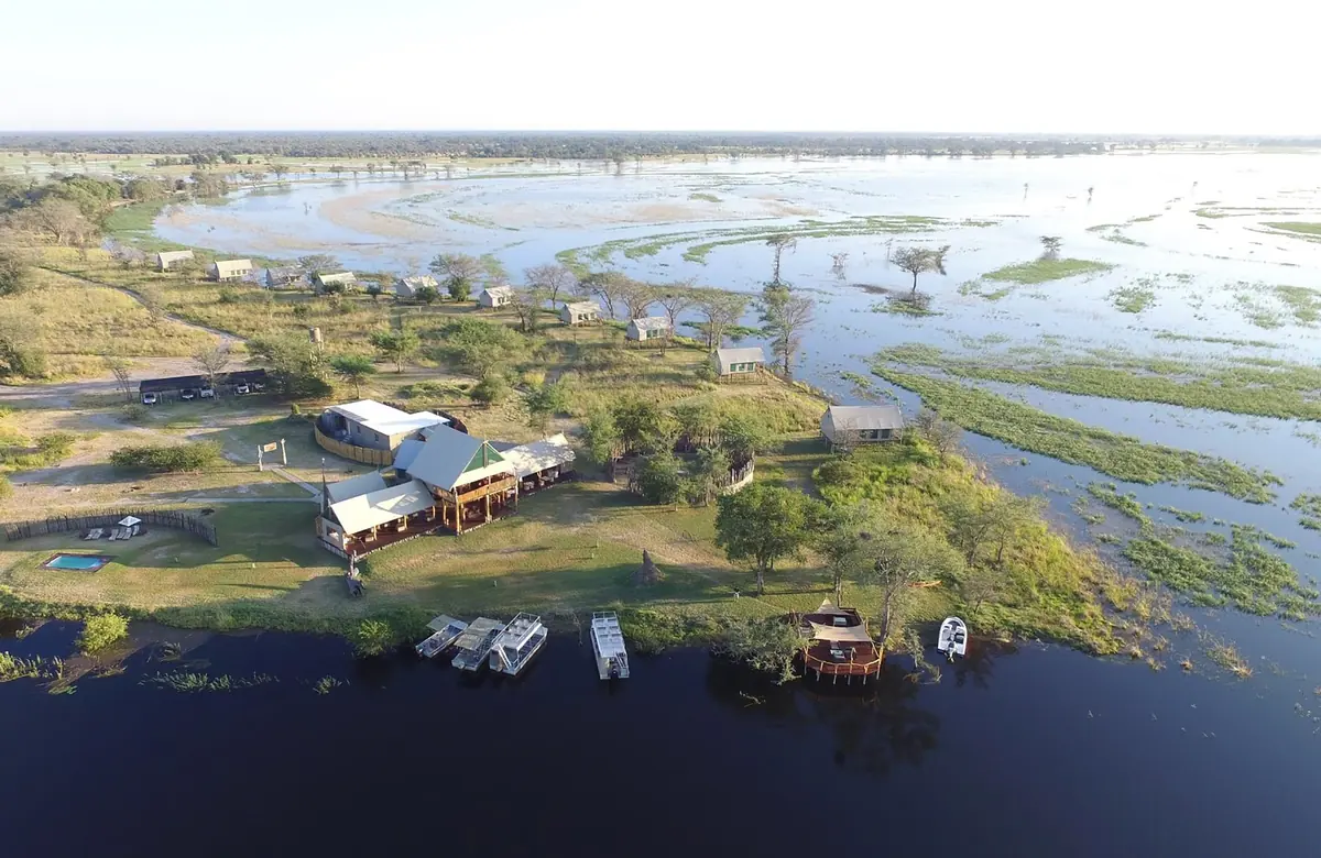
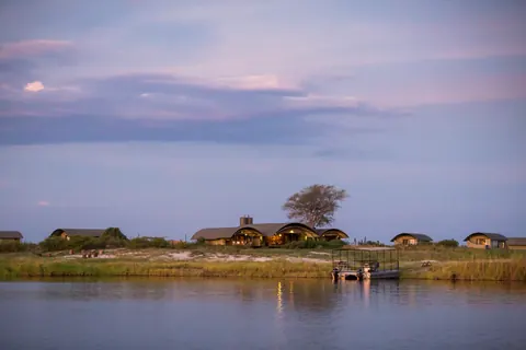
Namibia's wet north-eastern corner (the old Caprivi Region), ringed by the Zambezi, Kwando and Chobe rivers, with three national parks, Katima Mulilo and borders to Zambia and Botswana.
Short answer
This page covers 3 parks and reserves and 3 towns and cities in Zambezi. 3 of the parks have checked entry fees: international adults pay from N$200 at Bwabwata National Park to N$200 at Nkasa Rupara National Park.
- Parks and reserves
- 3
- Towns and cities
- 3
- Places to stay
- 15
- Where
- Namibia17.99°S 23.42°E
Parks and reserves in Zambezi
3Towns and cities in Zambezi
3Written up in smaller places around Zambezi
1
The Zambezi Region is the eastern end of the Caprivi Strip, the long arm of Namibia that reaches out between Angola, Zambia and Botswana towards the Victoria Falls. It was called the Caprivi Region until 2013. Forget the desert. This is the wettest region in the country, with rivers on almost every side and elephants crossing the main road. The 2023 census counted 142,373 people, about a third of them in Katima Mulilo, the capital.
Getting there
Nearly everyone drives in on the tarred B8. Rundu to Katima Mulilo is about 500 km, with a long stretch through Bwabwata National Park, and Kongola is 112 km short of Katima. Flights from Windhoek land a few times a week at Katima Mulilo Airport, 18 km south-west of town. Plenty of people are passing through: the Katima Mulilo bridge crosses the Zambezi to Sesheke in Zambia, and the Ngoma bridge over the Chobe leads into Botswana. Impalila Island, at the eastern tip, is reached only by boat.
When to go
The rains fall from about December to March. For game, pick the dry months, roughly May to November, when big herds of elephant and buffalo keep close to the Kwando, Zambezi and Chobe. The wet months (December to April) suit birders better, with lily-covered pans full of waterbirds and hippos. Flood levels are hard to predict. The Zambezi and Kwando rise with rain that falls far away in Zambia and Angola, and only in a wet year do they spread far over the floodplains.
What to do
Most people come for the three parks. Bwabwata’s eastern end and Mudumu both run along the Kwando River near Kongola, and Nkasa Rupara, in the far south on the Botswana border, is the largest protected wetland in Namibia. Mudumu has no fence, and the region is part of a five-country conservation area (KAZA), so animals move freely to and from Botswana. More than 400 bird species have been recorded in the region. Carmine bee-eaters breed on the Zambezi banks east of Katima from September to November.
For the people, try the Mafwe Living Museum above the Kwando, where villagers show their traditional way of life, or the small David Livingstone Museum at Sangwali. River cruises and tigerfish are on the Katima Mulilo page.
Good to know
UK health advice puts the whole region at high risk of malaria all year and the CDC recommends tablets, so see a travel clinic before you leave. The B8 is tarred, and so is the C49 loop between Kongola and Katima Mulilo. Most other roads are sandy, corrugated and muddy after rain, and in the wet season some cannot be driven at all, so phone your lodge first. There is no fuel in the parks, so fill up in town before you go in. Slow down for elephants on the B8. Every river has crocodiles and hippos, so do not swim. Park fees are in the tables on the Bwabwata, Mudumu and Nkasa Rupara pages.
History and culture
The Zambezi Region is the eastern end of the Caprivi Strip, river country of the Subia, Fwe, Yeyi, Totela and Mbukushu peoples and of Khwe San in the west, which a treaty signed in Europe in 1890 handed to German South West Africa so that Germany could reach the Zambezi. Its past runs through Subia chiefdoms and the Lozi and Makololo kingdoms, a forgotten German outpost, a South African homeland and war zone, a failed secession in 1999 and a change of name in 2013.
- 1570s to 1750
Subia tradition names Itenge as the first known chief, who led his people from the north to the Kafue floodplains in today's Zambia, and his son Ikuhane took them on to the Zambezi valley and the Chobe. The Zambezi and Chobe basin is still called Iteenge in Subiya. In the 1700s the chief Nsundano I set up his headquarters at Luchindo, opposite today's Ngoma border post, and Luchindo is now a shrine for all Subia. source
- 1851
Sebetwane, a Sotho chief who had led his people, later known as the Makololo, on a trek of more than 1,200 km from near today's Senekal in the Free State, crossed the Zambezi and conquered the Lozi kingdom, ruling from his capital at Linyanti. The Scottish missionary David Livingstone reached him there, and Sebetwane died on 7 July 1851, shortly after their meeting. source
- 1890
Under the Heligoland Zanzibar Treaty with Britain, Germany gave up its interest in Zanzibar and took this strip of land for German South West Africa, naming it after Chancellor Leo von Caprivi. The plan was a river route to German East Africa, but the Victoria Falls and other falls downstream made the Zambezi useless for that. Before colonial rule the land was known as Itenge. source
- 1966 to 1990
The Caprivi Game Reserve was proclaimed in 1966 and upgraded to a game park in 1968, but during the liberation war the South African Defence Force declared it a military area. Only after independence could it be run as a conservation area, and a survey then found about 5,000 people living inside it. It became Bwabwata National Park in 2007. source
- 1972 to 1989
Under apartheid, South Africa set up East Caprivi (also called Itenge) as a Bantustan, an ethnic homeland, in 1972, and granted it self-government in 1976. Unlike the other homelands in the territory it was run from Pretoria. It became an ethnic Representative Authority in 1980 and was abolished in May 1989, at the start of the move to independence. source
- 1966 to 21 March 1990
In 1966 SWAPO, the South West Africa People's Organisation, began an armed struggle against South African rule that grew into the wider South African Border War. Namibia became independent on 21 March 1990. source
- 1999
On 2 August 1999 the Caprivi Liberation Army, which wanted the strip to break away from Namibia, attacked the army base, police station, border post and state radio station in Katima Mulilo. Fourteen people were killed and a state of emergency followed. About 3,000 people fled to Botswana for fear of reprisals, and 132 people were arrested and charged with high treason in a trial so delayed that acquittals only came in 2012. source
- 2013
On 8 August 2013 President Hifikepunye Pohamba announced that the Caprivi Region would be renamed Zambezi, after the river, as part of removing colonial names from the map. source
- Languages
- In the 2023 census the main home languages of the region's households were Sisubiya (30.5%), Silozi (25.8%) and Sifwe (17.5%), followed by Sitotela (7.5%), Siyeyi (5.2%) and Thimbukushu (4.0%). Only 2.1% of households spoke English at home and 0.7% the Khwe San language. source
- English and Fanagalo
- Thanks to long contact with Zambia, Zimbabwe and Botswana, most people here speak English. Many older men also know Fanagalo, the pidgin used on the Johannesburg gold mines where they once worked. Afrikaans, common elsewhere in Namibia, is barely heard. source
- Royal seats
- Traditional kingdoms still matter here. Bukalo, 43 km south-east of Katima Mulilo, is the royal headquarters of the Subia. King Mutwa Liswani II (who reigned from 1965 to 1996) founded the royal palace there, and it is still the seat of the Subia Traditional Authority. source
- Lusata Festival
- The Mafwe hold their Lusata festival every year in the last week of September at Chinchimane, the royal village about 6 km from Katima Mulilo. It is named after the king's mace, an ivory-studded stick, and chiefs come from Zambia and Botswana for it. source
- Living from the rivers
- Most people live along the rivers and the main roads, fishing and farming small fields of maize, millet and groundnuts among other crops, and grazing their cattle on shared communal land. source
For German visitors: The strip carries a German name. In German colonial times it was the Caprivizipfel, after Leo von Caprivi, the German chancellor who negotiated the 1890 land exchange with Britain that brought it into German South West Africa. source
For German visitors: Hauptmann Kurt Streitwolf founded Schuckmannsburg on 7 February 1909 as the 'Kaiserliche Residentur' (Imperial Residence) of the strip, naming it after Governor Bruno von Schuckmann. His successor handed it over without a fight to British South Africa Police from Southern Rhodesia in September 1914, and it was renamed Luhonono, after a local tree, in 2013. source
For German visitors: Germany's KfW development bank and the German government are among the funders of the KAZA conservation area. The five countries signed its treaty on 18 August 2011, and it was formally opened in Katima Mulilo on 15 March 2012. source
For German visitors: The Mafwe Living Museum is supported by the Living Culture Foundation Namibia, a German-Namibian organisation founded in Tangermünde in Germany that helps communities set up living museums. source
Main sights in Zambezi
6- Mafwe Living Museum
An open-air museum opened in February 2008: a traditional village and fields on a hill above the Kwando River, where Mafwe people in traditional dress show how they used to live. Visitors can try things like net weaving and tasting the food, and a guide translates into English.
Living Culture Foundation Namibia, Mafwe Living Museum - David Livingstone Museum, Sangwali
A one-room museum at Sangwali, about 130 km from Katima Mulilo, founded by local teacher Linus Mukwata of the Mayeyi to tell the story of Livingstone's travels from Kuruman to Sangwali, where he lived for a time and dined with Sebetwane. It began in a clay and grass hut and was rebuilt in brick with EU support.
The Namibian, Museum to honour David Livingstone - Zambezi Museum, Katima Mulilo
Opened on 18 May 2021, International Museums Day, the region's museum looks at how people here have lived with the rivers, wildlife and forests, and how they now deal with deforestation, fish stocks and climate change.
Museums Association of Namibia, Zambezi Museum - Luhonono (Schuckmannsburg)
The German seat of the Caprivi from 1909, 65 km east of Katima Mulilo near the Zambezi. Most buildings were pulled down for their bricks after the capital moved to Katima in 1935, and the only relic left is a small brick house of about 12 square metres from 1909.
Wikipedia, Luhonono - Sekeletu's grave, Malengalenga
Local conservancies have marked this as one of their historical sites: the grave of Sekeletu, a man whose walking stick is said to have grown into a tree, lies close to that tree. Ask a conservancy guide to take you.
Namibia Wetland Route (namibiawetland.com), Zambezi Region birding and history - Impalila baobab
A baobab in the Impalila conservancy at the eastern tip of the region. Climb to the top and you can see the point where Namibia, Botswana, Zambia and Zimbabwe meet.
Namibia Wetland Route (namibiawetland.com), Zambezi Region birding and history
Did you know?
- From 1918 to 1929 the Caprivi Strip was run as part of the British Bechuanaland Protectorate, today's Botswana, before it was handed back to South West Africa. source
- Impalila Island, at the far eastern tip, has no road link to the rest of Namibia and can only be reached by boat. Most of its 2,500 to 3,000 people use the border post on the island, shop in Botswana and pay mainly in Botswana pula rather than Namibian dollars. source
- In December 1999 the International Court of Justice ruled that Kasikili Island in the Chobe River (Sedudu to Botswana) belongs to Botswana, although people from the eastern Caprivi had used it for grazing, reed cutting and burials for generations. source
- The region holds two of Namibia's five rivers that flow all year, the Zambezi and the Kwando, and up to a third of it is floodplain. source
- The Mayeyi were only recognised as a separate tribe in Namibia in 1992. Before that they came under the Mafwe traditional authority; their royal homestead is at Sangwali. source
- The Kavango Zambezi Transfrontier Conservation Area (KAZA), which takes in the Caprivi Strip, covers about 520,000 square kilometres across five countries: Angola, Botswana, Namibia, Zambia and Zimbabwe. source
Checked 7 October 2026.
In and around Zambezi
23 places listedWhere to stay in Zambezi 15
- 17.95°S 23.32°ECampsiteKazondwe Camp & Lodge+264 81 790 5778due-north.net
- 17.92°S 23.32°ECampsiteMavunje Campsite+264 81 461 9608mashiriversafaris.com
- 18.04°S 23.32°EHotelCamp Kwandocampkwando.cc.na
- 18.05°S 23.33°ECampsiteMalyo Wilderness Campcaprivi.biz
- 17.91°S 23.33°ECampsiteMashi River Safaris
- 17.99°S 23.30°ECampsiteNamushasha Campground
- 17.75°S 25.17°EHotelKaza Safari Lodge
- 17.87°S 23.33°ECampsiteKubunyana Community Camp
Show all 15 places to stay
- Mazambala Island Lodge · Hotel
- Muchenje River Camp · Campsite
- Mukolo Campground · Campsite
- Sharwimbo Adventure Lodge · Guest house
- Silolo Community Campsites · Campsite
- Zambezi Mubala Camp · Campsite
Sights 3
- Heritage VillageMuseum
- Kwando Traditional VillageAttraction
- Lizauli Historical VillageMuseum
Restaurants and cafes 1
- Namushasha RestaurantRestaurant
Bars and pubs 4
- Gina barBar · Makanga
- Iyamo barBar · Makanga
- Rukuzo barBar
- Come Together BarBar
Guides for Zambezi
Map of Zambezi
See every place on this map as a list