Village · Zambezi, Namibia
Kongola
A small roadside village by the B8 crossing of the Kwando River, with a fuel station and the turn-off to Mudumu and the Kwando side of Bwabwata.
Short answer
Kongola is in Zambezi, Namibia. This page lists 3 places to stay and 2 sights. The nearest park with an entry fee on this site is Mudumu National Park, about 35 km away, where international adults pay from N$200.
- Places to stay
- 3
- Sights
- 2
- Park fee nearby: Mudumu National Park
- US$12 €11 · N$200about 35 km away
- Where
- Zambezi, Namibia17.82°S 23.40°E
In and around Kongola
5 places listedWhere to stay in Kongola 3
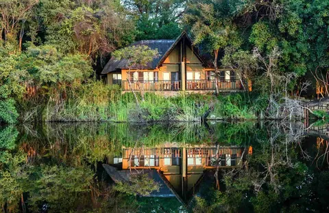
- 17.81°S 23.35°ECampsiteBush Camp by Camp Kwando
- 17.81°S 23.38°EGuest houseKawina Guest House
Sights 2
- Mafwe Living MuseumMuseum+264 81 762 9020lcfn.info
- Hippo Pond, Mbezi CampAttraction
Kongola is a small village on the east bank of the Kwando River, close to where the B8 across the Caprivi Strip (now the Zambezi Region) crosses the river. It is the administrative centre of the Kongola Constituency, which had 12,069 people at the 2023 census spread over more than 5,000 square kilometres. Most travellers stop only for fuel. The better reason to stay is the river: Mudumu National Park lies to the south and the Kwando core area of Bwabwata to the west, with lodges and camps along the bank.
Getting there
Kongola sits on the tarred B8, 112 km south-west of Katima Mulilo. From the west you cross the whole of Bwabwata National Park from Divundu, a stretch of about 190 km. The Kongola bridge opened in 2004 and is the only crossing of the Kwando for hundreds of kilometres. The C49 turns south off the B8 here and runs through Mudumu, roughly 35 to 40 km away (sources differ), and on round to Katima. You need no permit to drive the C49 itself, but every other track in Mudumu needs one.
When to go
July to November is the time for game. Once the pans inland dry up, the game moves to the river. October to December is the hottest stretch. Rain falls from about November to March, up to 600 mm a year. Tracks off the tar turn to mud after rain, so in the wet months ask your lodge about road conditions before you set off.
What to do
Get on the water. Lodges and camps along the river run boat trips for hippos, elephants and birds, and some run game drives into Mudumu, where 430 bird species have been recorded. If you have a 4x4 and some sand-driving confidence, the Kwando core area of Bwabwata is reached from this side. Its best-known spot is Horseshoe, a lagoon shaped like its name, where elephants gather at the water mostly between midday and late afternoon.
Mashi Crafts, a thatched craft shop in the village, was set up as an outlet for baskets, beadwork and carvings made in the surrounding conservancies. The most detailed write-up of it dates from 2008/9, so check it is still trading before you plan a stop.
Good to know
This is a high-risk malaria area. The CDC recommends antimalarial tablets for the Zambezi Region, so see a travel clinic before you leave home. Kongola has a fuel station with a small shop, and a 2016 trip report mentions an ATM and card payment for fuel. MEFT tells Mudumu visitors to bring their own water, food and fuel. Mudumu has no gate or fence, the tracks are signed for 4x4s, and in the rains MEFT recommends at least two vehicles travelling together. The river has hippos and crocodiles, so do not swim in it. The same report describes police checkpoints on the B8 through Bwabwata, one just before Kongola, checking vehicle papers, so keep yours handy. Park fees are on the Mudumu and Bwabwata pages.
History and culture
Kongola is a roadside village beside the only bridge over the Kwando River for hundreds of kilometres, in the Caprivi Strip, now the Zambezi Region. The ground around it has been Khwe San land, part of the Lozi kingdom, a German colonial corridor that never worked as planned, a South African military zone through the liberation war and, since independence, a place where communal conservancies and national parks share the river.
- Before 1890
Until the end of the 1800s the land between the Kwando and the Zambezi was known as Itenge and came under the Lozi kings. Late in the century Britain administered it as part of the Bechuanaland protectorate (now Botswana). source
- 1890
Germany acquired the strip for German South West Africa in an 1890 exchange with Britain and named it after Chancellor Leo von Caprivi. The idea was a river route along the Zambezi to German East Africa, which the Victoria Falls and further falls downstream made impossible. source
- 1914 to 1980s
During the First World War the strip went back under British rule as part of Bechuanaland. It was largely ignored and got a name as a lawless frontier. In the 1980s it mattered again, as a base and supply line for South Africa's backing of the UNITA rebels in Angola. source
- 1966 to 1989
The land west of the Kwando was proclaimed the Caprivi Game Reserve in 1966 and the Caprivi Game Park in 1968, but it never functioned as a park. Through the liberation war against South African rule it was a closed security area, held by the South African Police and then the South African Defence Force until UN Resolution 435 came into force in April 1989. Many Khwe San who lived there were drafted into the army and housed on bases such as Omega. source
- 1990
After independence in 1990 a survey of the old game park looked at what the military occupation had left and found about 5,000 people living inside it. That survey shaped the zoning still used today, with a core conservation area along the Kwando. source
- 1999 to early 2000s
A conflict in the Caprivi in 1999 lasted only a few days. In the early 2000s fighting in southern Angola spilled over the border, and for a time the B8 between Bagani and Kongola could only be driven in a military convoy. source
- 2004
The Kongola bridge opened in 2004, carrying the B8 over the Kwando. It is part of the long trade road now called the Walvis Bay-Ndola-Lubumbashi Development Road. source
- 2007
Bwabwata National Park was gazetted in 2007, joining the old Caprivi Game Park with the Mahango Game Reserve. Its eastern core conservation area runs along the Kwando, across the river from Kongola. source
- Languages
- In the 2023 census just over half of people in Kongola Constituency households spoke Sifwe at home (51.4%), followed by Thimbukushu (19.9%), the Khwe language (11.6%) and Silozi (8.0%). source
- Communities
- The constituency is mainly home to the Mafwe and the Mashi, each with its own traditional authority. In the western part, inside Bwabwata, live about 1,900 Khwe San. source
- Basketry
- Women in the surrounding conservancies weave palm-leaf baskets: square baskets from the western Caprivi, once used to carry fruit from the fields, and open baskets from the east used for the sorghum harvest. A 2008/9 report found necklaces of mbono seeds and crocheted bags of field fibre sold alongside them at Mashi Crafts. source
- Conservancies
- The parks around Kongola border communal land run as conservancies, and two camps inside Bwabwata on the Kwando are conservancy businesses: Nambwa belongs to the Mayuni Conservancy and Susuwe to the Kwando Conservancy. source
For German visitors: The Caprivi Strip (Caprivizipfel in German) is named after Leo von Caprivi, the German chancellor who negotiated it from Britain in 1890. source
For German visitors: The road and the Kongola bridge are closely tied to Klaus Dierks, a German-born civil engineer who became a Namibian transport planner and politician. source
For German visitors: The German government, through the development bank KfW, has paid for infrastructure, equipment and planning in Bwabwata National Park under the Namibia Parks Programme (NAMPARKS). source
Main sights in Kongola
4- Mashi Crafts
A thatched craft shop in the village, set up as an outlet for baskets, beadwork, reed mats and carvings from the conservancies around Kongola. A 2008/9 report counted 304 craftspeople selling through it, all but six of them women. That is the latest detailed account, so check it is still trading.
Travel News Namibia, Mashi Crafts (from Conservation and the Environment in Namibia 2008/9) - Kongola bridge and the Kwando
The causeway carrying the B8 over the Kwando, opened in 2004. Just west of it Bwabwata National Park begins.
Wikipedia (German), Kongolabrücke - Horseshoe, Bwabwata Kwando core area
A horseshoe-shaped lagoon of the Kwando, south of Nambwa, where elephants gather at the water mostly between midday and late afternoon. The tracks are deep sand and need a 4x4.
Info Namibia, Kwando Core Area - Mudumu National Park
A flat, unfenced park on the Kwando, created in 1990 just before independence, with a fossil river course called the Mudumu Mulapo in its centre. The C49 from Kongola to Sangwali runs through it, and you need no permit for that road itself.
Wikipedia, Mudumu National Park
Did you know?
- The name Kongola is Silozi for gathering in, the way a net pulls everything together, or for calling people to come together. source
- The Kongola bridge is not a bridge in the usual sense. It is an earth causeway about 70 m long with four corrugated steel culverts, each about 10 m wide, and it is the only crossing of the Kwando for hundreds of kilometres. source
- Kongola Constituency is the largest in the Zambezi Region at 5,174 square kilometres and the least densely populated, with about 2.3 people per square kilometre. Its population grew from 7,366 in 2011 to 12,069 in 2023. source
- Mudumu National Park has no entrance gate and no fence. A graded cutline is all that separates it from the neighbouring farmland. source
- The Mafwe made up nearly half the constituency's people in the 2023 census, 5,746 of 12,069, and 1,341 people gave their group as Khwe. source
- The Caprivi Region was renamed the Zambezi Region in August 2013, to take the names of colonial administrators off Namibia's maps. source
Checked 7 October 2026.
Map of Kongola
See every place on this map as a list