City · Omaheke, Namibia
Gobabis
Cattle town and capital of Omaheke, about 200 km east of Windhoek on the B6, and the last proper town before the Buitepos border with Botswana.
Short answer
Gobabis is in Omaheke, Namibia. This page lists 15 places to stay, 2 places to eat and drink and 2 sights.

- Places to stay
- 15
- Eat and drink
- 2
- Sights
- 2
- Where
- Omaheke, Namibia22.45°S 18.97°E
In and around Gobabis
19 places listedWhere to stay in Gobabis 15
- 22.45°S 18.99°EHostelSteps Backpackers LodgeHermanus Landsberg Avenue, Gobabisstepsforchildren.de
- 22.45°S 18.96°ECampsiteGoba Lodge Campsite
- 22.43°S 19.07°EGuest houseAfrica Awaits Lodge
- 22.38°S 18.95°EResortDigbyC 30, Gobabis
- 22.45°S 18.96°EHotelGoba Lodge
- 22.38°S 18.95°ECampsiteNossob Safaris
- 22.45°S 18.97°EGuest houseDie Houtkappers
Show all 15 places to stay
- Goba Lodge & Rest Camp · Guest house
- Kalahari Convention Centre Hotel · Hotel
- Omateko · Hotel
- Onze Rust Guest House · Guest house
- Trans Kalahari Resort · Campsite
- Xain Quaz Rest Camp · Campsite
Sights 2
- Cattle Country StatueMonument
- Gobabis MuseumMuseum
Restaurants and cafes 1
- Goba Lodge RestaurantRestaurant · american, german, chicken, cake, noodle, african, breakfast, burger, pasta, regional, steak house, soup
Bars and pubs 1
- Push And Pull BarBar
Gobabis is the capital of the Omaheke Region and the main town of Namibia’s eastern cattle country, on the edge of the Kalahari. About 33,400 people lived here at the 2023 census. Few visitors come for the town itself. Most stop because it sits on the Trans-Kalahari Highway between Windhoek and Botswana, and it is the last place with banks and big supermarkets before the border. Give it an hour and there is more to it than the bull at the entrance.
Getting there
The tarred B6 runs about 200 km east from Windhoek to Gobabis, passing Witvlei on the way. The Buitepos border post is roughly 110 km further east on the same road, and it has been open around the clock since April 2023. The railway from Windhoek ends here but no longer takes passengers, so without a car the practical option is a shared taxi (a combi) from Windhoek. Heading north towards the Waterberg Plateau, the C30 via Steinhausen is a more direct route than going back through Windhoek. Ask locally about its condition before you commit.
When to go
Rain falls mostly from November to April, with January and February the wettest months. Summer days run past 30°C. Winter (June to August) brings mild, dry days and nights that drop to around 3°C, so pack something warm if you camp. Those winter months are also hunting season on the farms around town. Endurance riders know the town for the Independence Ride, held each May at the Otjivero Endurance Club since 2006.
What to do
Stop at the Cattle Country statue, a large Brahman bull on the B6 at the southern entrance. The bull is no exaggeration. The region has hundreds of commercial farms and thousands of communal farmers, and most of them raise cattle.
The Gobabis Museum moved into the old library building and reopened in 2011. It has old farm implements in the yard and displays on the different peoples of Omaheke. Look out too for the Lazarett, a military hospital the German colonial army built in 1896 and one of the few buildings left from that time. It has been a national monument since 1974. Wikivoyage calls Gobabis the town of churches, with 14 historic churches across the main denominations.
The best known outing is Harnas Wildlife Foundation, a refuge for big cats roughly 85 km from town and now run by the N/a’an ku sê Foundation. Its site showed no guest bookings for 2026 when we checked, so contact them before driving out.
Good to know
Fill up, buy food and draw cash in Gobabis before the border. Advice on malaria differs. The CDC lists Omaheke among the regions where it recommends tablets, while the Belgian travel medicine institute rates this part of the country low risk. Ask a travel clinic, and use repellent from dusk either way. Epako, the township about 2 km east of the centre, was laid out under apartheid for Black workers and is still home to about half the town.
History and culture
Gobabis grew up around a spring where elephants once drank, on the frontier between Nama and Herero country. Missionaries, a German garrison and then the South African railway each left a mark, and the sandveld east of town is where thousands of Herero died fleeing German troops in 1904. Today it is a cattle town on the highway to Botswana, and its past is closer to the surface than its sleepy main street suggests.
- About 1840
The Kaiǀkhauan (Khauas), an Orlam group who had come north from the Cape, settled at the spring under their captain Amraal Lambert, with the consent of the Red Nation Nama at Hoachanas. Like many Orlam, Lambert spoke the Afrikaans of the Boers rather than Nama. Big game hunters and ivory traders were soon arriving in numbers. source
- 1845 and 1856
The Wesleyan missionary Joseph Tindall started a mission here on 6 August 1845 but soon left. The German Rhenish Mission took it over in 1856 at the captain's request, opened a school and consecrated a church in 1861. source
- 1864 to 1880s
After Amraal Lambert died in 1864 the Khauas split under two rival captains, and Gobabis, on the line between Nama and Herero country, became a battleground. In April 1865 the Herero of Okahandja joined forces with the Mbanderu (eastern Herero), whom the Khauas held as slaves, and the missionaries were driven out. A Herero counter attack in 1867 freed many of the Mbanderu, and the settlement that was left fell into deep poverty and lived by raiding. source
- 1895 to 1897
Gobabis came under German control on 28 May 1895, when a district chief was posted here. In March 1896 the Mbanderu and their Nama allies, the Veldschoendrager, attacked the station. The rising was put down, and the Mbanderu chiefs Kahimemua Nguvauva and Nikodemus Kavikunua were court martialled and executed at Okahandja. Rinderpest, a cattle plague, reached Gobabis early in 1897 and left its people poorer still. source
- 1904
After the Battle of Waterberg on 11 August 1904, most of the surviving Herero fled into the Omaheke, the dry sandveld east of Gobabis. General Lothar von Trotha set up a line of military posts between Gobabis and Grootfontein along the edge of the desert. Around 40,000 Herero died there of thirst, hunger or in killings by German patrols. This was part of the 1904 to 1908 genocide of the Herero and Nama, which the German government acknowledged as genocide in 2015. source
- 1915 to 1948
South African forces defeated the German army in 1915, and from 1920 South Africa ruled South West Africa under a League of Nations mandate. After the National Party won power in South Africa in 1948 it applied apartheid here too. source
- Apartheid years
The white administration of Gobabis laid out Epako as a separate township for Black workers, about 2 km east of the centre, and housed people in blocks by ethnic group, such as a Damara block and a Herero block. Epako got only basic infrastructure and is still the poorest part of town, though about half of Gobabis lives there. source
- 1966 to 1990
SWAPO (the South West Africa People's Organisation) launched its armed struggle against South African rule in 1966, and the UN recognised it as the representative of the Namibian people in 1973. Namibia became independent on 21 March 1990. source
- Language
- Otjiherero is the main home language in Omaheke. At the 2023 census it was the main language in 40.9% of the region's households, with Khoekhoegowab (the Nama and Damara language) in 23.9% and Afrikaans in 7.6%. Oshikwanyama, the San languages and Setswana come next, and English is the main home language in fewer than 2% of homes. source
- Communities
- Almost all of Namibia's Ovambanderu and Gobabis Juǀwa people live in Omaheke. The region is also home to Herero, Damara, Nama, Tswana, Afrikaner and German communities, and Gobabis is where they all come to shop and do business. source
- Cattle
- For the Ovambanderu, cattle are more than wealth. They supply meat, fat and omaere (sour milk), and a chosen cow's milk was once used in rituals at the holy fire (okuruwo) that links a family to its ancestors. Ovambanderu identify with the Green Flag (Otjingirine) and gather each year, in Namibia and in Botswana, at the graves of their leaders. source
For German visitors: The first lasting mission here belonged to the Rhenish Mission Society, a German Protestant mission, which took over the station in 1856 at the request of the Khauas captain and consecrated its church in 1861. source
For German visitors: In 2020 the municipal museum in Braunschweig found a leather belt labelled as taken from the Mbanderu chief Kahimemua Nguvauva by Gustav Voigts in 1896. His descendants remember it as his cartridge belt. Its history is not fully settled, but a return to the Ovambanderu has been planned since late 2021. source
For German visitors: Gobabis supplies nearly 500 farms in the district, and many of them are run by farmers of German descent. source
For German visitors: The German Green politician Ottmar von Holtz, a member of the Bundestag for Lower Saxony, was born in Gobabis in 1961. source
Main sights in Gobabis
4- Lazarett (German military hospital)
The German colonial army built this hospital in 1896, and until 1904 it treated people of every group in the district. It has been a national monument since 20 December 1974.
Wikipedia (German): Deutsches Lazarett (Gobabis) - Gobabis Museum
Local enthusiasts set it up, and it reopened in 2011 in what used to be the library. The bigger pieces, old farm machinery among them, stand outside in the yard, while the rooms cover the history of the peoples of Omaheke. The municipality runs it.
Namibian.org: museums in central Namibia - Cattle Country statue
The bull statue right beside the B6 at the southern entrance to town. It sums up the local economy well enough.
Wikivoyage: Gobabis - The churches of Gobabis
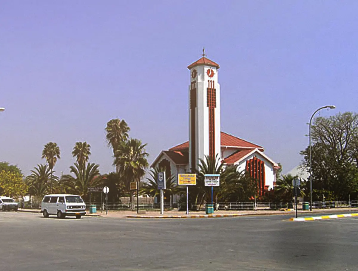
Gobabis likes to call itself the town of churches. Wikivoyage counts 14 historic ones, with every big denomination represented, which is a lot for a place this size.
Wikivoyage: Gobabis
Did you know?
- Nobody agrees on what the name means. Oral tradition gives the Khoekhoe name ǂKhoandabes, the place where the elephant came to lick. The missionary Heinrich Vedder made popular the reading elephant fountain, and in 1845 Joseph Tindall wrote that he had named it Elephant's Fountain. Another reading takes Gobabis from goba (quarrel) and bis (place), the place where people argued. source
- Herero speakers call the town Epako. source
- Omaheke means sandveld in Otjiherero. The region covers 84,731 square kilometres, slightly more than Austria, yet it is the least populated of Namibia's 14 regions, with just under 103,000 people in 2023. source
- The town's welcome sign is a statue of a large Brahman bull with the words Cattle Country. source
- Gobabis is twinned with Drachten, in the municipality of Smallingerland in the Netherlands. source
- The railway from Windhoek ends at Gobabis. South African Railways built it between 1921 and 1929, the first new line in the country after German rule, and today it carries only occasional freight. source
Checked 7 October 2026.
Thirty-four zebras in one night at Elephant Fountain
In the middle of September 1851 two travellers rode into the place now called Gobabis and found they had to watch their feet. Francis Galton, later famous for statistics and notorious for eugenics, and the young Swede Charles John Andersson had left Jonker Afrikaner’s settlement at what is now Windhoek on 30 August and spent a fortnight getting here. The spring came out of the side of a dark, thorny hill above the bed of the Black Nossob. All the ground around it had been dug into game pits, so well hidden that Andersson says even people who knew the place risked dropping into one.
Ivory in the mud
The pits worked. Galton recorded thirty-four zebras caught in them in a single night. He also gives the plainest reason for the English name, Elephant Fountain. When the pool was first cleared of its reeds, elephant bones and tusks were found lying in the mud, and a trader took away more than one wagon load of ivory. Galton thought it was two.
Hill Damara families grew tobacco in gardens beside the spring, on land that belonged to the Orlam chief Amraal Lambert. Both men mention what had already emptied the Wesleyan mission station here. Andersson calls it a destructive fever that killed many residents. Galton is more exact: it broke out in April, raged for two or three months, and had depopulated the place more than once.
Thirty rhinos at the next water
Amraal, by then well into his seventies, wanted to come along for the hunting, and by the time the party was on its way east it was several hundred strong. On 3 October they reached Tunobis, a spring close to where the Botswana border now runs, with no other water for two or three days in any direction. In a few days the party shot more than thirty rhinos. Andersson killed eight in five hours one night, and Galton a white rhino cow.
The San at Tunobis told the two men the country ahead was impassable that year, and they turned back. Andersson got to Lake Ngami in 1853.
Most of the hunting stories from the Fountain itself belong to the return, nearly a month later. Ostriches walked in to drink at about noon every day and barely bothered to retreat. Andersson shot eight of them. Lions were bold enough that several of Amraal’s hunters had been carried off or badly mauled while lying in wait at night, and the old chief worried about the Swede sitting out alone. One pitch-dark night, hidden in thorn scrub next to a big pit on the river bank, Andersson heard a purr behind him, then a rush and a cry as something sprang at an antelope close by. Three gunshots followed. Amraal had sent Eyebrecht, the guide Galton had hired at Windhoek, to fetch him back, and the man had met the lion on the path. In the morning its tracks were found a gun barrel’s length from where Andersson had been sitting.
Amraal died of smallpox at Gobabis in February 1864.
Off the train, and into the cells
Being the last town before the border has brought Gobabis some odd arrivals. In June 1931 the British banished the Bakwena ruler Sebele II to the far side of the Kalahari without a trial. He went by rail, and by one historian’s account a crowd turned out to celebrate him when his train pulled in at Gobabis, before he was driven on to Ghanzi.
In August 1963 the traffic ran the other way. Four Namibian activists, the Rehoboth doctor Kenneth Abrahams and Andreas Shipanga among them, had walked across the border and were on the road to Lobatse when three South African policemen in plain clothes and an unmarked truck seized them inside Bechuanaland, a gun to Abrahams’s head. They were locked up in Gobabis and charged with leaving the country illegally. It took British pressure and a habeas corpus case before South Africa’s prime minister, Verwoerd, announced at the end of that month that Abrahams would be sent back.
Looking for cheetahs with a dog called Enya
The big animals that are left here are the ones that hide. Farmers north of town share their land with cheetahs, and not happily. In November 2012 the Cheetah Conservation Fund was called to fetch five that had been trapped on a farm near Gobabis. One died. Among the four survivors, all females, was one they named Toeless, after old paw injuries that cost her a broken toe. The following month the four were moved into the fund’s soft-release reserve.
In March 2020, after years of drought had pushed up losses and tempers, the fund opened a field station in Gobabis under the carnivore researcher Hanlie Winterbach. Its cheetah study block north of town covers more than 4,000 square kilometres and about a hundred farms. A scat detection dog called Enya walked 395 km of farm tracks there sniffing out droppings, and cameras watch the play trees where territorial males leave their marks. Halfway through, the team had 68 cheetah samples and 105 from brown hyaena, leopard, caracal, jackal, bat-eared fox and genet.
So the cats are there, and you will almost certainly not see one from the B6. Wild dogs are rarer still. The fund puts Namibia’s adults at about 400, and the station also works with the communal farmers around Otjinene and Okakarara. What the town does offer is birds. Egyptian geese and ducks sit on the Black Nossob where it passes through, and an ornithologists’ expedition in November and December 1968 listed 143 species across the sandveld between here and Stampriet.
The thing to watch for on the drive is the fence. The highway to Botswana opened in 1998, and on the Namibian side it runs between stock fences with the verges cut short. Two cyclists who rode it in December 2024 noticed the fences stop at the border past Buitepos, and goats, donkeys and cattle take over the tar. A poster on the 4x4 Community forum gives the same warning about livestock near the villages, and says that is what makes the Botswana side dangerous after dark.
Map of Gobabis
See every place on this map as a list