Namaqua National Park
Succulent Karoo park on the N7 north of Cape Town, famous for August and September wildflowers at Skilpad and a wild 4x4 coast at Groenrivier.

What you'll pay to enter Namaqua National Park
VALID 01 NOV 2025 TO 31 OCT 2026 · ZAR PER PERSON PER DAY
| Fee | International | SADC nationals | SA residents |
|---|---|---|---|
| Daily conservation fee | R130child R62one source | R130child R62one source | R62child R32one source |
- International and SADC visitors pay the same rate at Namaqua.
- Wild Card members do not pay daily conservation fees.
- Child rate applies to ages 2 to 11; the adult rate applies from age 12.
- Figures marked "one source" were found in a single published source only.
- Set by South African National Parks (SANParks). Adult rate shown first, child rate below. Official tariff
CHECKED 06 OCT 2026 · 1 SOURCES
See every place on this map as a list
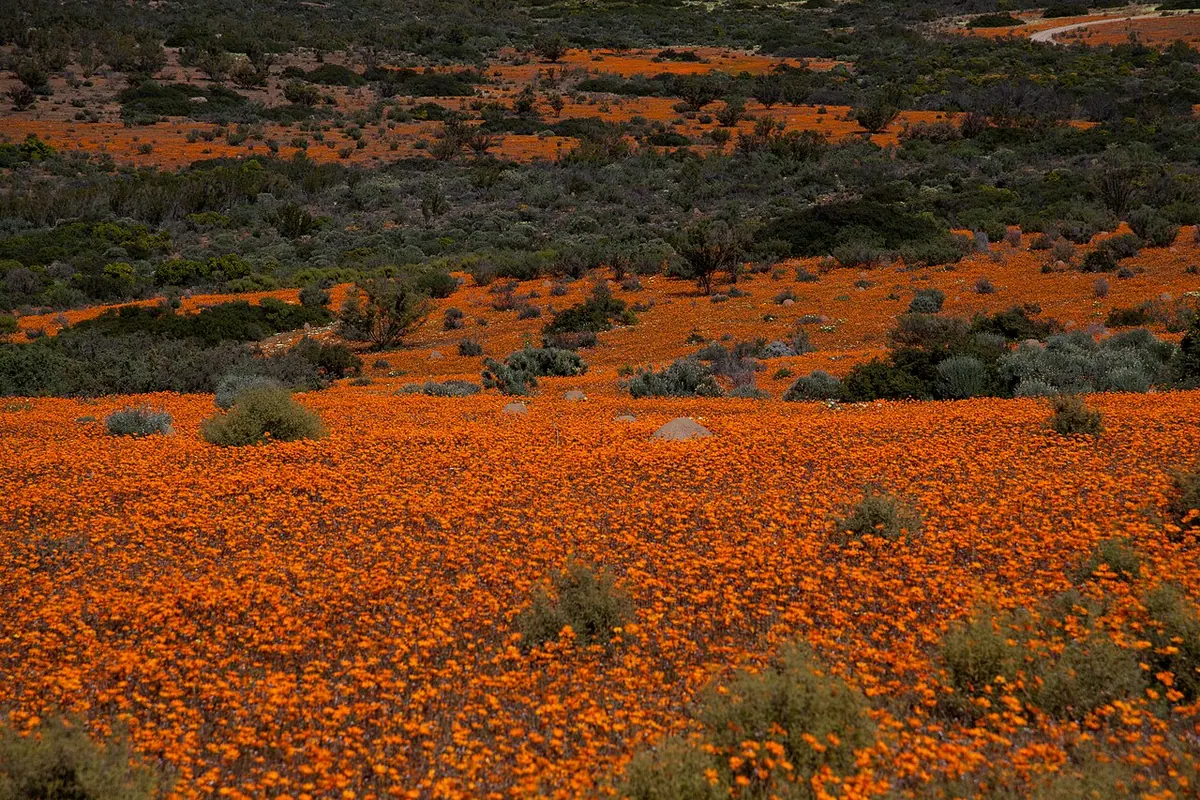
Namaqua National Park protects more than 1,300 square kilometres of the Succulent Karoo, from the Skilpad hills near Kamieskroon west to about 50 km of Atlantic coast. For most of the year it is a hard, dry place of quartz and stone-like vygies. Then, if the winter rain has been kind, the flats turn orange with daisies for a few weeks in August and September and the whole of Namaqualand drives up to look. Around 4,000 plant species grow in the region, more than 1,000 of them found nowhere else.
Getting there
Skilpad, the main section, is about 490 km north of Cape Town, roughly six hours on the N7. Turn off at Kamieskroon, pass the hotel and follow a gravel road for about 21 km to the gate. It is fine for any car. The coastal section is a separate approach: leave the N7 either 24 km south of Garies or 37 km north of Bitterfontein, then drive about 60 km of good gravel to the Groenrivier gate. Beyond that gate you need a 4x4; the coastal tracks are deep sand in places.
When to go
The flowers peak from mid August to mid September, but it shifts with the rain, which falls mainly from May to August. The display is weather-dependent in another way too: the flowers only open on sunny days, and they face the sun, so drive with the sun behind you and do not bother before mid morning. Winter wind off the Atlantic is bitingly cold. Summers are hot and still windy.
What to do
At Skilpad there is a roughly 5 km circular flower drive on gravel suitable for all cars, and two 3 km walks: the Skilpad trail heading west from the office and the Korhaan trail heading east. Look for the speckled padloper, the smallest tortoise in the world, along with gemsbok, red hartebeest, springbok, klipspringer, bat-eared fox and meerkat.
The Caracal Eco Route is a 4x4 trail of around 180 to 200 km from Skilpad down the Soebatsfontein pass, across the Wildeperdehoek plains and on to the Groen River mouth. Allow six to eight hours, or better, camp on the way. The coast has bird hides at the Spoeg and Groen river estuaries (waders at Spoeg, pelicans and flamingos at Groen), caves at Spoegrivier with evidence of sheep herding 2,100 years ago, the wreck of the trawler Aristea from 1945, and dolphins and seals offshore. River crossings can be impassable from June to August.
Good to know
- There is no fuel, shop or restaurant in the park. Fill up and stock up in Garies, Kamieskroon or Bitterfontein, and bring your own water and firewood.
- Accommodation inside is four self-catering chalets at Skilpad and about ten beach campsites on the coast (Platduin, Kwass and Skuilsklip among them), plus the remote Luiperdskloof cottage. In flower season everything books out months ahead, so look at Kamieskroon, Soebatsfontein or Hondeklip Bay too.
In and around Namaqua National Park
19 PLACESPlaces to stay 10
- 30.53°S 17.40°ECampsiteBoulder baai Camp
- 30.66°S 17.46°ECampsiteKoringkorrel baai Camp
- 30.66°S 17.47°ECampsiteSkuinklip Camp
- 30.62°S 17.44°ECampsiteSkuinsbaai Noord
- 30.67°S 17.47°ECampsiteBamboes Camp
- 30.83°S 17.56°ECampsiteDelwers Camp
- 30.83°S 17.56°ECampsiteGaljoenbaai Campsite
- 30.07°S 17.65°ECampsiteKookfontein
- 30.70°S 17.49°ECampsiteKwass se Baai
Sights 9
- Cape Fur Seal ColonyAttraction
- Jarse BaaiViewpoint
- KoeroebeesRuins
- KookfonteinRuins
- KookfonteinRuins
- Namaqualand FlowerAttraction
- Roof of NamaqualandViewpoint
- Spider lilyAttraction
- Spoegrivier CaveCave