District · Botswana
Chobe District
Botswana's north-eastern corner, where it touches Namibia, Zambia and Zimbabwe at Kazungula. Kasane and the Chobe riverfront, the Enclave villages, forest reserves and the long road from Nata.
Short answer
This page covers 1 parks and reserves and 3 towns and cities in Chobe District.
- Parks and reserves
- 1
- Towns and cities
- 3
- Places to stay
- 14
- Where
- Botswana18.39°S 24.71°E
Parks and reserves in Chobe District
1Towns and cities in Chobe District
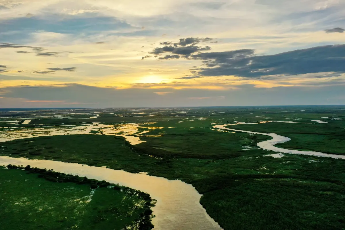
3Chobe is the north-eastern corner of Botswana, 20,800 km² with a little over 28,000 people at the 2022 census, and about six in ten of them live in Kasane and Kazungula. Namibia and Zambia lie to the north, Zimbabwe to the east. Most of the rest is Chobe National Park, forest reserve and farmland, shared with roughly 50,000 elephants. The riverfront near Kasane is the draw.
Getting there
From the south the road in is the A33 from Nata: just over 300 km, nearly all tar, and four to four and a half hours, passing Pandamatenga on the way. Elephant, buffalo, sable and giraffe are often on or beside it.
Kasane has the airport, with scheduled flights from Johannesburg and Gaborone. Kazungula, about 8 km east of it, has two separate border posts. The 923 m Kazungula Bridge over the Zambezi, opened in May 2021 in place of the old ferry, goes to Zambia. The Kazungula Road post goes to Zimbabwe and Victoria Falls. West of Kasane a tar road runs about 50 km to Ngoma and the bridge into Namibia. Hours for all of them are on our border posts page.
When to go
Go in the dry season, when the elephants stay on the Chobe and Linyanti rivers. With the rains (about 650 mm a year) they move some 200 km towards the south-east of the park. October to May is also when UK health advice rates the malaria risk high.
What to do
The park comes first, and it has its own page. In Kasane, a hollow baobab behind the police station once served the colonial administrators as a lock-up. Seboba has picnic sites and good birding beside the rapids. The CARACAL Biodiversity Centre lets you see snakes and other reptiles up close.
At Lesoma a memorial marks where 15 Botswana Defence Force soldiers were killed in an ambush by Rhodesian forces in February 1978.
The Chobe Enclave is five villages (Mabele, Kavimba, Kachikau, Satau and Parakarungu) whose community trust has earned from wildlife for more than thirty years.
Outside the park are four forest reserves (Kasane, Kazuma, Maikaelelo and Sibuyu) and, at Pandamatenga, around 40,000 hectares of sorghum, sunflower and cowpeas, with a border post into Zimbabwe.
Good to know
Chobe is a malaria area. The CDC names the district and advises tablets.
Elephants roam around Kasane, the airport included, so arrange a lift instead of walking. The UK government warns of occasional break-ins at lodges on the river, and of wildlife and livestock on the roads after dark, so do the A33 in daylight. For the Kazungula Bridge, plan on a taxi or your own car.
Kasane has ATMs (FNB, Absa and Bank Gaborone), a Shoprite and a Choppies. Fill up there. Savuti is only about 160 km from Serondela on the riverfront, but it is sand and takes around four hours, with no fuel between Kasane and Maun that way. Deep sand burns far more than tar, so carry plenty.
In and around Chobe District
14 places listedWhere to stay in Chobe District 14
- 17.95°S 24.69°ECampsiteLorato Camping+267 71 301 297
- 18.11°S 24.32°ECampsiteHyena‘s HowlPlot 1717 - HUHUWE+267 71 578 530
- 18.18°S 24.36°ECampsiteMoae CampsiteChobe Floodplains, Chobe, Botswana
- 17.93°S 24.72°EResortBuffalo Ridge CampNgoma Bridge
- 18.17°S 24.34°ECampsiteChobe Hideaway
- 18.25°S 23.96°ECampsiteLinyanti Bush Camp
Show all 14 places to stay
- Baobab Safari Lodge · Hotel
- Chobe Forest Camp · Campsite
- Chobe Mopani Forest Lodge · Hotel
- Ngoma Safari Lodge · Hotel
- Thobolo's Bush Camp · Campsite
Map of Chobe District
See every place on this map as a list