Village · Chobe District, Botswana
Kazungula
Border village 8 km east of Kasane where Botswana meets Zambia, Zimbabwe and Namibia. The bridge to Livingstone and the road to Victoria Falls both start here.
Short answer
Kazungula is in Chobe District, Botswana. This page lists 27 places to stay, 7 places to eat and drink and 1 sight. The nearest park with an entry fee on this site is Chobe National Park, about 121 km away, where international adults pay from P270.
- Places to stay
- 27
- Eat and drink
- 7
- Sights
- 1
- Park fee nearby: Chobe National Park
- US$20 €18 · P270about 121 km away
In and around Kazungula
35 places listedWhere to stay in Kazungula 27
- 17.79°S 25.23°ECampsiteCampsite Kubu LodgeKasane+267 625 0312kubulodge.net
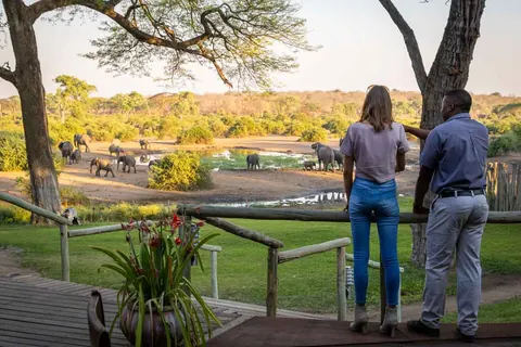
- 17.80°S 25.22°EHotelKwalape Safari LodgeKasane Road, Kazungula+267 625 1181kwalapesafarilodge.co.bw
- 17.79°S 25.21°EHotelBridgetown Holiday ResortsKasane Road, Kazungula
- 17.80°S 25.23°EGuest houseComfort Palace HotelKazungula
- 17.81°S 25.23°EHostelMasikiro Self CateringKazungula
- 17.80°S 25.22°EHotelNgina Safaris CampKasane Road, Kazungula
- 17.80°S 25.21°EHotelNkanga HotelKasane Road, Kazungula
Show all 27 places to stay
- Ramatie Guest Palace · Guest house · Kazungula
- The Big Five Lodge · Hotel · Kazangula
- Two Rivers Hotel · Hotel
- Arm Bush Safaris · Guest house
- Babu · Guest house
- Bananyana Backpackers · Campsite
- Bushtracks Safaris · Hostel
- Chobe Home Stead Guest House · Hostel
- Chobe Inn · Guest house
- Elephant Trail Guesthouse · Guest house
- Kabu Lodge · Hotel
- Kazungula Guest House · Hostel
- Kubu Lodge · Campsite
- Newstance Guesthouse · Hostel
- River View Lodge · Hotel
- Sekama Family Guest House · Hostel
- The Big 5 Campsite · Campsite
- The Big 5 Chobe Lodge · Hotel
Sights 1
- Kasane Hot SpringsHot spring
Restaurants and cafes 3
- Chisa NyamaRestaurant · barbecue, african
- Destination Coffee SpotCafe · american
- Kwalape Safari Lodge RestaurantRestaurant
Bars and pubs 4
- Kazungula BarBar · Pitse Road, Kazungula
- Kwalape Safari Lodge BarBar
- Moremogolo BarBar
- SeshekeBar
Kazungula is a border village on the south bank of the Chobe and Zambezi rivers, 8 km east of Kasane. Four countries come together here: Botswana, Zambia, Zimbabwe and Namibia. The 2022 census counted 8,704 people. You pass through on the way to Victoria Falls or Livingstone, or you sleep here because the riverside lodges are close enough to Chobe to do the park from.
Getting there
The A33 from Nata reaches the village after 300 km along the Zimbabwean border, through Pandamatenga and Lesoma. Kasane’s airport has flights from Johannesburg, Gaborone and Maun, and most lodges in the area collect their guests.
There are two separate border posts, and both are called Kazungula. The Kazungula Bridge crosses the Zambezi to Zambia, with Livingstone about 70 km beyond. The Kazungula Road post leads into Zimbabwe and is the direct way to Victoria Falls, about 70 km from Kasane. Opening hours for both are on our border posts page.
When to go
The rains fall from November to March. October is the hottest month, and Kasane next door has recorded 41°C. The UK government warns that flooding can close Botswana’s border crossings at short notice.
What to do
Look at the bridge. It is 923 m long, opened on 10 May 2021, and curves on purpose to keep clear of the Zimbabwean and Namibian borders. Botswana and Zambia share only about 150 m of boundary here, with Namibia’s Impalila Island at the confluence. Before the bridge, everything crossed the 400 m of river on two pontoons.
Kazungula was the administrative centre of Chobe District from 1909 to 1921, and David Livingstone crossed the Zambezi here. The name comes from the sausage tree, mzungula.
Lodges on the river here, Kubu Lodge among them, run boat cruises and game drives. The Kasane Hot Springs sit between the two villages, on a strip of bush that game moves through. The water is warm and salty. At Lesoma, down the A33, a memorial remembers the 15 Botswana Defence Force soldiers killed by Rhodesian forces in February 1978.
Good to know
This is a malaria area. The US CDC recommends tablets for Chobe District, and UK advice rates the risk high across the northern half of the country from October to May.
The bridge has footways, but Wikivoyage says you may not walk across, so take a cab. Cabs from the Botswana side go only as far as the border and you find another on the far side. The bridge is a one-stop post and a busy freight route, and KAZA.org warns that processing gets very slow in peak season.
Have the car’s original registration papers with you, and some pula in cash. Foot and mouth controls mean raw meat is often banned from crossing, so buy it in Kasane. Coming in from Zambia, expect to disinfect your shoes. The KAZA Univisa covers Zambia and Zimbabwe for up to 30 days, with day trips into Botswana over the bridge.
Wildlife and livestock stray onto the A33, so drive it in daylight. Stay out of the river.
Cattle tied by the horns: Kazungula's ferry years
For about forty years, from the 1920s to the 1960s, the usual way to get an ox across the Zambezi at Kazungula was to rope it by the horns to the frame of the pontoon, ten animals a side, and let it swim. Two chiefs from the district, Morgan Makhanga and Josephat Mwezi of Kavimba, have both described it: the cattle were never loaded, only tied on and towed at the ferry’s pace. Men in dugouts drove others across loose. In 1943 alone some 8,000 head went over, bound for the Copperbelt and its mine kitchens. Mwezi remembers farmers trekking cattle here from as far as Maun even in the motor ferry’s day, because the cold storage in Zambia was just over the river and Botswana’s own abattoir at Lobatse was more than 1,000 km south.
The little sausage tree
Researchers at the University of Botswana trace the name to the Chiikuhane (Subiya) word for the sausage tree, izuungwe. Put the diminutive ka in front and you get kazuungwe, the small one. A small one is said to have stood on the south bank at the confluence before anyone formally settled here in the early 1900s. The trader George Westbeech, who worked out of Pandamatenga, is said to have run his wagon road to a sausage tree on the river. In the 1880s the Czech explorer Emil Holub had a metal pontoon put together on the Zambezi, and by the historian Jeff Ramsay’s account sold it to Westbeech when he went home. That was the first ferry here that was not a dugout.
What grew up around it was not really a village but a depot. From the mid 1930s the Witwatersrand mines recruited men here, most of them from Barotseland across the river, and sent them on to Francistown for the train to Johannesburg, by road at first and later by air too. When it asked the colonial government for a primary school in 1940, the government opened a beer hall instead. The recruiters left in 1969. Their offices stood where Kubu Lodge has been since 1986, and their barges tied up on the Chobe bank close by.
A ferry South Africa called illegal
The motorised pontoon arrived in the early 1960s, owned by Northern Rhodesia. From June 1962 it had a second name, the Freedom Ferry. Southern Rhodesia had clamped down on the route north through its own territory, so South Africans, Namibians and Zimbabweans heading into exile came up through Bechuanaland and crossed here, about 25 to a trip. The man at the controls was a Zambian, Nelson Maimbolwa, who became a contact for the ANC’s armed wing.
Pretoria’s answer was a piece of map reading. In 1970 South Africa, then holding the Caprivi, told Botswana that the four territories met at a single point, so Botswana and Zambia had no shared border and the ferry was crossing someone else’s water. Botswana said no. Most accounts add that shots were fired at the ferry during the stand-off, and some years later Rhodesian forces sank it. Seretse Khama and Kenneth Kaunda had first talked about a bridge in 1968, and the same argument stopped that too. Today’s maps show two three-country points here, not much more than 100 m apart.
The ferry’s worst day came in 2003, when a truck overloaded with cobalt slid off the pontoon. Eighteen people drowned and six got out.
What went with the queue
A pontoon took two trucks a trip, roughly 80 a day, and the line on the Botswana side could run past 2 km, with drivers parked for days and sometimes weeks. A small economy lived off that wait: women cooking bream by the weighbridge, fruit sellers, sex workers from three countries. The bridge ended most of it. A year after it opened, Zambian customs was counting more than 280 trucks a day. Zimbabwe, for the record, walked away from the project in 2007, reportedly worried about losing traffic at Beitbridge, which is why the deck swings clear of its bank.
Botswana’s own pontoon, built locally and on the river from 2010, was meant to go to the Botswana Tourism Organisation once the bridge opened. There is now a marathon over the bridge each year.
Elephants after six in the evening
The animals here are not a sideshow to Chobe National Park. They are the same animals, walking from the park and the forest reserve to the river through whatever gaps the two villages have left. Tempe Adams and colleagues, working with Elephants Without Borders, put cameras on seven of those gaps in Kasane and Kazungula from November 2012 to April 2014 and collected 2,619 elephant pictures. Breeding herds with calves and bulls both used them, even the strips through industrial plots. More of the traffic was between six in the evening and six in the morning than by day. August was the busiest month and April, just after the rains stop, the next. Fewer came through when it was raining. One camera alone picked up 19 species, from civet to buffalo.
So the honest odds: in the dry months you have a good chance of meeting elephants on the tar between Kazungula and Kasane, most of all after dark, and they cross the roads out towards Lesoma and the Zimbabwe post as well. Keep your distance. In April 2015 two elderly men were killed by elephants within three weeks, one on the Nata road and one beside the Zimbabwe border road at half past two in the afternoon.
On the river frontage the regulars are smaller. Kubu Lodge lists Chobe bushbuck, warthog and mongoose in its grounds, with hippo and crocodile in the water in front. As for camping, one overlander on the 4x4 Community forum says Kazungula is usually overrun by truckers and he would avoid it, though by his own account he had not been for a few years. The person who started the thread wanted a river view and ended up booking a camp well back from the water, on an elephant corridor.
Guides for Kazungula
Map of Kazungula
See every place on this map as a list