Town · Central District, Botswana
Nata
The village where the tar from Francistown forks for Maun and for Kasane. Fuel, a bed and takeaway chicken, with the flamingo pan at Nata Bird Sanctuary a short drive south.
Short answer
Nata is in Central District, Botswana. This page lists 10 places to stay, 3 places to eat and drink and 1 sight. The nearest park with an entry fee on this site is Makgadikgadi Pans National Park, about 147 km away, where international adults pay from P190.
- Places to stay
- 10
- Eat and drink
- 3
- Sights
- 1
- Park fee nearby: Makgadikgadi Pans National Park
- US$14 €13 · P190about 147 km away
In and around Nata
14 places listedWhere to stay in Nata 10
- 20.19°S 26.19°ECampsiteEselbe Camp
- 20.22°S 26.27°ECampsiteNata Camp SiteNata
- 20.22°S 26.23°EChaletPelican Lodge and Camping+267 680 0653
- 20.21°S 26.18°EHostelHome nataA3
- 20.22°S 26.19°EMotelBel Rea Guest house
- 20.22°S 26.19°EMotelGong We Guest House
- 20.21°S 26.19°EHotelMaya Guest Inn
- 20.21°S 26.18°EGuest houseNata Guest Inn
- 20.22°S 26.27°EHotelNata Lodge
Show all 10 places to stay
- Northgate Lodge · Hotel
Sights 1
- Sun set pointAttraction
Restaurants and cafes 1
- BomaRestaurant
Bars and pubs 2
- Bar and RestuarantBar
- Makgadikgadi BarBar
Nata is a junction with a village attached. The tarred A3 comes up from Francistown, and here you either stay on it for Maun or turn north on the A33 for Kasane. Almost everyone driving northern Botswana passes through, usually with a low tank. The 2022 census counted 7,779 people in six wards along the Nata River, in white sand country dotted with mokolwane palms and big termite mounds. Few visitors stay longer than a night. The reason to make it two is Sua Pan, just to the south.
Getting there
It is all tar. Francistown is roughly 180 km and two and a half hours away. Maun is about 300 km west through Zoroga (40 km) and Gweta (100 km). Kasane is a little over 300 km north through Pandamatenga, about four hours.
You cannot fly in. There is an airstrip, but the lodge says it is out of use, and the nearest working airports are Francistown, Maun and Kasane.
When to go
As a fuel stop, any day of the year. As a place to stay, it depends what you want from the pan. Summer rain brings the Nata River down from Zimbabwe, where it rises near Bulawayo, and turns the white flats into a shallow sea with migrant birds on it. Flamingos breed in winter, but only if enough water is left. In a dry year they don’t show.
What to do
Go to Nata Bird Sanctuary, the community reserve on the corner of Sua Pan, off the A3 south of the village. You can drive yourself in or take a guided sunset drive from Nata Lodge, which usually leaves at four. The lodge also runs a tour of the village. That is about it, and for a one-night stop that is fine.
Good to know
Fuel is the main business here. There are three filling stations at the junction. Don’t arrive on fumes all the same: in September 2023 a traveller found all three without diesel for two days and had to fill up in Gweta. Top up at Francistown, Maun or Kasane before you set off.
Food is takeaway at the garages (regulars point you to the chicken at North Gate, and Engen has a Wimpy), or a proper meal at one of the lodges. Shops are basic.
Drive in daylight. Cattle and donkeys wander onto the tar, and on the Kasane road so do elephants, which are common along it.
Veterinary gates on these roads are staffed. Raw meat may not come east from Maun to Nata, so expect your cool box to be opened and your shoes to go on a disinfectant mat.
Nata is in Tutume sub-district, which is on the CDC’s list of malaria areas where tablets are recommended. After the heavy rains of early 2025 the WHO named Tutume among the worst-hit districts. See a travel clinic before you come.
A night up a tree on the Nata River, 1875
On a cold night around the end of June 1875 a Czech doctor named Emil Holub tied himself into the fork of a tree beside the Nata River and waited for a lion. The bark was torn where lions had been sharpening their claws, and the boughs spread like a candelabrum, which he thought would do as a seat for ten or twelve hours. His servant Pit walked him there before sunset and went back to the wagon.
Holub wrote the night up in Seven Years in South Africa, and nobody has left a better account of this river. Zebra stallions called first, out on the grass plain, a sound he spells “quag-ga”. Something scraped in the sand all night, and he put that down to meerkats digging for grubs. Steenbok came down the game path under him to lick the salty mud of the riverbed. Kudu passed on the far bank with their horns knocking in the thicket, and a brown hyena trotted by. The lion came late, through long grass to about fifteen yards, lay still for a quarter of an hour, looked up at him and went. Holub never fired.
Red salt and a raiding party
The day before, on the plain north of Sua Pan, his Bamangwato servant Meriko came sprinting through the grass shouting that he was about to be killed, with a band of armed men behind him. They said they were Lobengula’s. The Ndebele king sent a party to the Nata every year to gather salt, and Meriko told Holub that these gangs took the guns off any of Khama’s people they came across. Holub bought them off with a bowl of gunpowder and two pounds of lead for each leader and strips of calico for the rest.
The afternoon after his night in the tree, with their camp empty, he went to look at their workings. In a side arm of the river he found pools of deep red brine, 12 to 18 inches deep in winter, with a sheet of salt lying under the surface “like a stout layer of ice” and the poles used to break out the salt lying where they had been dropped.
The riverbed he measured at 100 to 150 feet across and about twenty deep. There was palm scrub and baobab along the lower reaches, and one pool of fresh water among all the salt ones, which a San man had told them to look for two days earlier. He saw the last springbok of his journey north here and shot a pair of saddle-billed storks that were circling the salt shallows after fish. On 3 July he left up the left bank on a track of deep sand.
Westbeech’s road
What came next was a wagon track. George Westbeech, the trader who had set up at Pandamatenga in 1871, was by Holub’s account the first traveller to use the route along the Nata and Maitengwe rivers to Matabeleland. Holub came back south with him in February 1876 and named the track the Westbeech road.
Frank Oates went up it too. He was a naturalist from near Leeds, on his fourth try at reaching the Victoria Falls. On 2 December 1874 he wrote home from the Maitengwe that he had met the wagons of two English hunters coming down from the Zambezi, Wood and Selous, and that both told him to go now, while it was raining, because the fever came after the rains stopped. He crossed the Nata within days, a long way upstream of today’s village, and on 5 and 6 December shot three kingfishers there. The Kalanga name he was given for the bird was gogoda, and he was told it kept to the mopane. From the bill he describes, red above and black below, it is the woodland kingfisher, a migrant that still turns up here for the wet months.
Oates saw the falls on New Year’s Day 1875. He took fever on the road home, travelling alongside Westbeech’s wagons, and died on 5 February. The Selous who gave the advice was Frederick Courteney Selous, then 22. Thirteen years on, in April 1888, he shot what he called his most beautiful gemsbok between the lower Nata and the top of the pan.
What is left of all that
Not much of the game. Chris McIntyre’s Bradt guide describes much of the country around the pans as ranching land where cattle have largely replaced the game, and it remembers Nata itself as a garage with hand-cranked petrol pumps and a bottle store that was always busy.
Holub calls the man who knew where the sweet water was a Masarwa, the word then used for San. A San language is still spoken in and around Nata, though only just. Shua was put at roughly 6,000 speakers in 2004, and the linguist William McGregor, who has worked on it since 2010, reports that the Nata variety is spoken fluently only by adults over about thirty.
The river is easier to get onto than it was. Eselbe Camp sits on the bank at Nata and keeps seven canoes. The camp says that at the end of the wet season, when the Nata is running into Sua, it takes groups down through the village and past a pod of hippos to the flamingos and pelicans on the pan. That is the camp’s own claim. A Tracks4Africa writer repeated it in 2021 and added only that hippo are sometimes seen when the pan holds enough water. Don’t count on them.
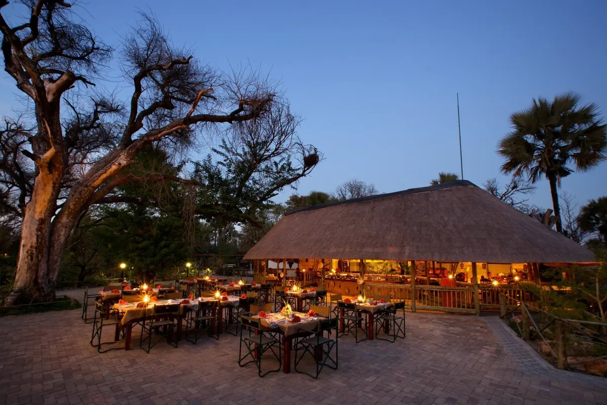
Bushbabies are a better bet. At Nata Lodge, south of the village among fan palms and marulas, the wildlife writer Mike Unwin once watched a family jump from tree to tree across the swimming pool, and the lodge still lists them. Look up after dark.
For big animals you go north. One operator calls the Kasane road an accidental game drive, with elephant the usual sighting and buffalo, sable and giraffe the extras. McIntyre gives the best reason for not driving it after dark: a grey elephant on grey tar is very hard to see. The flamingos are another matter, and they have their own page.
Guides for Nata
Map of Nata
See every place on this map as a list